© Kwok Fai Chiang
Chek Lap Kok, Hong Kong, China
Latitude: 22° 18' 56'' N
Longitude: 113° 55' 20'' E
15 March 2010 0712 (Local Time)
Camera direction: towards SW
Image P/S code: S.11.1.1.1
Image I.D.: 4968
CL = 6, CM = 0, CH = 0
-
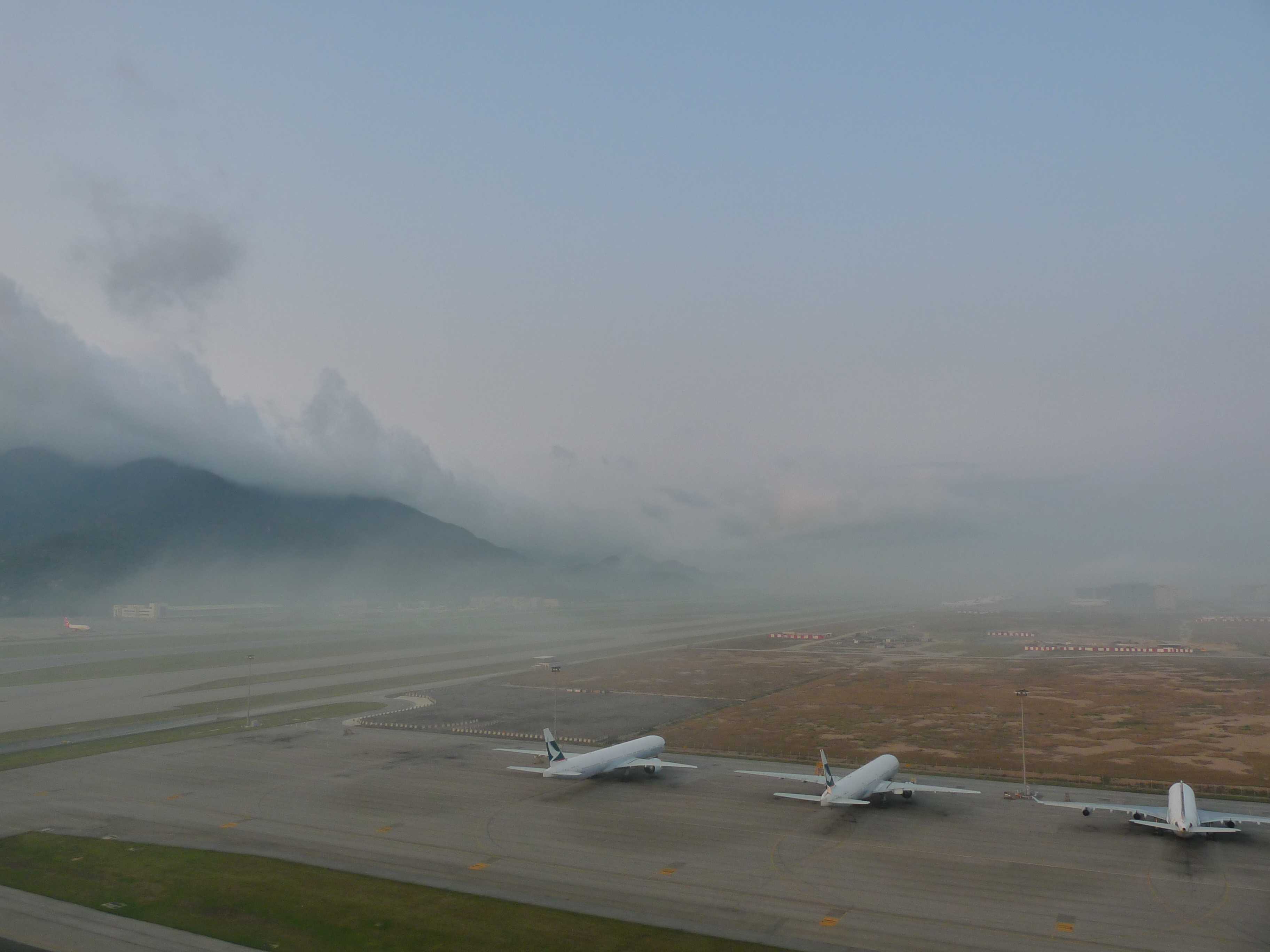
Mist, with Stratus forming upslope fog
A change in wind direction brought humid maritime air into Hong Kong Airport (China), resulting in a rapid deterioration in the visibility, together with the formation of upslope Stratus on the hills.
From the perspective of the airport meteorological observer, mist was reported. At 0700 hours, the prevailing visibility was 6 km but had deteriorated to 1 600 m to the west. At 0730 and 0800 hours, the general visibility was 2 900 m and 2 400 m respectively.
As moist air ascended the hills, Stratus cloud formed due to the air being adiabatically cooled to its saturation temperature. The result was upslope fog. Upslope fog is a type of hill fog. When viewed from beneath, it is seen as Stratus. However, to anyone on the hill ascending into the cloud, the visibility from that person's perspective is reduced to fog.
Links in the image description will highlight features on the image. Mouse over the features for more detail.
© Kwok Fai ChiangChek Lap Kok, Hong Kong, ChinaLatitude: 22° 18' 56'' NLongitude: 113° 55' 20'' E15 March 2010 0712 (Local Time)Camera direction: towards SWCL = 6, CM = 0, CH = 0Image P/S code: S.11.1.1.1Image I.D.: 4968 © The Government of the Hong Kong Special Administrative Region
 The upper-air ascent shows a stable, low-level profile with saturated air near the surface.© The Government of the Hong Kong Special Administrative Region
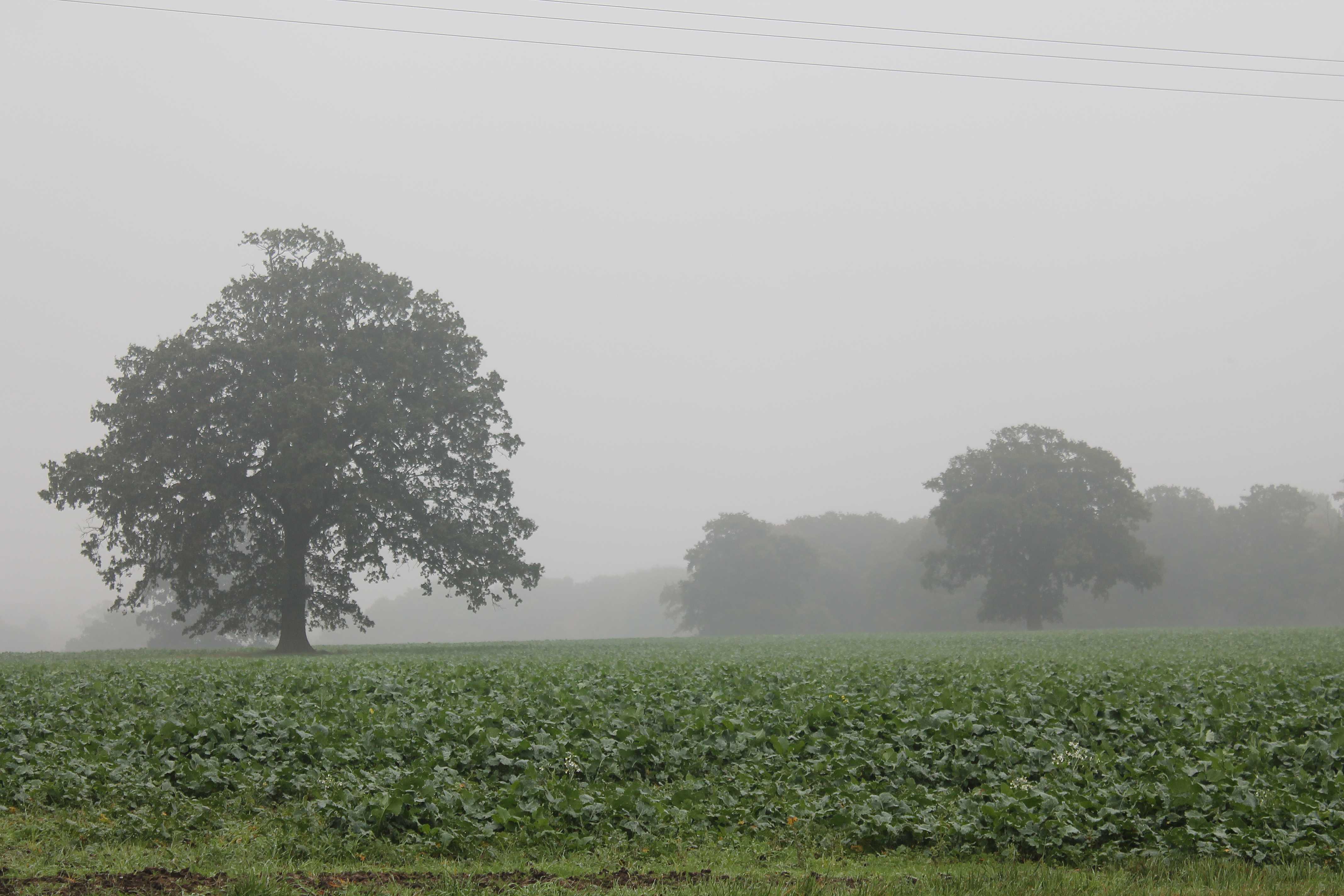
Mist
At the time of this photograph in the late morning, overnight fog was slowly lifting into mist and low Stratus. The horizontal visibility was estimated to be 1 100 m.
Mist is a suspension of very small, usually microscopic water droplets in the air that reduce the horizontal visibility at the Earth's surface to not less than 1 km. When the visibility is less than 1 km, the obscuration is due to fog. In practice, mist is considered synonymous with “light fog”.
The bank of trees on the right are about 450 m away from the observation point. In the distance, trees at 800 m are visible, and more distant ground features are just discernible on the far left at around 1 100 m. The overcast layer of low cloud is Stratus nebulosus and, as the Sun is not visible, the variety is opacus.
Links in the image description will highlight features on the image. Mouse over the features for more detail.
© George AndersonBracknell, England, United Kingdom of Great Britain and Northern IrelandLatitude: 51° 25' 26'' NLongitude: 0° 48' 25'' W01 November 2016 1038 (Local Time)Camera direction: towards ESECL = 6, CM = /, CH = /Image P/S code: P.11.1.1.1Image I.D.: 5186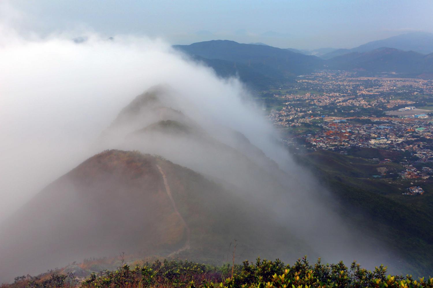
Upslope fog/hill fog
Upslope fog is formed when air flows upwards over rising terrain and is adiabatically cooled to its saturation temperature. In this picture, a Stratus cloud thus formed covers the high ground.
Upslope fog is a type of hill fog. When viewed from beneath or, as in this picture, from the side, it is seen as Stratus. However, to a person climbing the hill and ascending into the cloud, the visibility will be reduced to fog.
Links in the image description will highlight features on the image. Mouse over the features for more detail.
© Kam Hoo ManYuen Long, Hong Kong, ChinaLatitude: 22° 26' 40'' NLongitude: 114° 1' 20'' E19 April 2014 0636 (Local Time)CL = 6, CM = /, CH = /Image P/S code: P.11.1.1.6Image I.D.: 4905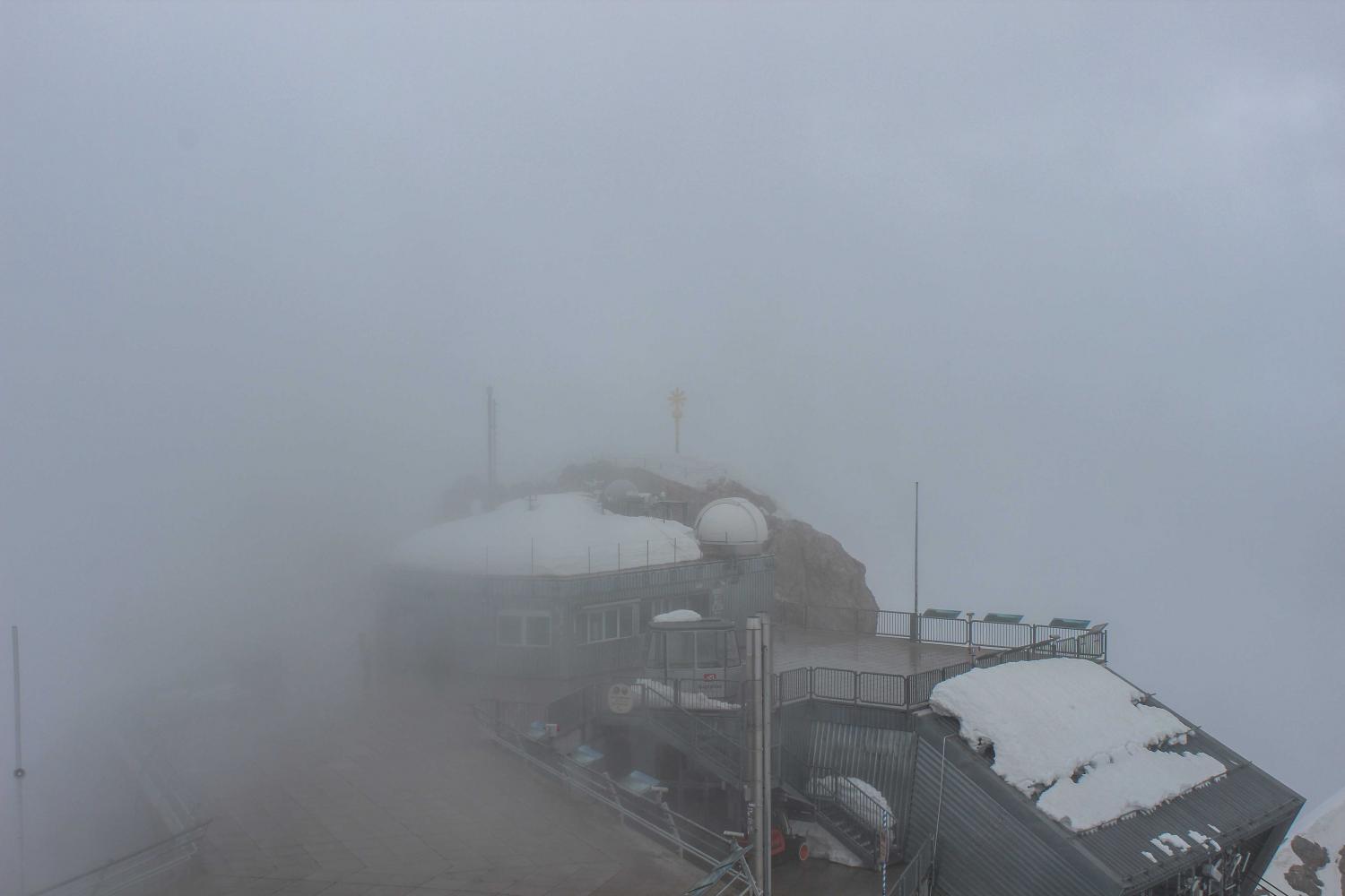
Hill fog
At an altitude of 2 962 m above sea level, the summit of Mt. Zugspitze in the Bavarian Alps, Germany is shrouded in cloud. From the perspective of the observer, the cloud is in contact with the ground at the point of observation, and so the observer is in fog. This is hill fog.
Links in the image description will highlight features on the image. Mouse over the features for more detail.
© Amarbileg ShajbalidirMt. Zugspitze, Bavarian Alps, GermanyLatitude: 47° 25' 15'' NLongitude: 10° 59' 7'' E23 May 2014 0848 (Local Time)Camera direction: towards ECL = 6, CM = /, CH = /Image P/S code: P.11.1.1.7Image I.D.: 4971