© Stefan Kämpfe
Weimar, Thuringia, Germany
Latitude: 50° 58' 60'' N
Longitude: 11° 19' 31'' E
29 January 2016 0936 (Local Time)
Camera direction: towards SW
Image P/S code: P.7.8
Image I.D.: 5908
CL = 5, CM = 0, CH = 0
-
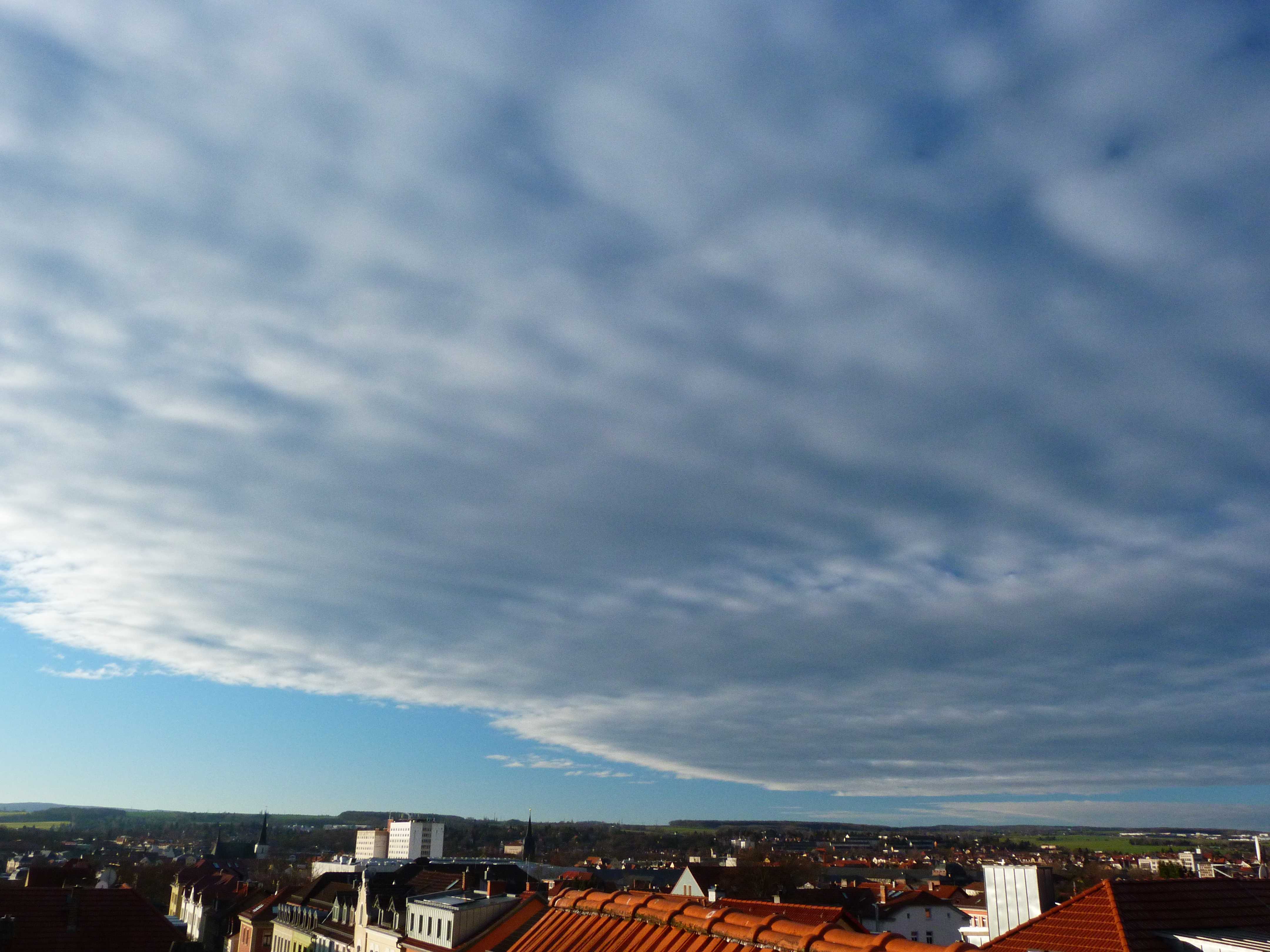
Stratocumulus stratiformis translucidus perlucidus
This photograph shows a whitish to grey layer of Stratocumulus cloud that has some darker parts and displays the fairly flattened base associated with the species stratiformis. The layer is sufficiently thin or translucent that it could reveal the position of the Sun; this is the variety translucidus. In addition, there are spaces between the cloud elements, through which some blue sky can be seen at 2 and 3; this is the variety perlucidus.
Links in the image description will highlight features on the image. Mouse over the features for more detail.
© Stefan KämpfeWeimar, Thuringia, GermanyLatitude: 50° 58' 60'' NLongitude: 11° 19' 31'' E29 January 2016 0936 (Local Time)Camera direction: towards SWCL = 5, CM = 0, CH = 0Image P/S code: P.7.8Image I.D.: 5908
The 0600 UTC synoptic chart shows a deep low of 955 hPa centred near the Faroe Islands, with associated fronts moving quickly east over UK and southern Scandinavia. A weakening warm front is approaching the location where the image was taken.
© Crown Copyright
The 0000 UTC sounding from Meiningen, Germany (WMO 10548) shows a nocturnal inversion at the surface and a thin moist layer near 900 hPa. Above 1 200 m, the air is very dry until Cirrus levels are reached.
© University of Wyoming
This 0900 UTC Meteosat infrared image shows an active cold front associated with the deep low near the Faroe Islands extending from near south-west Norway to the west English Channel. Only thin scraps of light grey-coloured cloud (warm cloud top temperature) can be seen over Germany.
© EUMETSAT, 2016
