© Matthew Clark
Salcombe Regis, Devon, United Kingdom of Great Britain and Northern Ireland
Latitude: 50° 40' 58'' N
Longitude: 3° 11' 56'' W
24 March 2015 1700 (Local Time)
Camera direction: towards E
Image P/S code: P.9.9
Image I.D.: 3875
CL = 2, CM = 0, CH = 0
-
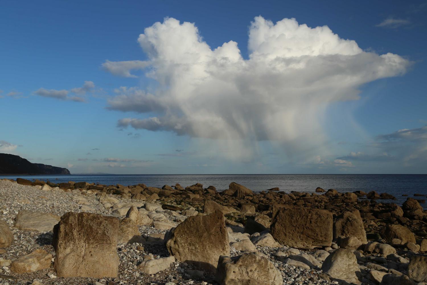
Cumulus congestus with precipitation
This image of a sprouting Cumulus cloud shows various features of the species congestus. It has considerable vertical extent and generally sharp outlines with mostly brilliant white sunlit parts. The bulging upper parts resemble a cauliflower, while the base is relatively dark and nearly horizontal (but partly obscured in this example). Cumulus congestus may produce precipitation, the supplementary feature praecipitatio, which is seen here reaching the surface as light showers of rain and snow pellets. With a freezing level of approximately 900 m, the tapering precipitation shafts are probably due to precipitation melting near the surface, while dry air in the lowest 1 500 m has promoted evaporation below the cloud base. Patches of Stratocumulus at 5 and 6 can be seen on the flanks of the main cloud and in isolated patches elsewhere. Anti-crepuscular rays are also visible.
Links in the image description will highlight features on the image. Mouse over the features for more detail.
© Matthew ClarkSalcombe Regis, Devon, United Kingdom of Great Britain and Northern IrelandLatitude: 50° 40' 58'' NLongitude: 3° 11' 56'' W24 March 2015 1700 (Local Time)Camera direction: towards ECL = 2, CM = 0, CH = 0Image P/S code: P.9.9Image I.D.: 3875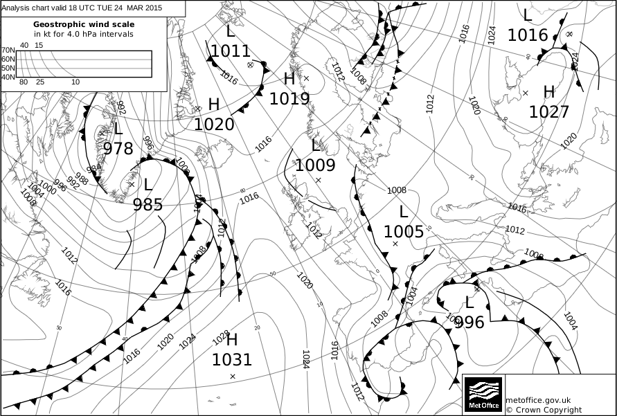
At 1800 UTC, a light northerly airflow covered south-west England, the location of the photograph, between a ridge of high pressure in the eastern Atlantic and a shallow depression over continental Europe.
© Crown Copyright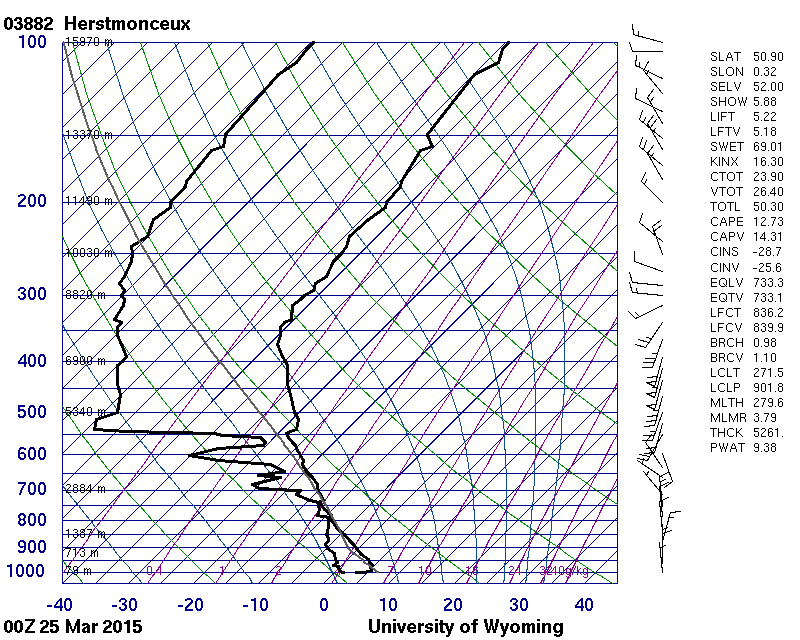
The Herstmonceux, England, UK (WMO 03882) 1200 UTC sounding shows a conditionally unstable atmosphere to about 4 500 m. The relatively dry air in the lowest 1 500 m likely aided evaporation of precipitation below the cloud base. A light to moderate northerly flow and weak vertical wind shear characterize the unstable layer.
© University of Wyoming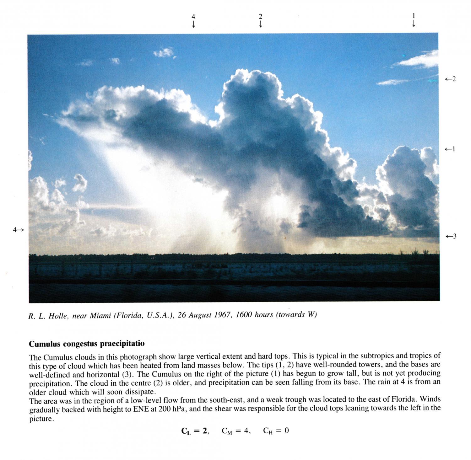
Cumulus congestus praecipitatio
The Cumulus clouds in this photograph show large vertical extent and hard tops. This is typical in the subtropics and tropics of this type of cloud which has been heated from land masses below. The tips 1 and 2 have well-rounded towers, and the bases are well-defined and horizontal. The Cumulus on the right of the picture has begun to grow tall, but is not yet producing precipitation. The cloud in the centre is older, and precipitation can be seen falling from its base. The rain at 6 is from an older cloud which will soon dissipate. .
The area was in the region of a low-level flow from the south-east, and a weak trough was located to the east of Florida. Winds gradually backed with height to ENE at 200 hPa, and the shear was responsible for the cloud tops leaning towards the left in the picture.
Links in the image description will highlight features on the image. Mouse over the features for more detail.
© R.L. HolleMiami, FL, United States of AmericaLatitude: 25° 45' 42'' NLongitude: 80° 11' 30'' W26 August 1967 1600 (Local Time)Camera direction: towards WCL = 2, CM = 4, CH = 0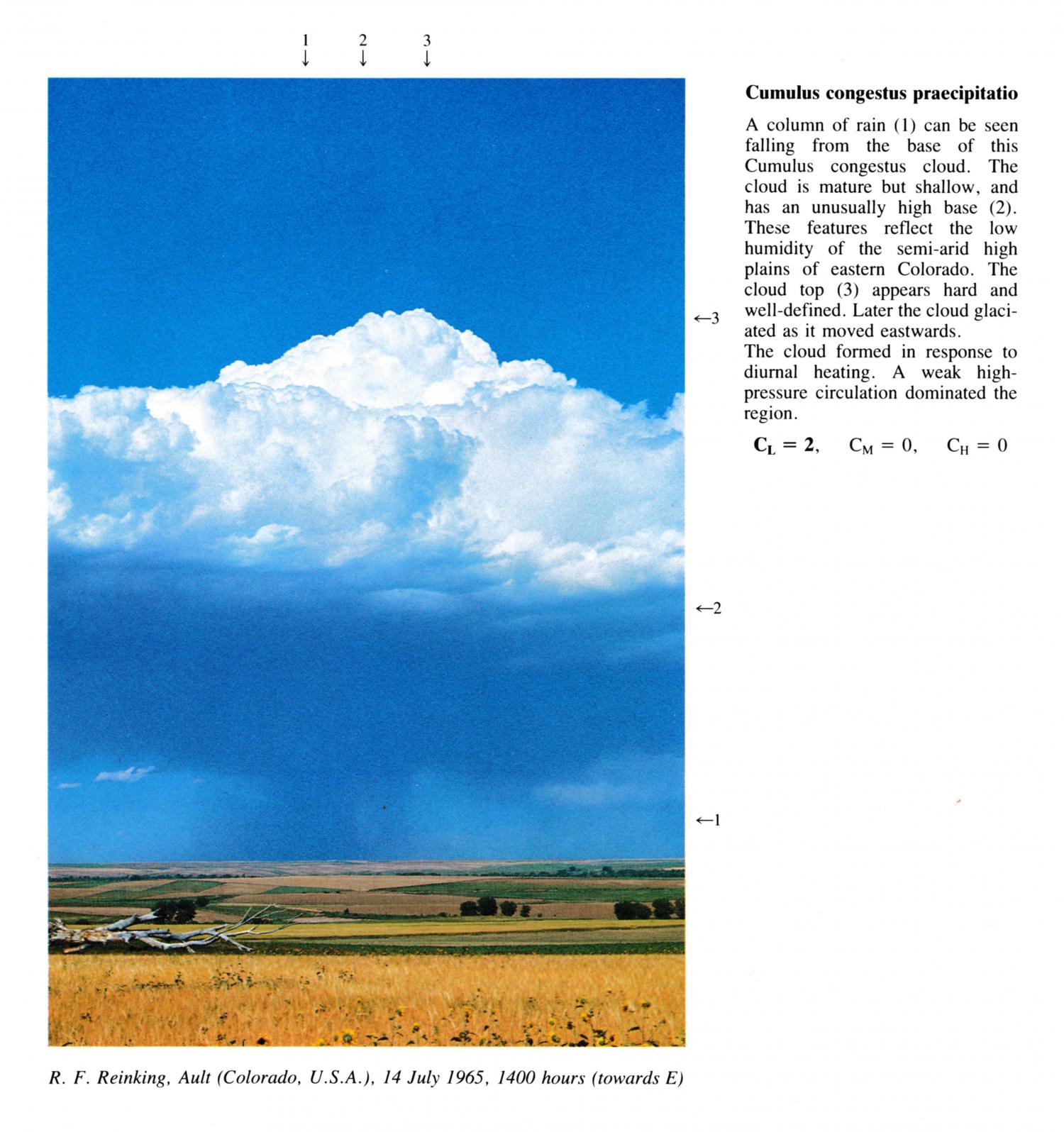
Cumulus congestus praecipitatio
A column of rain can be seen falling from the base of this Cumulus congestus cloud. The cloud is mature but shallow, and has an unusually high base. These features reflect the low humidity of the semi-arid high plains of eastern Colorado. The cloud top appears hard and well-defined. Later the cloud glaciated as it moved eastwards. The cloud formed in response to diurnal heating. A weak high pressure circulation dominated the region.
CL= 2, CM = 0, CH = 0
Links in the image description will highlight features on the image. Mouse over the features for more detail.
© R.F. ReinkingAult, Colorado, United States of AmericaLatitude: 40° 34' 57'' NLongitude: 104° 43' 55'' W14 July 1965 1400 (Local Time)Camera direction: towards ECL = 2, CM = 0, CH = 0