© Stephen Burt
Sorrento, Naples, Italy
Latitude: 40° 37' 52'' N
Longitude: 14° 22' 60'' E
26 May 2015 0926 (Local Time)
Camera direction: towards N
Image P/S code: S.9.3
Image I.D.: 3876
CL = 2, CM = 0, CH = 0
-

Cumulus congestus and haze
The image shows a good example of Cumulus congestus clouds with sharp outlines, dark bases and bright sunlit tops. The most developed cloud over Mt. Vesuvius, in the centre, is of great vertical extent, the upper part having strong sproutings with a cauliflower appearance. The clouds developed quickly on hillslopes in the region, in a light but unstable northerly airflow. A layer of haze can be seen on the left-hand side of the image.
Links in the image description will highlight features on the image. Mouse over the features for more detail.
© Stephen BurtSorrento, Naples, ItalyLatitude: 40° 37' 52'' NLongitude: 14° 22' 60'' E26 May 2015 0926 (Local Time)Camera direction: towards NCL = 2, CM = 0, CH = 0Image P/S code: S.9.3Image I.D.: 3876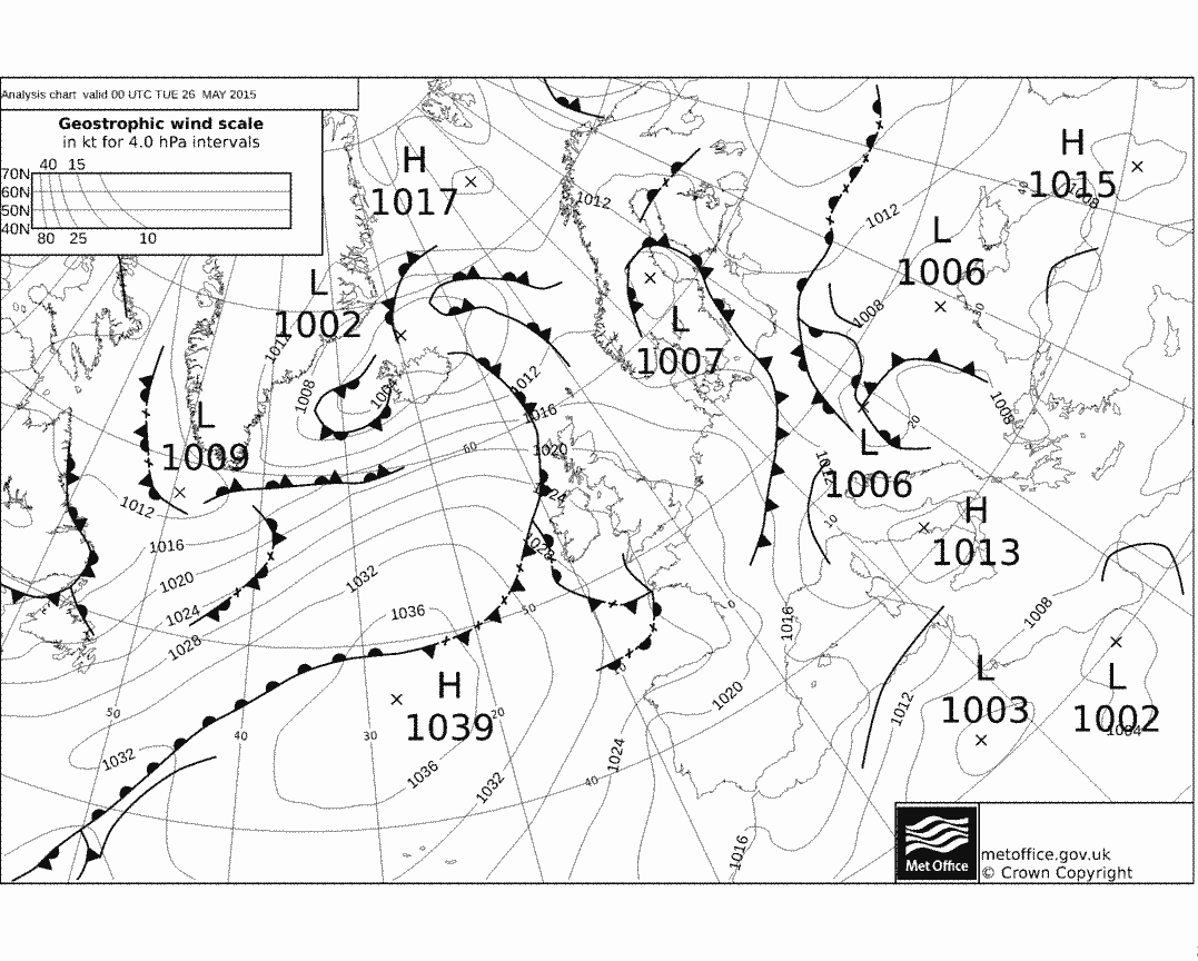
At 0000 UTC, central Italy lay in an unstable light northerly flow, with a small anticyclone of 1 013 hPa centred near Naples. The anticyclone helped to suppressed convection for several hours after dawn, after which the Cumulus clouds grew rapidly.
© Crown Copyright
The sounding from Pratica di Mare, Italy (WMO 16245) at 1200 UTC shows an atmosphere that is unstable to daytime temperatures.
© University of Wyoming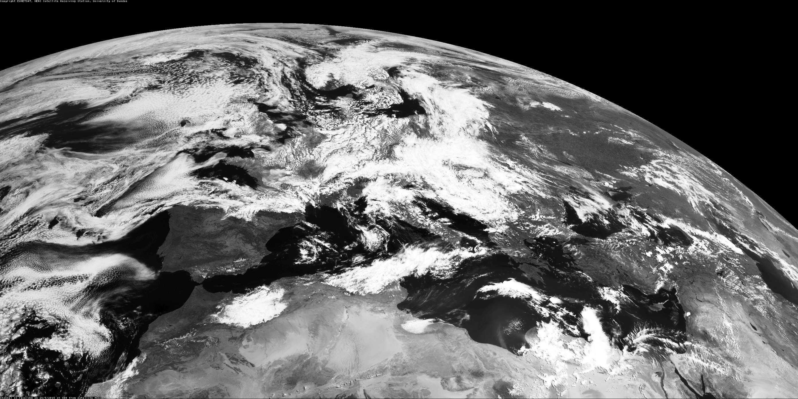
On the 0900 UTC Meteosat image, the speckled pattern of cloud over central Italy is Cumulus cloud building up in response to rising daytime temperatures.
© NEODAAS/University of Dundee