© Frank Le Blancq
Portelet, St Brelade, Jersey
Latitude: 49° 10' 23'' N
Longitude: 2° 10' 24'' W
11 January 2012 0910 (Local Time)
Camera direction: towards SW
Image P/S code: P.7.7
Image I.D.: 4714
CL = 5, CM = /, CH = /
-
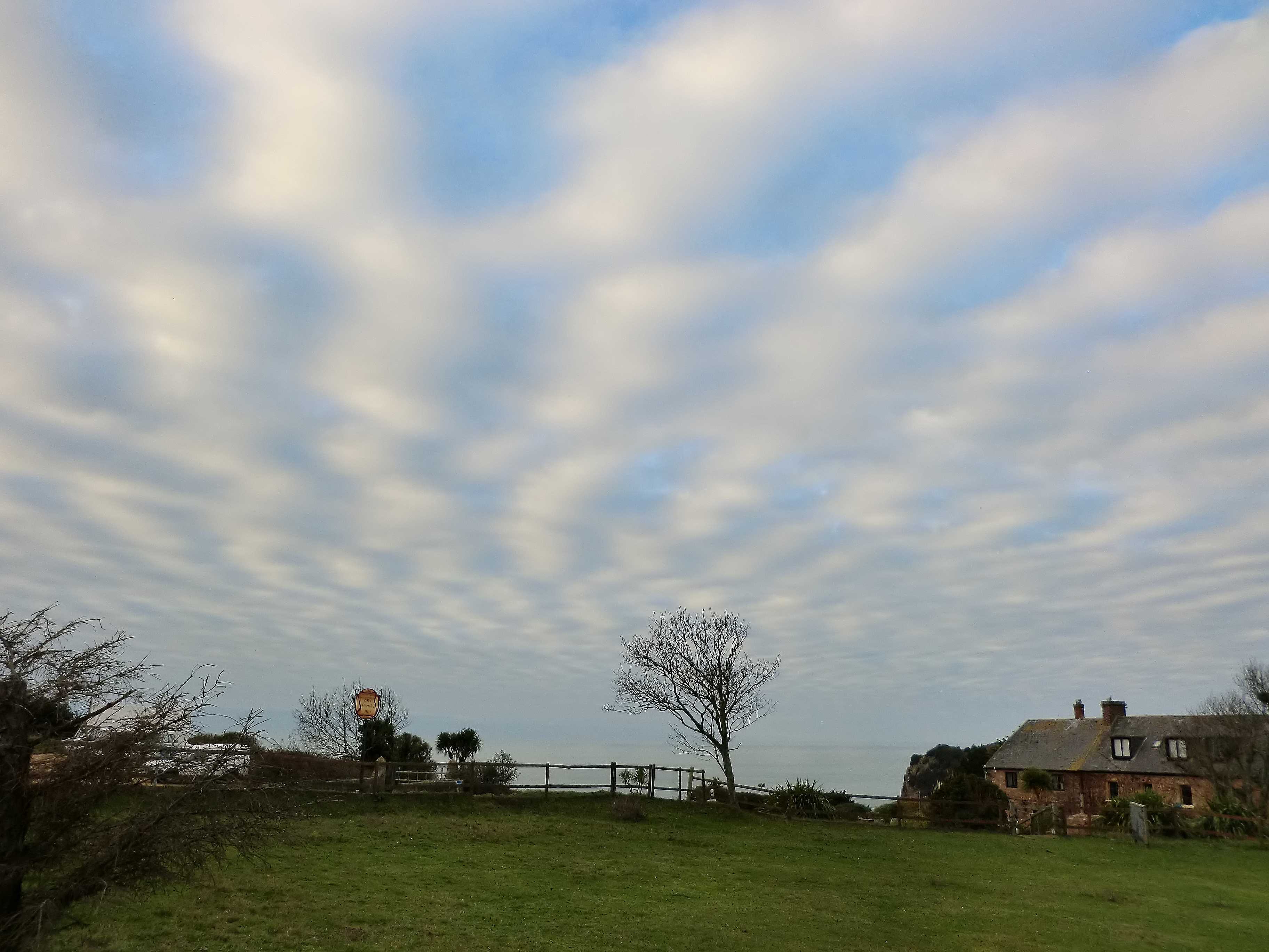
Stratocumulus stratiformis translucidus undulatus
This extensive layer of rolls of grey and whitish cloud is typical of Stratocumulus stratiformis. The cloud is not very thick, with areas of blue sky visible through the layer, and the merged elements are arranged in nearly parallel lines; these features identify the varieties translucidus and undulatus. A nearby synoptic station reported a cloud base of 4 000 ft with an estimated cloud top of 5 500 ft from a representative sounding.
Links in the image description will highlight features on the image. Mouse over the features for more detail.
© Frank Le BlancqPortelet, St Brelade, JerseyLatitude: 49° 10' 23'' NLongitude: 2° 10' 24'' W11 January 2012 0910 (Local Time)Camera direction: towards SWCL = 5, CM = /, CH = /Image P/S code: P.7.7Image I.D.: 4714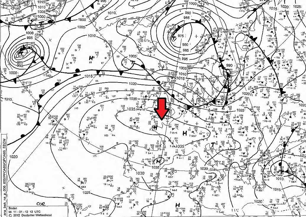
The area was dominated by an anticyclone which extended from eastern Europe across northern France to the East Atlantic, with one centre over Germany and another (1 037 hPa) over Brittany, France, close to the photo location. The nearest active fronts and lows were far to the north.
© Deutscher Wetterdienst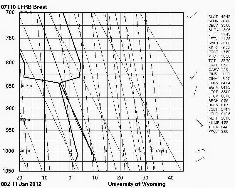
The Brest, France (WMO 07110) sounding at 0000 UTC, taken in the same air mass, shows a gradual moistening of the air, especially from 900 hPa to 843 hPa. The moist layer is capped by a strong inversion of nearly 8 °C between 843 hPa (96 %RH) and 830 hPa (18 %RH), which is typical of a strong anticyclone as dry warming air from aloft descends to lower levels.
© University of Wyoming