© Frank Le Blancq
Jersey Airport, St. Peter, Jersey
Latitude: 49° 12' 23'' N
Longitude: 2° 11' 44'' W
04 August 2011 1217 (Local Time)
Camera direction: towards NW
Image P/S code: P.8.1
Image I.D.: 4717
CL = 6, CM = /, CH = /
-
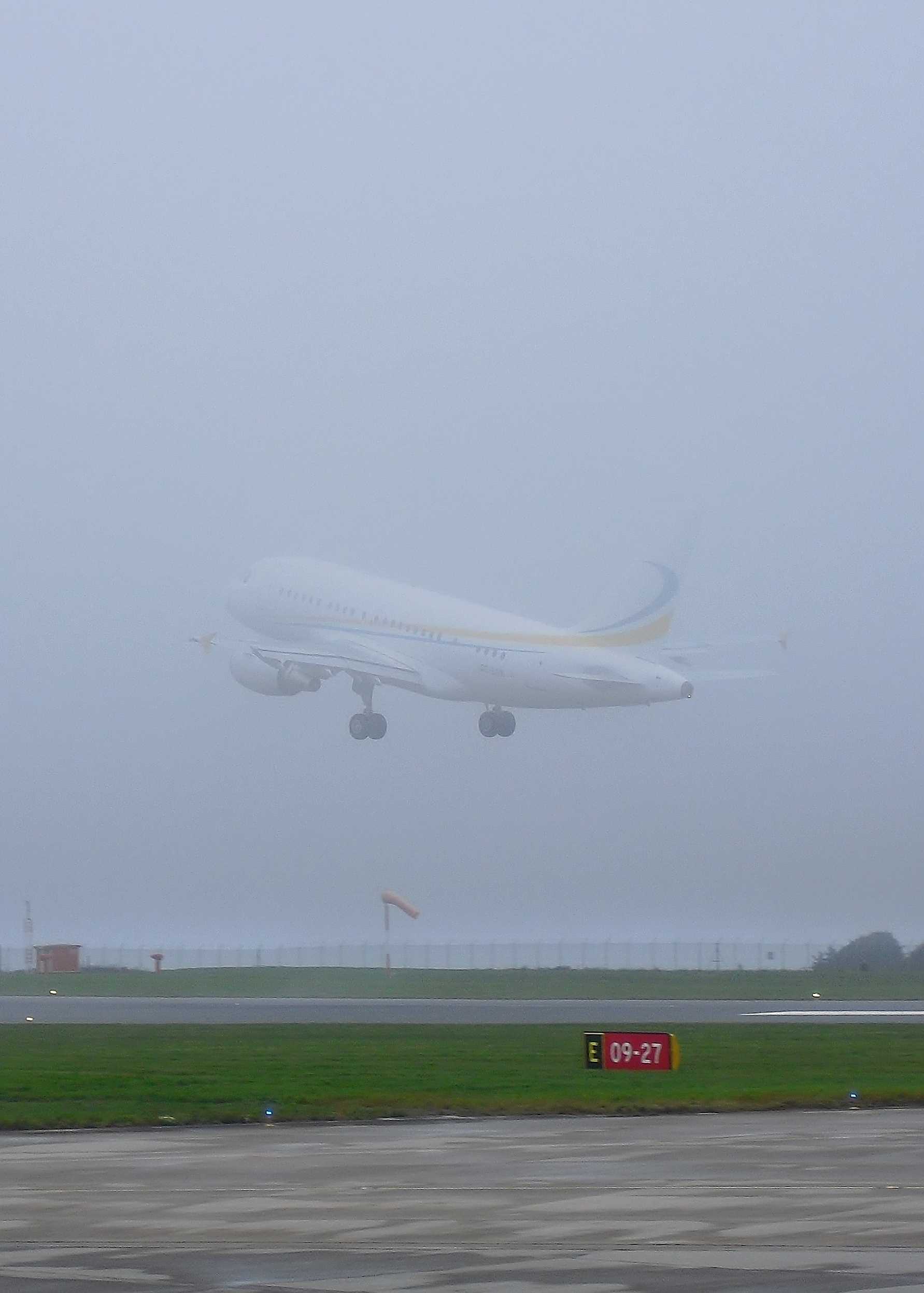
Stratus nebulosus
Stratus is generally a grey layer of cloud with a fairly uniform base. In this image, the uniform, featureless nature of the species nebulosus can be seen. The departing aircraft shows the diffuse nature of the low cloud base (27 to 30 m (90 to 100 ft)) as it begins to disappear into the Stratus layer. The tip of the tail has disappeared from view, but the undercarriage remains visible. The whole aircraft disappeared in the cloud within 2 seconds. As no precipitation was falling, it is a typical Stratus cloud not of bad weather. The hut, windsock and trees lack clarity as the horizontal visibility was reduced by a thick mist.
Links in the image description will highlight features on the image. Mouse over the features for more detail.
© Frank Le BlancqJersey Airport, St. Peter, JerseyLatitude: 49° 12' 23'' NLongitude: 2° 11' 44'' W04 August 2011 1217 (Local Time)Camera direction: towards NWCL = 6, CM = /, CH = /Image P/S code: P.8.1Image I.D.: 4717
At 1200 UTC, shallow low pressure of 1005 hPa was centred over the Irish Sea. A weak warm sector covered the southern English Channel. The photograph was taken just ahead of the weak cold front which passed over the airfield about 1 hour later.
© Deutscher Wetterdienst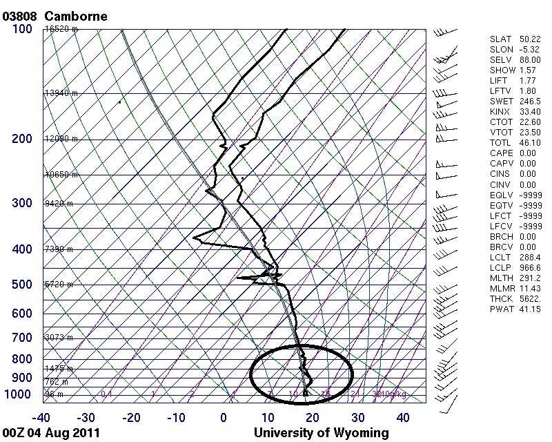
The sounding was taken about 12 hours earlier than the photograph in the same warm sector. It shows moist conditions from the surface to about 500 hPa (5 600 m) and, in particular, the moist stable air in the boundary layer.
© University of Wyoming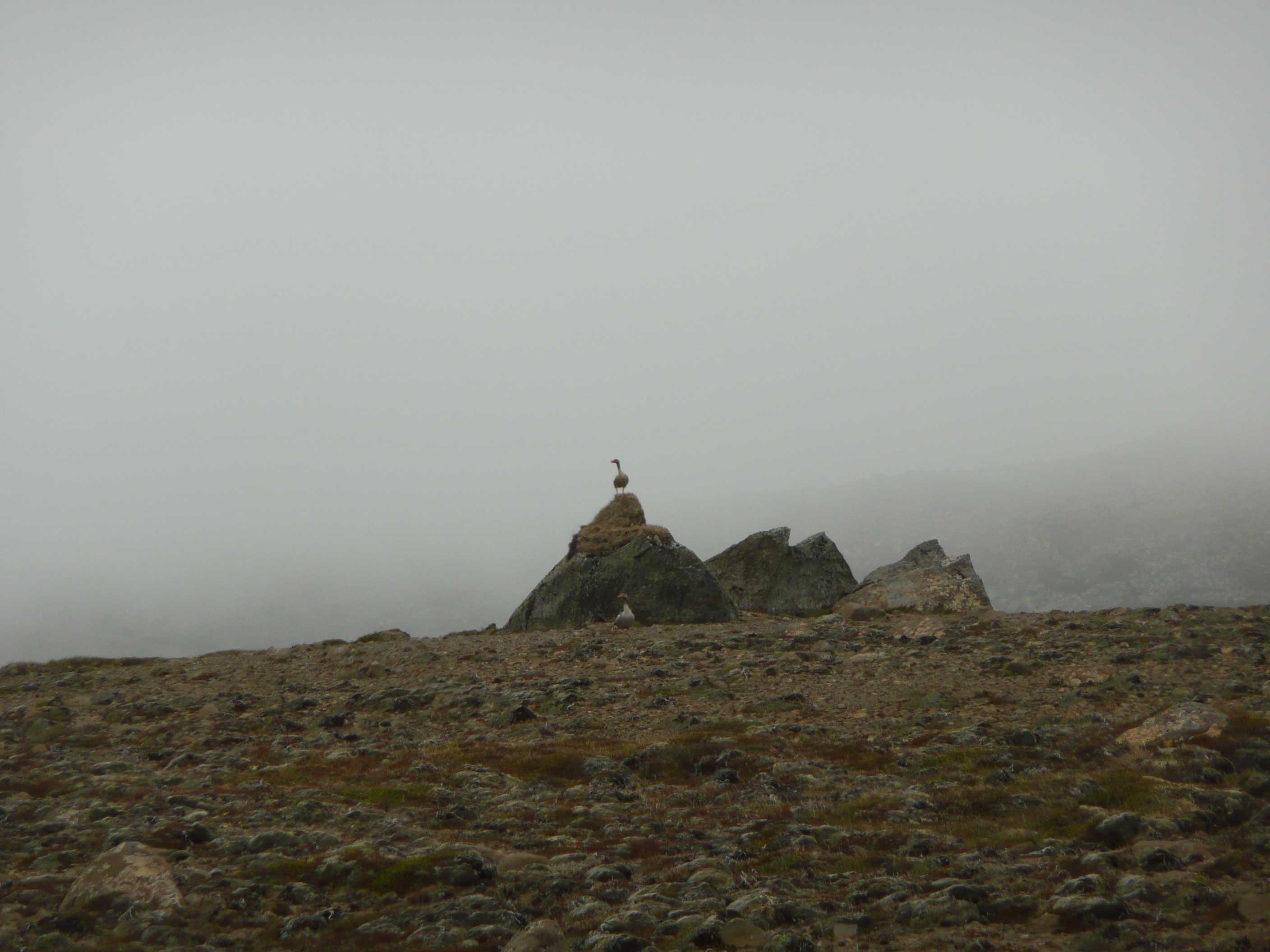
Stratus nebulosus
Stratus is generally seen as a grey cloud layer with a fairly uniform base, which may give drizzle, snow or snow grains. This photograph shows the uniform and almost featureless layer of cloud of the species nebulosus. The hills in the background are only just visible, indicating the presence of a thick mist and, as a light drizzle was occurring at the time the image was taken, the cloud is regarded as a Stratus of wet weather.
Links in the image description will highlight features on the image. Mouse over the features for more detail.
© Kirsten WicherNear Akureyri, IcelandLatitude: 65° 44' 3'' NLongitude: 17° 50' 28'' W23 June 2011 1325 (Local Time)Camera direction: towards SWCL = 7, CM = /, CH = /Image P/S code: S.8.1Image I.D.: 4783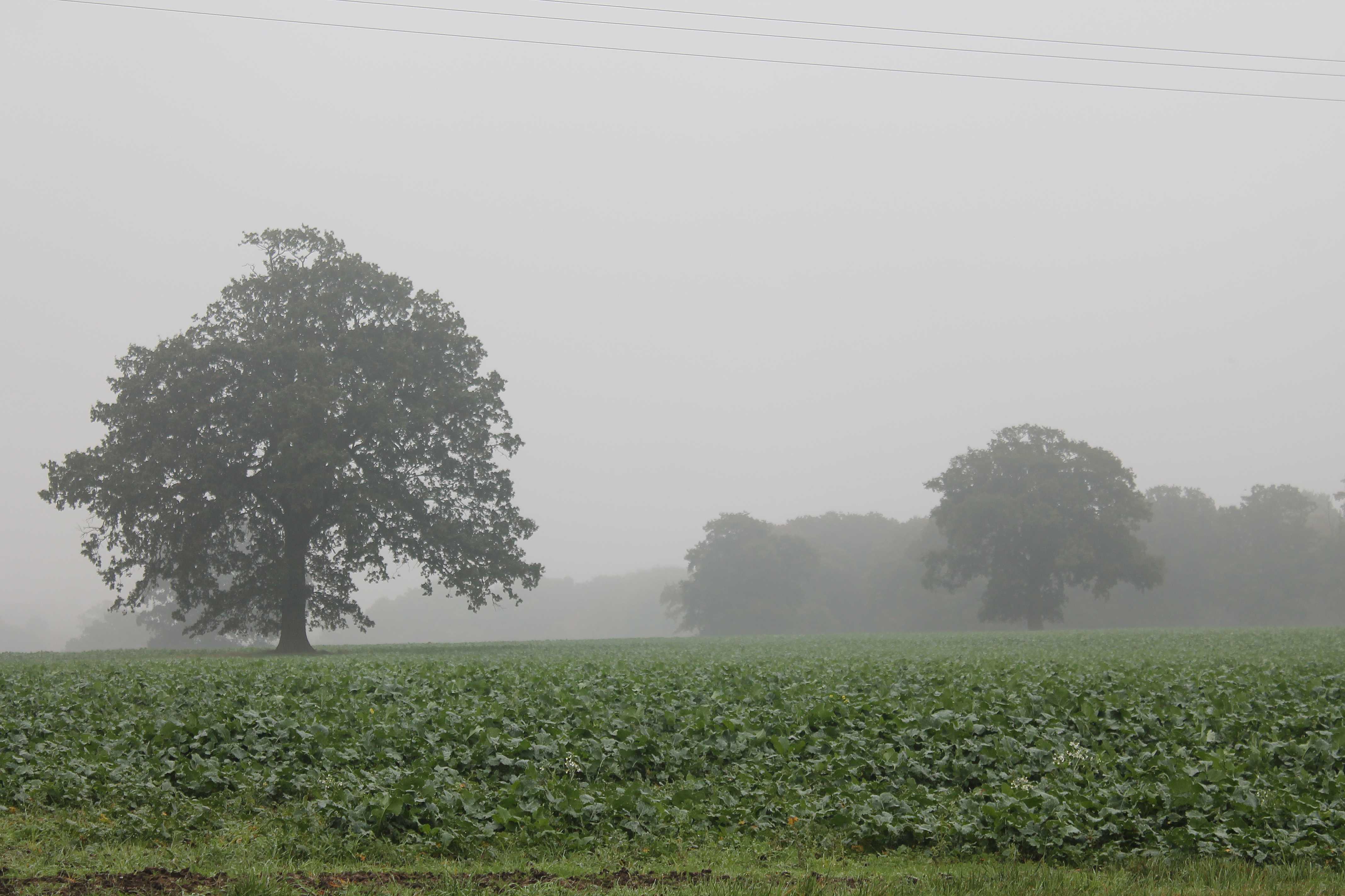
Mist
At the time of this photograph in the late morning, overnight fog was slowly lifting into mist and low Stratus. The horizontal visibility was estimated to be 1 100 m.
Mist is a suspension of very small, usually microscopic water droplets in the air that reduce the horizontal visibility at the Earth's surface to not less than 1 km. When the visibility is less than 1 km, the obscuration is due to fog. In practice, mist is considered synonymous with “light fog”.
The bank of trees on the right are about 450 m away from the observation point. In the distance, trees at 800 m are visible, and more distant ground features are just discernible on the far left at around 1 100 m. The overcast layer of low cloud is Stratus nebulosus and, as the Sun is not visible, the variety is opacus.
Links in the image description will highlight features on the image. Mouse over the features for more detail.
© George AndersonBracknell, England, United Kingdom of Great Britain and Northern IrelandLatitude: 51° 25' 26'' NLongitude: 0° 48' 25'' W01 November 2016 1038 (Local Time)Camera direction: towards ESECL = 6, CM = /, CH = /Image P/S code: P.11.1.1.1Image I.D.: 5186
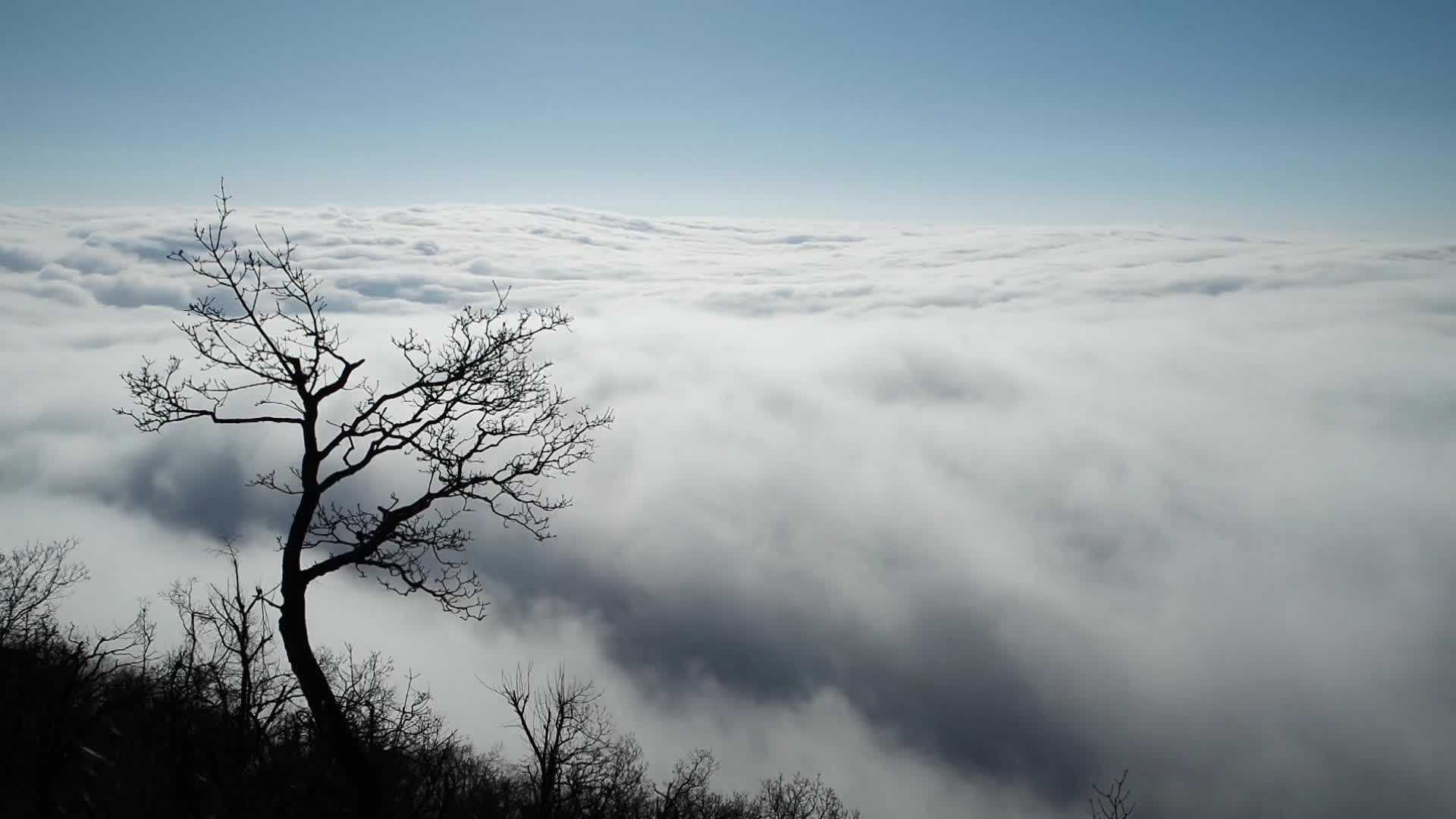
Stratus viewed from above
Viewed from above, the upper surface of Stratus generally shows undulations (usually of short wavelength) as shown in this time-lapse video, filmed from the Pilis mountain in Hungary. In strong winds the undulations become more pronounced. The top of the Stratus was estimated to be at an altitude of about 500 m.
Links in the image description will highlight features on the image. Mouse over the features for more detail.
© Kornél KolláthPilisszentkereszt, HungaryLatitude: 47° 41' 26'' NLongitude: 18° 52' 44'' E25 December 2015 1127 (Local Time)Camera direction: towards SWCL = 6, CM = /, CH = /Image P/S code: S.8.1Image I.D.: Array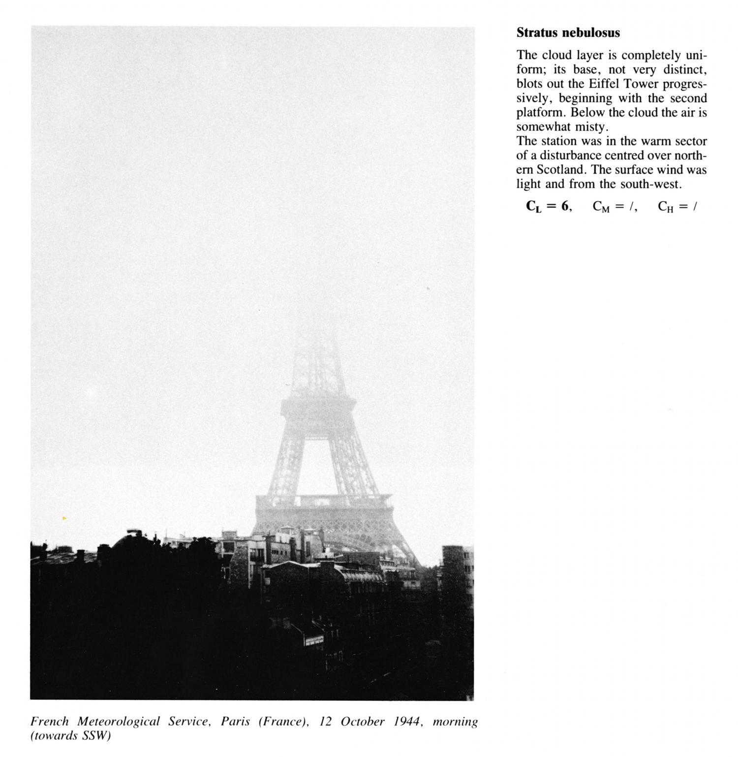
Stratus nebulosus
(NB. Time of day highly uncertain; morning only specified)
The cloud layer is completely uniform; its base, not very distinct, blots out the Eiffel Tower progressively, beginning with the second platform. Below the cloud the air is somewhat misty. The station was in the warm sector of a disturbance centred over northern Scotland. The surface wind was light and from the south-west.
Links in the image description will highlight features on the image. Mouse over the features for more detail.
© French Meteorological ServiceParis, FranceLatitude: 48° 51' 24'' NLongitude: 2° 21' 8'' E12 October 1944 0900 (Local Time)Camera direction: towards SSWCL = 6, CM = /, CH = /