© Jim Galvin
Exeter, Exeter, Devon, United Kingdom of Great Britain and Northern Ireland
Latitude: 50° 43' 35'' N
Longitude: 3° 28' 31'' W
02 August 2015 1943 (Local Time)
Camera direction: towards E
Image P/S code: P.4.4
Image I.D.: 4722
CL = 0, CM = 8, CH = 0
-
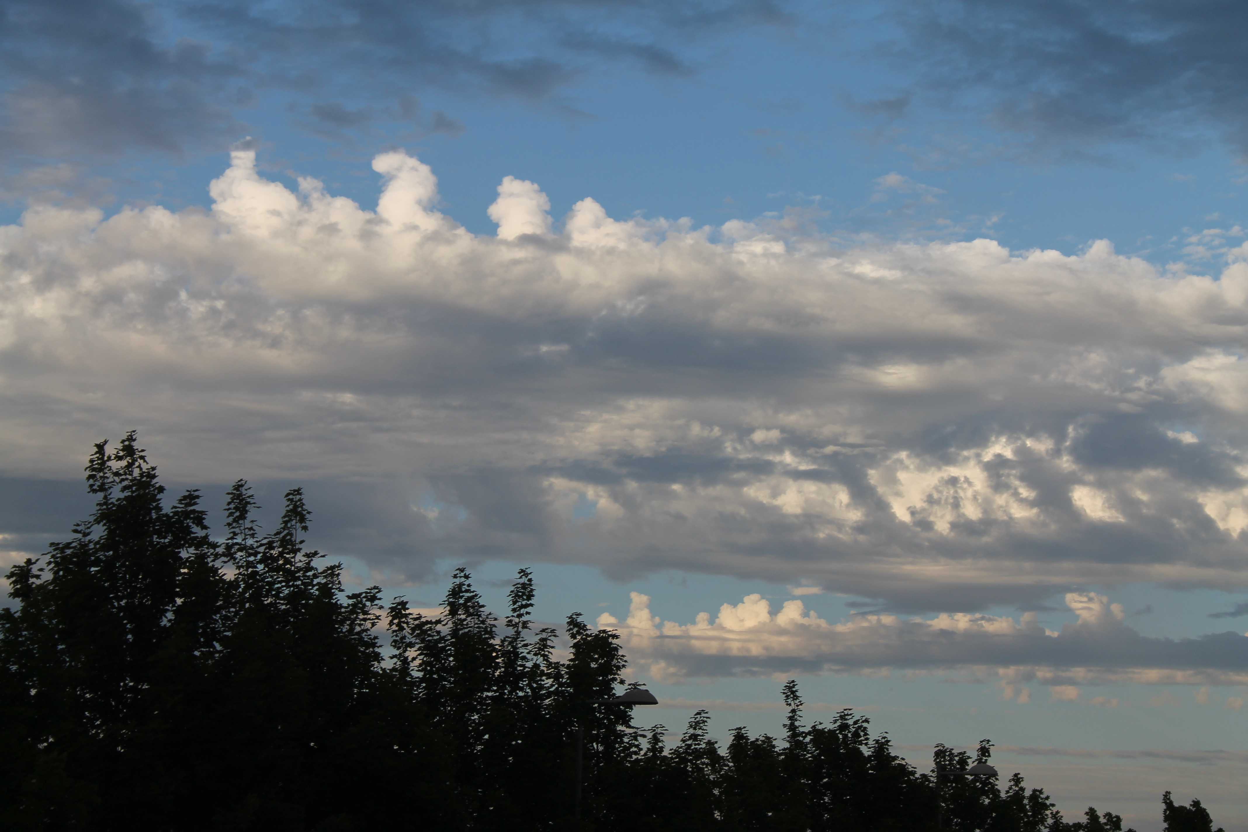
Altocumulus castellanus radiatus
Cumuliform towers in the form of turrets give this cloud a crenelated appearance (species castellanus). The cumuliform turrets are taller than they are wide, have a common horizontal base and are arranged in parallel bands (variety radiatus). The towers may keep developing and transition to Cumulus congestus as there looks to be significant development in one of the bands, which is unfortunately masked by cloud in the foreground.
The cloud base appeared too high to be Stratocumulus, confirmed by a nearby upper air sounding and observations from Dunkeswell Airport, England, UK.
Links in the image description will highlight features on the image. Mouse over the features for more detail.
© Jim GalvinExeter, Exeter, Devon, United Kingdom of Great Britain and Northern IrelandLatitude: 50° 43' 35'' NLongitude: 3° 28' 31'' W02 August 2015 1943 (Local Time)Camera direction: towards ECL = 0, CM = 8, CH = 0Image P/S code: P.4.4Image I.D.: 4722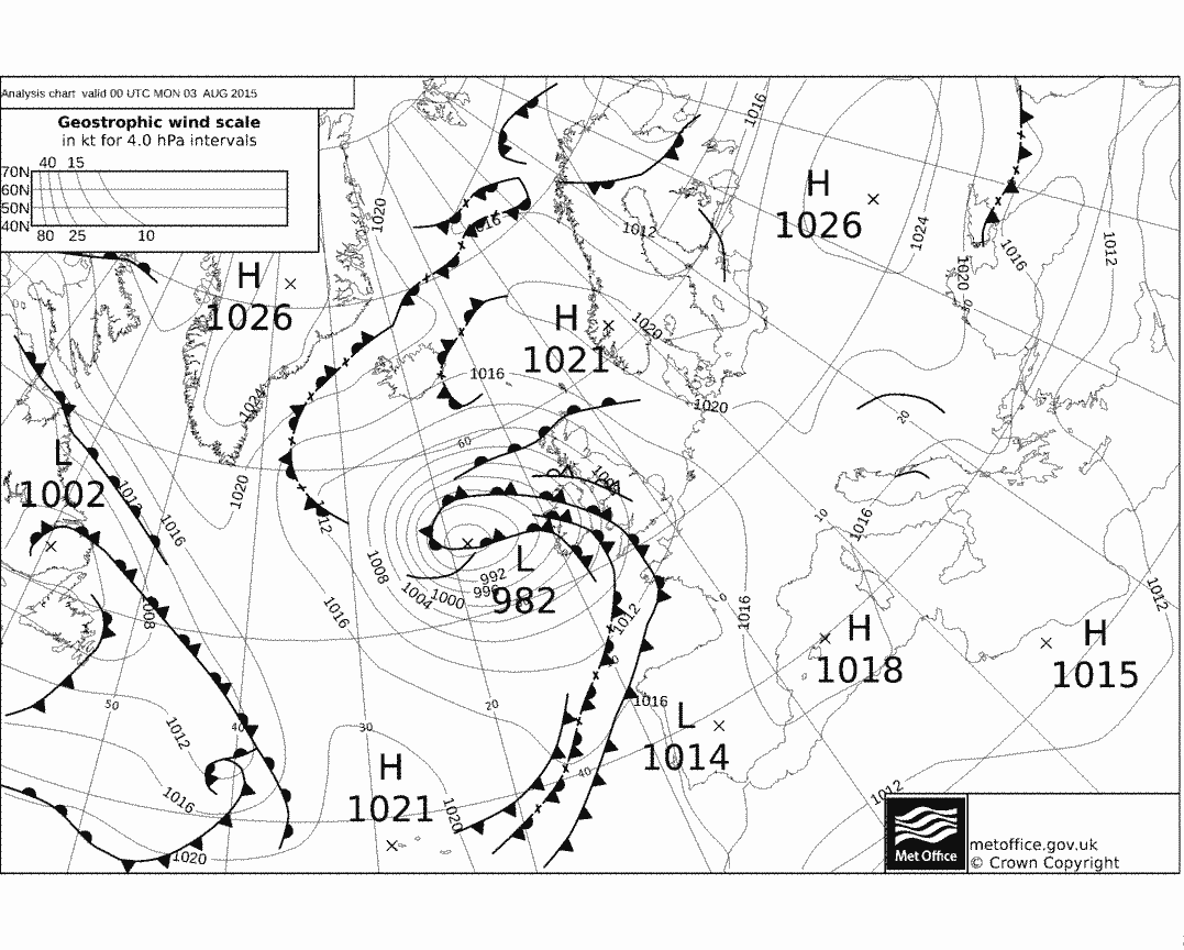 © Crown Copyright
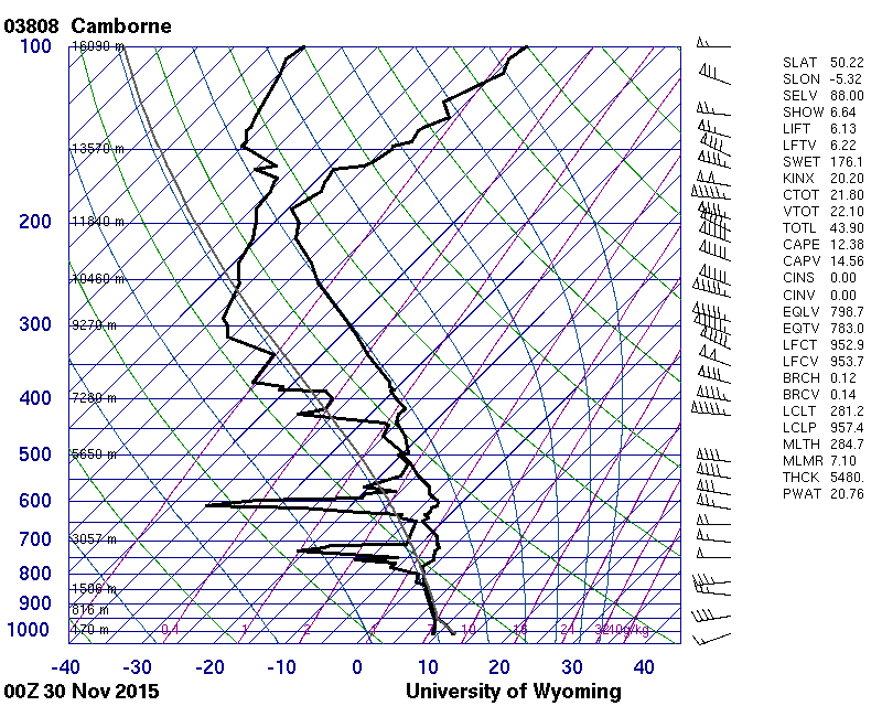
Sounding 140 km to the west-south-west, 4.5 hours after the photo. Unstable moist layer from 600 to 3 400 m.
© University of Wyoming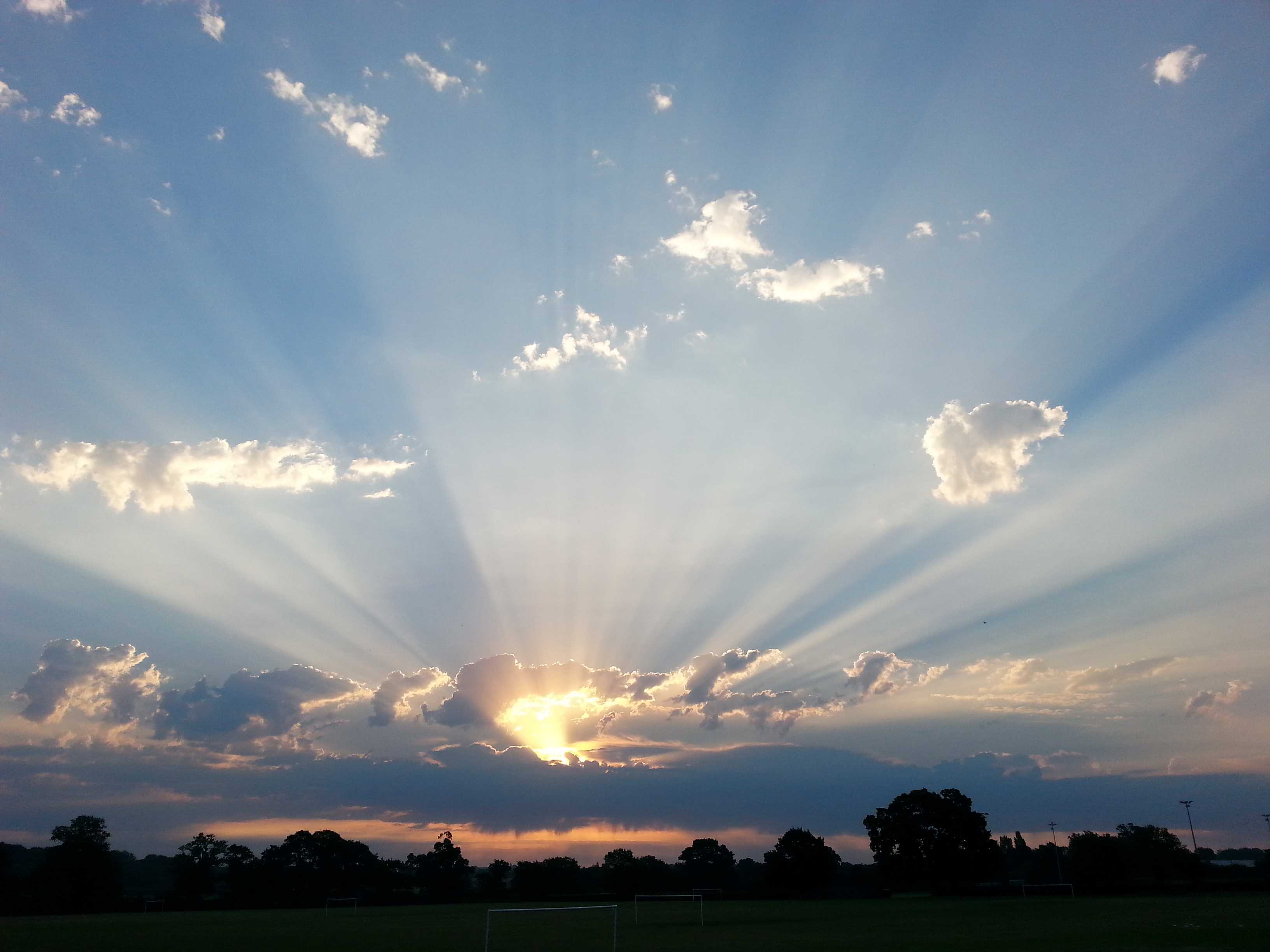
Crepuscular rays and Altocumulus castellanus and Altocumulus floccus
Crepuscular rays at 1 and 2 emanate from the rising Sun behind Altocumulus cloud in this picture from Wokingham in southern England, UK.
The term “crepuscular rays” normally refers to dark bluish streaks and light beams observed radiating from the Sun across the twilight sky. However, the name can also be used to refer to the shadowed bands and light beams which diverge from the Sun at any time of day when it is hidden behind cloud.
In the top half of the photograph, the species of Altocumulus is floccus at 3 and 4. Just above the level of the Sun is a line of Altocumulus floccus, evolved from castellanus as the latter have lost a common base. The floccus elements are being sheared toward the north-east by the upper level south-westerly winds. Below the level of the Sun is a solid line of Altocumulus castellanus, from which virga can be seen falling beneath the cloud base. Many different stages of vertical development can be seen in the turreted tops of this line.
Observations from nearby weather stations and upper air soundings put the cloud base at 14 000 ft.
Links in the image description will highlight features on the image. Mouse over the features for more detail.
© George AndersonWokingham, England, United Kingdom of Great Britain and Northern IrelandLatitude: 51° 25' 16'' NLongitude: 0° 50' 23'' W01 July 2015 0535 (Local Time)Camera direction: towards NECL = 0, CM = 8, CH = 0Image P/S code: S.13.11.4.2Image I.D.: 4704
Altocumulus castellanus and Cirrostratus cumulonimbogenitus
This is classic Altocumulus castellanus. There are cumuliform turrets, some of which are taller than they are wide; the elements are arranged in lines and in each line the elements have a common horizontal base.
Altocumulus castellanus is an indicator of middle-level instability, which often leads to the development of Cumulonimbus and thunderstorms. Cumulonimbus clouds were observed at Amsterdam, Netherlands in the morning and afternoon of 9 June 2014 and a large area of thunderstorms spanned from western to north-western Germany when this photo was taken. Cirrostratus cumulonimbogenitus from these thunderstorms is visible on the left side of the horizon.
A very distant Cumulonimbus calvus top is to the south (right) of the Cirrostratus. CL=3 is not used as the base of this cell is beyond the horizon.
Links in the image description will highlight features on the image. Mouse over the features for more detail.
© Ger BremanNetherlandsLatitude: 52° 27' 29'' NLongitude: 5° 49' 0'' E09 June 2014 1443 (Local Time)Camera direction: towards SECL = 0, CM = 8, CH = 8Image P/S code: S.4.4 3Image I.D.: 4774
Altocumulus castellanus radiatus
Several long lines of Altocumulus, seen at 1, 2 and 3, appear to converge towards a point near the horizon (variety radiatus). The oblique view reveals turrets rising from a common horizontal base. A cold front and an upper-air disturbance were responsible for local rain earlier in the day.
Links in the image description will highlight features on the image. Mouse over the features for more detail.
© Barry ChanSai Kung, Hong Kong, ChinaLatitude: 22° 23' 1'' NLongitude: 114° 16' 15'' E17 January 2016 1735 (Local Time)CL = 0, CM = 8, CH = 0Image P/S code: S.4.4 2Image I.D.: 5646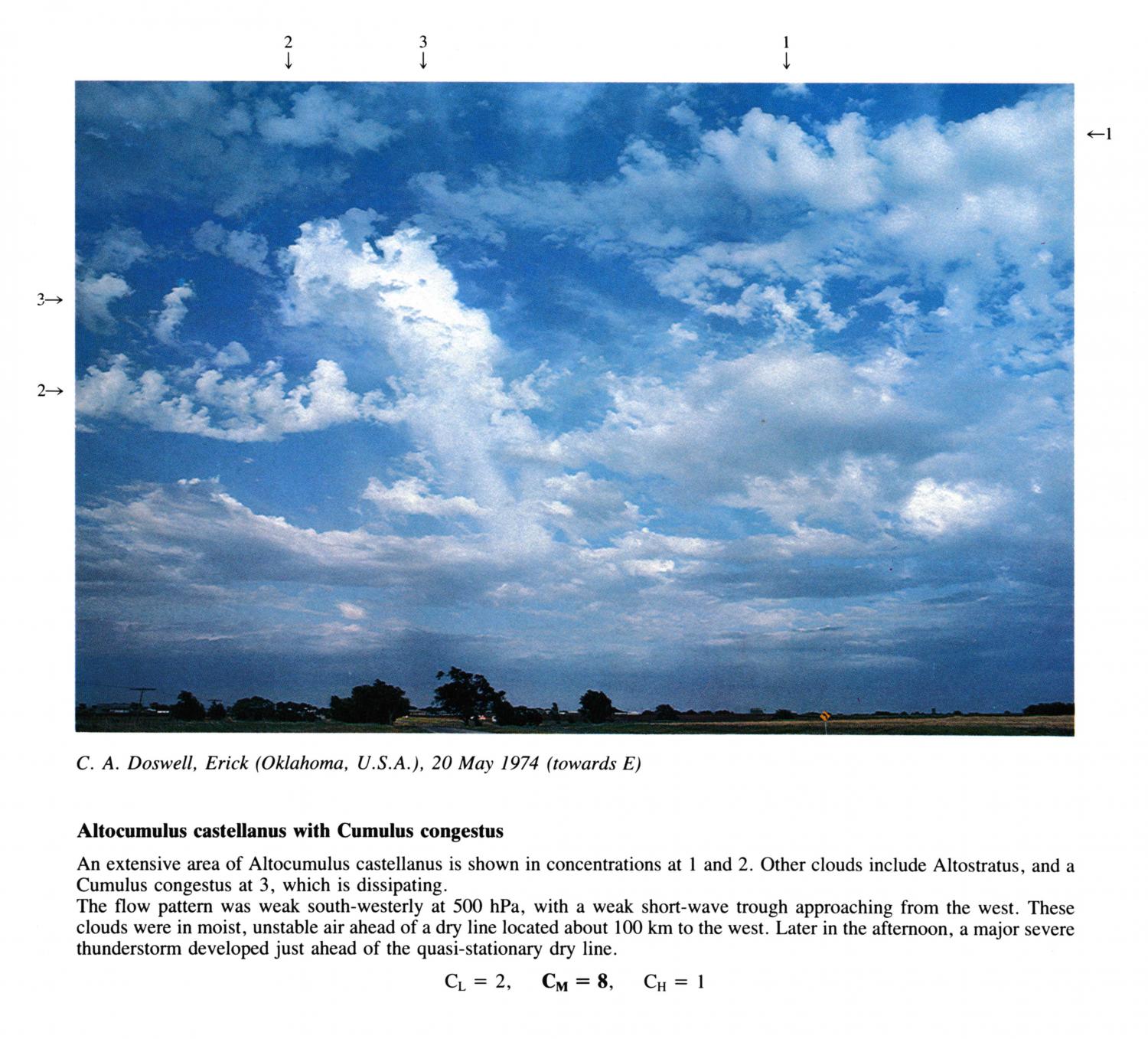
Altocumulus castellanus with Cumulus congestus
(NB. Hour of day estimated)
An extensive area of Altocumulus castellanus is shown in concentrations at 1 and 2. Other clouds include Altostratus, and a Cumulus congestus at 3, which is dissipating. The flow pattern was weak south-westerly at 500 hPa, with a weak short-wave trough approaching from the west. These clouds were in moist, unstable air ahead of a dry line located about 100 km to the west. Later in the afternoon, a major severe thunderstorm developed just ahead of the quasi-stationary dry line.
Links in the image description will highlight features on the image. Mouse over the features for more detail.
© C.A. DoswellErick, Oklahoma, United States of AmericaLatitude: 35° 12' 36'' NLongitude: 99° 51' 36'' W20 May 1974 1200 (Local Time)Camera direction: towards ECL = 2, CM = 8, CH = 1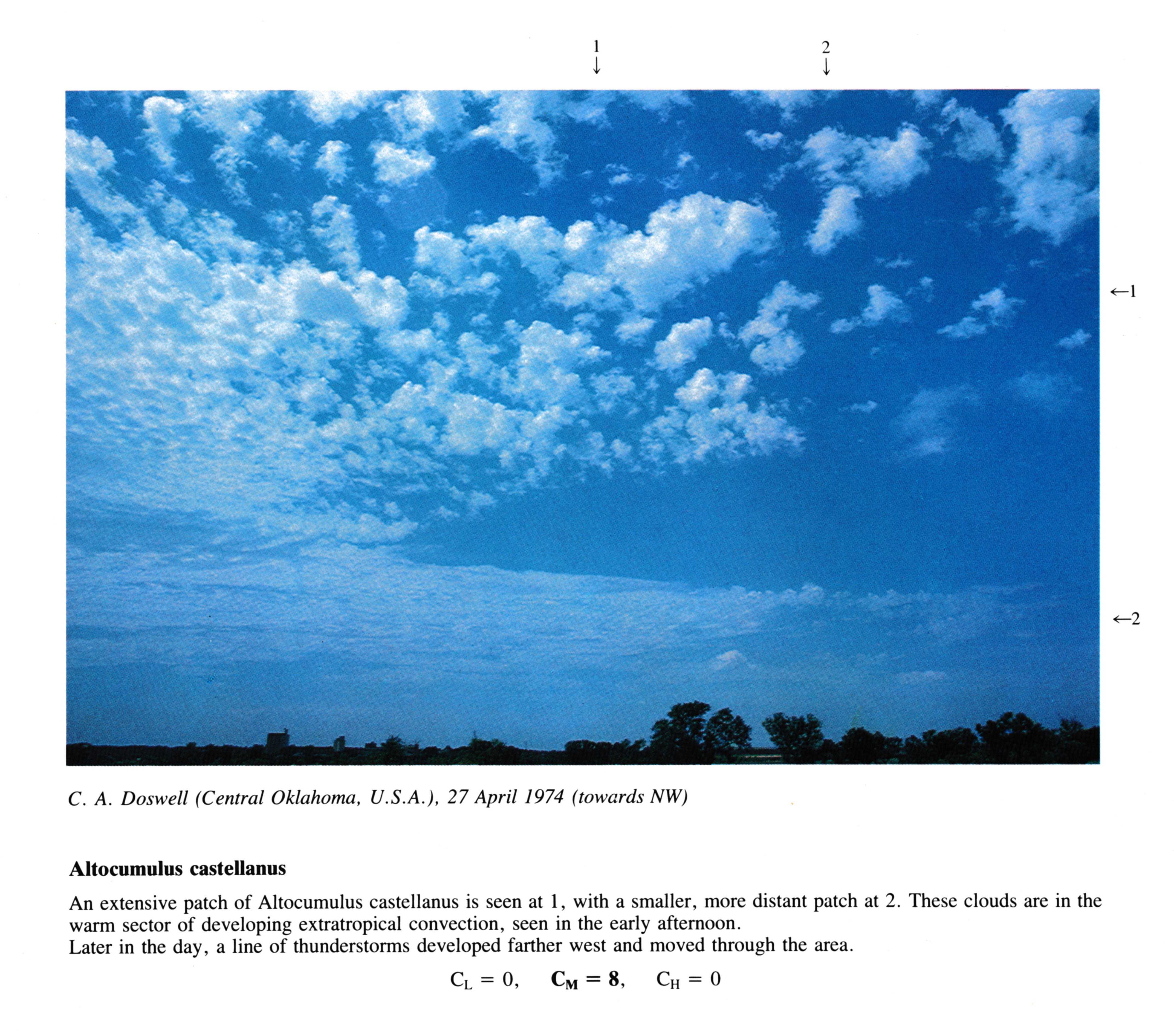
Altocumulus castellanus
(NB. Hour of day estimated)
An extensive patch of Altocumulus castellanus is seen at 1, with a smaller, more distant patch at 2. These clouds are in the warm sector of developing extratropical convection, seen in the early afternoon. Later in the day, a line of thunderstorms developed farther west and moved through the area.
Links in the image description will highlight features on the image. Mouse over the features for more detail.
© C.A. DoswellCentral Oklahoma, United States of AmericaLatitude: 35° 39' 27'' NLongitude: 97° 28' 19'' W27 April 1974 1200 (Local Time)Camera direction: towards NWCL = 0, CM = 8, CH = 0