© Stefan Kämpfe
Weimar, Thuringia, Germany
Latitude: 51° 0' 0'' N
Longitude: 11° 0' 0'' E
08 November 2015 1530 (Local Time)
Camera direction: towards SW
Image P/S code: S.3.2
Image I.D.: 4798
CL = 0, CM = 8, CH = 7
-
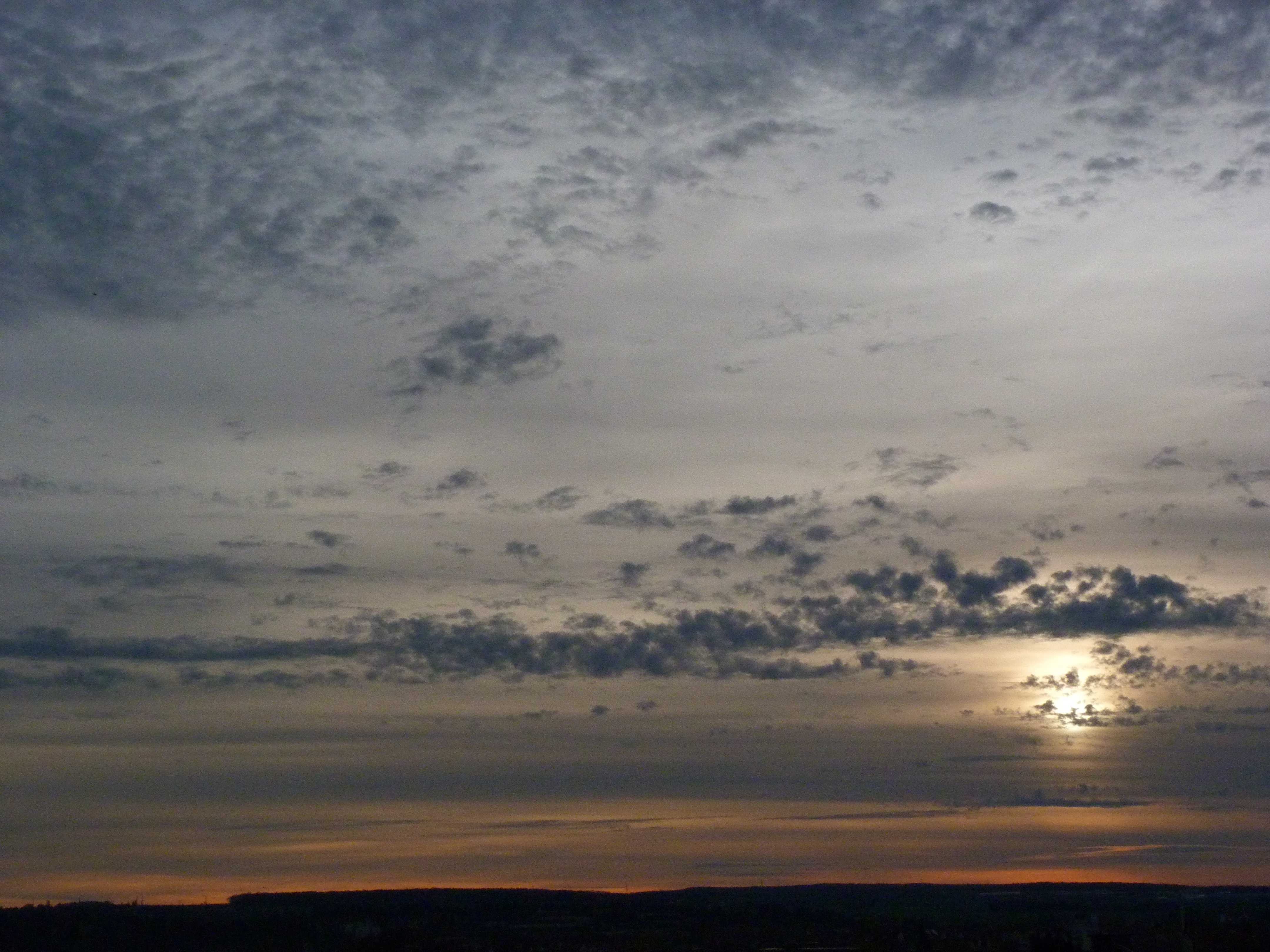
Cirrostratus fibratus and Altocumulus floccus
An overcast layer of Cirrostratus near the horizon can be mistaken for Altostratus. Cirrostratus is never thick enough to prevent objects on the ground from casting shadows, at least when the Sun is high above the horizon. When the Sun is low (less than about 30°), the greater slant depth of the atmosphere reduces the light intensity such that shadows may not be cast on the ground. In this photo the Sun was below 10°. An observer would have noted this “absence of shadows” by the presence of shading in thicker parts of the Cirrostratus fibratus veil.
Lower tufts of Altocumulus floccus and a small line of Altocumulus castellanus are also present. By the following morning, the cloud had thickened into Altostratus and possibly Nimbostratus; light rain was reported in the area. The location was ahead of a warm front and a series of cold fronts.
Links in the image description will highlight features on the image. Mouse over the features for more detail.
© Stefan KämpfeWeimar, Thuringia, GermanyLatitude: 51° 0' 0'' NLongitude: 11° 0' 0'' E08 November 2015 1530 (Local Time)Camera direction: towards SWCL = 0, CM = 8, CH = 7Image P/S code: S.3.2Image I.D.: 4798
This sounding from 57 km to the south-south-west and 3.5 hours before the photo shows very dry air from 917 to 514 hPa (800 to 5 900 m). The next sounding (8.5 hours after the photo) has a significant increase in middle-level moisture.
© University of Wyoming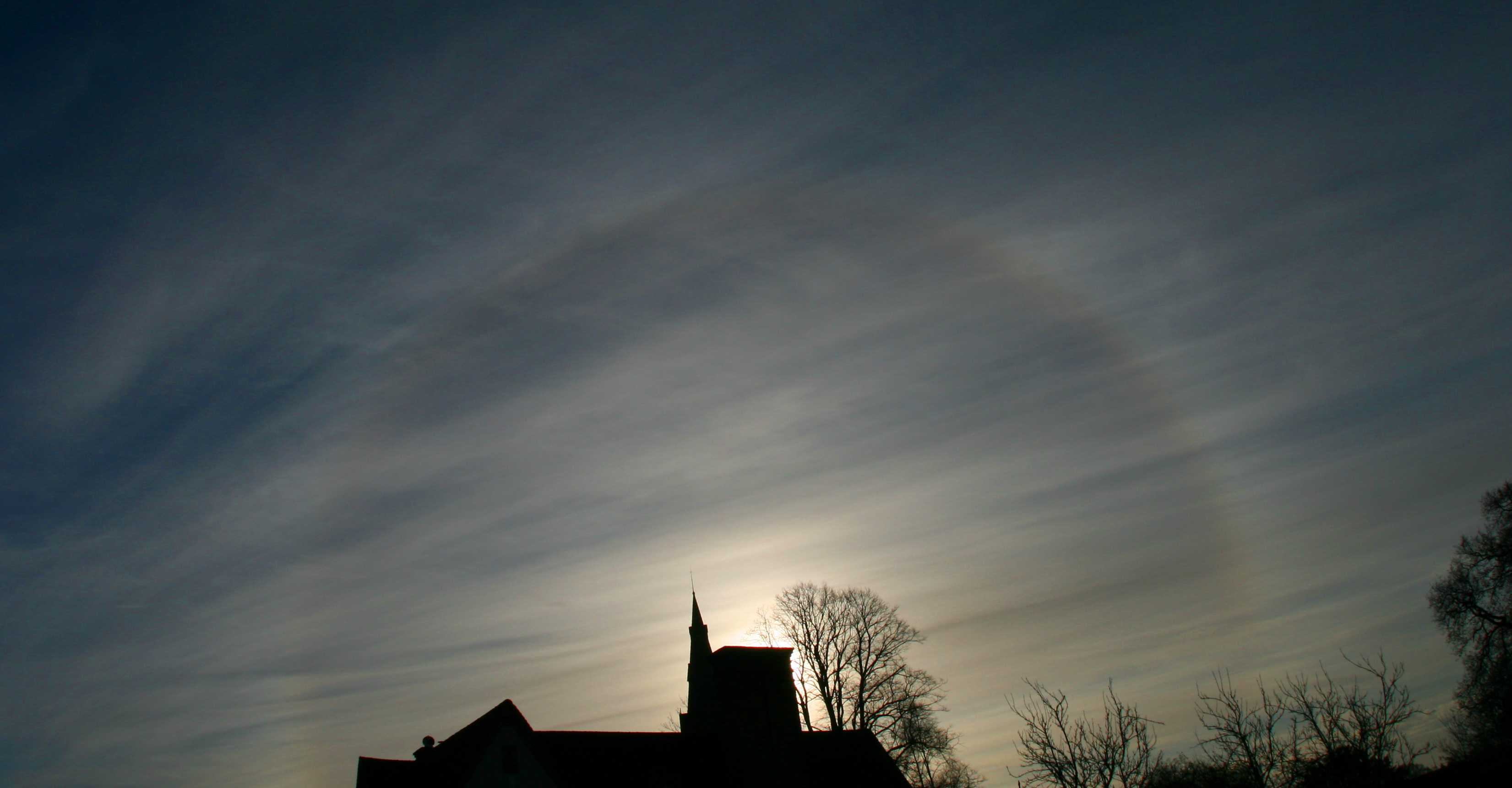
Cirrostratus fibratus undulatus with 22° halo
The double layer of Cirrostratus is identified by the alignment of fibratus striations. In the lower layer, the fibratus is aligned north-east to south-west; the higher layer is at a right angle to the lower layer; that is, south-east to north-west.
Links in the image description will highlight features on the image. Mouse over the features for more detail.
© Stephen BurtStratfield Mortimer, near Reading, Berkshire RG7, United Kingdom of Great Britain and Northern IrelandLatitude: 51° 22' 12'' NLongitude: 1° 2' 24'' W02 December 2009 1011 (Local Time)Camera direction: towards SECL = 0, CM = 0, CH = 8Image P/S code: P.3.2Image I.D.: 5491