© Javier Ceberio García
Madrid, Spain
Latitude: 40° 22' 6'' N
Longitude: 3° 36' 46'' W
09 June 2014 1604 (Local Time)
Camera direction: towards SE
Image P/S code: P.1.6
Image I.D.: 4810
CL = /, CM = /, CH = 5
-
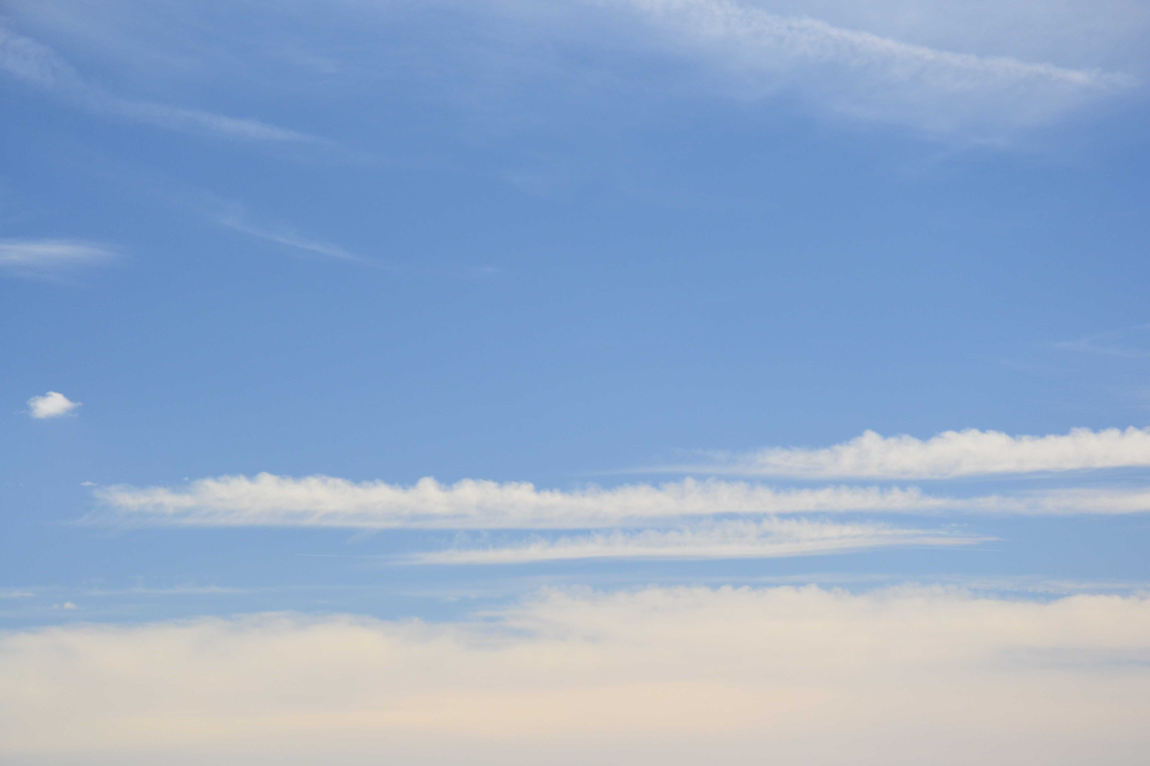
Cirrus castellanus
The image shows Cirrus with small rounded turrets or crenelations extending from a common base at 1 and 2, which identify it as the species castellanus. It is white in colour, but unlike Altocumulus castellanus, it has no shading or shadows. At the bottom of the image, a veil of Cirrostratus nebulosus is visible, with no distinct detail. Two aircraft condensation trails are visible at 4 and 5; both are within very high and fine Cirrus and Cirrostratus.
Links in the image description will highlight features on the image. Mouse over the features for more detail.
© Javier Ceberio GarcíaMadrid, SpainLatitude: 40° 22' 6'' NLongitude: 3° 36' 46'' W09 June 2014 1604 (Local Time)Camera direction: towards SECL = /, CM = /, CH = 5Image P/S code: P.1.6Image I.D.: 4810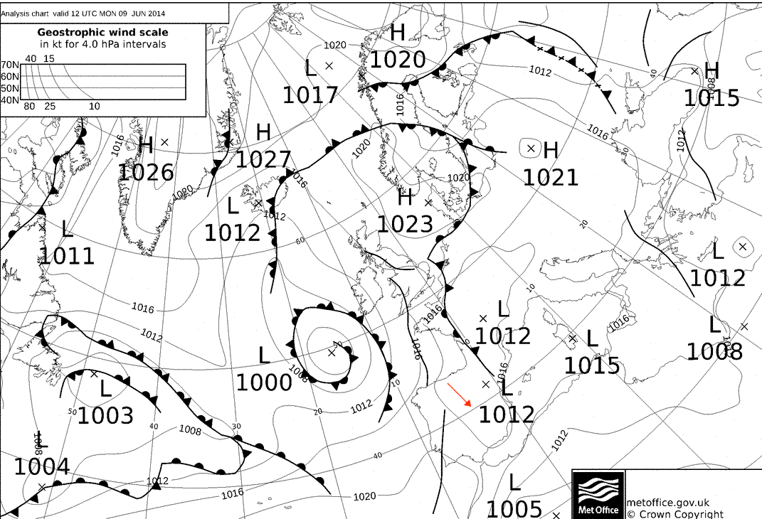
A broad low pressure area covered Spain. Instability was enhanced by an approaching trough.
© Crown Copyright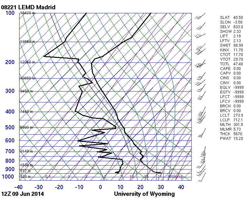
Unstable low levels and conditionally unstable middle levels, with cloud signatures from 507 to 493 hPa and 270 to 201 hPa
© University of Wyoming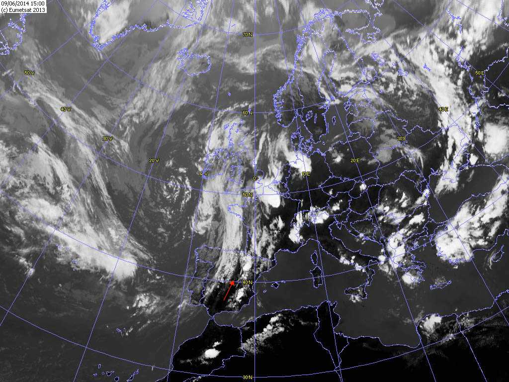
Satellite image an hour after the photo was taken. Cumulonimbus cells are developing to the east of Madrid, Spain in the unstable pre-frontal air mass. To the west of Madrid can be seen middle- and high-level cloud on the trough line.
© EUMETSAT, 2013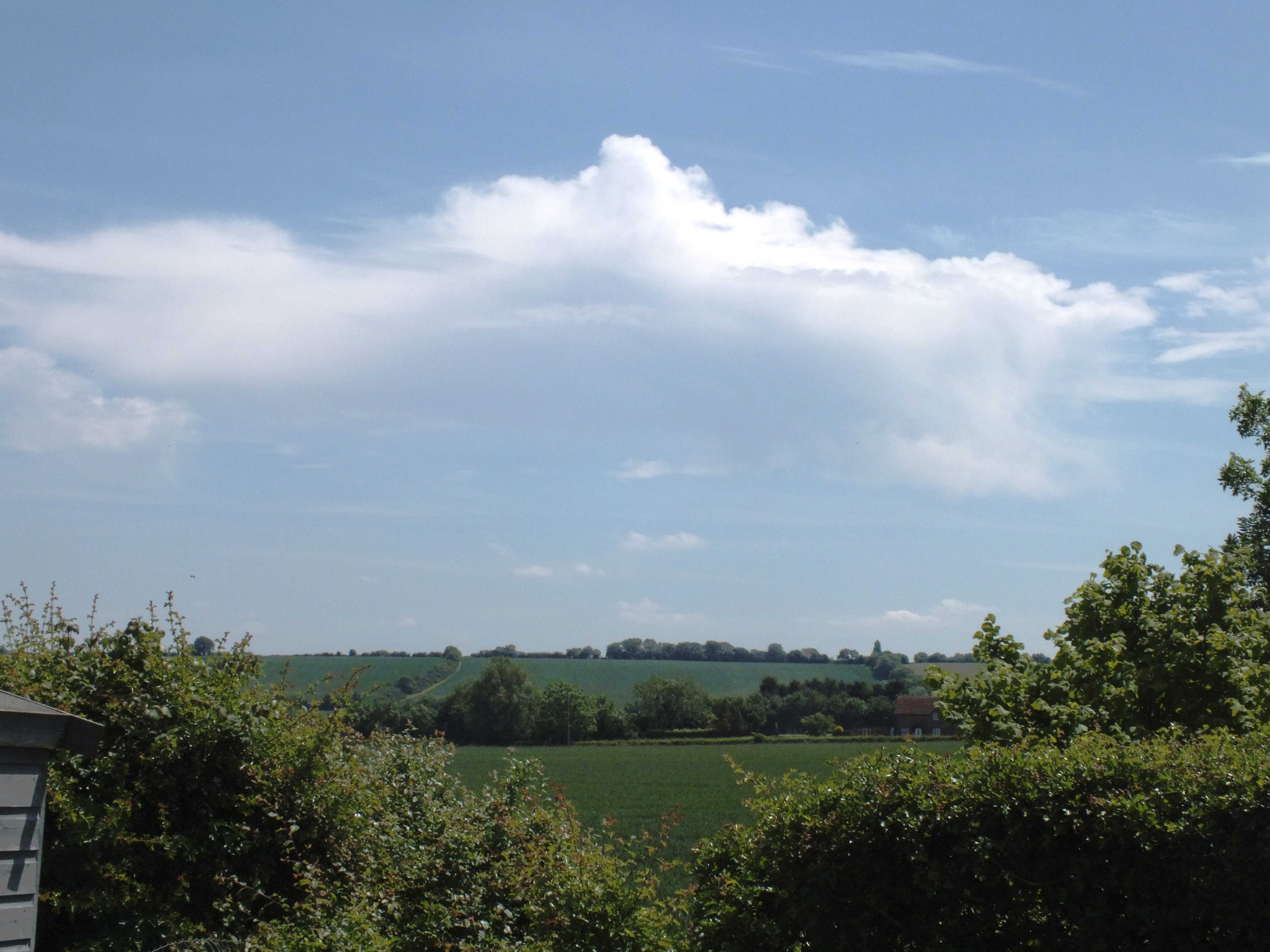
Cirrus spissatus and castellanus with mamma
Thick large patches of Cirrus spissatus at 1, 2 and 3 that appear to be the remains of the upper parts of Cumulonimbus. However, there was no Cumulonimbus development over England or Wales, UK on this day.
At the top of the main patch of spissatus there is considerable cumuliform development, which is sufficient to reclassify this patch as castellanus. Indistinct mamma can also be seen hanging from the base of this patch.
Numerous small patches of Atocumulus are present, as are Cumulus humilis cells and several areas of Cirrus.
Links in the image description will highlight features on the image. Mouse over the features for more detail.
© Rodney HaleHoughton Conquest, Bedford, Central Bedfordshire MK45, United Kingdom of Great Britain and Northern IrelandLatitude: 52° 4' 5'' NLongitude: 0° 28' 18'' W04 June 2015 1359 (Local Time)Camera direction: towards SECL = 1, CM = 3, CH = 2Image P/S code: S.1.6Image I.D.: 4842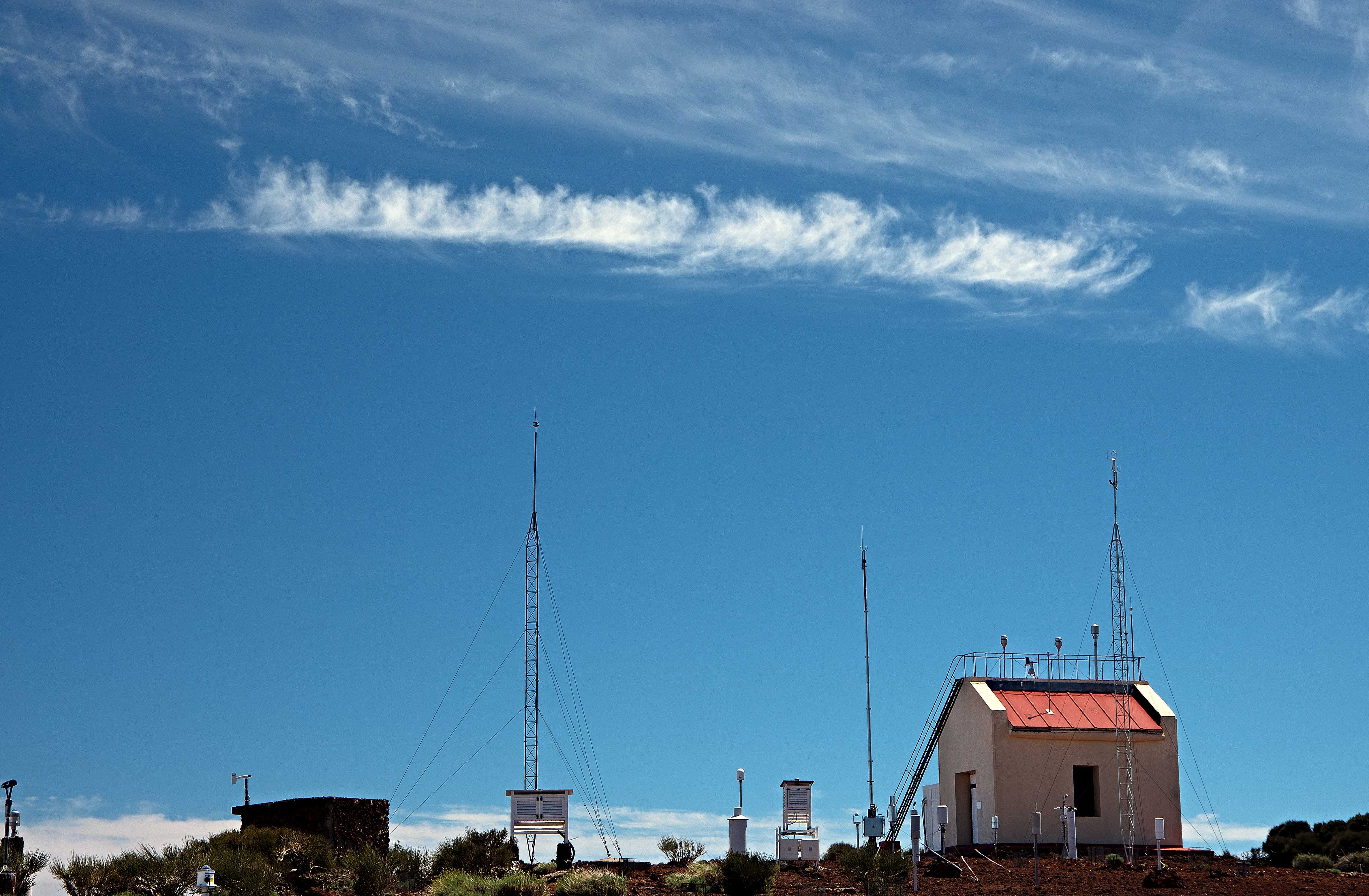
Cirrus castellanus and fibratus
This image, taken from about 2 380 m above sea level, shows an example of Cirrus castellanus. Seen from the side, the bright white Cirrus has protuberances in the form of turrets, which are connected by a common base and seem to be arranged in lines. In general, the turrets are taller than they are wide. The Cirrus was driven by south-west winds high in the troposphere, where cloud developed in conditions of high relative humidity. In the upper part of the image, Cirrus fibratus is visible.
Links in the image description will highlight features on the image. Mouse over the features for more detail.
© Rubén del Campo-HernándezIzaña Atmospheric Observatory, Güímar, Tenerife, SpainLatitude: 28° 18' 32'' NLongitude: 16° 29' 58'' W29 April 2016 1532 (Local Time)Camera direction: towards SCL = 0, CM = 0, CH = 1Image P/S code: S.1.6 2Image I.D.: 5152
