© Stephen Burt
Truro, Cornwall, United Kingdom of Great Britain and Northern Ireland
Latitude: 50° 12' 35'' N
Longitude: 5° 5' 23'' W
07 August 2005 1821 (Local Time)
Camera direction: towards S
Image P/S code: S.1.4
Image I.D.: 4825
CL = 0, CM = 0, CH = 8
-
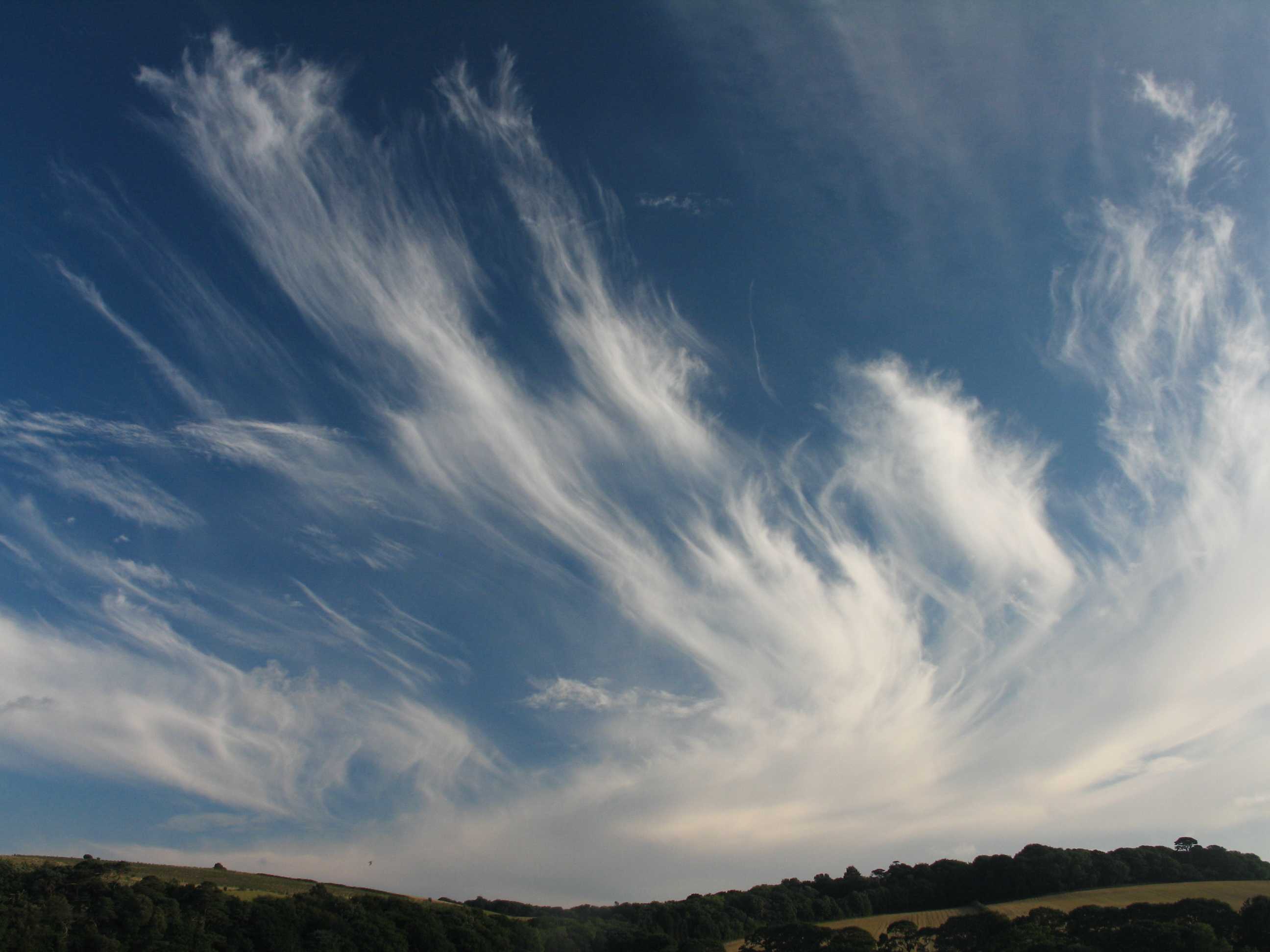
Cirrus spissatus
This photo shows extensive and beautiful sheaves of dense Cirrus (species spissatus) originating from a weak and decaying warm front.
Links in the image description will highlight features on the image. Mouse over the features for more detail.
© Stephen BurtTruro, Cornwall, United Kingdom of Great Britain and Northern IrelandLatitude: 50° 12' 35'' NLongitude: 5° 5' 23'' W07 August 2005 1821 (Local Time)Camera direction: towards SCL = 0, CM = 0, CH = 8Image P/S code: S.1.4Image I.D.: 4825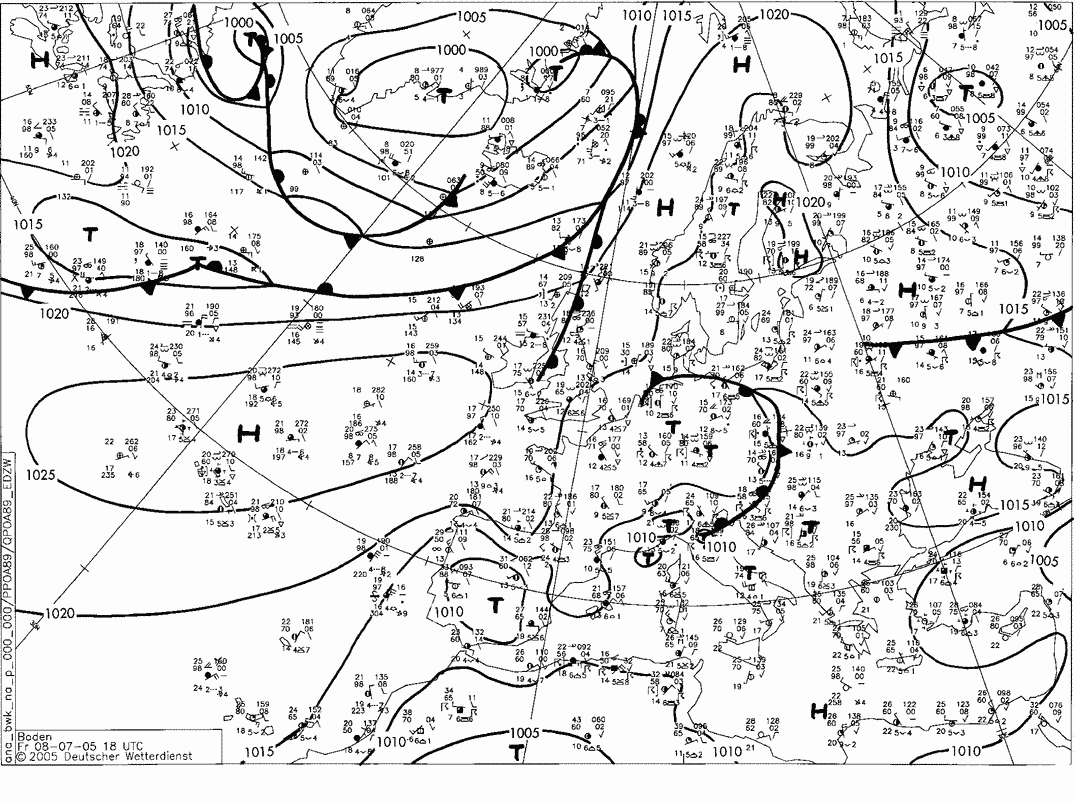
A weak and decaying warm front lay over western parts of the United Kingdom, within a developing ridge from the Azores anticyclone.
© Deutscher Wetterdienst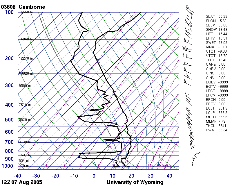
The nearby Camborne, England, UK (WMO 03808) ascent shows several dry layers due to anticyclonic subsidence at lower levels. The Cirrus cloud is probably in the moister layer at about 8 500 m.
© University of Wyoming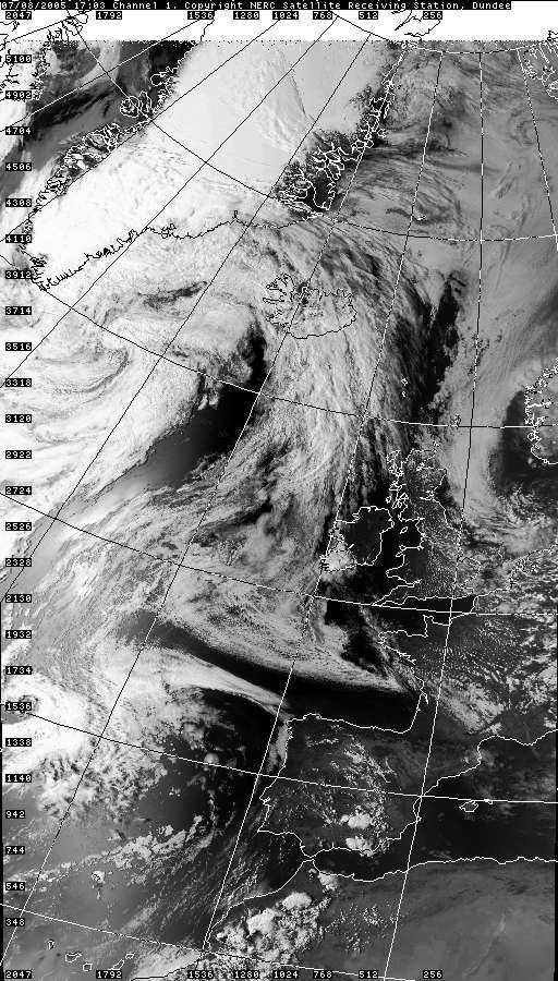
An area of high cloud associated with the weak warm front is evident on the satellite image. Reduced convection owing to anticyclonic subsidence and to the reduction in solar radiation can also be seen.
© NEODAAS/University of Dundee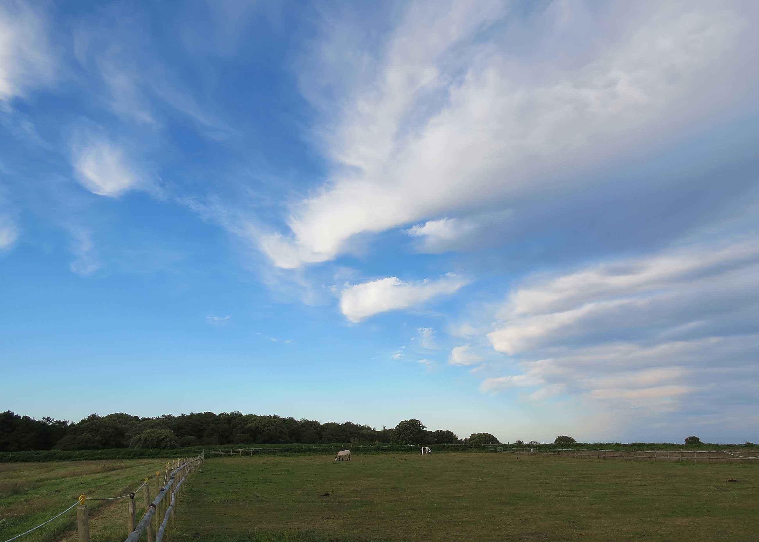
Cirrus spissatus mamma and Cirrus floccus
Dense patches of Cirrus spissatus following the passage of a surface cold front. The patches are aligned transverse to the upper level winds and also show signs of convective development, suggesting instability at their level. This is confirmed by a distinctive patch of Cirrus floccus with trails and Cirrus floccus in the initial stage of development. Some indistinctive mamma completes the story.
Links in the image description will highlight features on the image. Mouse over the features for more detail.
© Frank Le BlancqSt Brelade, JerseyLatitude: 49° 10' 12'' NLongitude: 2° 10' 9'' W22 June 2015 1954 (Local Time)Camera direction: towards ECL = 0, CM = 0, CH = 2Image P/S code: P.1.4Image I.D.: 4718