© Frank Le Blancq
St. Brelade, Jersey
Latitude: 49° 10' 18'' N
Longitude: 2° 10' 9'' W
24 June 2010 1626 (Local Time)
Camera direction: towards SW
Image P/S code: S.1.2
Image I.D.: 4840
CL = 0, CM = 0, CH = 1
-
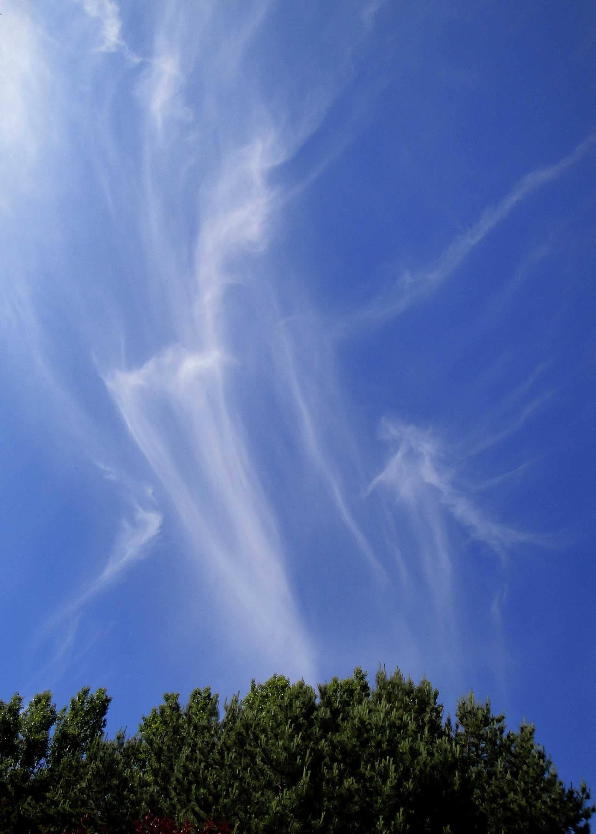
Cirrus uncinus
The cloud is white and without shading but has delicate filaments and patches identifying it as Cirrus. Some of the long ice crystal streamers end in tufts, typical of the species uncinus at 1 and 2. The Cirrus was associated with a weak frontolyzing cold front over Cornwall, UK.
Links in the image description will highlight features on the image. Mouse over the features for more detail.
© Frank Le BlancqSt. Brelade, JerseyLatitude: 49° 10' 18'' NLongitude: 2° 10' 9'' W24 June 2010 1626 (Local Time)Camera direction: towards SWCL = 0, CM = 0, CH = 1Image P/S code: S.1.2Image I.D.: 4840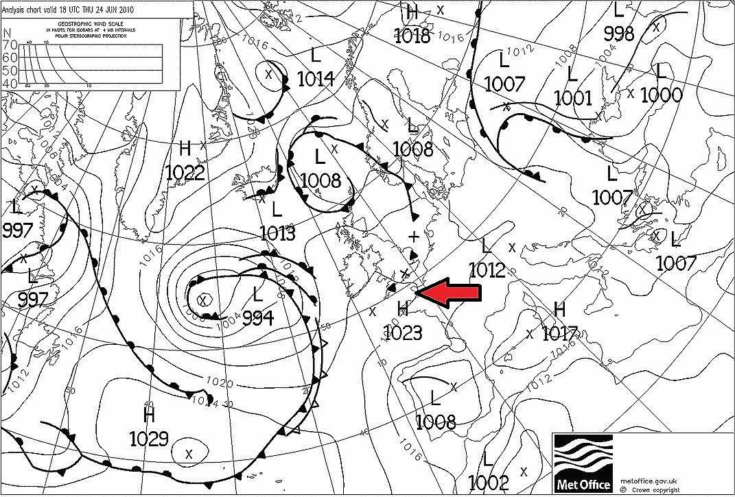
A weak ridge of high pressure covered most of UK, France and the South-West Approaches to UK, with a centre (1 023 hPa) off Cornwall, UK. Low pressure dominated the North Atlantic to the west of UK. A cold front extending from south-west Norway through East Anglia, England, UK to the Scilly Islands, Cornwall, UK was frontolyzing over southern England.
© Crown Copyright
A ridge was developing to the south-west of UK in the upper atmosphere. The Camborne, England, UK (WMO 03808) sounding at 1200 UTC shows relatively dry air at low levels and at medium levels in particular, with an abrupt increase in humidity from 33 %RH to 67 %RH above 370 hPa (7 900 m), the likely height of the Cirrus cloud base. The wind at that height was 300° at 25 kt (12.9 m/s), placing the sounding station directly upwind of the photo location.
© University of Wyoming