© Kam Hoo Man
Yuen Long, Hong Kong, China
Latitude: 22° 26' 40'' N
Longitude: 114° 1' 20'' E
19 April 2014 0636 (Local Time)
Image P/S code: P.11.1.1.6
Image I.D.: 4905
-
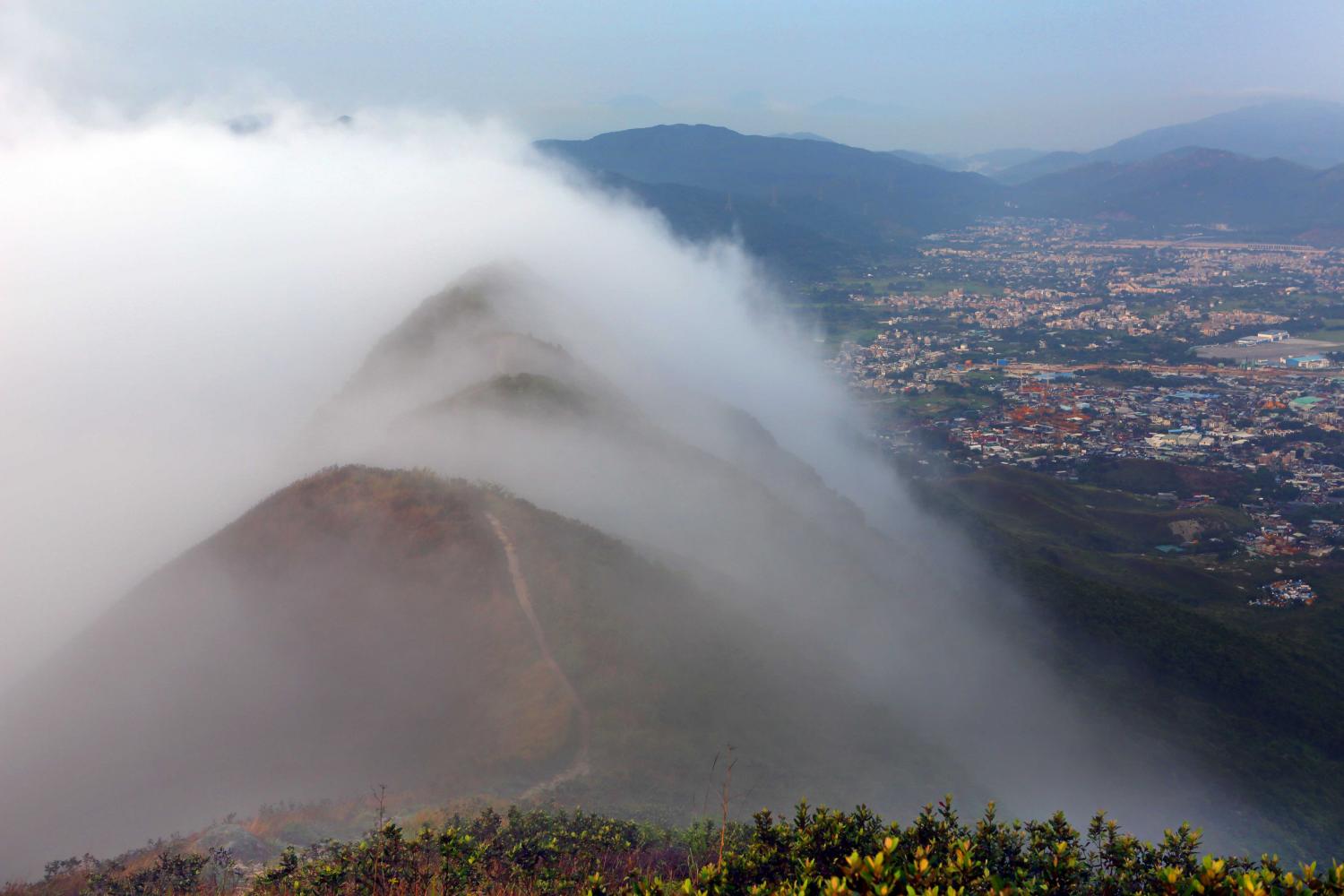
Upslope fog/hill fog
Upslope fog is formed when air flows upwards over rising terrain and is adiabatically cooled to its saturation temperature. In this picture, a Stratus cloud thus formed covers the high ground.
Upslope fog is a type of hill fog. When viewed from beneath or, as in this picture, from the side, it is seen as Stratus. However, to a person climbing the hill and ascending into the cloud, the visibility will be reduced to fog.
Links in the image description will highlight features on the image. Mouse over the features for more detail.
© Kam Hoo ManYuen Long, Hong Kong, ChinaLatitude: 22° 26' 40'' NLongitude: 114° 1' 20'' E19 April 2014 0636 (Local Time)Image P/S code: P.11.1.1.6Image I.D.: 4905 © The Government of the Hong Kong Special Administrative Region
 © The Government of the Hong Kong Special Administrative Region
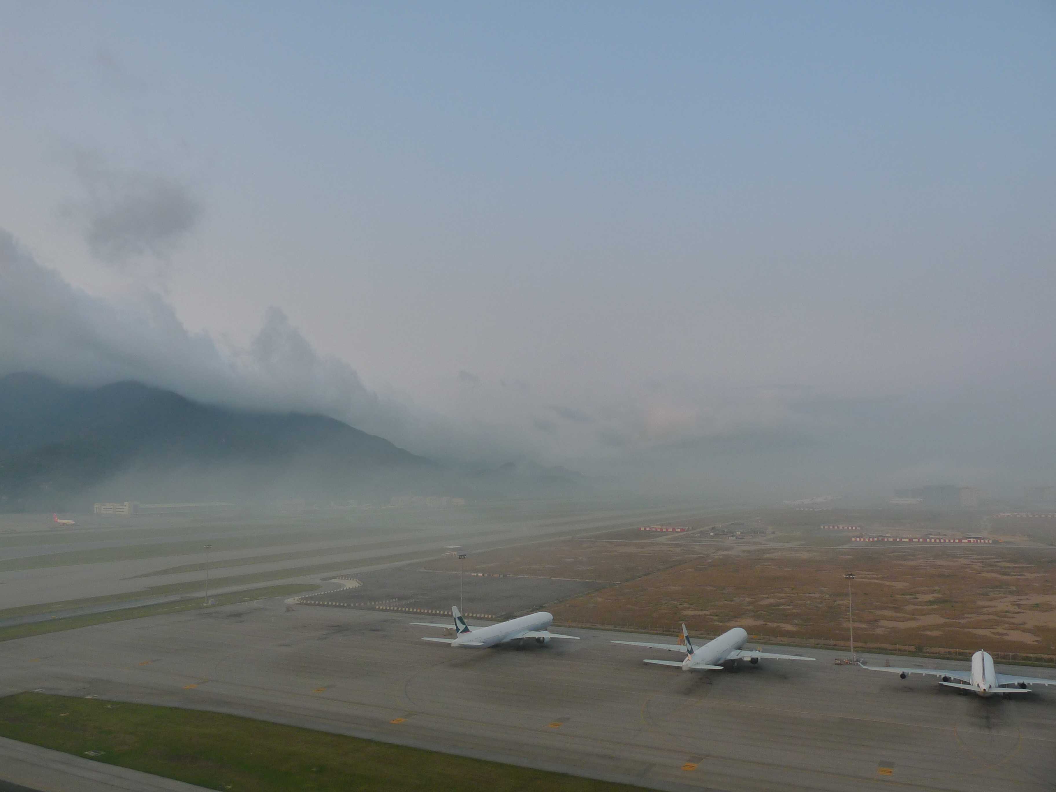
Mist, with Stratus forming upslope fog
A change in wind direction brought humid maritime air into Hong Kong Airport (China), resulting in a rapid deterioration in the visibility, together with the formation of upslope Stratus on the hills.
From the perspective of the airport meteorological observer, mist was reported. At 0700 hours, the prevailing visibility was 6 km but had deteriorated to 1 600 m to the west. At 0730 and 0800 hours, the general visibility was 2 900 m and 2 400 m respectively.
As moist air ascended the hills, Stratus cloud formed due to the air being adiabatically cooled to its saturation temperature. The result was upslope fog. Upslope fog is a type of hill fog. When viewed from beneath, it is seen as Stratus. However, to anyone on the hill ascending into the cloud, the visibility from that person's perspective is reduced to fog.
Links in the image description will highlight features on the image. Mouse over the features for more detail.
© Kwok Fai ChiangChek Lap Kok, Hong Kong, ChinaLatitude: 22° 18' 56'' NLongitude: 113° 55' 20'' E15 March 2010 0712 (Local Time)Camera direction: towards SWCL = 6, CM = 0, CH = 0Image P/S code: S.11.1.1.1 3Image I.D.: 4968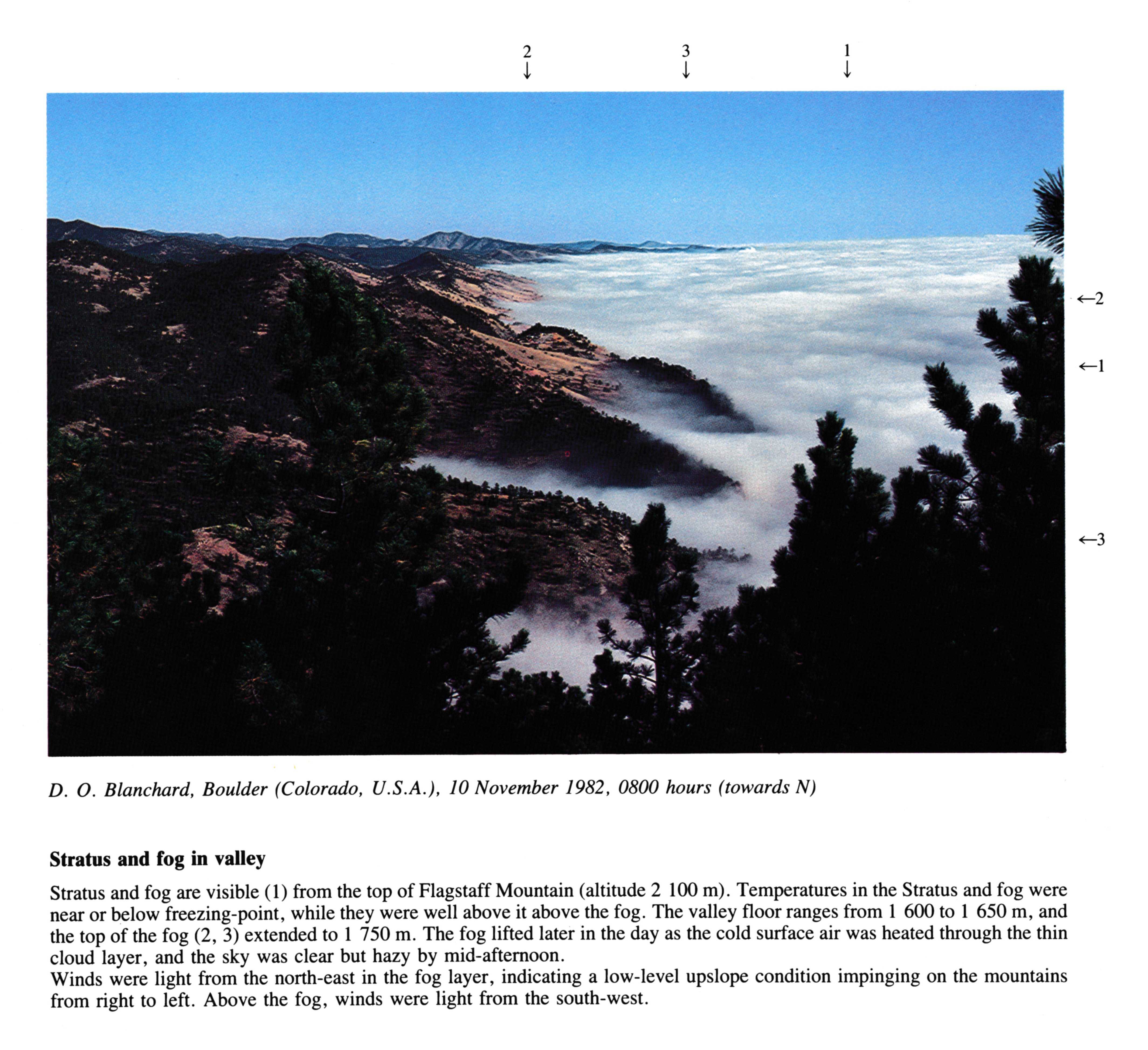
Stratus and fog in valley
Stratus and fog are visible from the top of Flagstaff Mountain (altitude 2 100 m). Temperatures in the Stratus and fog were near or below freezing-point, while they were well above it above the fog. The valley floor ranges from 1 600 to 1 650 m, and the top of the fog at 2, 3 extended to 1 750 m. The fog lifted later in the day as the cold surface air was heated through the thin cloud layer, and the sky was clear but hazy by mid-afternoon.
Winds were light from the north-east in the fog layer, indicating a low-level upslope condition impinging on the mountains from right to left. Above the fog, winds were light from the south-west.
Links in the image description will highlight features on the image. Mouse over the features for more detail.
© D.O. BlanchardBoulder, Colorado, United States of AmericaLatitude: 40° 0' 54'' NLongitude: 105° 16' 14'' W10 November 1982 0800 (Local Time)Camera direction: towards NCL = /, CM = /, CH = /