© Matthew Clark
Exeter, Devon, United Kingdom of Great Britain and Northern Ireland
Latitude: 50° 38' 47'' N
Longitude: 3° 34' 8'' W
01 March 2012 0830 (Local Time)
Camera direction: towards E
Image P/S code: S.13.11.4.3
Image I.D.: 4906
-
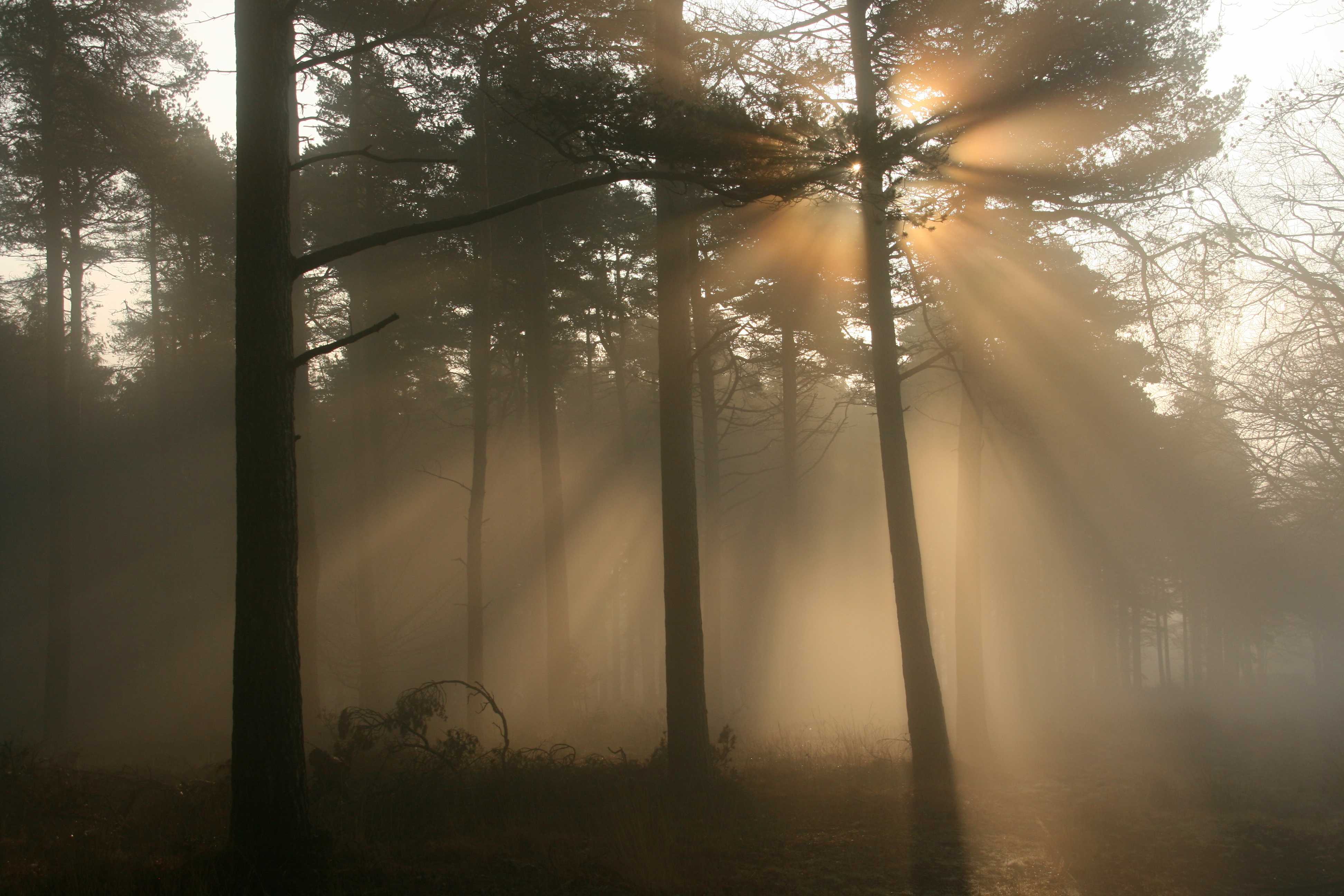
Crepuscular rays in fog
Crepuscular rays cast by the shadows of tree branches in Haldon Forest, near Exeter in south-west England, UK. A corona can be seen around the Sun. The fog formed during a clear, cold night under anticyclonic conditions and was sufficiently thick to obscure the Sun over low ground. However, the summits of the Haldon Hills (about 250 m above sea level) were just below the level of the top of the fog, so strong sunshine penetrated the fog locally.
Links in the image description will highlight features on the image. Mouse over the features for more detail.
© Matthew ClarkExeter, Devon, United Kingdom of Great Britain and Northern IrelandLatitude: 50° 38' 47'' NLongitude: 3° 34' 8'' W01 March 2012 0830 (Local Time)Camera direction: towards EImage P/S code: S.13.11.4.3Image I.D.: 4906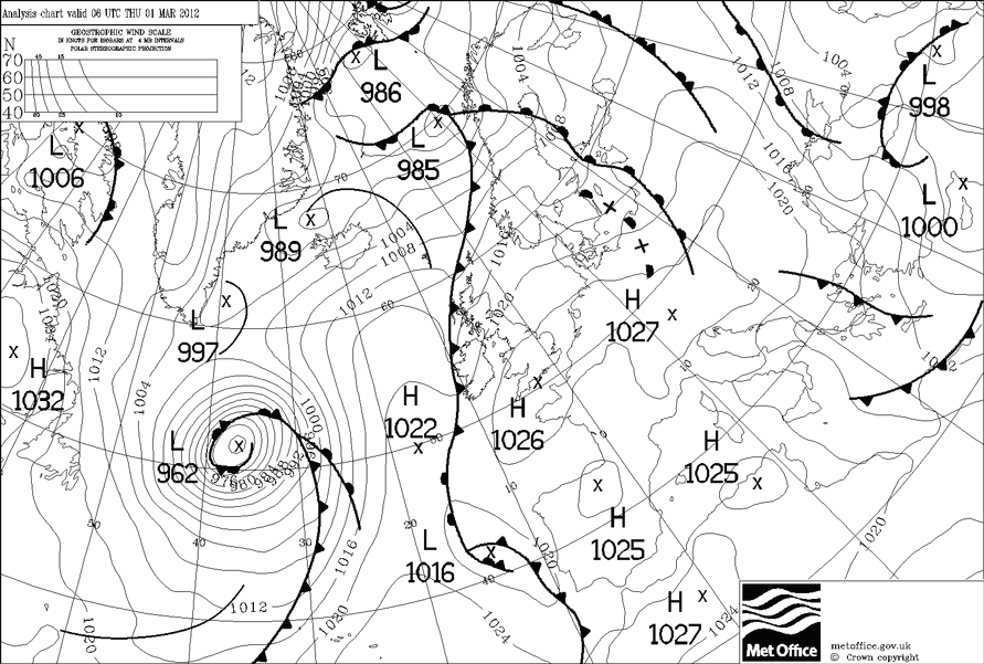
Surface analysis chart for 0600 UTC on 1 March 2012. An anticyclone is centred over Lyme Bay with very light winds across southern England, UK.
© Crown Copyright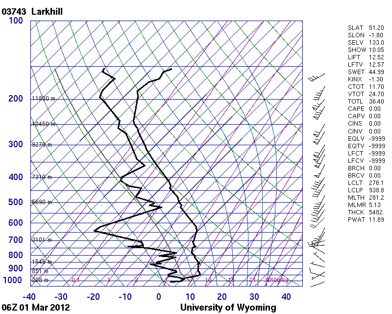
This is the 0600 UTC upper air sounding from Larkhill, England, UK on 1 March 2012. A strong inversion is present at about 200 m, associated with strong nocturnal radiative cooling. The air is saturated at and below the level of the inversion. Above the inversion, the air is much drier.
© University of Wyoming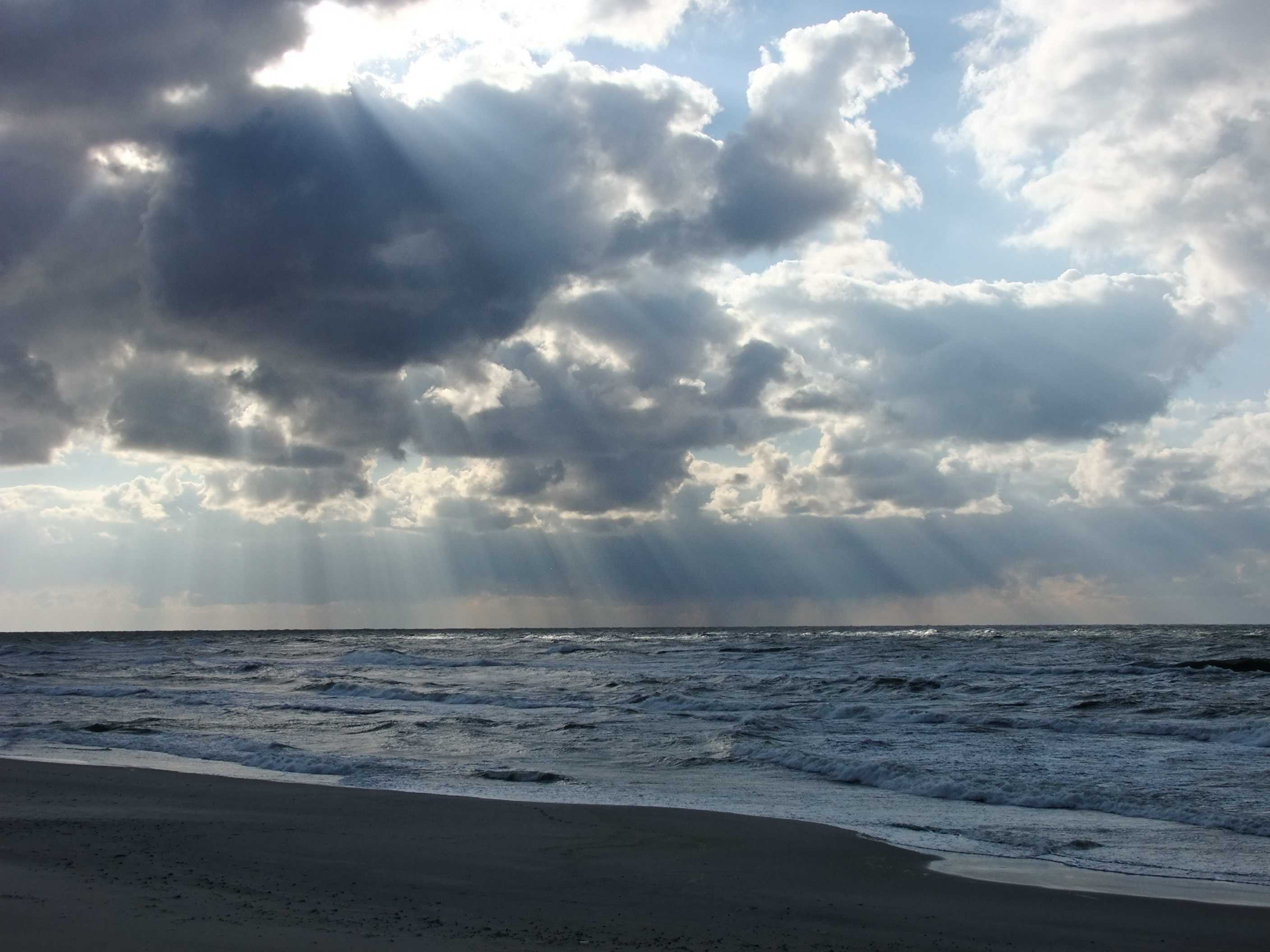
Crepuscular rays through gaps in cloud
The term “crepuscular rays” normally refers to the dark bluish streaks and light beams observed radiating from the Sun across the twilight sky. However, the name is perhaps more commonly used in reference to the shadowed bands and light beams which may be seen diverging from the Sun at any time of day when it is hidden behind broken cloud cover.
This picture from Neringa, Lithuania shows crepuscular rays (seen at 1 and 2) cast by Cumulus clouds over the Baltic Sea. The Cumulus in the picture is mostly of the species mediocris. However, a recent light rain shower had occurred at the location and precipitation can also be seen in the distance, so at least some Cumulus congestus or Cumulonimbus must have been present in the area.
Links in the image description will highlight features on the image. Mouse over the features for more detail.
© Raimundas StonkusNida, Neringa, LithuaniaLatitude: 55° 18' 12'' NLongitude: 20° 58' 31'' E23 September 2014 1724 (Local Time)Camera direction: towards SWCL = 2, CM = /, CH = /Image P/S code: P.13.11.4.3Image I.D.: 5133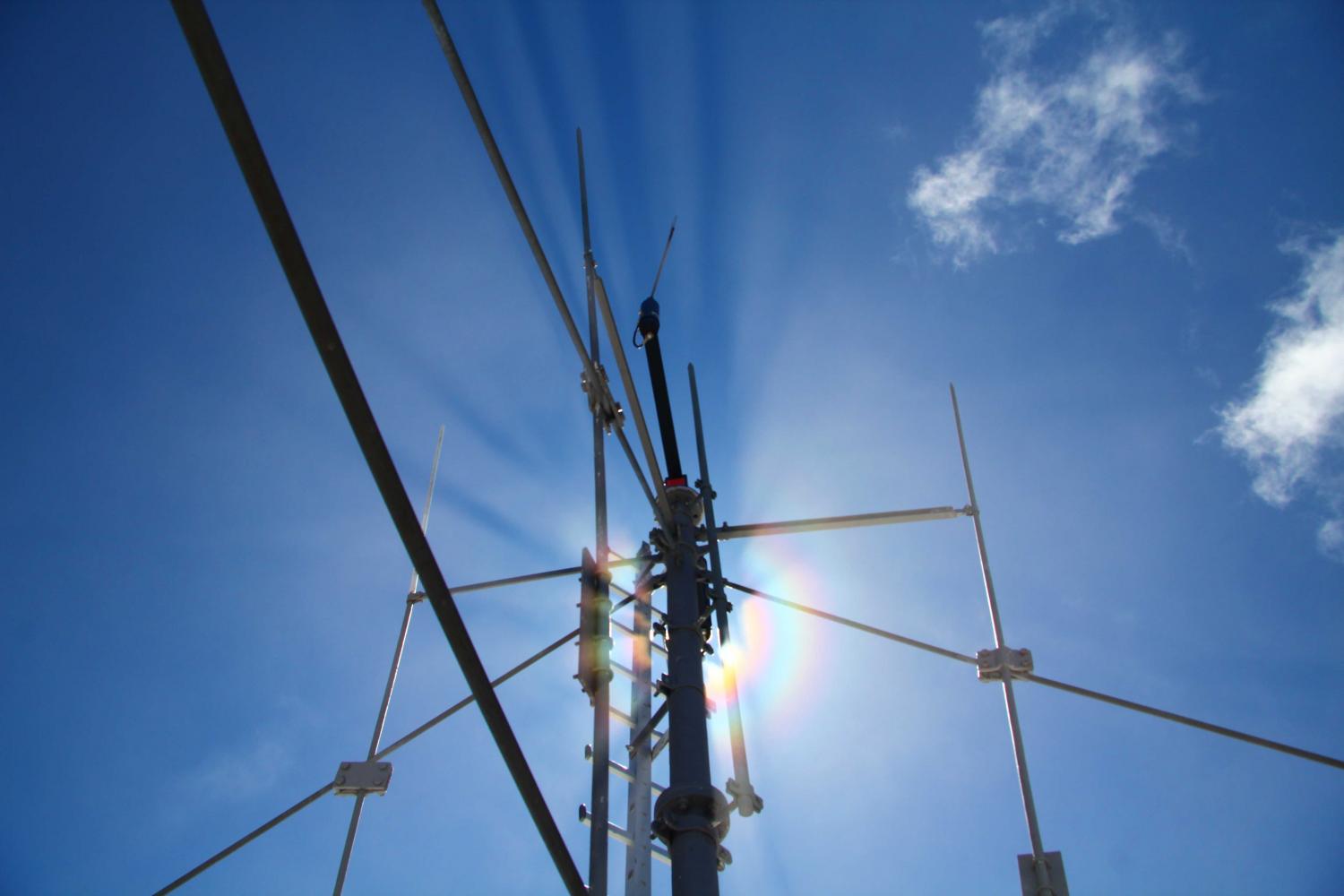
Solar corona and crepuscular rays
The coloured rings seen around the Sun in this picture form a corona. The corona is caused by the diffraction of sunlight through thin cloud composed of very small water or ice particles. Much of the cloud here is very thin and almost invisible when viewed against the glare of the sun, but some patches of Cumulus fractus are clearly visible. Shadows from the masts on the summit of Mt. Zugspitze, Wetterstein Mountains, Germany (2 963 m) are rendered visible against the thin cloud as crepuscular rays.
Links in the image description will highlight features on the image. Mouse over the features for more detail.
© Claudia HinzMt. Zugspitze, Wetterstein Mountains, GermanyLatitude: 47° 25' 16'' NLongitude: 10° 59' 18'' E08 May 2013 1313 (Local Time)Camera direction: towards SCL = 2, CM = /, CH = /Image P/S code: P.13.2.1Image I.D.: 4176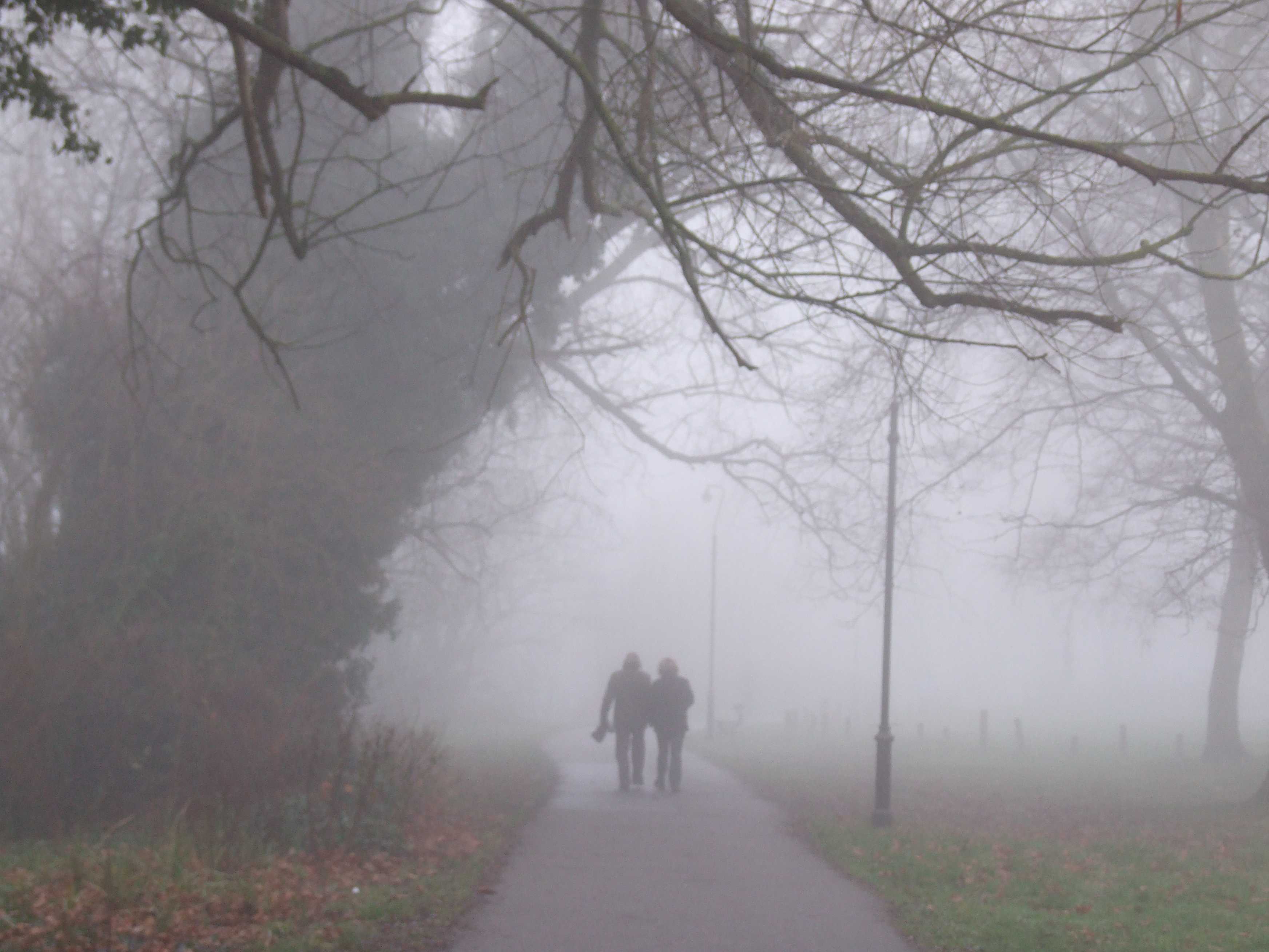
Fog
Fog is a suspension of very small, usually microscopic water droplets in the air, reducing visibility at the Earth's surface. The term is used when the horizontal visibility is reduced to less than 1 km. In this picture the visibility is only about 100 m.
The reduction in visibility depends on the structure of the fog, and especially on the number density and size distribution of the droplets. The structure may vary a great deal in time and space. However, in this particular example on the banks of the River Thames in Reading, England, UK at 1500 hours in the afternoon, the visibility changed only slowly and the fog persisted throughout the day.
A ridge of high pressure extended over southern England from an anticyclone centred over continental Europe.
Links in the image description will highlight features on the image. Mouse over the features for more detail.
© George AndersonReading, United Kingdom of Great Britain and Northern IrelandLatitude: 51° 27' 41'' NLongitude: 0° 57' 58'' W23 December 2007 1500 (Local Time)Camera direction: towards WCL = 2, CM = /, CH = /Image P/S code: P.11.1.1Image I.D.: 4697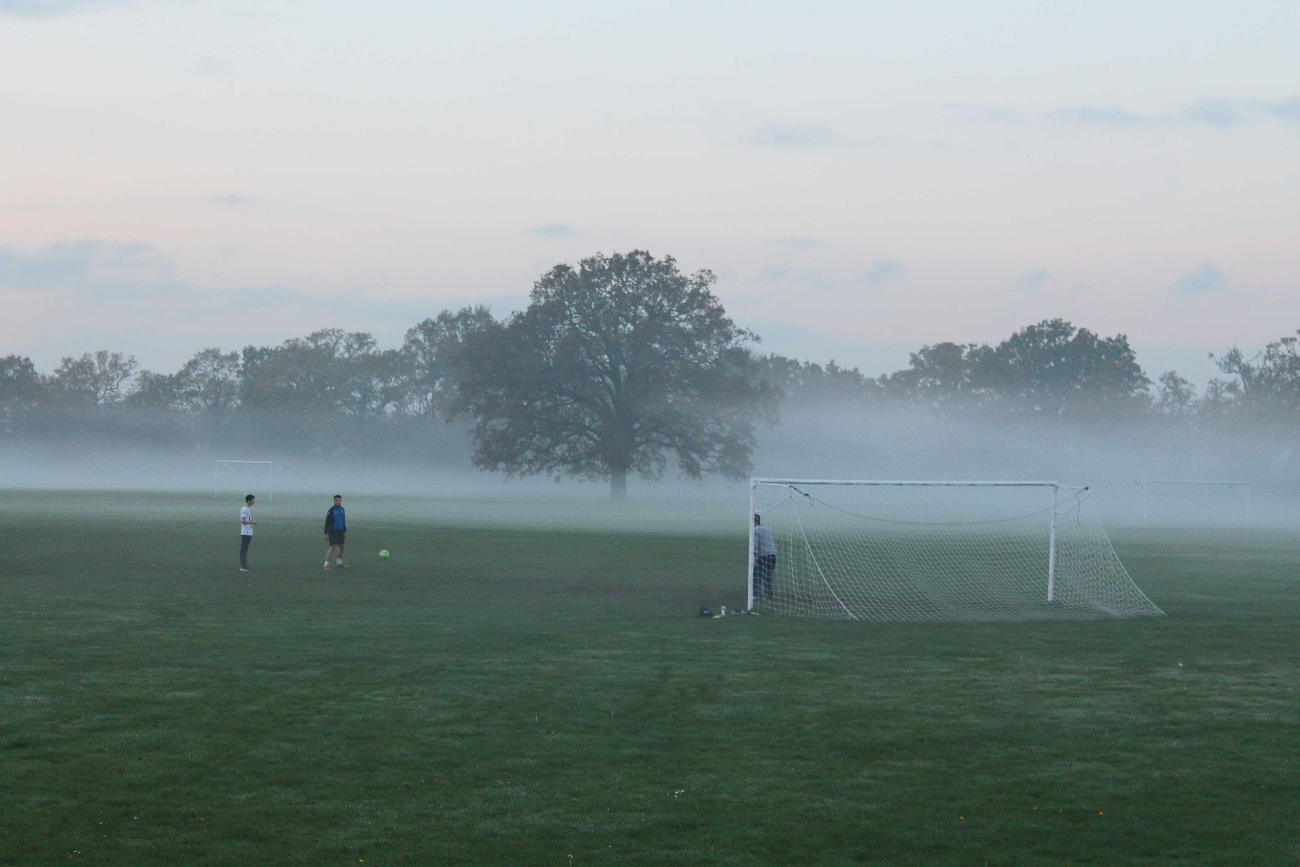
Ground fog thickening into fog
Radiation fog is formed when the ground surface cools through radiation, usually at night, cooling the air just above the ground to its saturation temperature. When the fog occurs in a shallow enough layer that it does not restrict horizontal visibility when viewed from a height of about 2 m, it is known as ground fog, or shallow fog.
This picture, taken a few minutes before sunset over playing fields at Wokingham in southern England, UK on a day in late autumn, shows ground fog thickening into fog.
A complex area of low pressure was situated to the west of UK with a slack surface airflow over southern England. The air temperature (at a height of 1.25 m above the ground) reached a maximum of 12 °C early in the afternoon and then fell quickly towards sunset under clearing skies. By the time of this photograph at 1610 hours, it had fallen to 9 °C, while the temperature at the grass surface had fallen from 15 °C in the early afternoon to 3 °C. The low-level air near the grass surface became saturated and patches of ground fog formed. Some parts of the ground fog then subsequently began to deepen to a height greater than 2 m to become proper fog, as seen here. For reference, the goal posts are 2.44 m high.
Links in the image description will highlight features on the image. Mouse over the features for more detail.
© George AndersonWokingham, United Kingdom of Great Britain and Northern IrelandLatitude: 51° 25' 18'' NLongitude: 0° 50' 15'' W15 November 2014 1610 (Local Time)Camera direction: towards NWCL = 2, CM = /, CH = /Image P/S code: S.11.1.1.3 1Image I.D.: 4696
Radiation fog
Fog is a suspension of very small, usually microscopic water droplets in the air, reducing visibility at the Earth's surface. The term is used when the horizontal visibility is reduced to less than 1 km. In this picture, taken at Wokingham in southern England, UK, the visibility is only about 100 m.
Radiation fog forms when the ground surface cools through radiation, usually at night, cooling the air just above the ground to its saturation temperature. On this occasion, a ridge of high pressure extended over southern England from an anticyclone centred over continental Europe.
Links in the image description will highlight features on the image. Mouse over the features for more detail.
© George AndersonWokingham, England, United Kingdom of Great Britain and Northern IrelandLatitude: 51° 25' 56'' NLongitude: 0° 50' 38'' W23 December 2007 0843 (Local Time)Camera direction: towards WCL = 2, CM = /, CH = /Image P/S code: S.11.1.1 1Image I.D.: 4698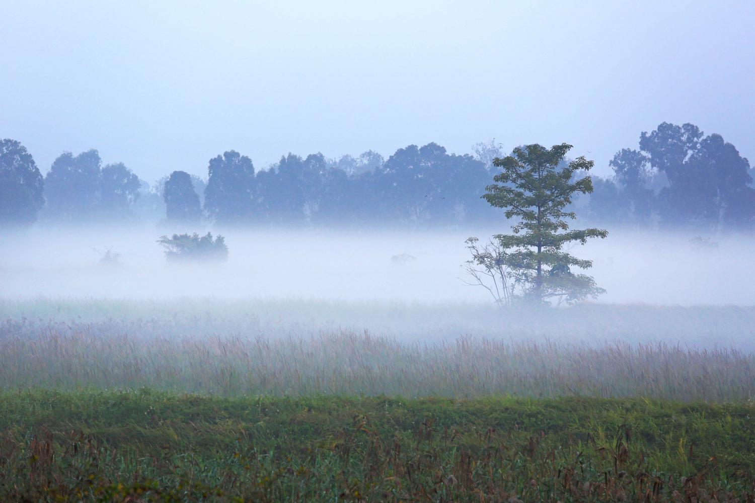
Radiation fog and mist
This picture shows radiation fog that has formed overnight due to radiational cooling from the ground. The fog is deep enough (greater than 2 m) to restrict the horizontal visibility such that it obscures the lower parts of the trees in the distance. Above the fog the visibility is greater, but is restricted by mist.
Links in the image description will highlight features on the image. Mouse over the features for more detail.
© Kam Hoo ManYuen Long, Hong Kong, ChinaLatitude: 22° 26' 40'' NLongitude: 114° 1' 20'' E23 December 2015 0713 (Local Time)CL = 2, CM = /, CH = /Image P/S code: S.11.1.1 2Image I.D.: 4833
Radiation fog
The first light at dawn reveals radiation fog that has formed overnight. Radiation fog occurs when the ground cools through the radiation of heat, and the air just above the ground is cooled sufficiently to reach its saturation temperature. Clear skies, light winds and low-level moisture are key factors that favour the formation of radiation fog.
The fog very likely formed initially as ground or shallow fog, but the mixing of the low-level air by a gentle wind, such as indicated here by the wisp of fog, will have led to an increase in the fog’s depth. The majority of the fog in this picture is deeper than ground or shallow fog such that, to an observer standing within the fog, the horizontal visibility would be substantially reduced, probably to just a few tens or hundreds of metres. However, the depth of the fog is still shallow enough that the sky would be visible above.
Links in the image description will highlight features on the image. Mouse over the features for more detail.
© Stefan KämpfeWeimar, Thuringia, GermanyLatitude: 51° 58' 52'' NLongitude: 11° 18' 43'' E27 September 2013 0640 (Local Time)Camera direction: towards SECL = 2, CM = /, CH = /Image P/S code: S.11.1.1.3 5Image I.D.: 4855
Radiation fog
This view from an elevated location shows radiation fog in the Exe Valley in south-west England, UK, after a clear night with light winds. The top of the fog was located at about 150 m above sea level and the photograph was taken at an altitude of about 200 m above sea level. A light south-westerly breeze had begun to increase just above the level of the nocturnal inversion, as a frontal system began to approach from the north-west. It is likely that the undulations in the top of the fog layer were associated with vertical wind shear at the inversion level, where this south-westerly flow interfaced with local drainage flow (which typically comes from a northerly direction in the lower Exe Valley) below the inversion. A Kelvin-Helmholtz billow has formed where the light south-westerly flow has interacted with more complex topography at the edge of the Haldon Hills. The small dome in the top of the fog on the far left of the photograph is associated with outflow from a factory chimney.
Links in the image description will highlight features on the image. Mouse over the features for more detail.
© Matthew ClarkDunchideock, Exeter, Devon, United Kingdom of Great Britain and Northern IrelandLatitude: 50° 41' 25'' NLongitude: 3° 35' 27'' W16 December 2008 0730 (Local Time)Camera direction: towards ECL = 2, CM = /, CH = /Image P/S code: S.11.1.1.3 6Image I.D.: 4856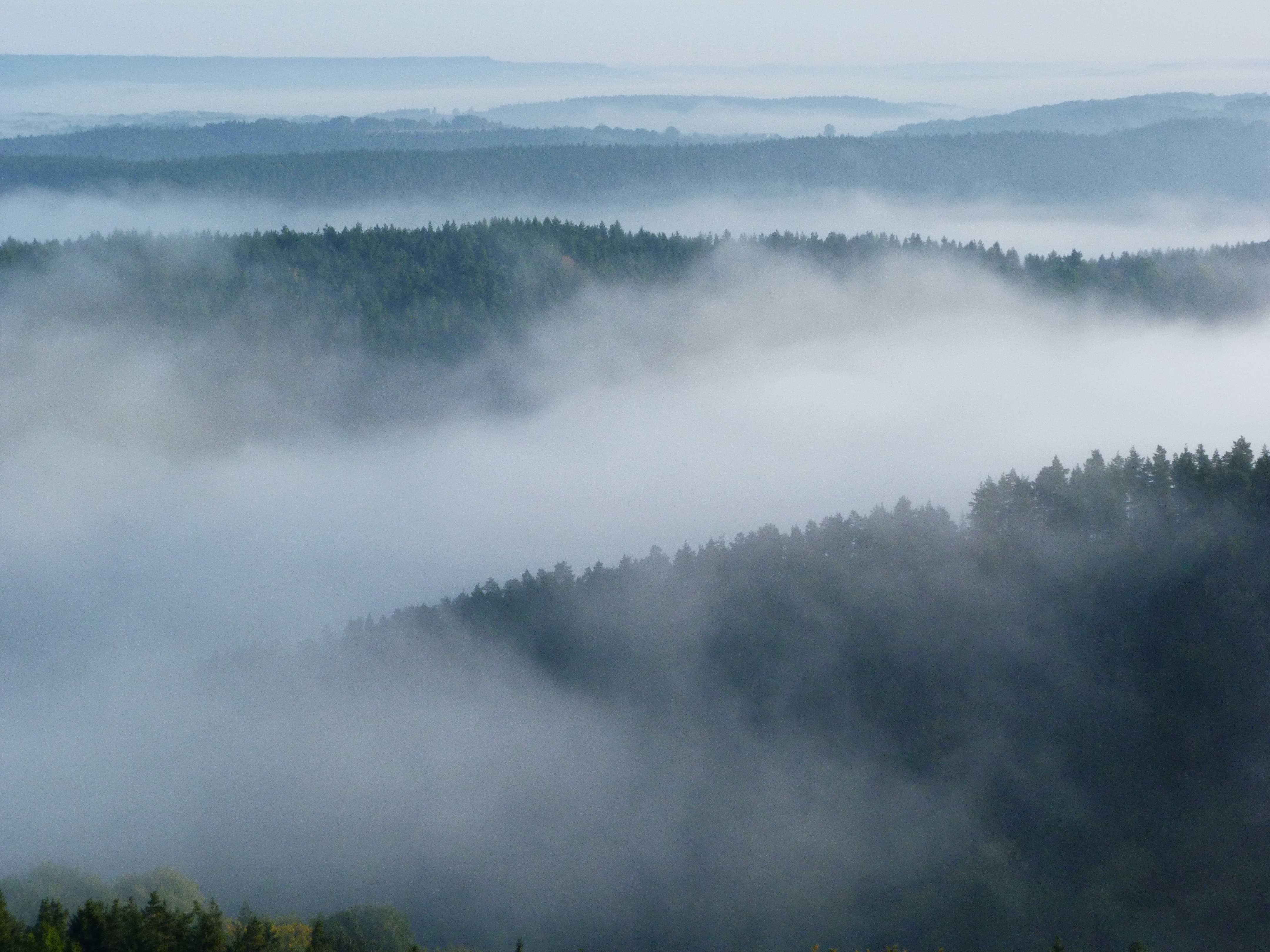
Radiation fog
An elevated location provides a view across the top of radiation fog covering low-lying ground. The visibility across the top of the fog is fair, but to an observer standing in a location within the fog, the horizontal visibility would be substantially reduced to only a few tens or hundreds of metres.
Radiation fog occurs when the ground cools by radiation, usually at night, and the air just above the ground is cooled to reach its saturation temperature. Clear skies, light winds and low-level moisture are key factors that favour the formation of radiation fog. The fog often forms first in low-lying locations due to the pooling of cold air.
Links in the image description will highlight features on the image. Mouse over the features for more detail.
© Stefan KämpfeWeimar, Thuringia, GermanyLatitude: 51° 58' 59'' NLongitude: 11° 18' 58'' E28 September 2014 0755 (Local Time)Camera direction: towards NECL = 2, CM = /, CH = /Image P/S code: S.11.1.1.3 8Image I.D.: 4857