© Amarbileg Shajbalidir
Mt. Zugspitze, Bavarian Alps, Germany
Latitude: 47° 25' 15'' N
Longitude: 10° 59' 7'' E
23 May 2014 0848 (Local Time)
Camera direction: towards E
Image P/S code: P.11.1.1.7
Image I.D.: 4971
-
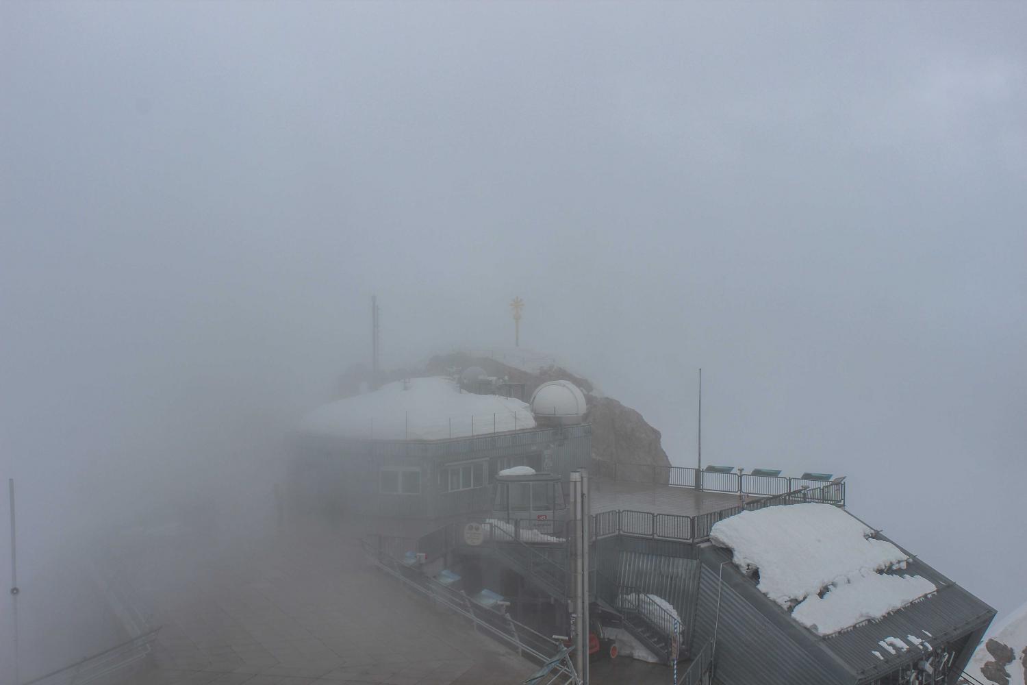
Hill fog
At an altitude of 2 962 m above sea level, the summit of Mt. Zugspitze in the Bavarian Alps, Germany is shrouded in cloud. From the perspective of the observer, the cloud is in contact with the ground at the point of observation, and so the observer is in fog. This is hill fog.
Links in the image description will highlight features on the image. Mouse over the features for more detail.
© Amarbileg ShajbalidirMt. Zugspitze, Bavarian Alps, GermanyLatitude: 47° 25' 15'' NLongitude: 10° 59' 7'' E23 May 2014 0848 (Local Time)Camera direction: towards EImage P/S code: P.11.1.1.7Image I.D.: 4971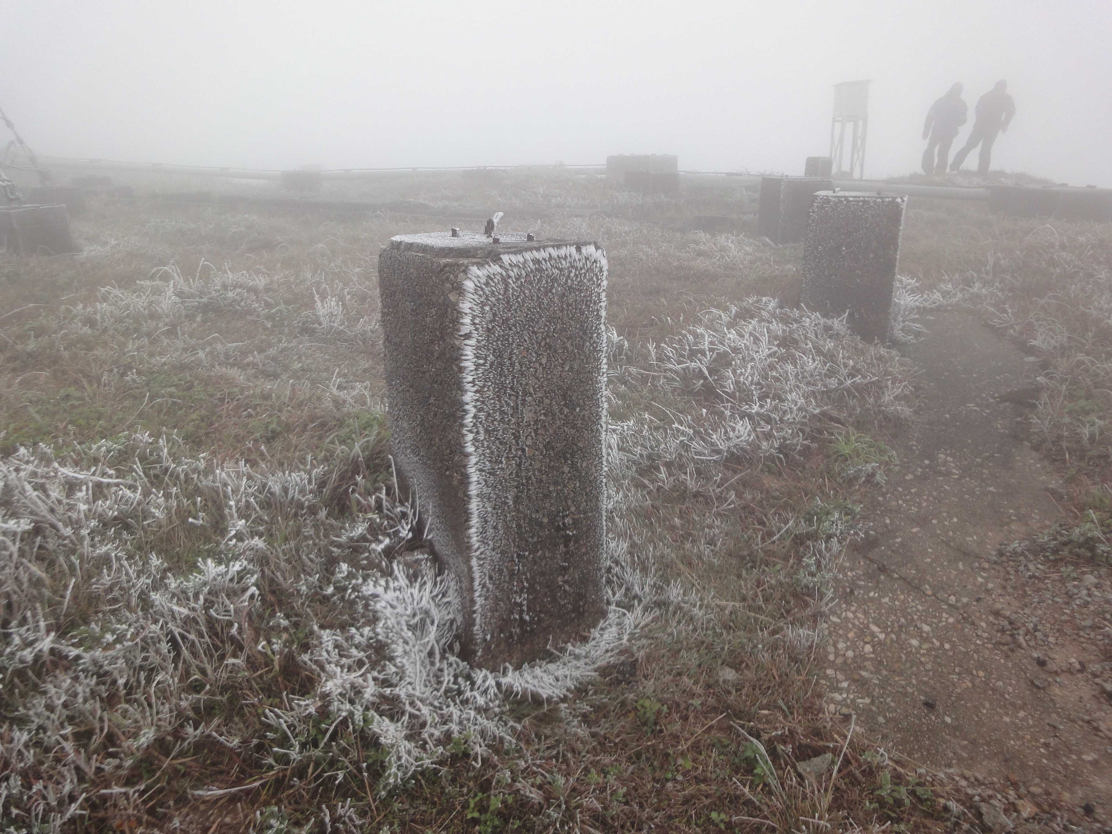
Freezing hill fog depositing rime
Freezing fog occurs at a temperature below 0 °C when supercooled fog droplets freeze on impact with the ground or other objects to deposit rime.
This picture was taken at the weather station on Tai Mo Shan, the highest peak in Hong Kong (China), during a severe winter monsoon and shows the summit shrouded in hill fog as a result of low cloud covering the high ground. With the air temperature having cooled to around -2 °C, the cloud droplets were in a supercooled state and, driven by a strong wind, they froze on impact with vegetation on the ground and with other objects to produce deposits of rime at 2 and 3.
Links in the image description will highlight features on the image. Mouse over the features for more detail.
© Ho Yin LeeTai Mo Shan, Hong Kong, ChinaLatitude: 22° 24' 32'' NLongitude: 114° 8' 17'' E16 December 2010 1051 (Local Time)Image P/S code: P.11.1.1.2Image I.D.: 4711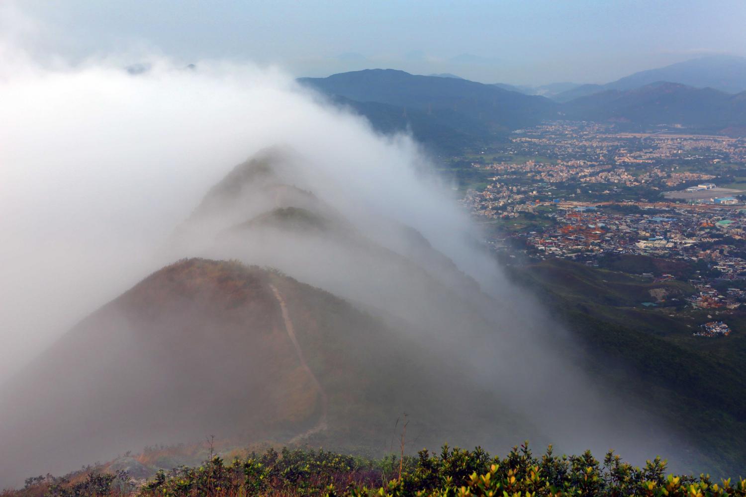
Upslope fog/hill fog
Upslope fog is formed when air flows upwards over rising terrain and is adiabatically cooled to its saturation temperature. In this picture, a Stratus cloud thus formed covers the high ground.
Upslope fog is a type of hill fog. When viewed from beneath or, as in this picture, from the side, it is seen as Stratus. However, to a person climbing the hill and ascending into the cloud, the visibility will be reduced to fog.
Links in the image description will highlight features on the image. Mouse over the features for more detail.
© Kam Hoo ManYuen Long, Hong Kong, ChinaLatitude: 22° 26' 40'' NLongitude: 114° 1' 20'' E19 April 2014 0636 (Local Time)Image P/S code: P.11.1.1.6Image I.D.: 4905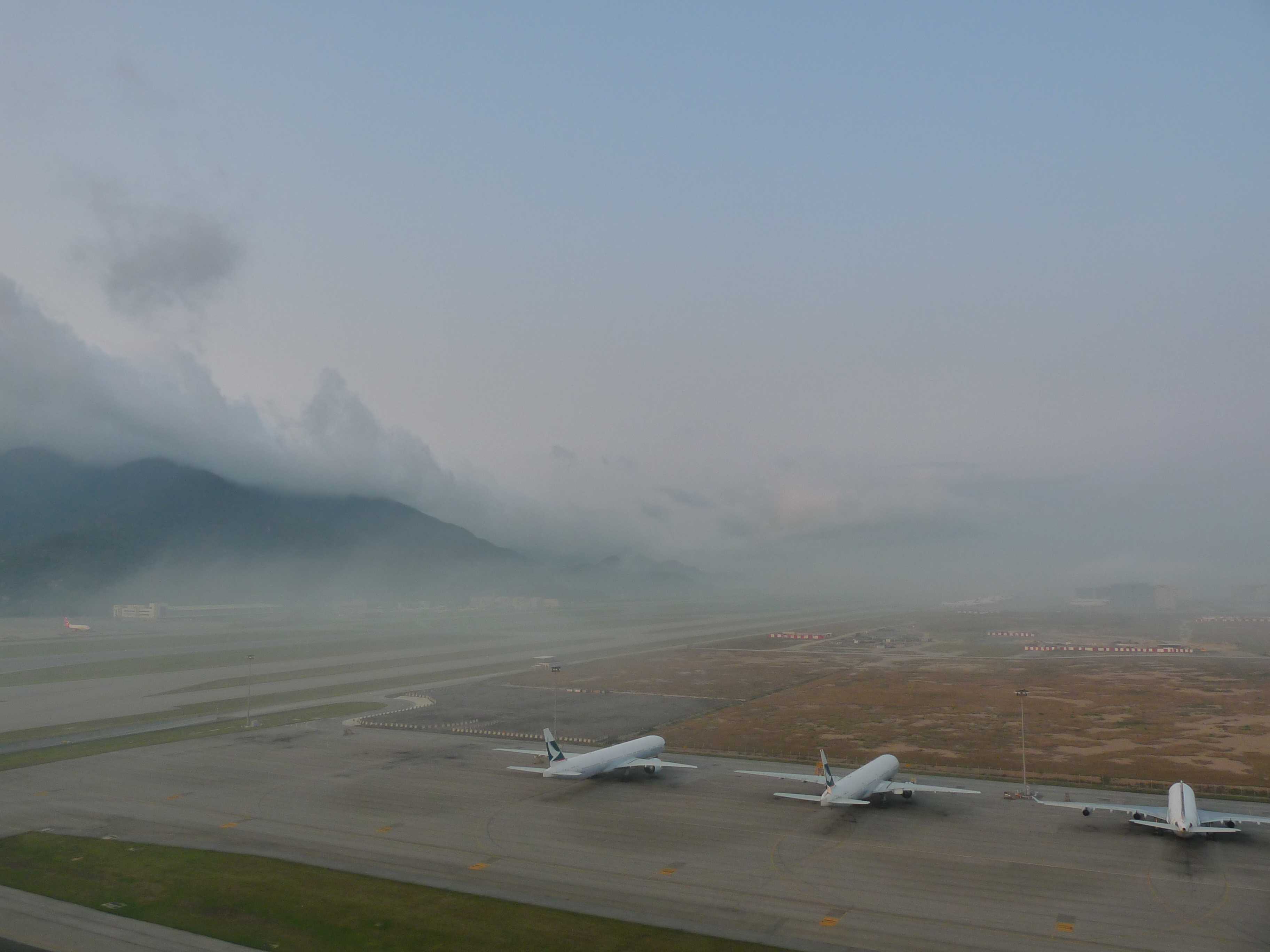
Mist, with Stratus forming upslope fog
A change in wind direction brought humid maritime air into Hong Kong Airport (China), resulting in a rapid deterioration in the visibility, together with the formation of upslope Stratus on the hills.
From the perspective of the airport meteorological observer, mist was reported. At 0700 hours, the prevailing visibility was 6 km but had deteriorated to 1 600 m to the west. At 0730 and 0800 hours, the general visibility was 2 900 m and 2 400 m respectively.
As moist air ascended the hills, Stratus cloud formed due to the air being adiabatically cooled to its saturation temperature. The result was upslope fog. Upslope fog is a type of hill fog. When viewed from beneath, it is seen as Stratus. However, to anyone on the hill ascending into the cloud, the visibility from that person's perspective is reduced to fog.
Links in the image description will highlight features on the image. Mouse over the features for more detail.
© Kwok Fai ChiangChek Lap Kok, Hong Kong, ChinaLatitude: 22° 18' 56'' NLongitude: 113° 55' 20'' E15 March 2010 0712 (Local Time)Camera direction: towards SWCL = 6, CM = 0, CH = 0Image P/S code: S.11.1.1.1 3Image I.D.: 4968