© Frank Le Blancq
northern France
Latitude: 49° 15' 56'' N
Longitude: 3° 12' 5'' E
05 June 2014 1648 (Local Time)
Camera direction: towards NE
Image P/S code: S.9.1
Image I.D.: 4984
-
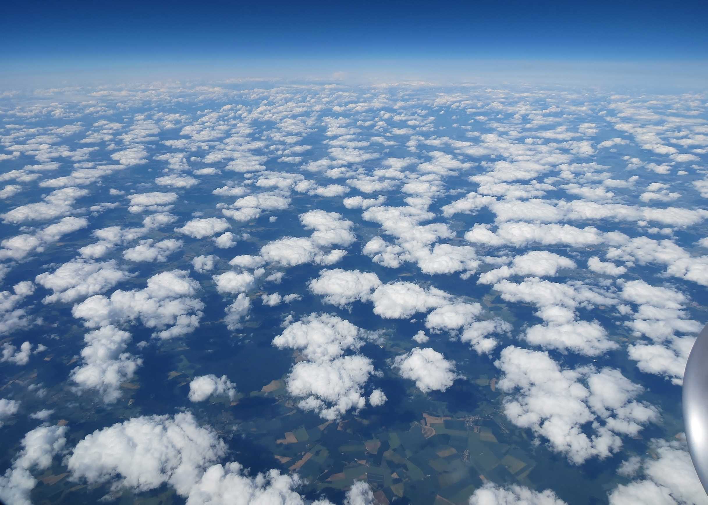
Cumulus humilis
The aerial image shows Cumulus cloud from above. The cloud elements are generally dense but in a relatively random pattern. There is only limited vertical development with a generally flattened appearance to the cloud, indicative of the species humilis (CL = 1). The reported cloud base was 5 000 ft and the cloud tops were estimated at approximately 6 000 ft. The surface data were taken from Charles de Gaulle Airport, Paris, France observations.
Links in the image description will highlight features on the image. Mouse over the features for more detail.
© Frank Le Blancqnorthern FranceLatitude: 49° 15' 56'' NLongitude: 3° 12' 5'' E05 June 2014 1648 (Local Time)Camera direction: towards NEImage P/S code: S.9.1Image I.D.: 4984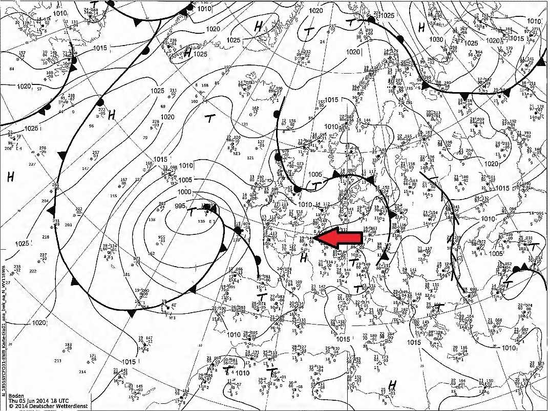
The area was under a weak ridge of high pressure located between low pressure over the Black Sea and low pressure of 991 hPa west of the Bay of Biscay. Earlier in the day the area had been in a polar maritime airflow.
© Deutscher Wetterdienst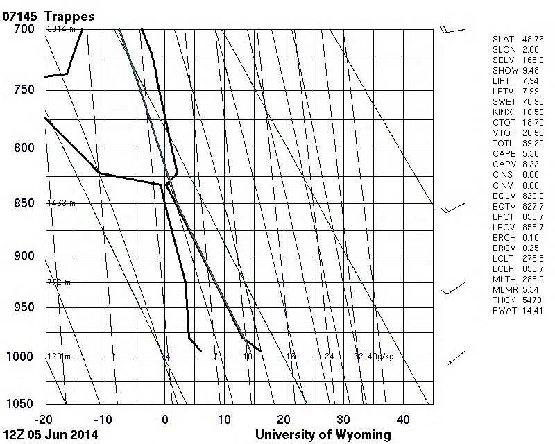
The Trappes, France (WMO 07145) sounding at 1200 UTC shows an unstable boundary layer. An inversion of 2 °C was present at 830 hPa with very dry air above.
© University of Wyoming