© Jarmo Koistinen
Espoo, Finland
Latitude: 60° 0' 0'' N
Longitude: 25° 0' 0'' E
18 March 2016 1227 (Local Time)
Camera direction: towards SW
Image P/S code: P.11.3.2
Image I.D.: 5027
-
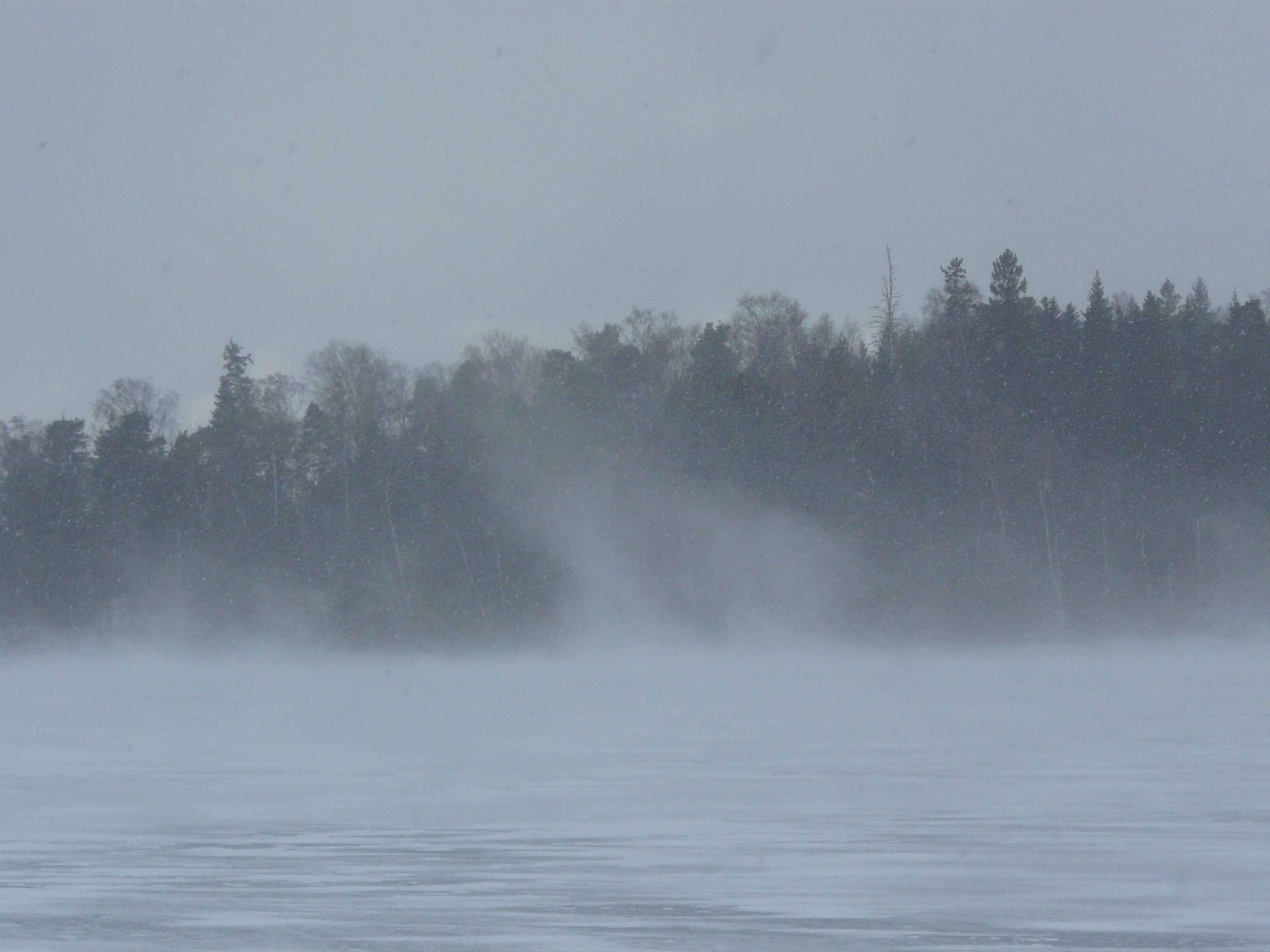
Blowing snow (Image 1)
This series of photographs shows blowing snow over the coastal sea ice of the Gulf of Finland. Blowing snow is an ensemble of snow particles raised by the wind to moderate or great heights above the ground. Horizontal visibility at eye level is generally very poor in blowing snow.
The snow particles being lifted from the ground and into the air by strong wind gusts of 15–20 m/s are actually snow pellets that have fallen from a Cumulonimbus shower cloud. A whirling vortex of blowing snow can be seen in the centre of this picture. A moderate shower of snow pellets was occurring at the same time and so the prevailing weather code is ww = 88.
Links in the image description will highlight features on the image. Mouse over the features for more detail.
© Jarmo KoistinenEspoo, FinlandLatitude: 60° 0' 0'' NLongitude: 25° 0' 0'' E18 March 2016 1227 (Local Time)Camera direction: towards SWImage P/S code: P.11.3.2Image I.D.: 5027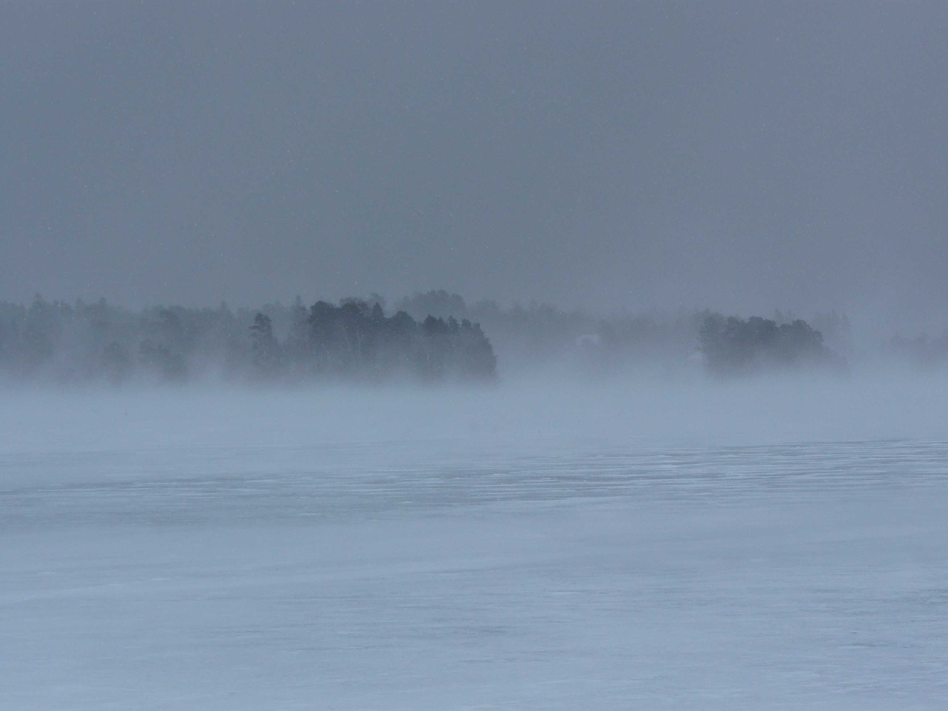
Blowing snow (Image 2)
This image is a zoomed photograph, but of a farther distance than Image 1. The visibility is poor due to the combination of a shower of snow pellets falling from a Cumulonimbus cloud and blowing and drifting snow.
Drifting snow can be seen as the bright white diffuse zone immediately above the sea ice, where freshly fallen snow pellets are being raised by the wind. The visibility close to the ground level is approximately 500 m.
Some 5 to 10 m-high protuberances of blowing snow are rising up from the ice level due to the gusty wind. This blowing snow can be seen clearly against the dark forest in the background. In the dark grey sky, there are snow pellets falling from the Cumulonimbus cloud and also some snow pellets being raised from the ground by the wind. Visibility at the height of 2 m is approximately 2 km.
The prevailing weather code is ww = 88 as a moderate shower of snow pellets is observed. The cloud code is CL = 9, CM = / and CH = / as the Cumulonimbus shower cloud covers all of the sky.
Links in the image description will highlight features on the image. Mouse over the features for more detail.
© Jarmo KoistinenEspoo, FinlandLatitude: 60° 0' 0'' NLongitude: 25° 0' 0'' E18 March 2016 1229 (Local Time)Camera direction: towards SECL = 9, CM = /, CH = /Image P/S code: P.11.3.2Image I.D.: 5028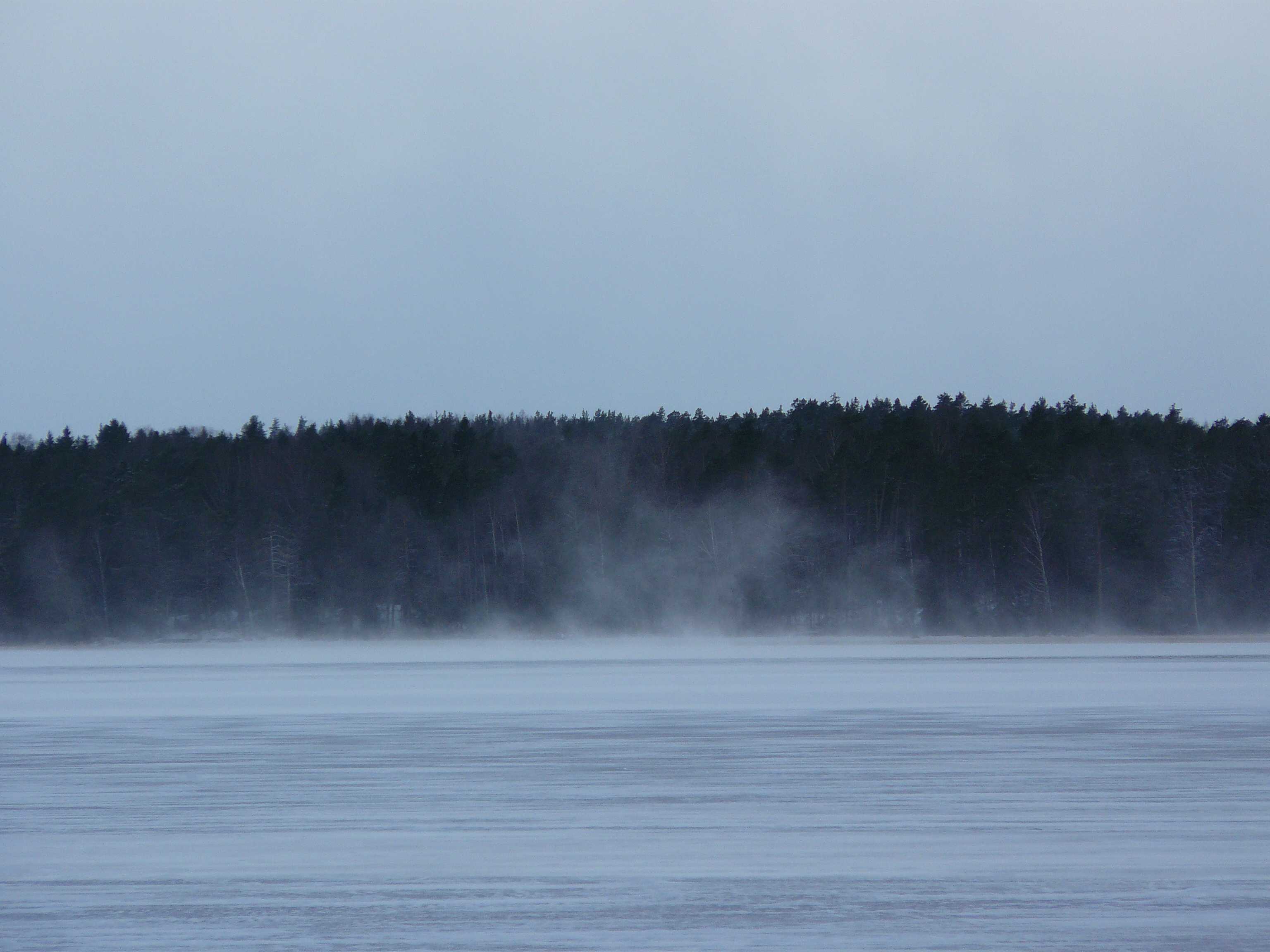
Blowing snow (Image 3)
In this image, the shower of snow pellets has passed and only towering whirls of blowing snow are propagating over the sea ice due to the strong and gusty wind. The prevailing weather code is ww = 38 as weak blowing snow is observed.
Links in the image description will highlight features on the image. Mouse over the features for more detail.
© Jarmo KoistinenEspoo, FinlandLatitude: 60° 0' 0'' NLongitude: 25° 0' 0'' E18 March 2016 1231 (Local Time)Camera direction: towards NWCL = 9, CM = /, CH = /Image P/S code: P.11.3.2Image I.D.: 5029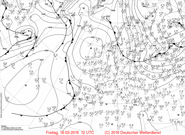
The synoptic situation is characterized by the strong northerly flow of a cold polar air mass.
© Deutscher Wetterdienst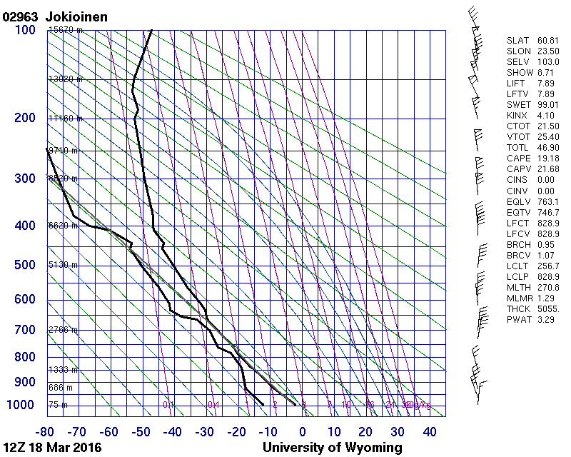
The upper-air sounding was measured 3 hours after the images, and about 100 km north-west from their location. It shows the very low tropopause in the cold air mass. Due to strong winds and a considerable amount of solar radiation between the shower periods, the lower troposphere is well mixed and prone to gusts.
© University of Wyoming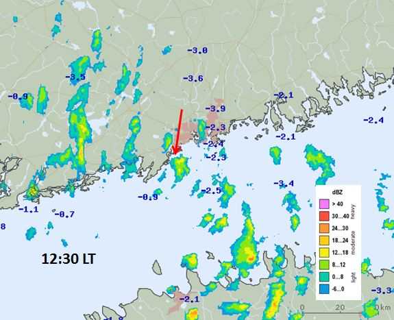
The radar image from 1230 hours local time reveals the numerous snow showers moving in the direction of the red arrow. The arrow is also pointing at the convective cell that the photographs are associated with. The observation location is at the head of the arrow.
© Finnish Meteorological Institute