© Ian Simpson
Lanherne (E-bound), Dawlish, Devon, United Kingdom of Great Britain and Northern Ireland
Latitude: 50° 34' 56'' N
Longitude: 3° 27' 52'' W
06 May 2013 1100 (Local Time)
Camera direction: towards SE
Image P/S code: S.11.1.1.4
Image I.D.: 5032
-

Advection fog/sea fog from the air
This view from the air over south-west England, UK shows extensive sea fog/low Stratus covering a large part of Lyme Bay in the English Channel. Sea fog is a type of advection fog and is formed when relatively warm, moist air moves (advects) over a cooler sea surface and the temperature of the air near the surface is cooled to saturation by contact with the cooler water.
The fog was confined to the sea and immediate coastline, lifting into low Stratus and readily dissipating inland.
Links in the image description will highlight features on the image. Mouse over the features for more detail.
© Ian SimpsonLanherne (E-bound), Dawlish, Devon, United Kingdom of Great Britain and Northern IrelandLatitude: 50° 34' 56'' NLongitude: 3° 27' 52'' W06 May 2013 1100 (Local Time)Camera direction: towards SEImage P/S code: S.11.1.1.4Image I.D.: 5032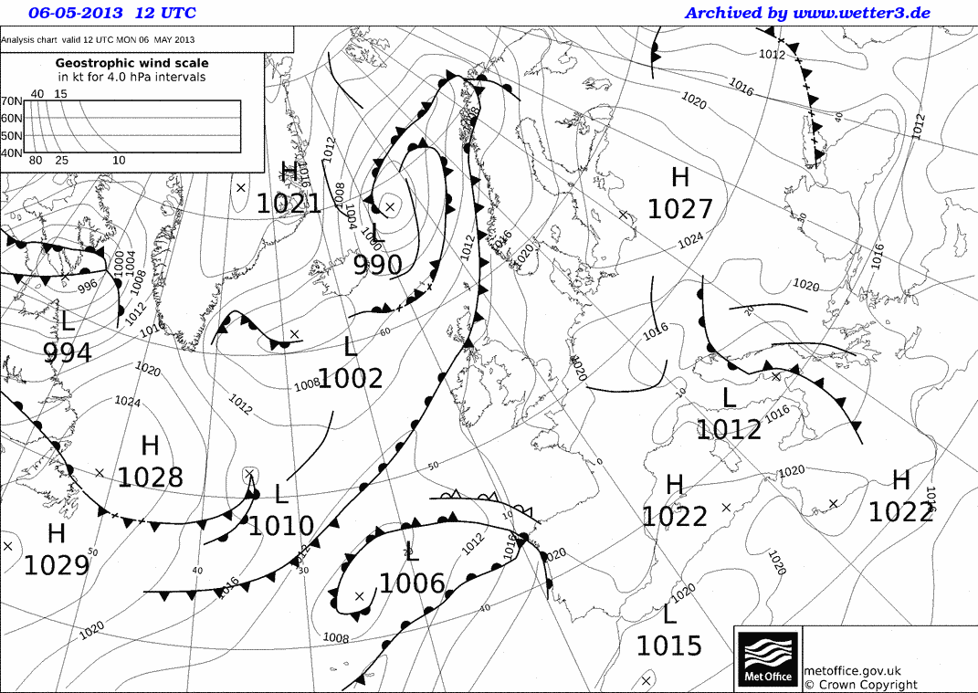
The synoptic situation over UK was that of a ridge of high pressure extending south-west to cover much of the British Isles, with a centre of high pressure located around the Baltic Sea (1 027 hPa). A low pressure area (1 006 hPa) was located to the south-west of the British Isles at 43°N 26°W, with others (990 hPa) north-east of Iceland and another (1 012 hPa) over southern Italy. A cold front straddled northern parts of Scotland, UK. The air mass over the British Isles was that of a warm, moist south to south-westerly, with the warm, moist air being cooled to its dew point over the coasts of southern England, UK.
© Crown Copyright
The upper-air ascent for midnight on 6 May 2013 shows the air to be well subsided due to the descent associated with the ridge of high pressure. A surface inversion to about 1 000 hPa is evident, with the air looking to be wholly saturated at or near the surface. There is very dry air above about 960 hPa and this is indicative of a large part of the atmosphere up to around 500 hPa.
© University of Wyoming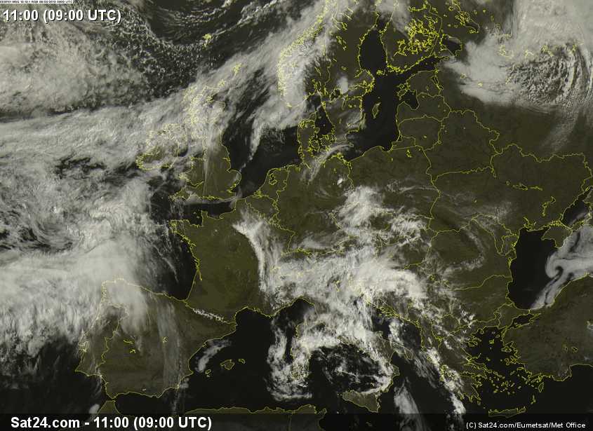
Sea fog can be seen on this visual satellite image stretching eastwards from Lyme Bay in south-west England, UK along the south coast to the coast of south-east England. The cloud over northern Scotland, UK and Northern Ireland, UK is associated with a slow-moving cold front.
© Sat24.com/Eumetsat/Met Office