© Matthew Clark
Exeter, Devon, United Kingdom of Great Britain and Northern Ireland
Latitude: 50° 44' 8'' N
Longitude: 3° 27' 39'' W
22 June 2007 1715 (Local Time)
Camera direction: towards SE
Image P/S code: P.9.13
Image I.D.: 5041
CL = 2, CM = 0, CH = 0
-
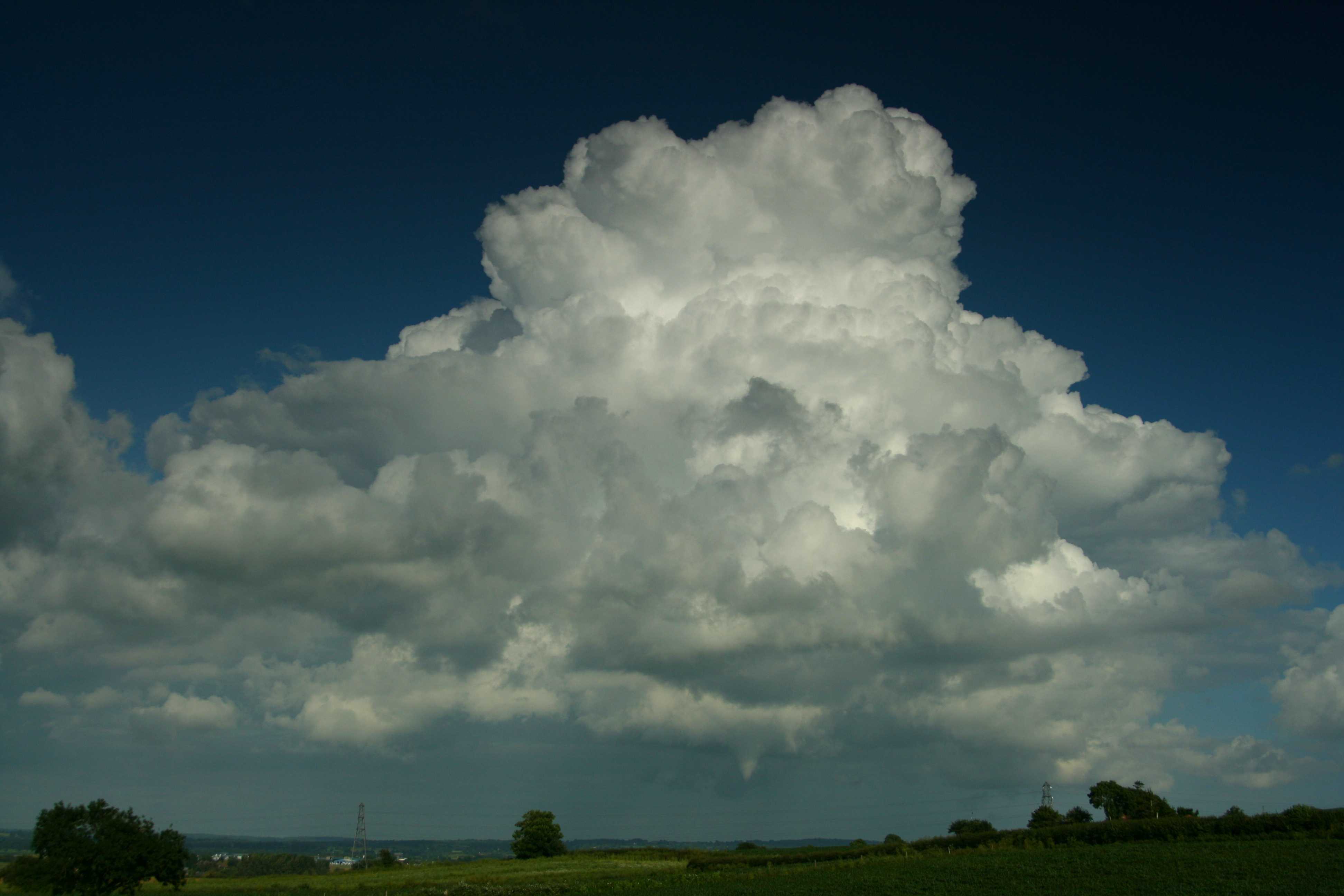
Cumulus congestus with funnel cloud
This photograph shows a sprouting Cumulus cloud, estimated to be about 10 km distant. It formed in a convergence zone and has several features associated with the species congestus, being of moderate to strong vertical extent with sharp outlines. The sunlit parts are generally white and the bulging upper parts resemble a cauliflower, while the cloud bases are darker and nearly horizontal. Cumulus congestus can produce precipitation, but none was present in this example. However, in the distance, an inverted cloud cone is visible; this is the supplementary feature tuba, commonly known as a funnel cloud. It lasted for about two minutes.
Links in the image description will highlight features on the image. Mouse over the features for more detail.
© Matthew ClarkExeter, Devon, United Kingdom of Great Britain and Northern IrelandLatitude: 50° 44' 8'' NLongitude: 3° 27' 39'' W22 June 2007 1715 (Local Time)Camera direction: towards SECL = 2, CM = 0, CH = 0Image P/S code: P.9.13Image I.D.: 5041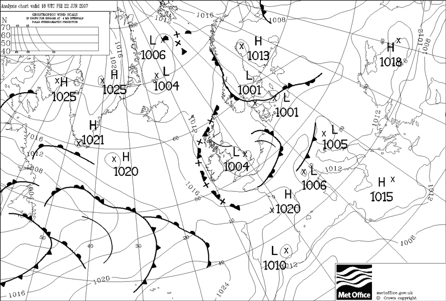
At 1800 UTC a shallow low of 1 004 hPa was centred over East Anglia. A slack north-westerly flow covered the location of the photograph in south-west England, UK, where local sea breezes developed.
© Crown Copyright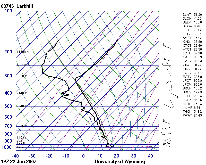
The 1200 UTC Larkhill (WMO 03743) sounding over central southern England, UK shows an unstable atmosphere from the surface to the tropopause height near 9 000 m, with light winds throughout (generally 10 kt or less).
© University of Wyoming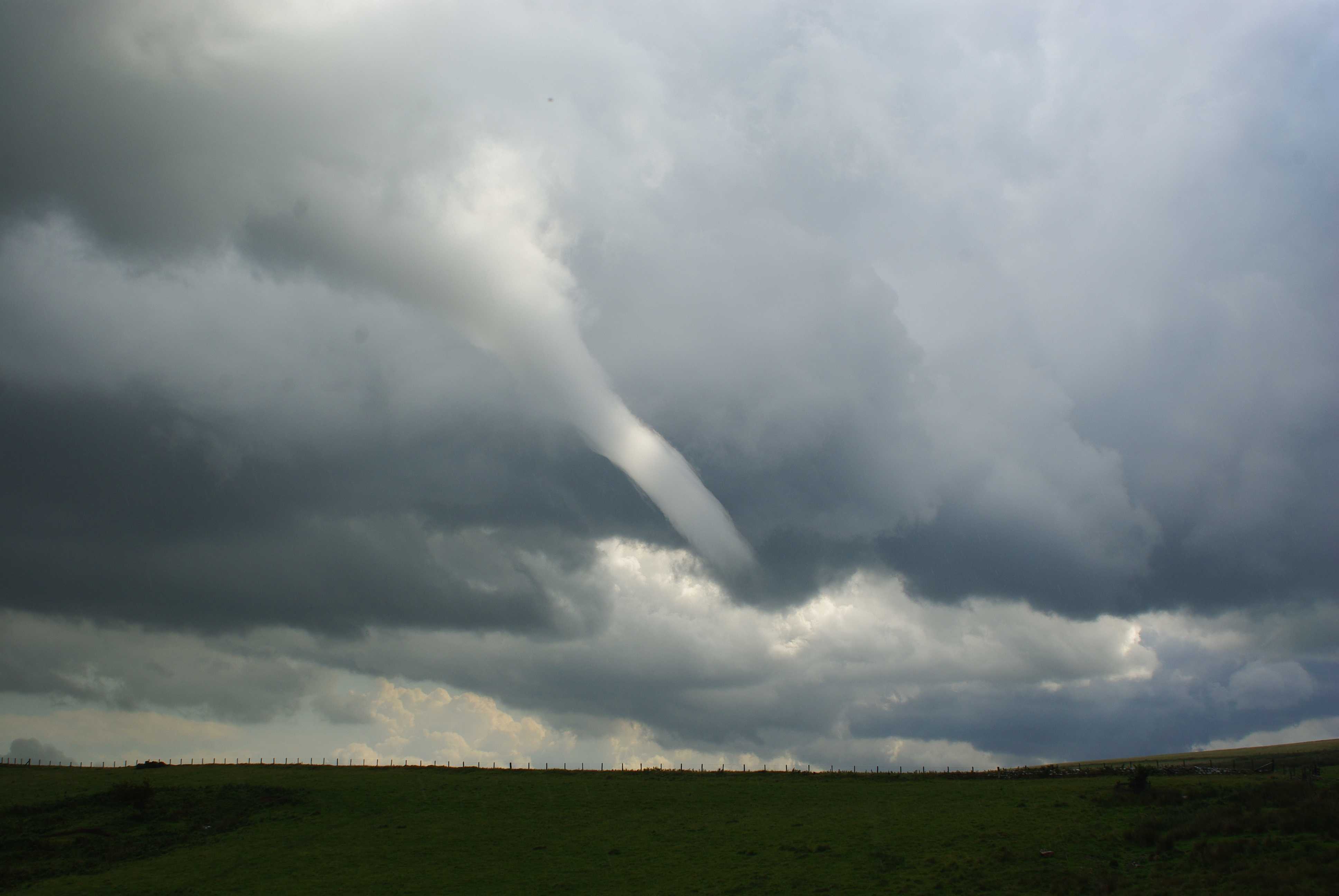
Funnel cloud/cold-air funnel
This funnel cloud developed from the base of a cumuliform cloud (Cumulus congestus or Cumulonimbus) that was associated with a trough and located in a showery northerly airflow over north-east England, UK.
While all tornadoes begin with the development of a funnel cloud that subsequently reaches the ground, cold-air funnels, such as the one illustrated here, arise from localized convective and shear vortices and are not associated with larger scale mesocyclones. Cold-air funnels typically develop from Cumulus congestus or Cumulonimbus clouds. They usually do not reach the ground, but when they do (as tornadoes) they are much less violent than tornadoes associated with mesocyclones.
Links in the image description will highlight features on the image. Mouse over the features for more detail.
© Stephen LewinsRothbury, Northumberland, England, United Kingdom of Great Britain and Northern IrelandLatitude: 55° 16' 22'' NLongitude: 1° 59' 36'' W27 August 2010 1418 (Local Time)Image P/S code: P.11.5.1.5Image I.D.: 5706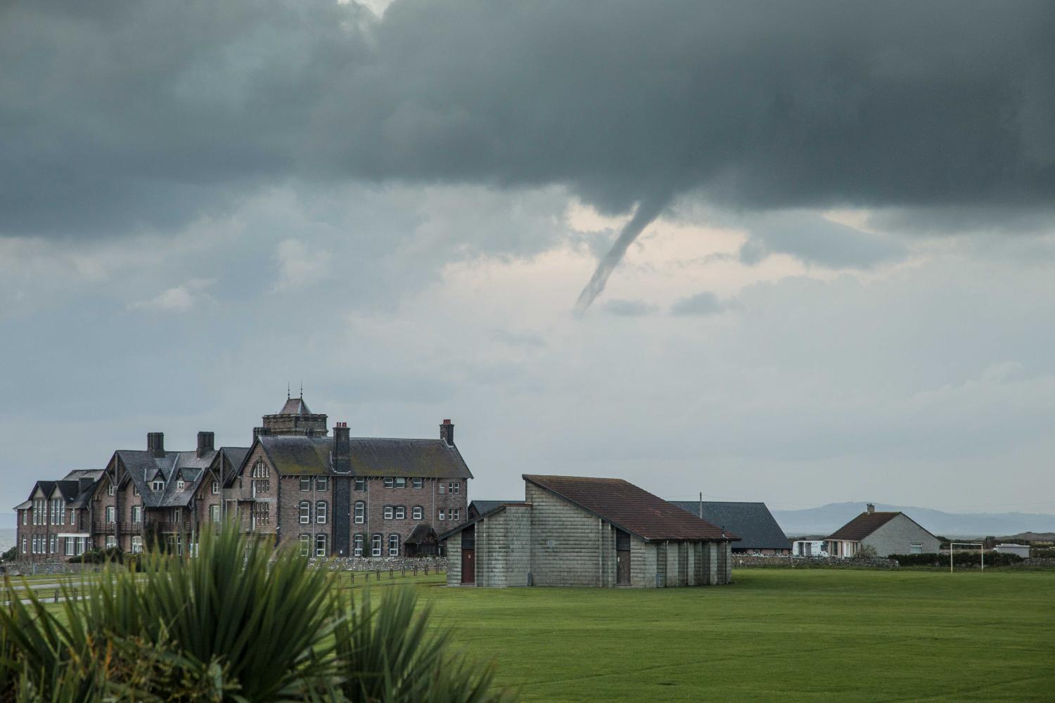
Funnel cloud/cold-air funnel
A funnel cloud is a type of spout. This cold-air funnel developed from the base of cumuliform cloud in an unstable airflow on the coast of south Wales, UK.
Cold-air funnels such as this one arise from localized convective and shear vortices associated with Cumulus congestus or Cumulonimbus and are not associated with larger scale mesocyclones.
Links in the image description will highlight features on the image. Mouse over the features for more detail.
© Tim BowRest Bay, Porthcawl, Wales, United Kingdom of Great Britain and Northern IrelandLatitude: 51° 29' 30'' NLongitude: 3° 43' 23'' W07 October 2014 1817 (Local Time)Image P/S code: S.11.5.1.5Image I.D.: 5721