© Jarmo Koistinen
Hauho, Finland
Latitude: 61° 10' 18'' N
Longitude: 24° 33' 48'' E
16 August 2012 0949 (Local Time)
Camera direction: towards W
Image P/S code: P.9.20
Image I.D.: 5047
CL = 2, CM = 6, CH = 0
-
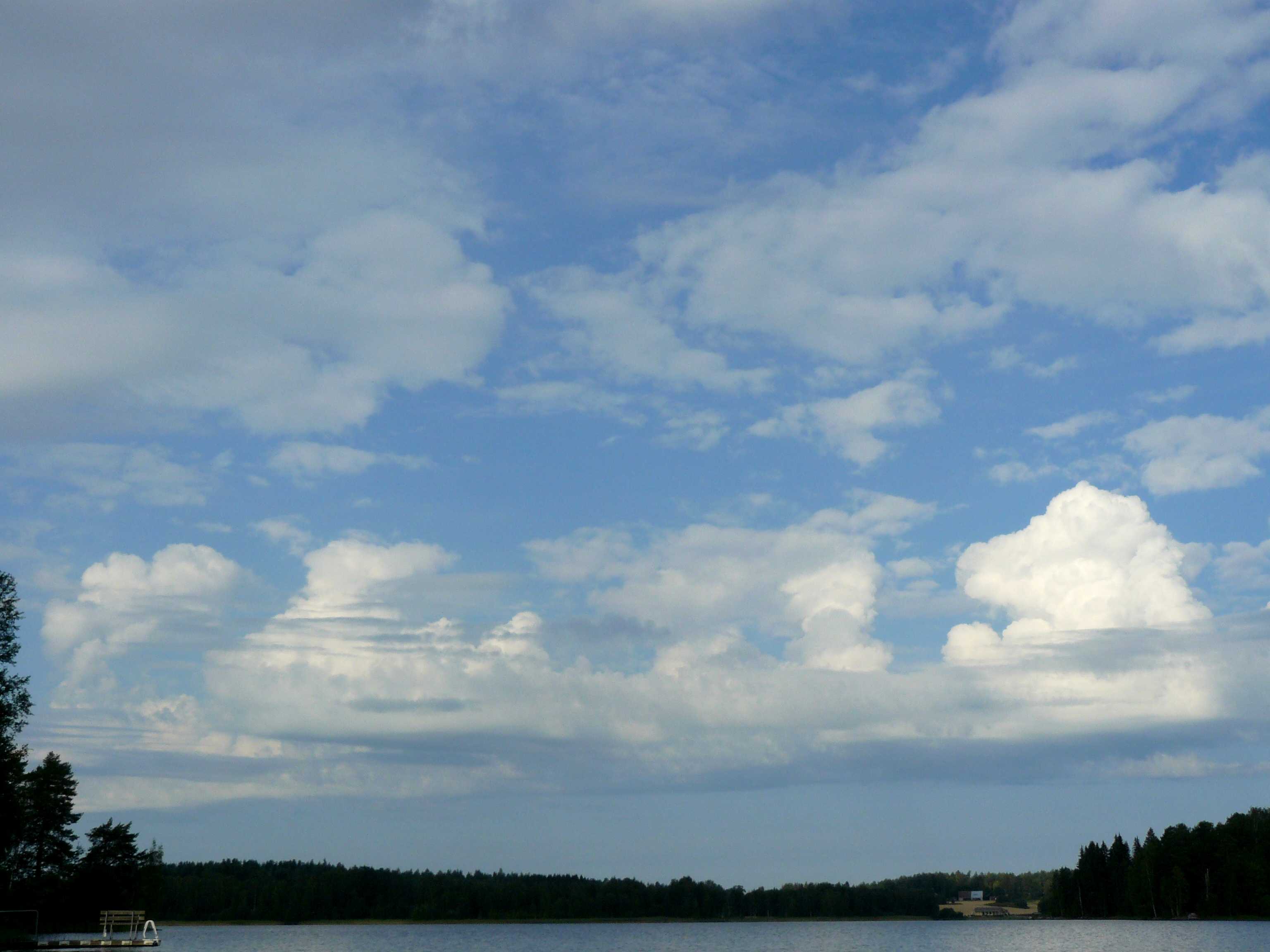
Cumulus and Stratocumulus with a common base
The image shows convective instability with towering Cumulus clouds and Stratocumulus with a common base, from which the Cumulus developed. The convective cloud is generally white and dense, is of moderate vertical extent and has protuberances associated with the species mediocris. On the right, sharp outlines and a cauliflower appearance identify the species congestus. A long, smooth and darker horizontal base appears to link the individual cells. Thin layers of Stratocumulus can also be seen in front of the convective cloud. One Cumulus top is spreading out to form Altocumulus cumulogenitus. Higher in the sky are thin patches of Altocumulus stratiformis with distinct spaces between the elements, which identifies the variety perlucidus. Showers with thunder developed several hours after the image was captured. A ceilometer 29 km to the south measured bases mostly at 1 500 m, but also at 2 900 m, the likely height of the Altocumulus.
Links in the image description will highlight features on the image. Mouse over the features for more detail.
© Jarmo KoistinenHauho, FinlandLatitude: 61° 10' 18'' NLongitude: 24° 33' 48'' E16 August 2012 0949 (Local Time)Camera direction: towards WCL = 2, CM = 6, CH = 0Image P/S code: P.9.20Image I.D.: 5047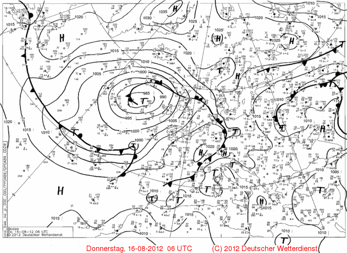
A weak ridge of high pressure covered northern Scandinavia, with a light north-easterly flow blowing over southern Finland. At 500 hPa, a small and rather weak upper-level low was approaching from the north-west, which enhanced the convective upper-level instability.
© Deutscher Wetterdienst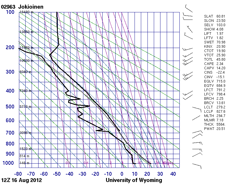
The sounding from Jokioinen, Finland (WMO 02963) at 1200 UTC, about 5 hours after the image and 77 km to the south-west, shows an unstable lower troposphere. The sounding at 0000 UTC showed a shallow moist layer at 1 500 m, the height of the base of the Cumulus and Stratocumulus cloud.
© University of Wyoming