© Matthew Clark
Lincoln, Nebraska, United States of America
Latitude: 40° 48' 49'' N
Longitude: 96° 38' 4'' W
01 June 2009 0015 (Local Time)
Camera direction: towards SW
Image P/S code: P.14.1.1.2.1
Image I.D.: 5074
-
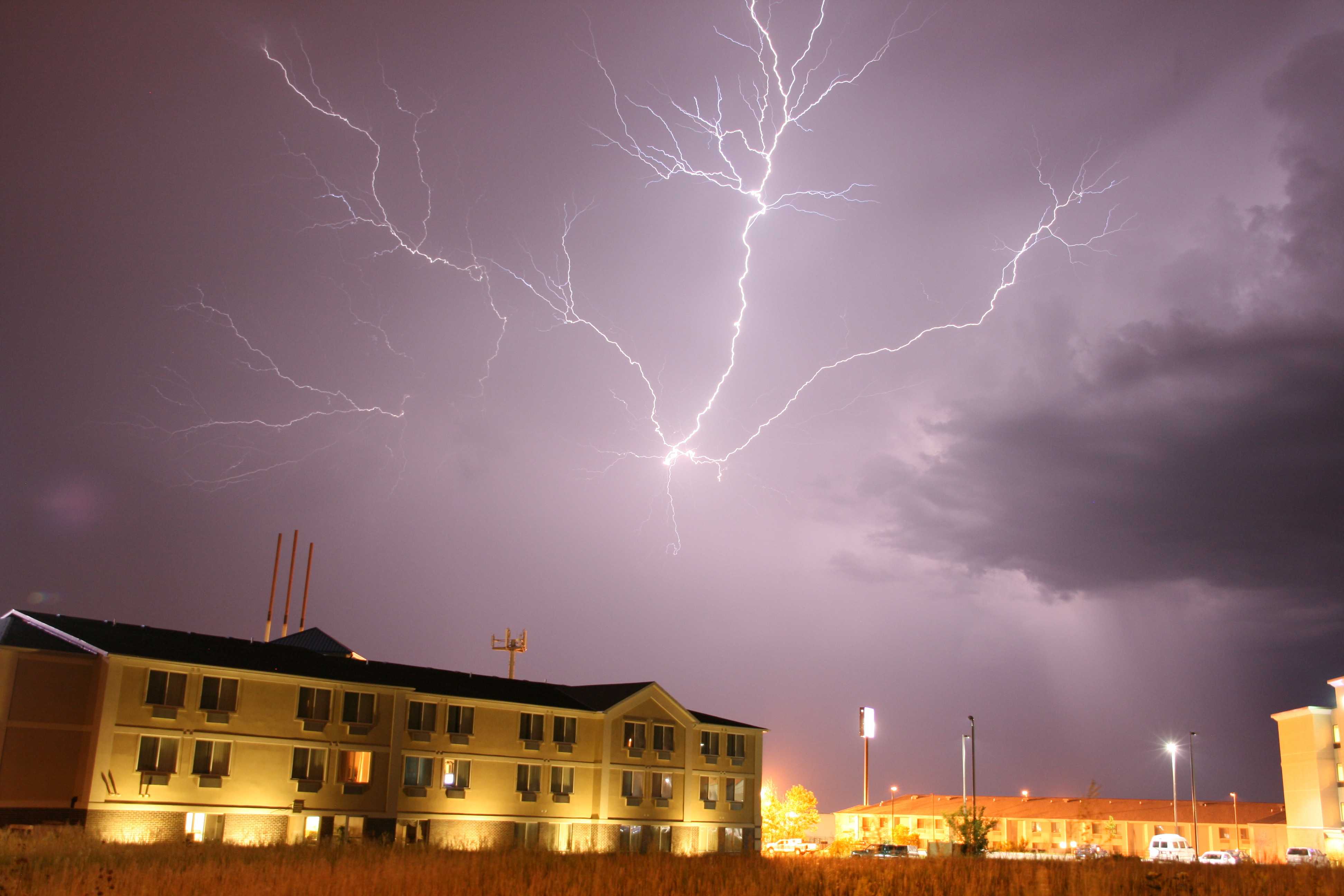
“Anvil crawler” lightning
This picture shows lightning branching through the anvil of a strong mid-level thunderstorm over Lincoln, Nebraska, USA. These cloud discharges are colloquially known as ”anvil crawlers”.
A rain-free updraught base can be seen at the right-hand side of the image. Elsewhere, cloud detail is masked by heavy precipitation. Shafts of precipitation are evident near to the rain-free updraught base.
Links in the image description will highlight features on the image. Mouse over the features for more detail.
© Matthew ClarkLincoln, Nebraska, United States of AmericaLatitude: 40° 48' 49'' NLongitude: 96° 38' 4'' W01 June 2009 0015 (Local Time)Camera direction: towards SWImage P/S code: P.14.1.1.2.1Image I.D.: 5074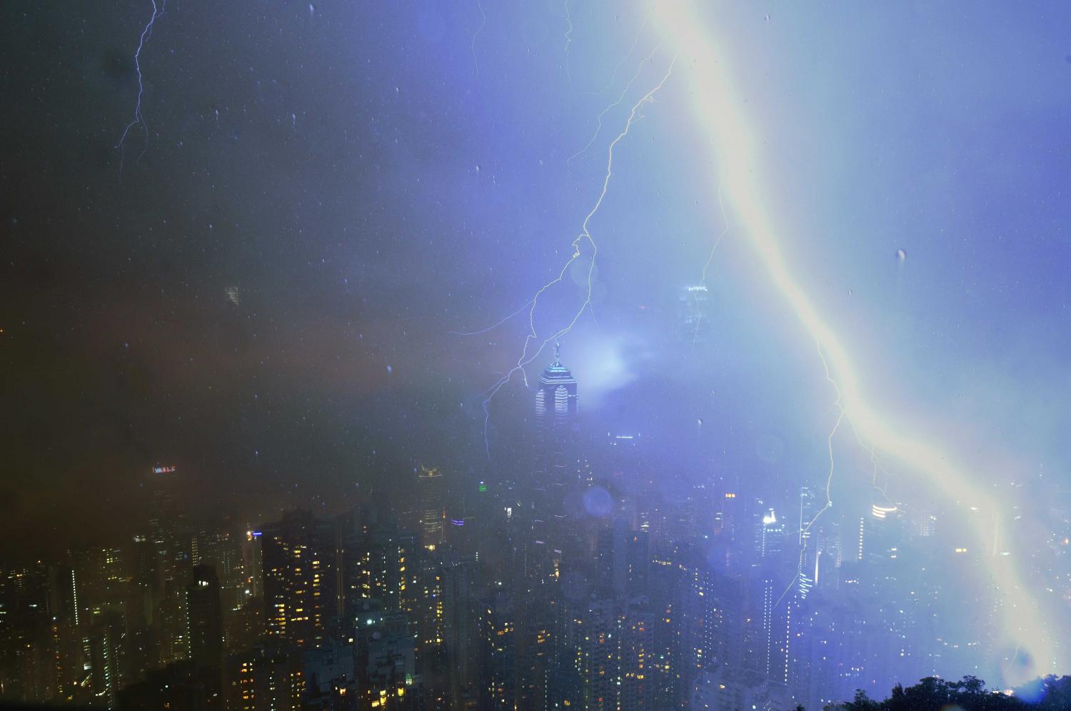
Lightning: ground discharge
A lightning ground discharge (cloud-to-ground lightning) from a Cumulonimbus cloud strikes the high ground of the Peak at Hong Kong (China).
A trough of low pressure brought thundery showers to the coastal areas of Guangdong. By convention, when lightning occurs the cloud is classified as Cumulonimbus.
Links in the image description will highlight features on the image. Mouse over the features for more detail.
© Irene HoThe Peak, Hong Kong, ChinaLatitude: 22° 16' 33'' NLongitude: 114° 8' 30'' E31 March 2014 1945 (Local Time)Image P/S code: S.14.1.1.1Image I.D.: 4947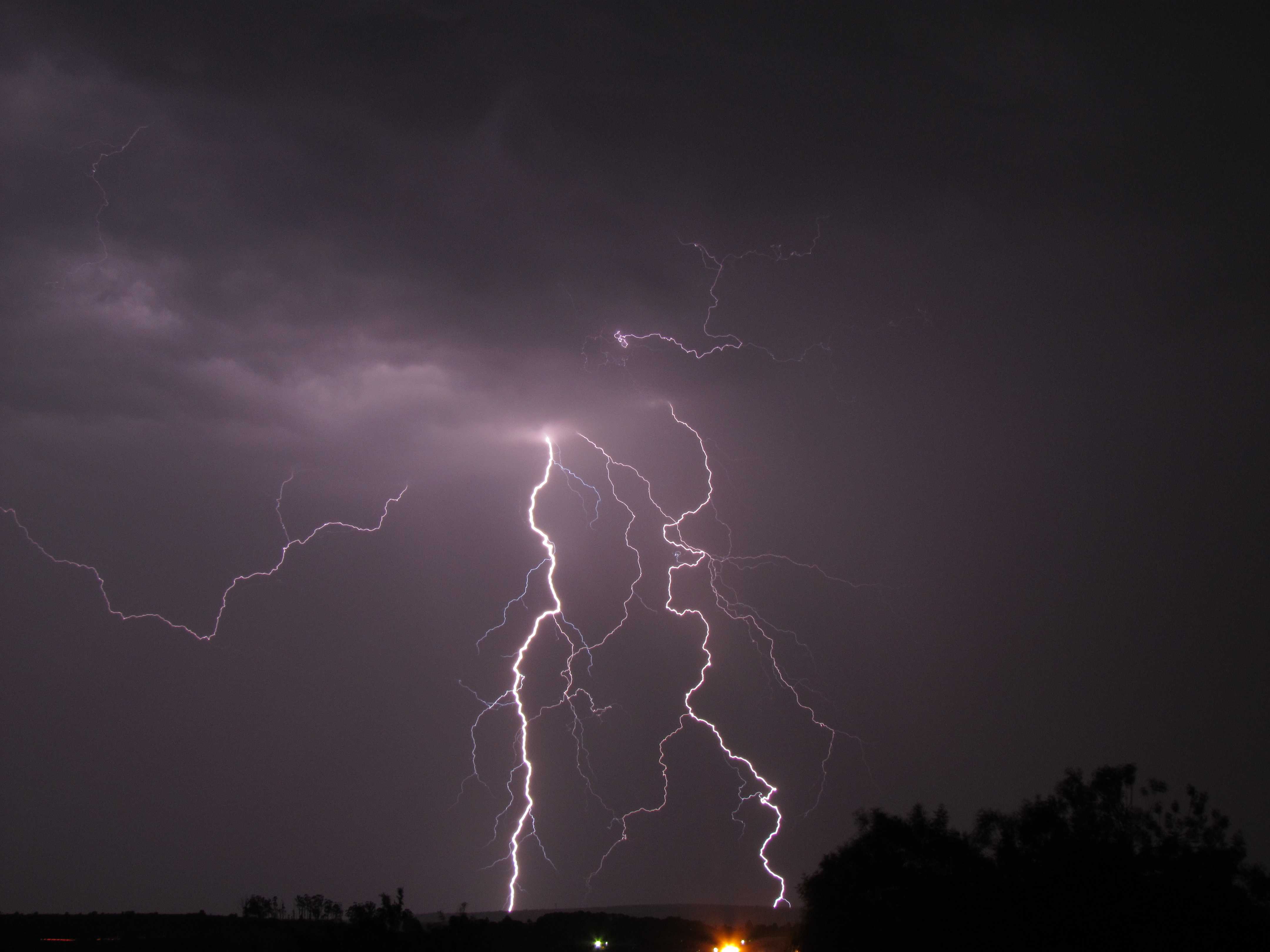
Lightning: ground discharges
The main features in this picture are the lightning ground discharges at 1 and 2 (cloud-to-ground lightning). The discharges appear to follow a tortuous path between cloud and ground and are commonly known as forked lightning. Smaller branches from the main discharge at 3, 4 and 5 dissipate into clear air. The discharge on the left of the picture, from cloud to air, appears not to strike the ground and is an air discharge.
When lightning occurs, the cloud is identified as Cumulonimbus. If it is not possible to determine whether the species is calvus or capillatus, as in this picture, by convention the coding is CL = 9.
Links in the image description will highlight features on the image. Mouse over the features for more detail.
© Duncan Paul KellyVryheid, South AfricaLatitude: 27° 45' 41'' SLongitude: 30° 46' 42'' E30 December 2011 2257 (Local Time)Camera direction: towards WCL = 9, CM = /, CH = /Image P/S code: S.14.1.1.1Image I.D.: 4950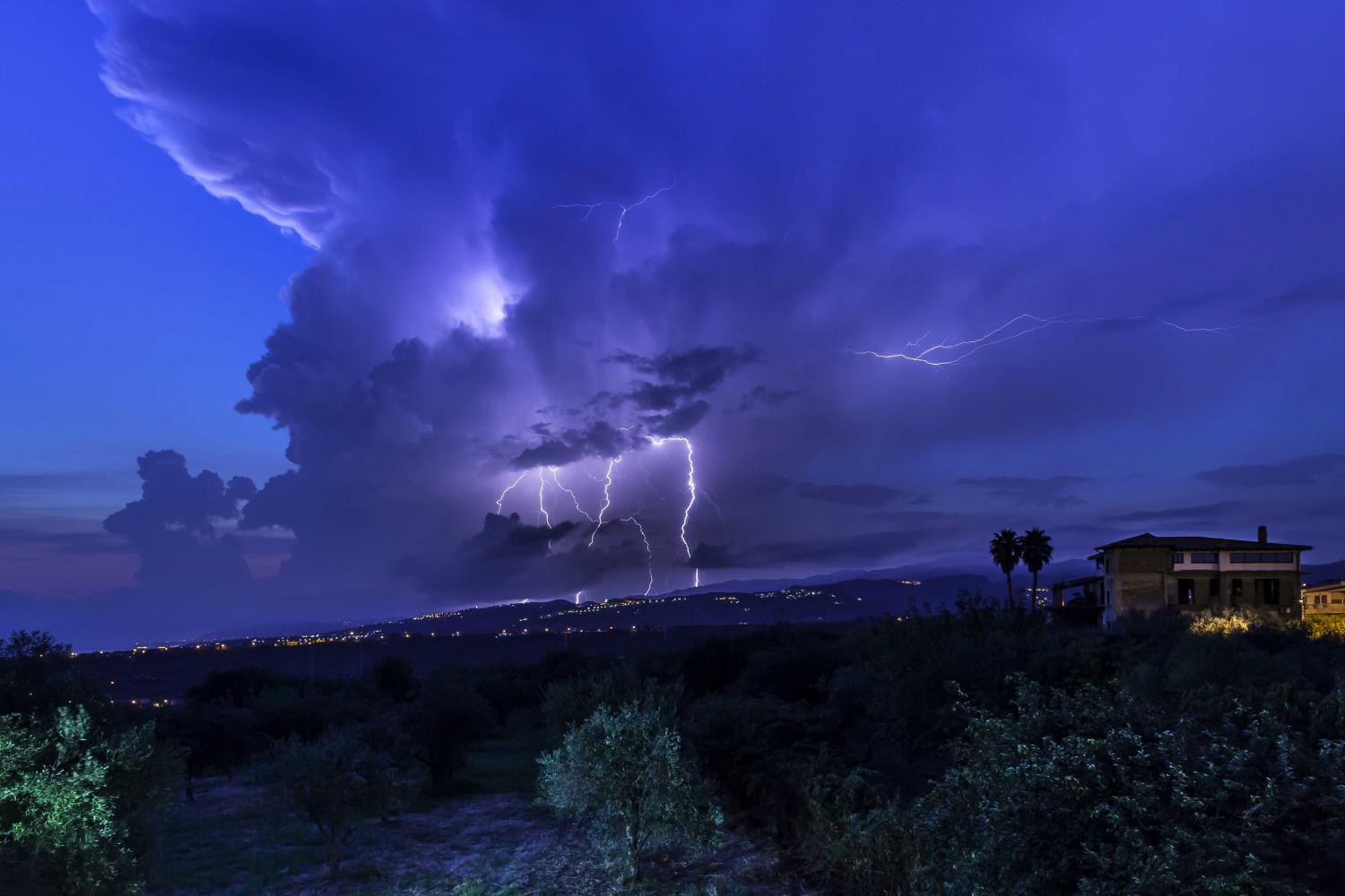
Lightning from Cumulonimbus capillatus
Lightning strikes to the ground, known as ground discharges, are seen from the lower part of this Cumulonimbus cloud. The cloud is specifically identified as Cumulonimbus capillatus incus by the fibrous top to the cloud and anvil (coding CL = 9). Other lightning activity is occurring within the thundercloud cloud (intra-cloud lightning), with some cloud discharges lighting up the interior. One lightning flash – an anvil crawler – originates from the upper portion of the cloud, beneath the anvil, and travels horizontally for some distance, generating several branches.
Links in the image description will highlight features on the image. Mouse over the features for more detail.
© Fabrizio MicalizziPace del Mela, ItalyLatitude: 38° 11' 3'' NLongitude: 15° 18' 41'' E07 August 2015 0422 (Local Time)Camera direction: towards SECL = 9, CM = /, CH = /Image P/S code: S.14.1Image I.D.: 4951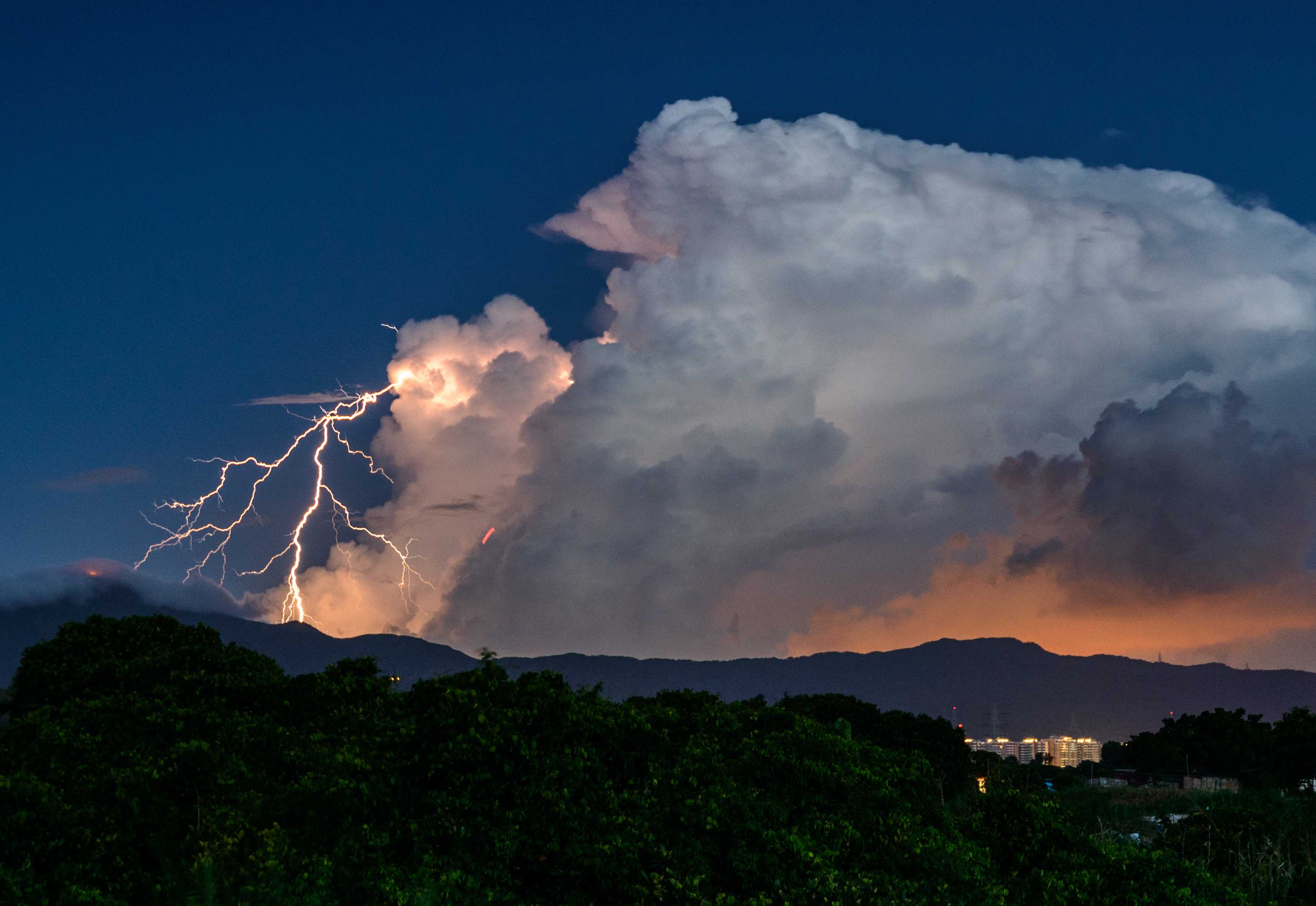
Thunderstorm
A tropical depression over the northern part of the South China Sea intensified into a tropical storm named Mirinae. In Hong Kong (China), the weather was hot with sunny periods during the day and there were also a few squally showers and thunderstorms.
Thunderstorms are associated with Cumulonimbus clouds and are most often accompanied by precipitation. This photograph shows a thunderstorm during the evening from a Cumulonimbus calvus cloud. A thunderstorm is defined as one or more sudden electrical discharges, manifested by a flash of light (lightning) and a sharp or rumbling sound (thunder).
Links in the image description will highlight features on the image. Mouse over the features for more detail.
© Sung Lok CheungYuen Long, Hong Kong, ChinaLatitude: 22° 28' 33'' NLongitude: 114° 1' 20'' E26 July 2016 1934 (Local Time)Camera direction: towards SECL = 3, CM = 0, CH = 0Image P/S code: P.14.1Image I.D.: 4997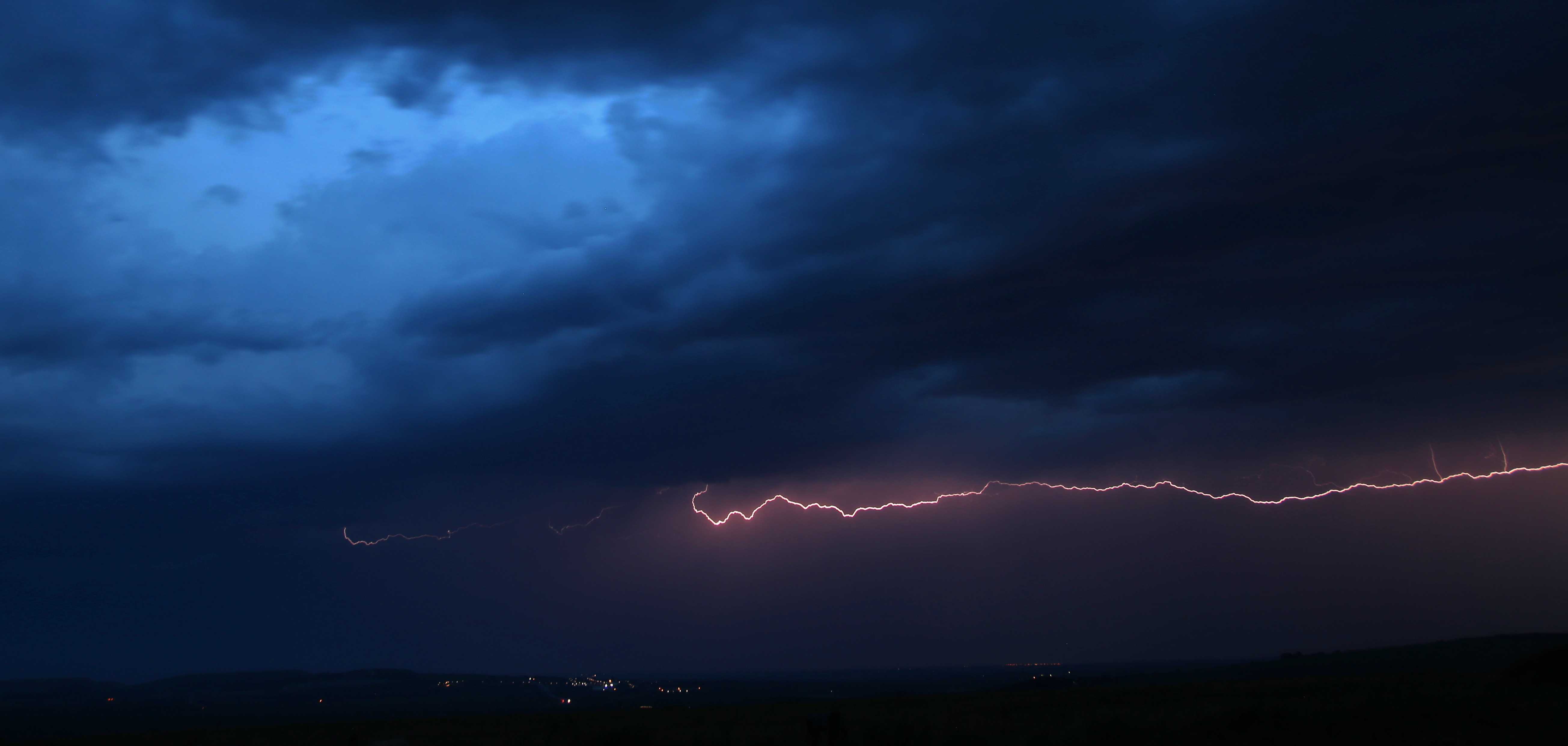
Lightning: cloud discharge
Cloud-to-cloud lightning discharge of great horizontal extent
Links in the image description will highlight features on the image. Mouse over the features for more detail.
© Matthew ClarkChateau Cl, Gothers, St Dennis, Saint Austell, United Kingdom of Great Britain and Northern IrelandLatitude: 50° 23' 30'' NLongitude: 4° 51' 36'' W17 July 2014 2100 (Local Time)Camera direction: towards SWCL = 3, CM = 0, CH = 0Image P/S code: S.14.1.1.2Image I.D.: 5024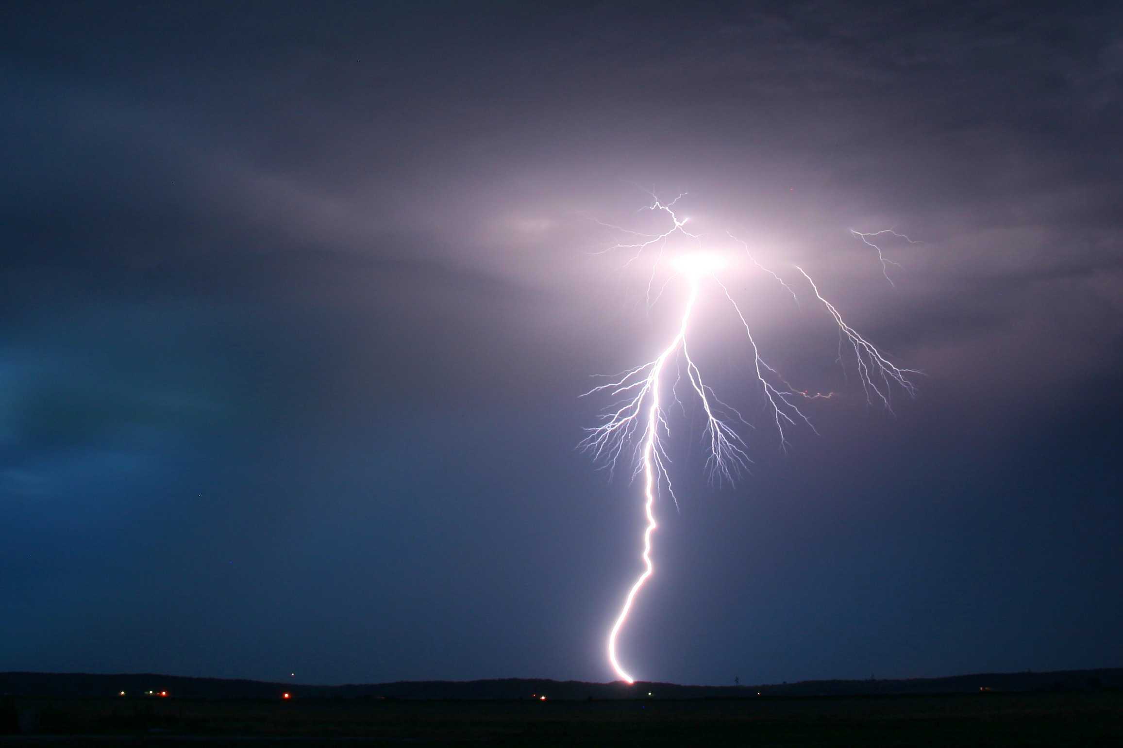
Lightning: ground discharge
This photograph shows a cloud-to-ground lightning discharge from a rather high-based evening thunderstorm over Iowa, USA.
Links in the image description will highlight features on the image. Mouse over the features for more detail.
© Matthew ClarkPrairie, Iowa, United States of AmericaLatitude: 40° 45' 9'' NLongitude: 95° 33' 53'' W31 May 2009 2200 (Local Time)Camera direction: towards ECL = 3, CM = 0, CH = 0Image P/S code: P.14.0Image I.D.: 5073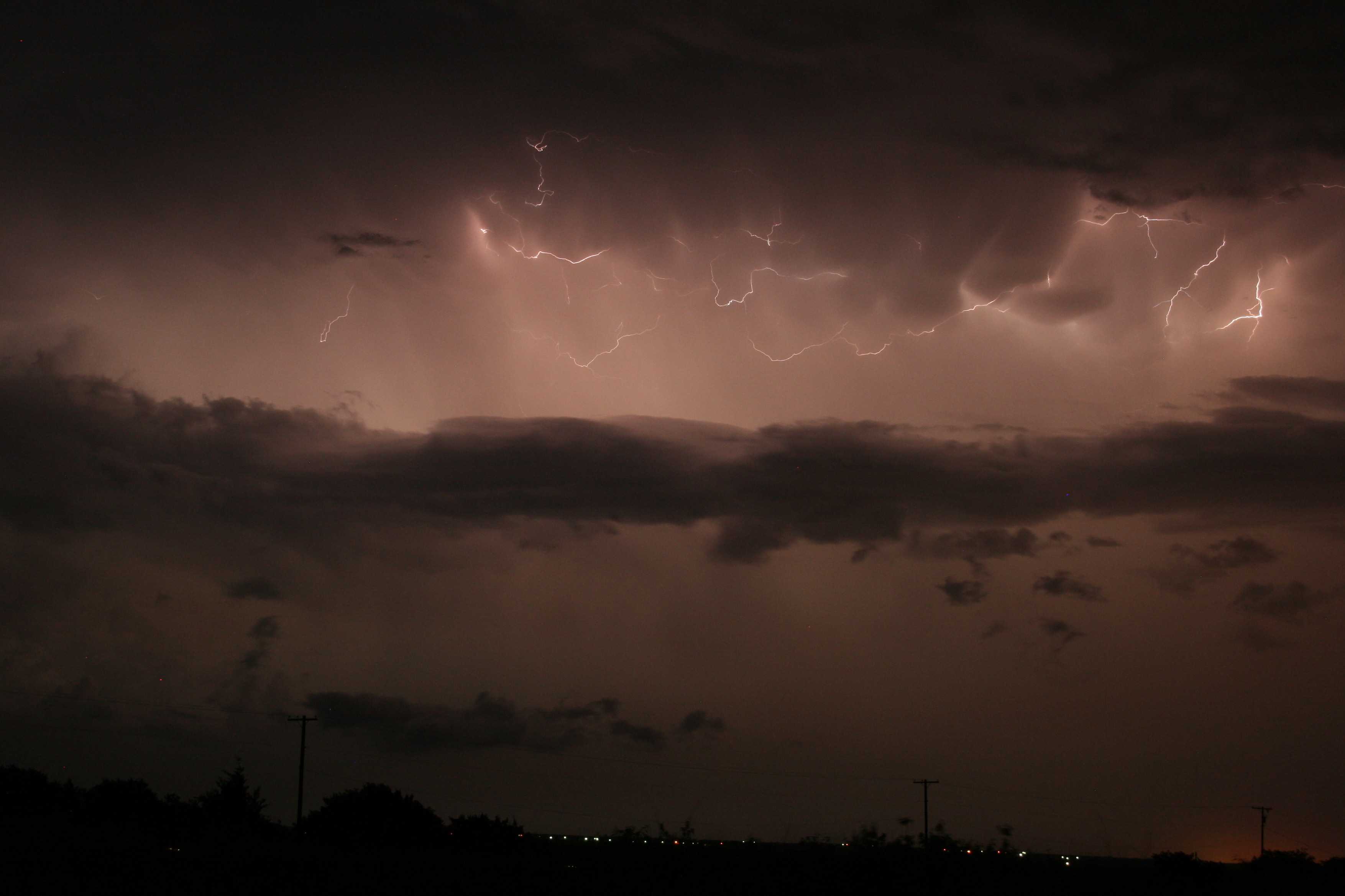
Lightning: cloud discharge (“anvil zits”)
This image features numerous small lightning discharges, informally known as “anvil zits”, in the anvil of a severe thunderstorm near Decatur in Texas, USA (seen at 1 and 2). The photo was a 15-second exposure, so that many examples of the lightning discharges have been captured. Weakly defined mamma is also evident in the anvil. The thunderstorm produced 5 cm diameter hail.
Links in the image description will highlight features on the image. Mouse over the features for more detail.
© Matthew ClarkBoyd, Texas, United States of AmericaLatitude: 33° 5' 40'' NLongitude: 97° 38' 47'' W26 May 2009 2130 (Local Time)Camera direction: towards ECL = 3, CM = 0, CH = 0Image P/S code: S.14.1.1.2Image I.D.: 5080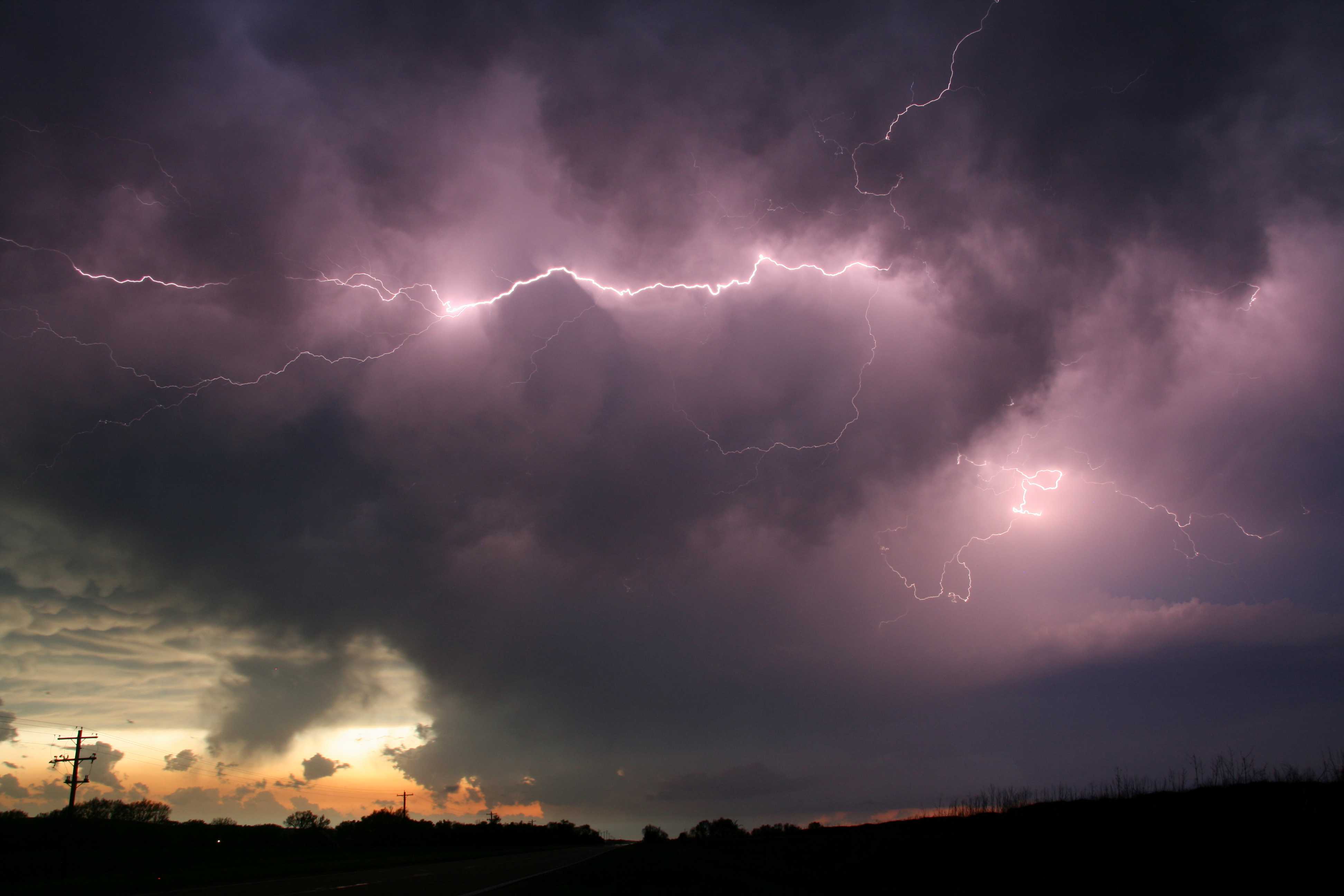
Lightning: cloud discharges
This picture shows cloud discharges of lightning at 1 and 2 during an evening thunderstorm over Nebraska, USA. The thunderstorm was rather high-based, and mamma can be seen in the distance where part of the extensive anvil of the storm is visible. A small updraught base is visible at the lower right, with cumuliform clouds growing into the storm. Cumulus fractus clouds are evident underneath the storm, with other Cumulus species in the distance.
Links in the image description will highlight features on the image. Mouse over the features for more detail.
© Matthew ClarkHamlet, Nebraska, United States of AmericaLatitude: 40° 21' 7'' NLongitude: 101° 7' 25'' W23 May 2010 2000 (Local Time)Camera direction: towards WCL = 3, CM = 0, CH = 0Image P/S code: P.14.1.1.2Image I.D.: 5081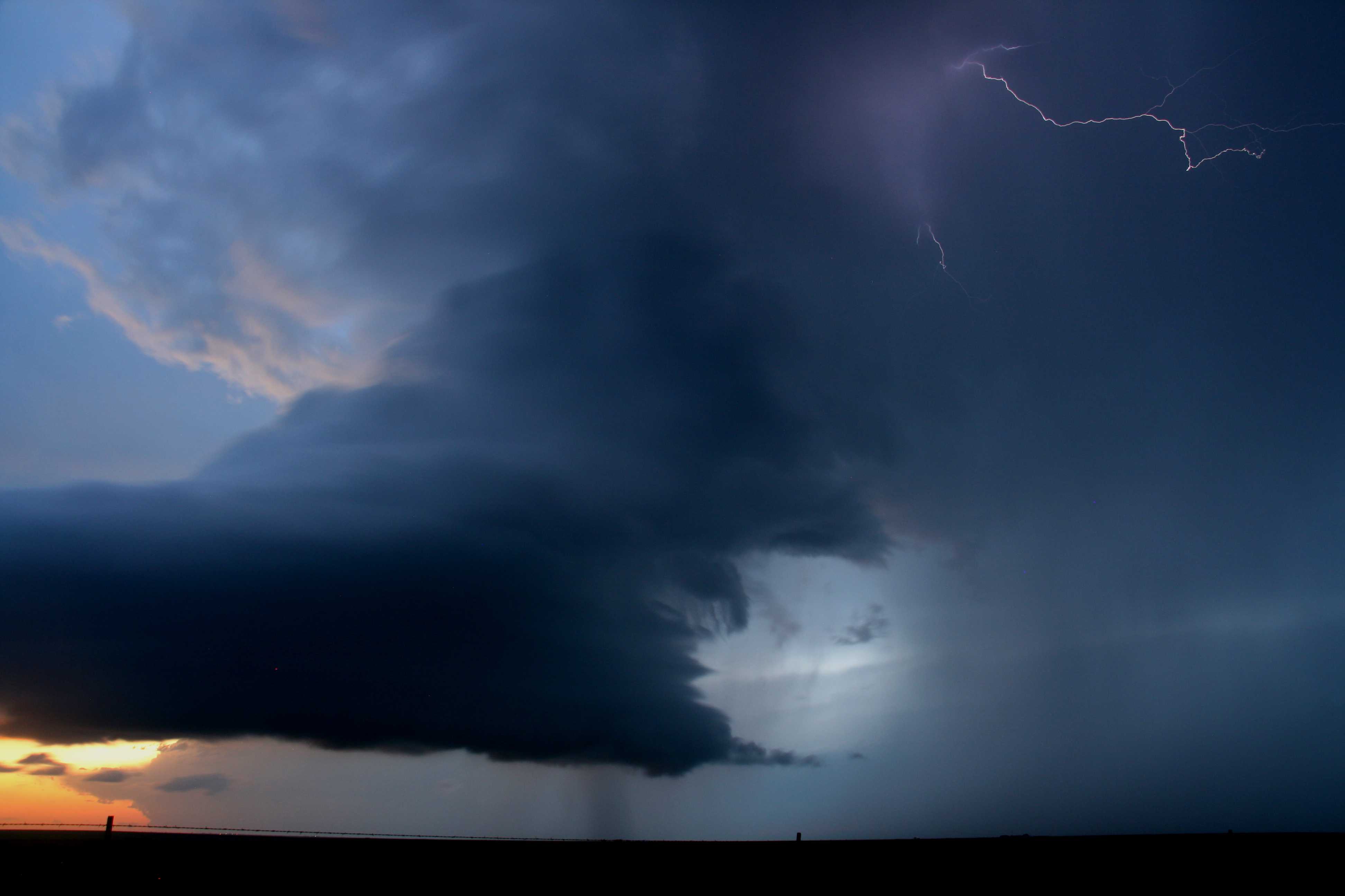
Cumulonimbus capillatus praecipitatio cauda
A low-precipitation supercell at sunset. The updraught tower was gradually narrowing as the surface temperature cooled and thermals weakened. Eventually the tower became very narrow and the updraught ceased. Precipitation (rain and hail – there were reports of golf ball-sized hail) can be seen falling out to the right (north) of the updraught tower. A small inflow tail cloud, or cauda, can be seen at the north flank of the updraught base, where rain-cooled air is being drawn into the updraught. Lightning is occurring near the updraught–downdraught interface, and part of the back-sheared anvil is lit by the low Sun. Another large Cumulonimbus can be seen in the far distance.
Links in the image description will highlight features on the image. Mouse over the features for more detail.
© Matthew ClarkHappy, Texas, United States of AmericaLatitude: 34° 38' 56'' NLongitude: 101° 55' 5'' W25 May 2010 2000 (Local Time)Camera direction: towards WNWCL = 9, CM = 0, CH = 0Image P/S code: S.10.3 5Image I.D.: 5085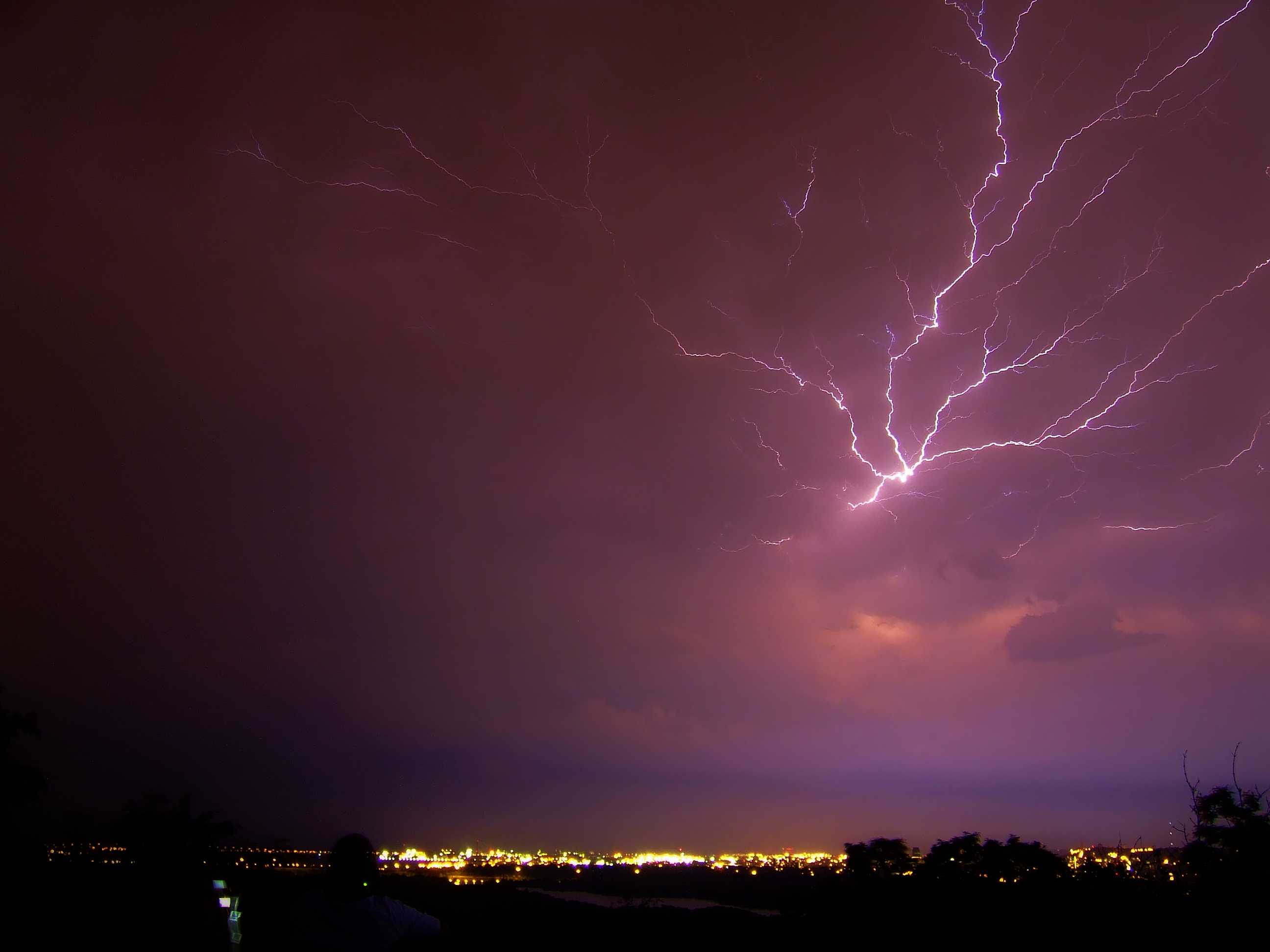
“Anvil crawler” lightning
The image shows lightning associated with a severe storm complex crossing the lower Great Lakes. Discrete convective cells mutated into a powerful squall line ahead of a strong cold front moving south-east during the evening hours. Hail, damaging winds and heavy rain accompanied its passage. Pictured here is the north flank of the thunderstorm complex as it crossed the Canadian border into New York state and Pennsylvania, USA. This cloud discharge, colloquially known as “anvil crawlers”, covers some horizontal distance and generates multiple tree-like branches.
Links in the image description will highlight features on the image. Mouse over the features for more detail.
© Eric Van LochemWaterdown, Hamilton, Ontario, CanadaLatitude: 43° 19' 29'' NLongitude: 79° 54' 11'' W09 August 2009 2230 (Local Time)Camera direction: towards SECL = 9, CM = 0, CH = 0Image P/S code: S.14.1.1.2.1Image I.D.: 5557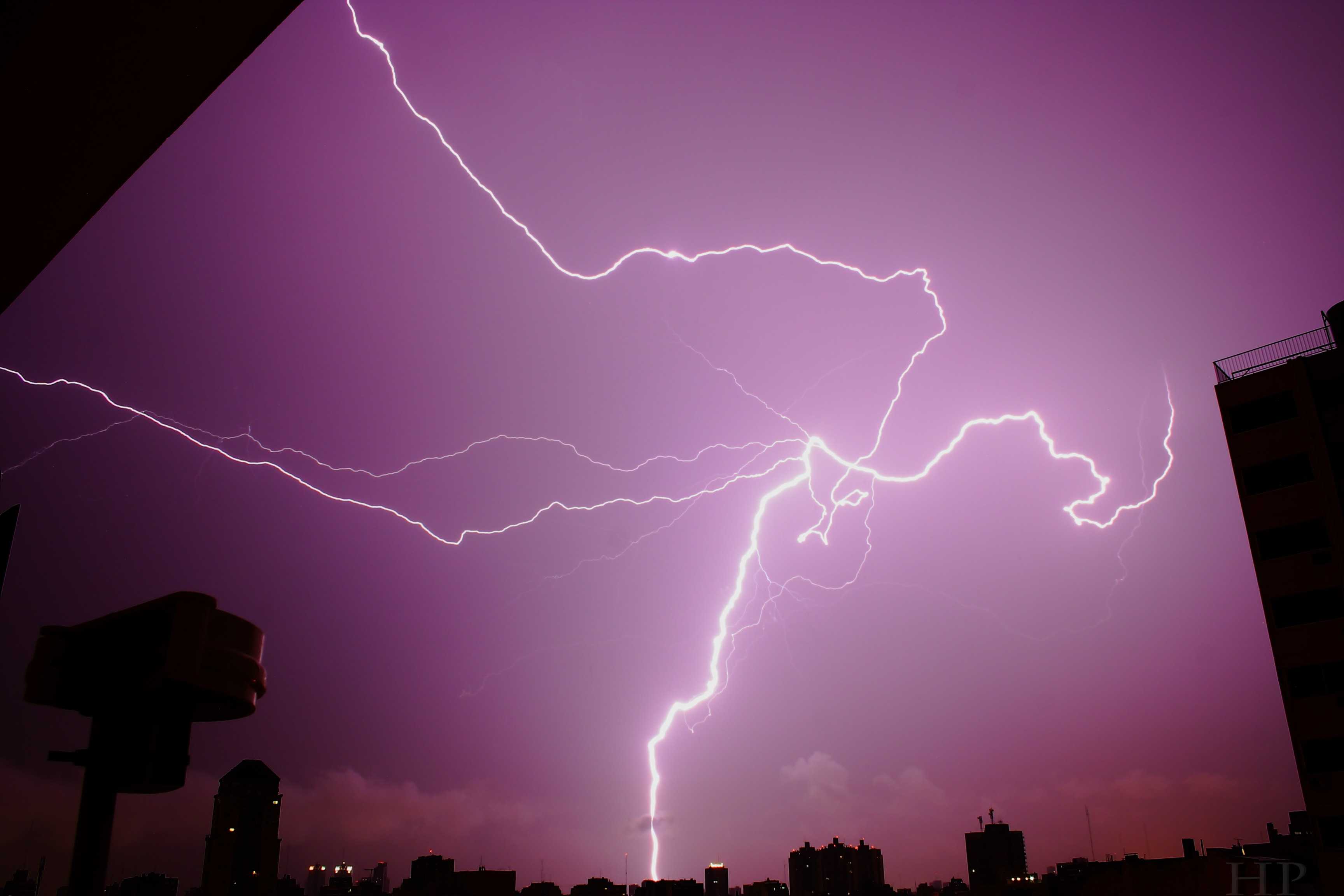
Cloud and ground lightning discharges
Lightning electrical discharges often follow a tortuous course. Here one connects with the ground as a cloud-to-ground discharge while others travel horizontally for some distance within or beneath the cloud.
Links in the image description will highlight features on the image. Mouse over the features for more detail.
© Hernàn PalmiscianoAlmagro, Buenos Aires, ArgentinaLatitude: 34° 36' 31'' SLongitude: 58° 25' 18'' W13 March 2012 0237 (Local Time)Camera direction: towards NECL = 9, CM = /, CH = /Image P/S code: S.14.1Image I.D.: 5568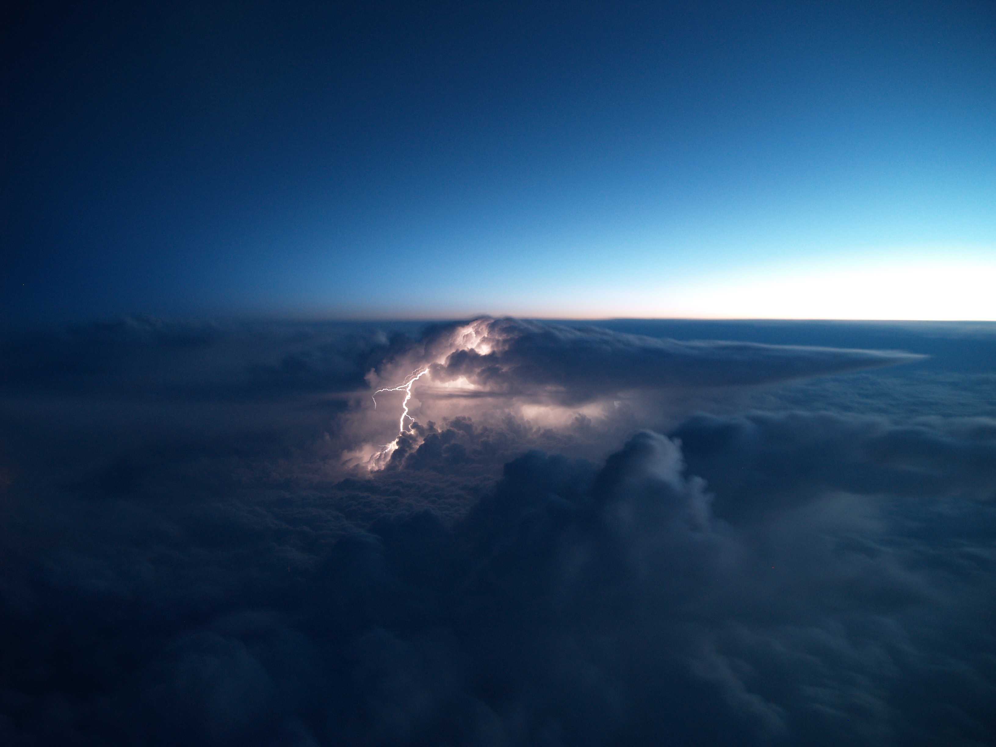
Lightning from Cumulonimbus capillatus incus
In this view from an aircraft, a lightning discharge is seen originating from near the top of a large Cumulonimbus capillatus incus. The supplementary feature incus is the uppermost portion of the Cumulonimbus spread out in the shape of an anvil.
Links in the image description will highlight features on the image. Mouse over the features for more detail.
© Severin Manuel BaerlocherPunjab, IndiaLatitude: 30° 17' 49'' NLongitude: 74° 26' 36'' E19 December 2010 0213 (Local Time)Camera direction: towards NECL = 9, CM = /, CH = /Image P/S code: S.14.1 21Image I.D.: 5569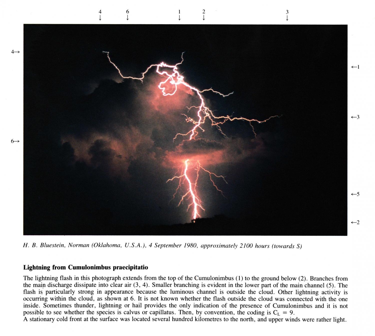
Lightening from Cumulonimbus praecipitatio
The lightning flash in this photograph extends from the top of the Cumulonimbus to the ground below. Branches from the main discharge dissipate into clear air at 3, 4. Smaller branching is evident in the lower part of the main channel. The flash is particularly strong in appearance because the luminous channel is outside the cloud. Other lightning activity is occurring within the cloud, as shown at 6. It is not known whether the flash outside the cloud was connected with the one inside. Sometimes thunder, lightning or hail provides the only indication of the presence of Cumulonimbus and it is not possible to see whether the species is calvus or capillatus. Then, by convention, the coding is CL = 9.
A stationary cold front at the surface was located several hundred kilometres to the north, and upper winds were rather light.
Links in the image description will highlight features on the image. Mouse over the features for more detail.
© H.B. BluesteinNorman, Oklahoma, United States of AmericaLatitude: 35° 13' 21'' NLongitude: 97° 26' 22'' W04 September 1980 2100 (Local Time)Camera direction: towards SCL = /, CM = /, CH = /