© George Anderson
Wokingham, England, United Kingdom of Great Britain and Northern Ireland
Latitude: 51° 25' 4'' N
Longitude: 0° 51' 48'' W
13 June 2014 0926 (Local Time)
Camera direction: towards SE
Image P/S code: P.2.0
Image I.D.: 5091
CL = 0, CM = 0, CH = 9
-
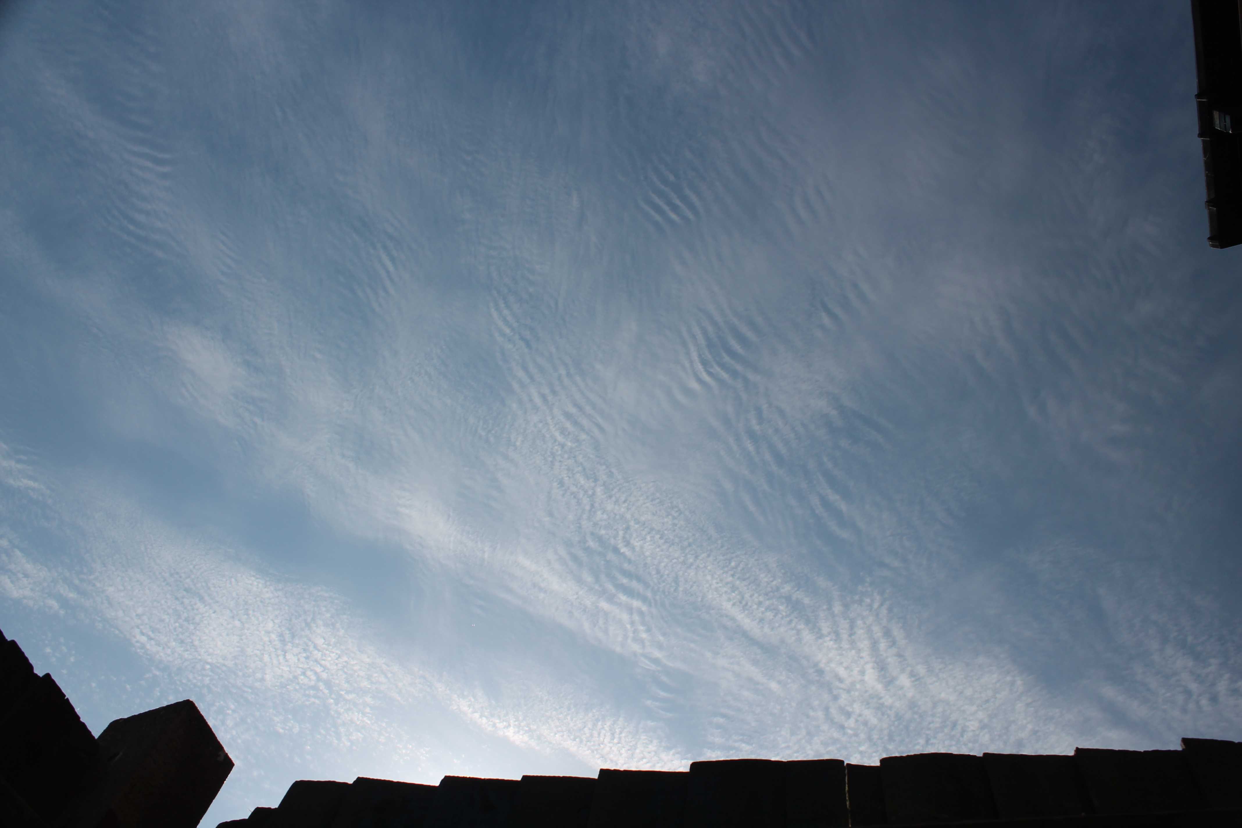
Cirrocumulus stratiformis undulatus
A ridge of high pressure extended across southern UK from an anticyclone (1 027 hPa) centred to the south-west of the British Isles. Frontal cloud affected the north and west of the British Isles but, in the south, under the ridge of high pressure, skies were clearer with just various forms of high-level cirriform clouds drifting from west to east. This picture shows an area of Cirrocumulus stratiformis undulatus. The cloud is identified as Cirrocumulus by the very small, and hence high-level, white cloud elements that are without shading and in the form of grains or ripples. The species is stratiformis because of the extensive layer, and the ripples identify the variety as undulatus.Links in the image description will highlight features on the image. Mouse over the features for more detail.
© George AndersonWokingham, England, United Kingdom of Great Britain and Northern IrelandLatitude: 51° 25' 4'' NLongitude: 0° 51' 48'' W13 June 2014 0926 (Local Time)Camera direction: towards SECL = 0, CM = 0, CH = 9Image P/S code: P.2.0Image I.D.: 5091Cirrocumulus stratiformis undulatus
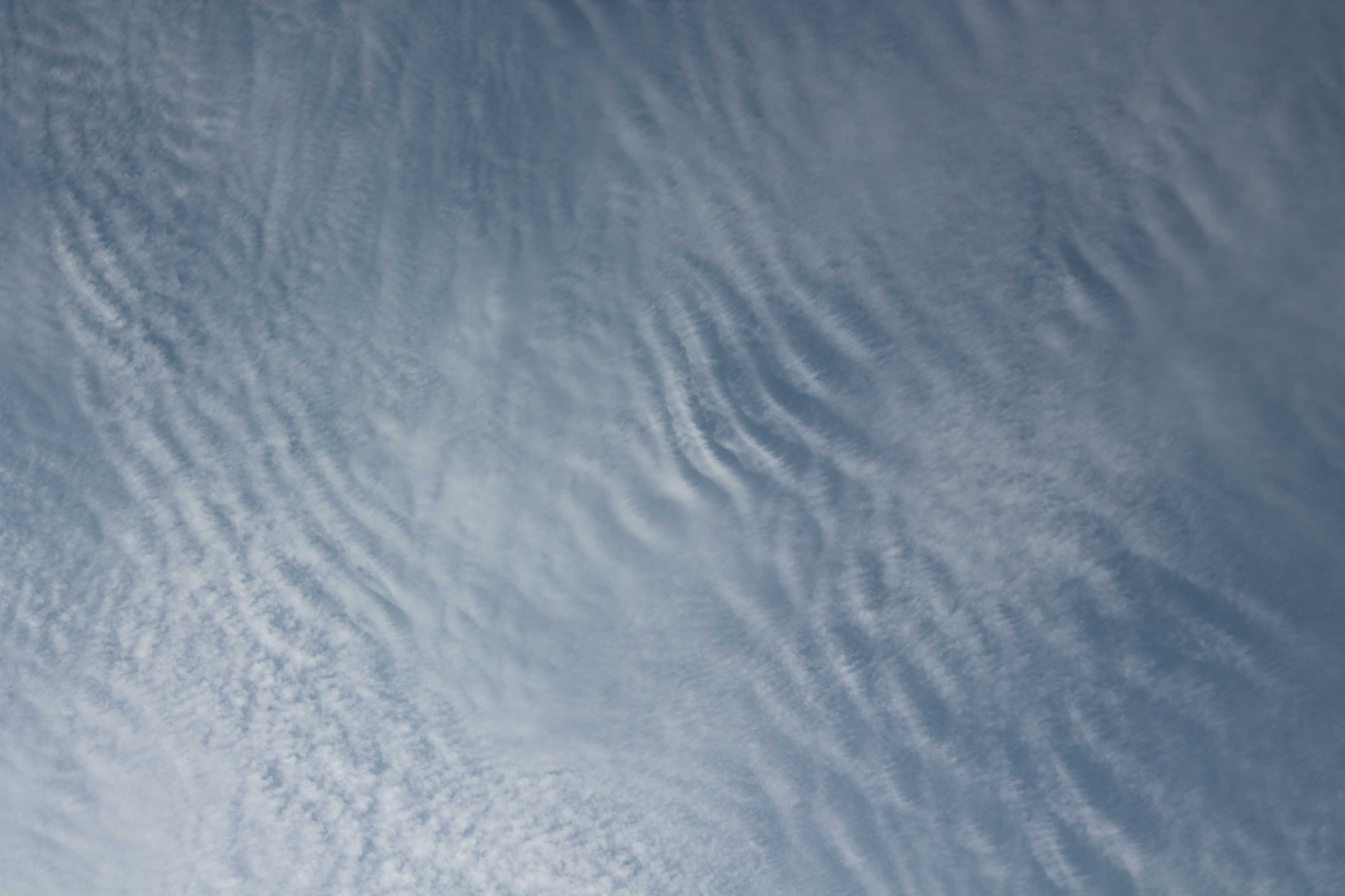
A ridge of high pressure extended across southern UK from an anticyclone (1 027 hPa) centred to the south-west of the British Isles. Frontal cloud affected the north and west of the British Isles but, in the south, under the ridge of high pressure, skies were clearer with just various forms of high-level cirriform clouds drifting from west to east. This picture is a close-up view of Cirrocumulus stratiformis undulatus, showing the fine detail of the cloud.
The cloud is identified as Cirrocumulus by the very small, and hence high-level, white cloud elements that are without shading and in the form of grains and ripples. The species is stratiformis because of the extensive layer, and the ripples identify the variety as undulatus.
Links in the image description will highlight features on the image. Mouse over the features for more detail.
© George AndersonWokingham, England, United Kingdom of Great Britain and Northern IrelandLatitude: 51° 25' 4'' NLongitude: 0° 51' 48'' W13 June 2014 0926 (Local Time)Camera direction: towards SECL = 0, CM = 0, CH = 9Image P/S code: P.2.5Image I.D.: 5092Cirrocumulus stratiformis undulatus
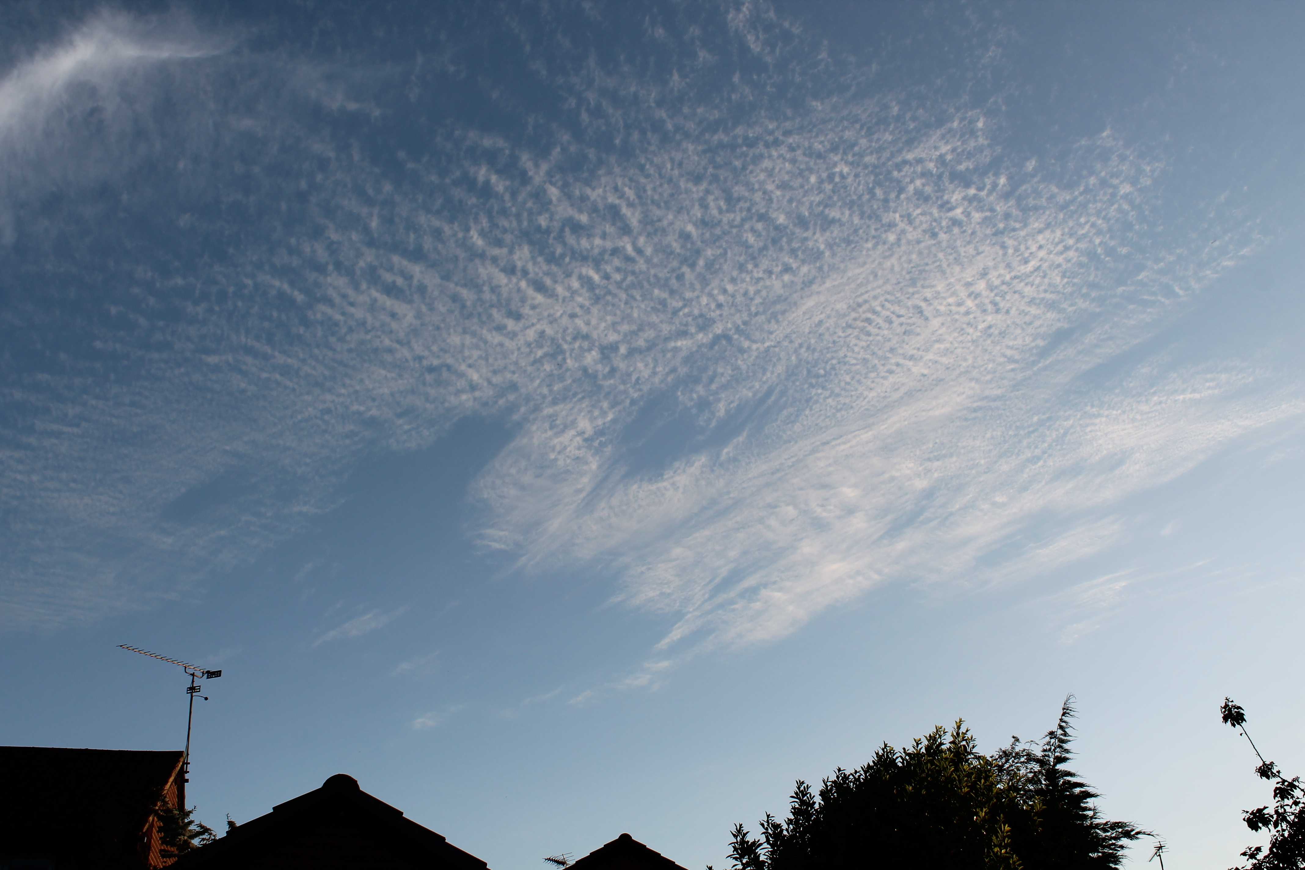
This picture shows a close-up view of the fine detail in Cirrocumulus stratiformis undulatus.
The cloud is identified as Cirrocumulus by the very small, and hence high-level, thin white cloud elements that are without shading and in the form of grains or ripples. The cloud elements have an apparent width of less than 1°. The species is identified as stratiformis by the extensive layer and the ripples indicate the variety undulatus.
Links in the image description will highlight features on the image. Mouse over the features for more detail.
© George AndersonWokingham, England, United Kingdom of Great Britain and Northern IrelandLatitude: 51° 25' 4'' NLongitude: 0° 51' 48'' W13 June 2014 0927 (Local Time)Camera direction: towards SECL = 0, CM = 0, CH = 9Image P/S code: P.2.5Image I.D.: 5093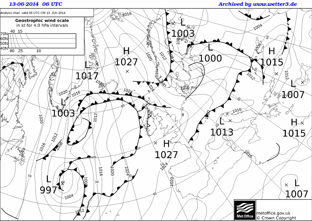
Fronts affected the north and west of the British Isles, but a ridge of high pressure extended across England and Wales, UK from an anticyclone (1 027 hPa) centred to the south-west of UK.
© Crown Copyright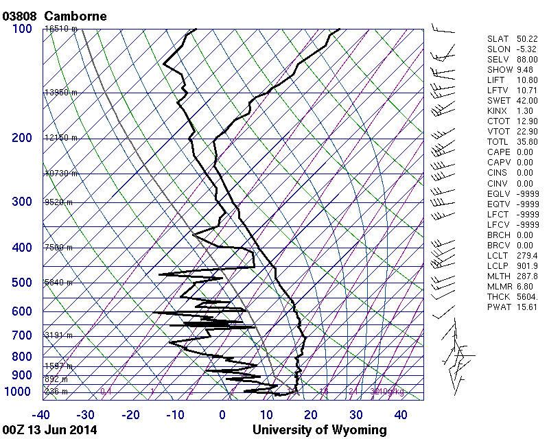
This is the 0000 UTC upper-air ascent for Camborne in the south-west of England, UK. Camborne is approximately 335 km west-south-west of Wokingham.
© University of Wyoming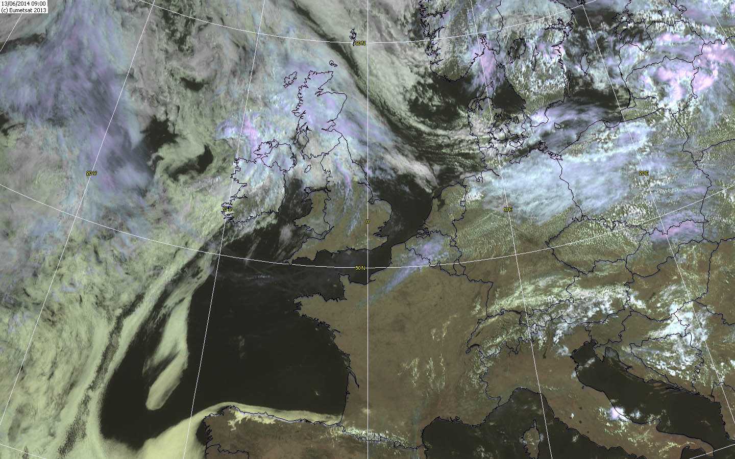
This MSG visible image at 0900 UTC (1000 hours local time) shows frontal cloud over the north and west of the British Isles, but in the south there are only small areas of high cloud.
© EUMETSAT, 2013Cirrocumulus
The image shows a patch of Cirrocumulus, a thin white cloud without shading. It is composed of very small elements with an apparent width of less than 1°. Towards the left and right of the image, ripples or undulations at 2 and 3 identify the variety as undulatus.
Links in the image description will highlight features on the image. Mouse over the features for more detail.
© George AndersonWokingham, England, United Kingdom of Great Britain and Northern IrelandLatitude: 51° 25' 5'' NLongitude: 0° 51' 49'' W04 June 2015 2011 (Local Time)Camera direction: towards WCL = 0, CM = 0, CH = 9Image P/S code: S.2.5 10Image I.D.: 5051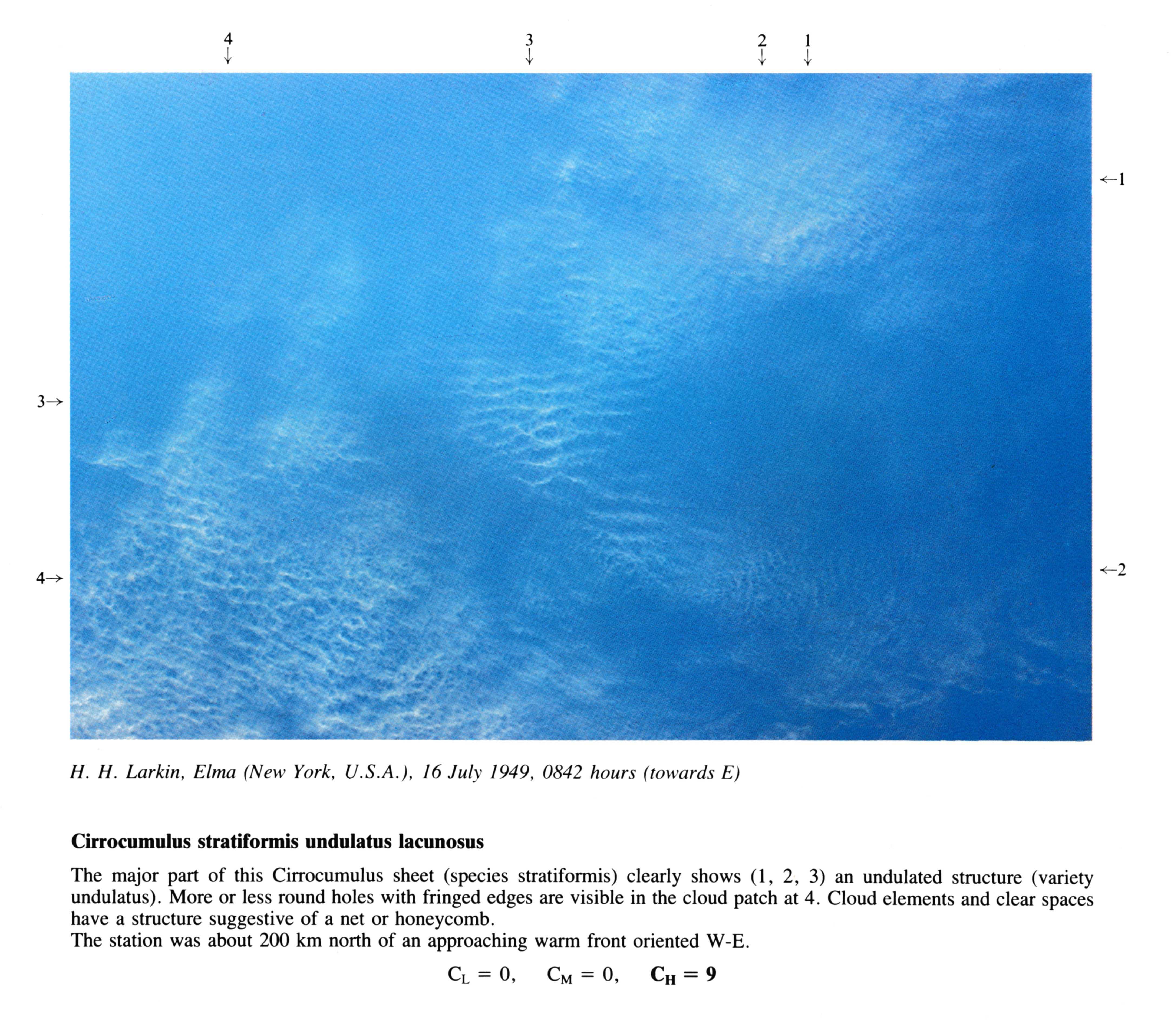
Cirrocumulus stratiformis undulatus lacunosus
The major part of this Cirrocumulus sheet (species stratiformis) clearly shows at 1, 2, 3 an undulated structure (variety undulatus). More or less round holes with fringed edges are visible in the cloud patch at 4. Cloud elements and clear spaces have a structure suggestive of a net or honeycomb.
The station was about 200 km north of an approaching warm front oriented W-E.
Links in the image description will highlight features on the image. Mouse over the features for more detail.
© H.H. LarkinElma, New York, United States of AmericaLatitude: 42° 49' 16'' NLongitude: 78° 38' 3'' W16 July 1949 0842 (Local Time)Camera direction: towards ECL = 0, CM = 0, CH = 9
