© Martin Gudd
Bad Kreuznach, Germany
Latitude: 49° 50' 39'' N
Longitude: 7° 50' 32'' E
07 December 2015 1439 (Local Time)
Camera direction: towards S
Image P/S code: P.2.3
Image I.D.: 5101
CL = 0, CM = 0, CH = 9
-

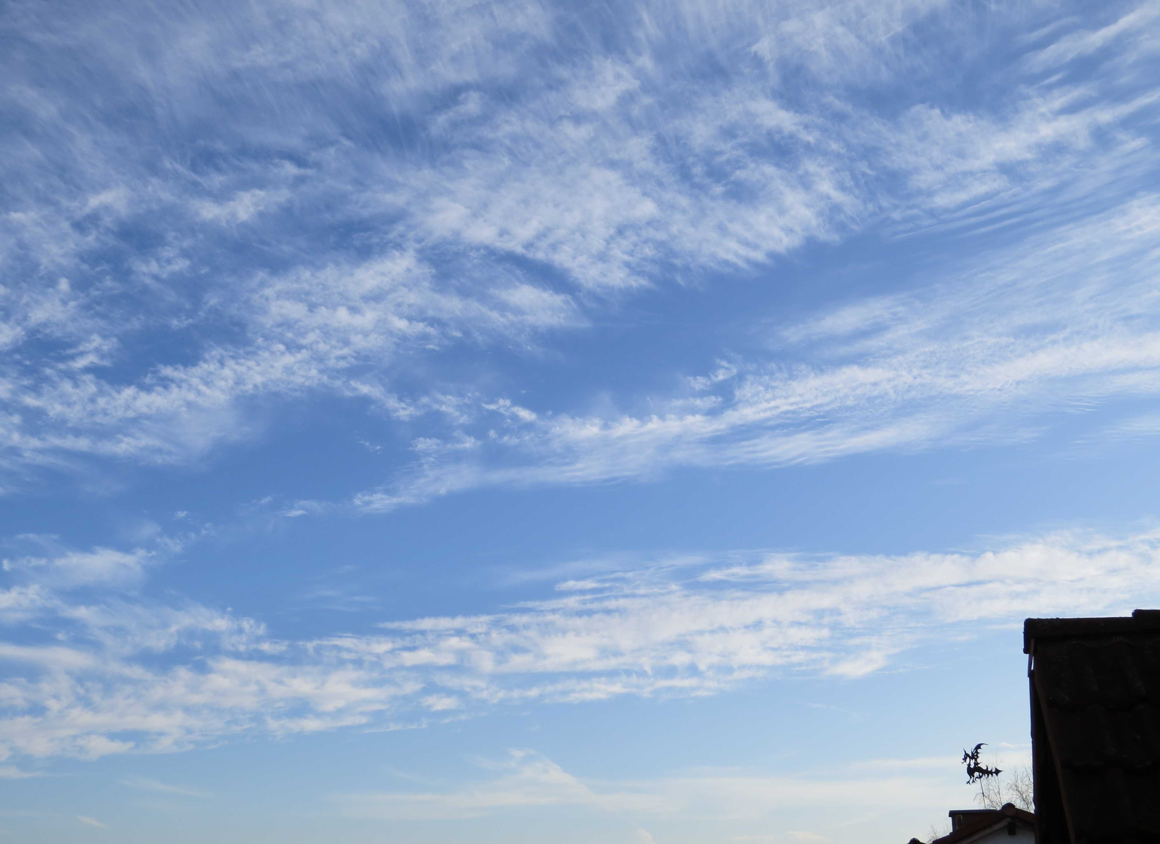
Cirrocumulus castellanus undulatus
This is a complex sky of Cirrocumulus castellanus, floccus and stratiformis undulatus, arranged in two layers (variety duplicatus). Cirrus fibratus and spissatus are also present. Cirrus and Cirrocumulus combined is a common feature in mid-latitude skies.
Several contrails can be seen low on the horizon, as at 1 and 2.
This is coded as CH = 9 as the Cirrocumulus predominates.
Links in the image description will highlight features on the image. Mouse over the features for more detail.
© Martin GuddBad Kreuznach, GermanyLatitude: 49° 50' 39'' NLongitude: 7° 50' 32'' E07 December 2015 1439 (Local Time)Camera direction: towards SCL = 0, CM = 0, CH = 9Image P/S code: P.2.3Image I.D.: 5101
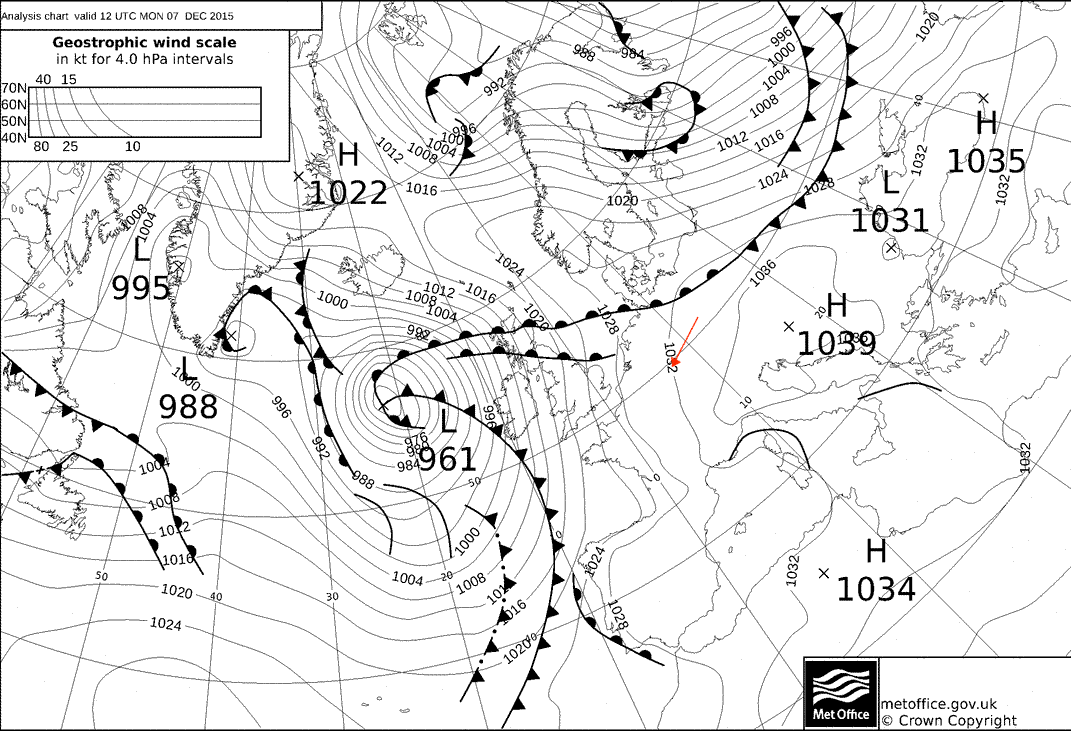
The synoptic chart shows the situation about one hour before the photo was taken. There are two main frontal systems: a warm front, stretching from Iceland over the North Sea to the northern parts of Germany, and a cold front, stretching southward from Iceland to Ireland and on to the Bay of Biscay. Great parts of Germany are in the warm-air sector.
© Crown Copyright
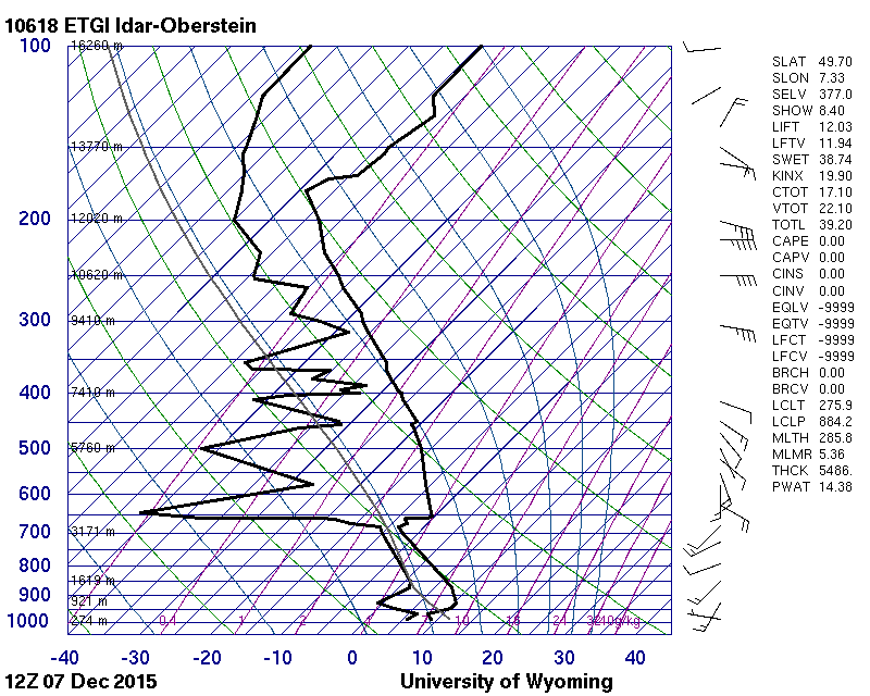
Sounding from 40 km west-south-west – spikes of high moisture content at 389 and 314 hPa and conditional instability from 459 to 366 hPa
© University of Wyoming
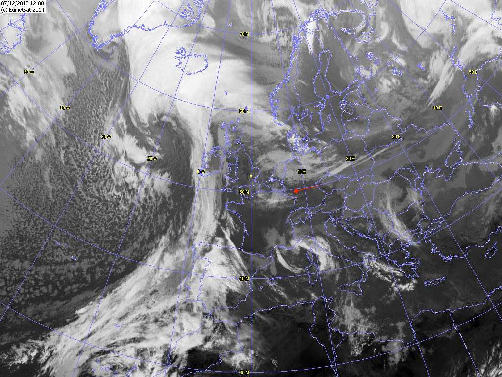
There are two main frontal systems: a warm front, stretching from Iceland over the North Sea to the northern parts of Germany, and a cold front, stretching southward from Iceland to Ireland and on to the Bay of Biscay. Great parts of Germany are in the warm-air sector. Within this warm air, some high and middle clouds have developed. Over Benelux and the western parts of Germany, there is a small patch of high and middle clouds, stretching eastward at about the 50th parallel. A weak short-wave, upper-level trough was responsible for this cloud.
© EUMETSAT, 2014