© Jarmo Koistinen
Espoo, Finland
Latitude: 60° 12' 24'' N
Longitude: 24° 39' 34'' E
02 August 2012 1830 (Local Time)
Camera direction: towards N
Image P/S code: P.2.4
Image I.D.: 5109
CL = 0, CM = 0, CH = 9
-
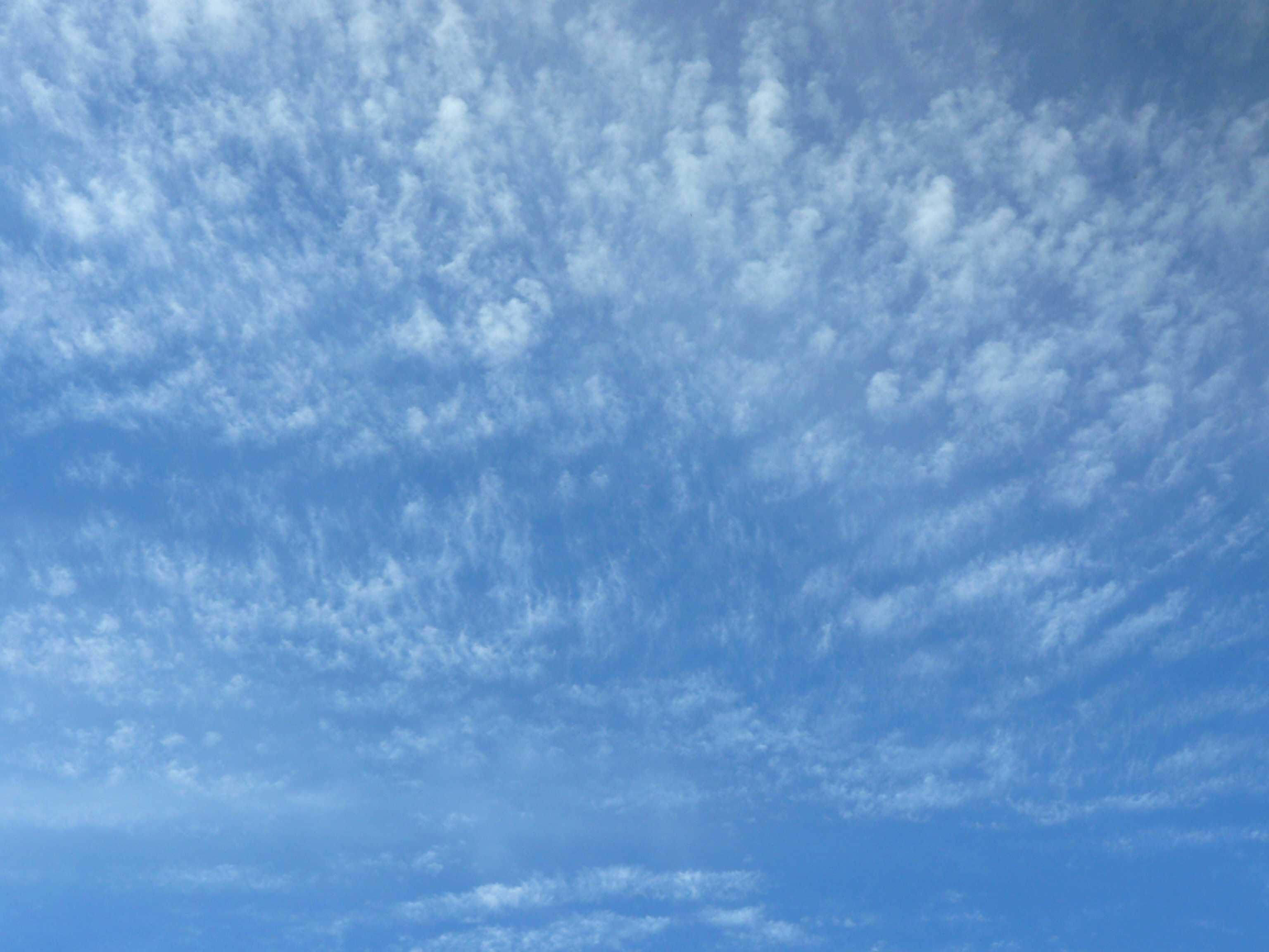
Cirrocumulus floccus with virga
This photograph illustrates a Cirrocumulus cloud composed of very small cumuliform tufts, the lower parts of which are more or less ragged. This indicates the species floccus. The apparent width of the tufts is always less than 1° (the width of a little finger) when observed at an angle of more than 30° above the horizon. Cirrocumulus floccus can be the evolution of castellanus where the base has dissipated. Thin virga trails can be seen at 2 and 3, rendering some of the cloud elements a little diffuse. A nearby ceilometer measured cloud bases from 6 100 to 7 000 m.
Links in the image description will highlight features on the image. Mouse over the features for more detail.
© Jarmo KoistinenEspoo, FinlandLatitude: 60° 12' 24'' NLongitude: 24° 39' 34'' E02 August 2012 1830 (Local Time)Camera direction: towards NCL = 0, CM = 0, CH = 9Image P/S code: P.2.4Image I.D.: 5109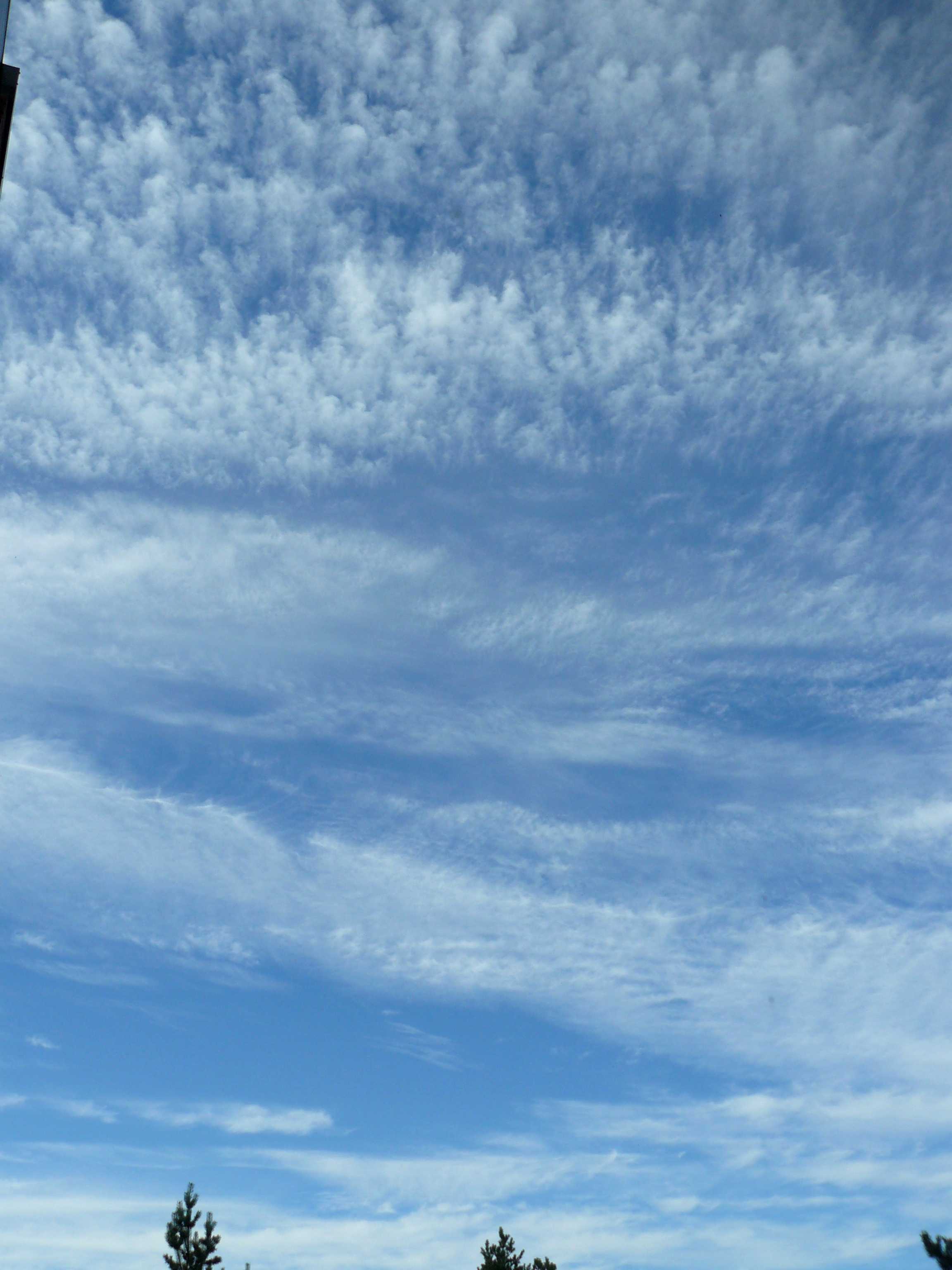
Cirrocumulus floccus with virga
The upper part of this image displays Cirrocumulus composed of very small cumuliform tufts, the lower parts of which are more or less ragged. This is the species floccus. The apparent width of the tufts is always less than 1° (the width of a little finger) when observed at an angle of more than 30° above the horizon. Cirrocumulus floccus can be the evolution of castellanus where the base has dissipated. Thin virga is locally present at 2 and 3. The Cirrocumulus in the middle looks like it is the species stratiformis with some virga, making the clouds look somewhat diffuse. This suggests a transformation from Cirrocumulus to Cirrus is occurring; this has probably already happened in the lowest part of the image where more Cirrus is present. A nearby ceilometer measured the cloud bases at 6 100 to 7 000 m.
Links in the image description will highlight features on the image. Mouse over the features for more detail.
© Jarmo KoistinenEspoo, FinlandLatitude: 60° 12' 17'' NLongitude: 24° 39' 41'' E02 August 2012 1835 (Local Time)Camera direction: towards NCL = 0, CM = 0, CH = 9Image P/S code: P.2.4Image I.D.: 5108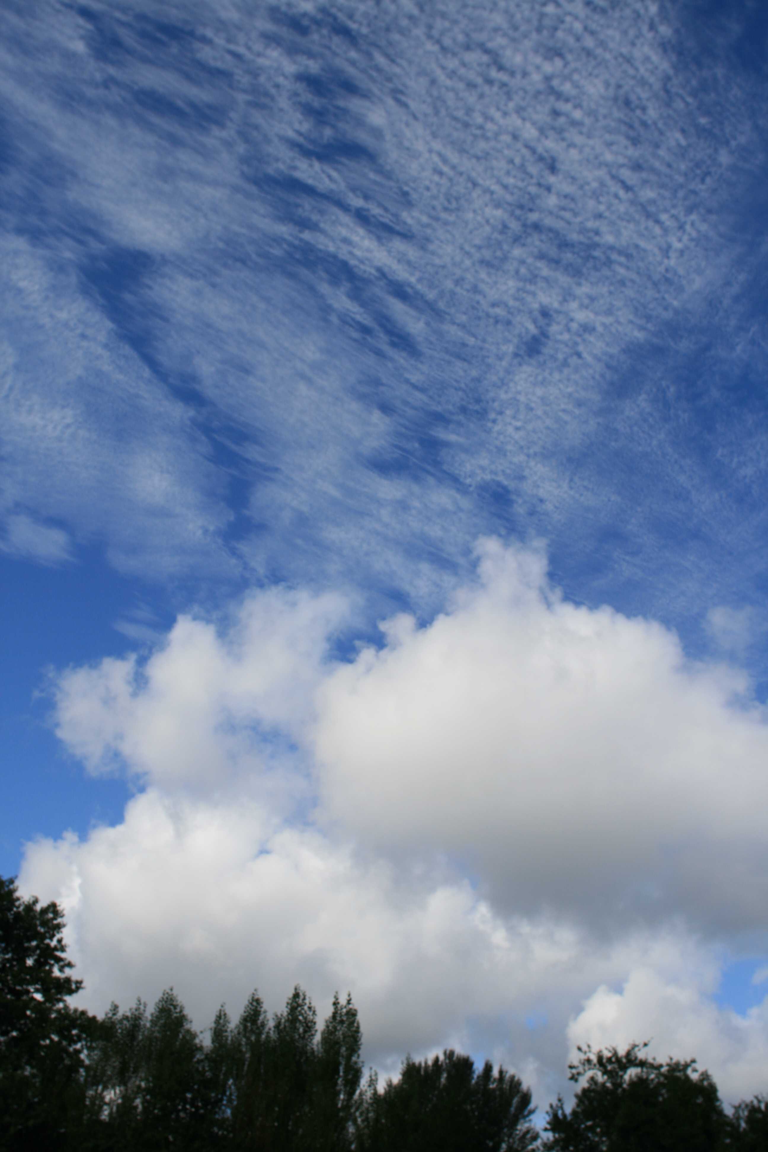
Cirrocumulus floccus
The patch of white cloud without shading in the upper half of the photograph is Cirrocumulus, which appeared behind an occluded front. It is composed of very small cumuliform tufts and close examination of the lower parts shows that they are ragged; these are both features typical of the species floccus. The apparent width of the tufts is always less than 1° and their presence indicates instability at that level. Cumulus can be seen immediately above the trees. The presence of some protuberances and sproutings identify it as Cumulus mediocris rather than the variety humilis, which has a more flattened appearance.
Links in the image description will highlight features on the image. Mouse over the features for more detail.
© Stephen BurtStratfield Mortimer, near Reading, England, United Kingdom of Great Britain and Northern IrelandLatitude: 51° 22' 12'' NLongitude: 1° 2' 24'' W17 August 2008 0920 (Local Time)Camera direction: towards WCL = 2, CM = 0, CH = 9Image P/S code: S.2.4 1Image I.D.: 5094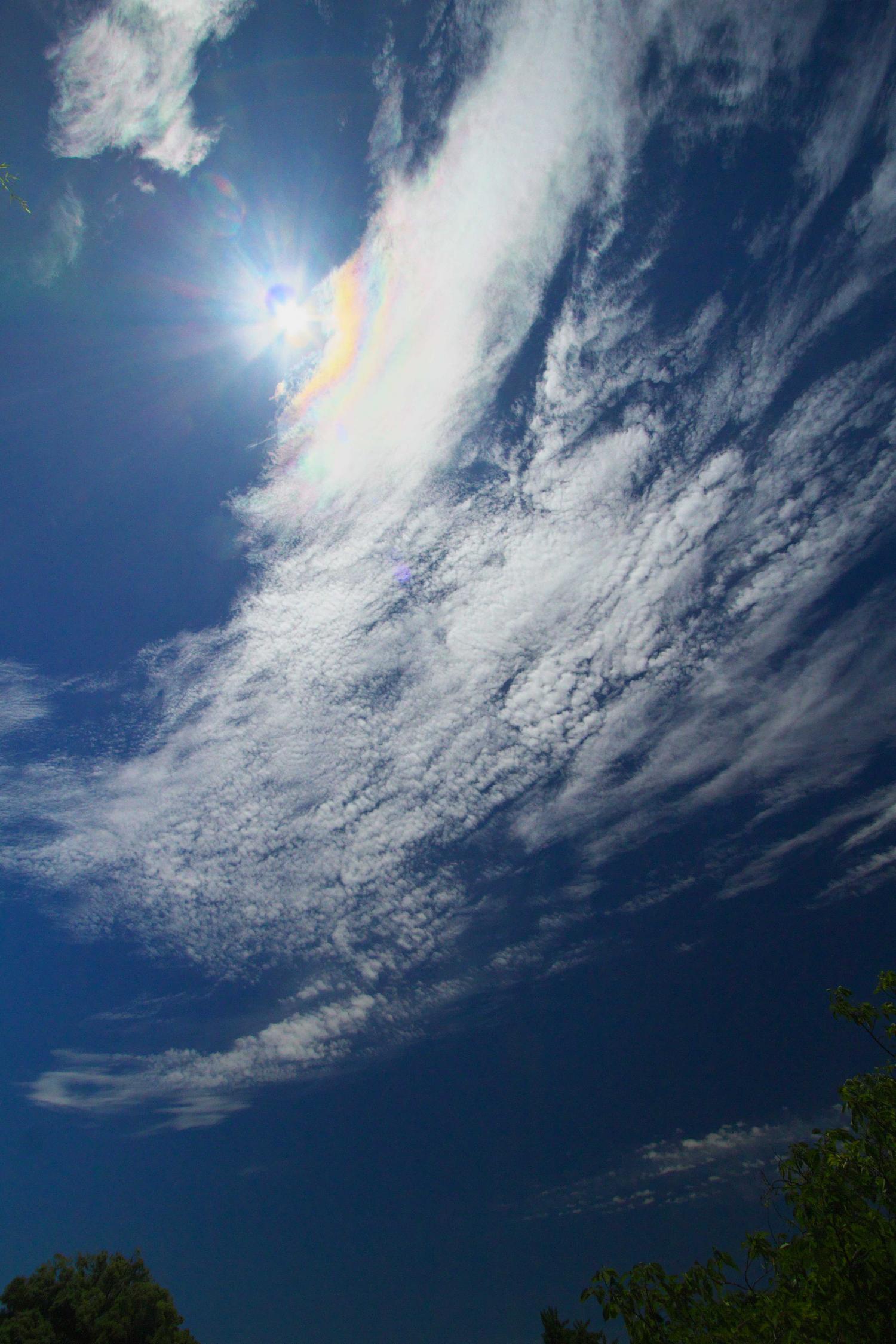
Cirrocumulus with solar corona
The photograph shows an extensive patch of cloud that, on account of its whiteness and lack of shading, is of the genus Cirrocumulus, with the species floccus present. Of principal interest are colourations in the upper left of the image, close to the Sun. These are parts of the solar corona. The best examples have several successively fainter coloured rings surrounding the Sun. Unlike a rainbow, the colours are generally soft, subtle pastel shades that merge more gently from one to another. A corona indicates the presence of very small water droplets high in the atmosphere, where water can exist at temperatures well below freezing.
Links in the image description will highlight features on the image. Mouse over the features for more detail.
© Yoshiaki SatoTokyo, JapanLatitude: 35° 41' 9'' NLongitude: 139° 45' 40'' E15 July 2015 1213 (Local Time)Camera direction: towards SCL = 0, CM = 0, CH = 9Image P/S code: S.2.4 10Image I.D.: 5097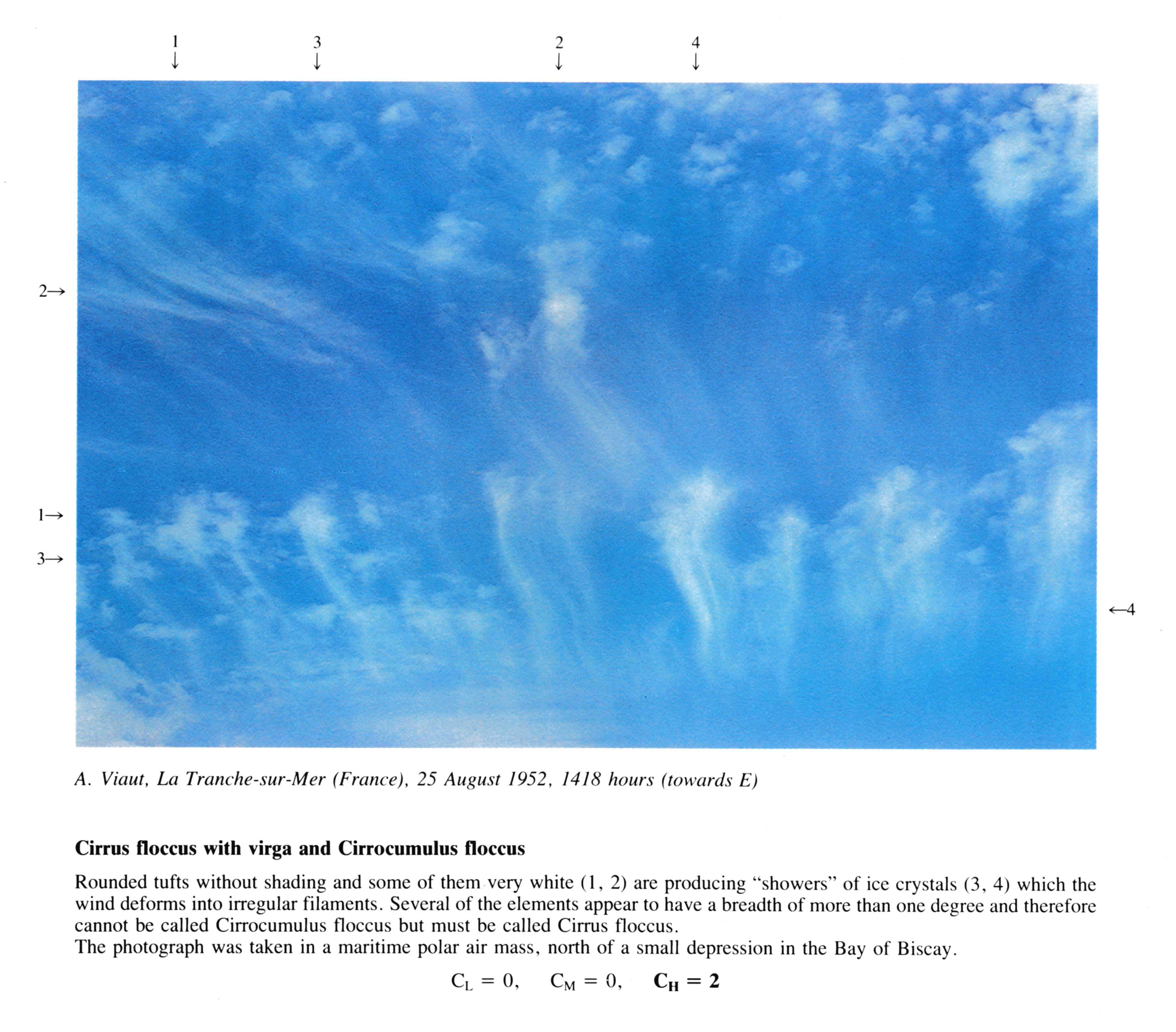
Cirrus floccus with virga and Cirrocumulus floccus
Rounded tufts without shading and some of them very white (1, 2) are producing "showers" of ice crystals (3, 4) which the wind deforms into irregular filaments. Several of the elements appear to have a breadth of more than one degree and therefore cannot be called Cirrocumulus floccus but must be called Cirrus floccus. The photograph was taken in a maritime polar air mass, north of a small depression in the Bay of Biscay.
Links in the image description will highlight features on the image. Mouse over the features for more detail.
© A. ViautLa Tranche-sur-Mer, FranceLatitude: 46° 20' 39'' NLongitude: 1° 26' 20'' W25 August 1952 1418 (Local Time)Camera direction: towards ECL = 0, CM = 0, CH = 2