© George Anderson
northern France
Latitude: 50° 22' 15'' N
Longitude: 1° 39' 40'' E
02 September 2013 1855 (Local Time)
Camera direction: towards N
Image P/S code: S.9.5
Image I.D.: 5140
-
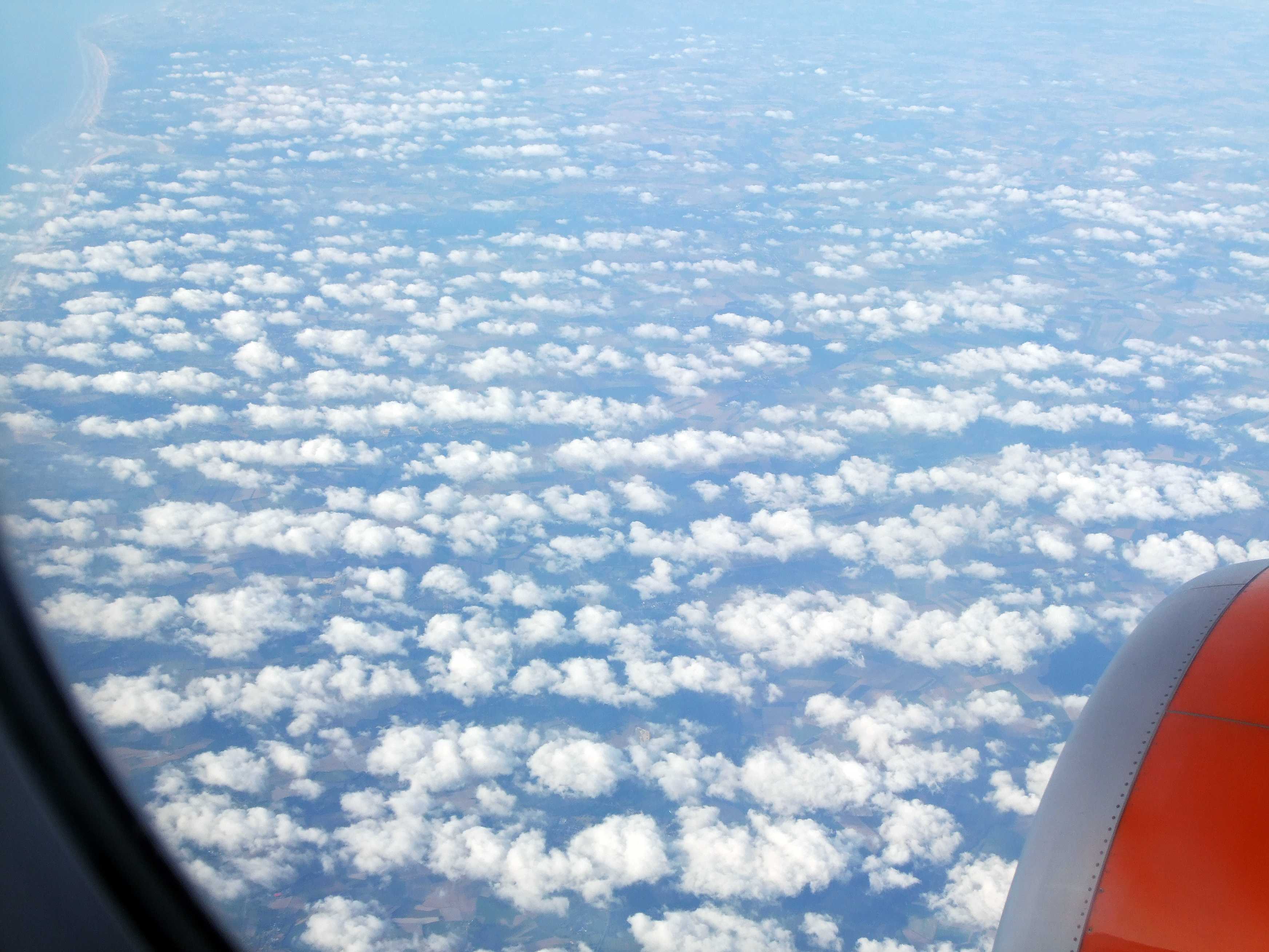
Cumulus mediocris radiatus
Cumulus mediocris cloud over northern France, viewed from an aircraft on descent towards London Gatwick Airport, England, UK. The view is looking north-north-east along the English Channel coast, which can be seen in the top left of the picture. The air flow at cloud height is from the north-west, from left to right across the image, and the clouds are aligned in lines or streets at 1, 2 and 3, making this the variety radiatus.
Links in the image description will highlight features on the image. Mouse over the features for more detail.
© George Andersonnorthern FranceLatitude: 50° 22' 15'' NLongitude: 1° 39' 40'' E02 September 2013 1855 (Local Time)Camera direction: towards NImage P/S code: S.9.5Image I.D.: 5140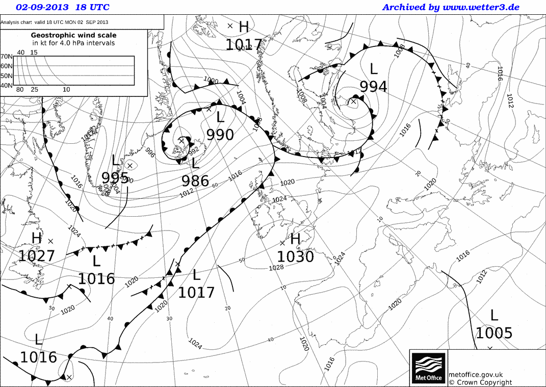
An anticyclone (1 030 hPa) is centred just to the south-west of England, UK.
© Crown Copyright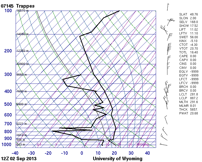
The upper-air sounding from Trappes, France (near Paris) shows limited instability to daytime surface heating, capped by an anticyclonic subsidence inversion. The wind at cloud height is about 15 kt from the north-west.
© University of Wyoming