© Jüri Kamenik
Pääsküla, Tallinn, Estonia
Latitude: 59° 21' 33'' N
Longitude: 24° 37' 55'' E
06 December 2014 1407 (Local Time)
Camera direction: towards S
Image P/S code: P.8.6
Image I.D.: 5142
CL = 6, CM = /, CH = /
-
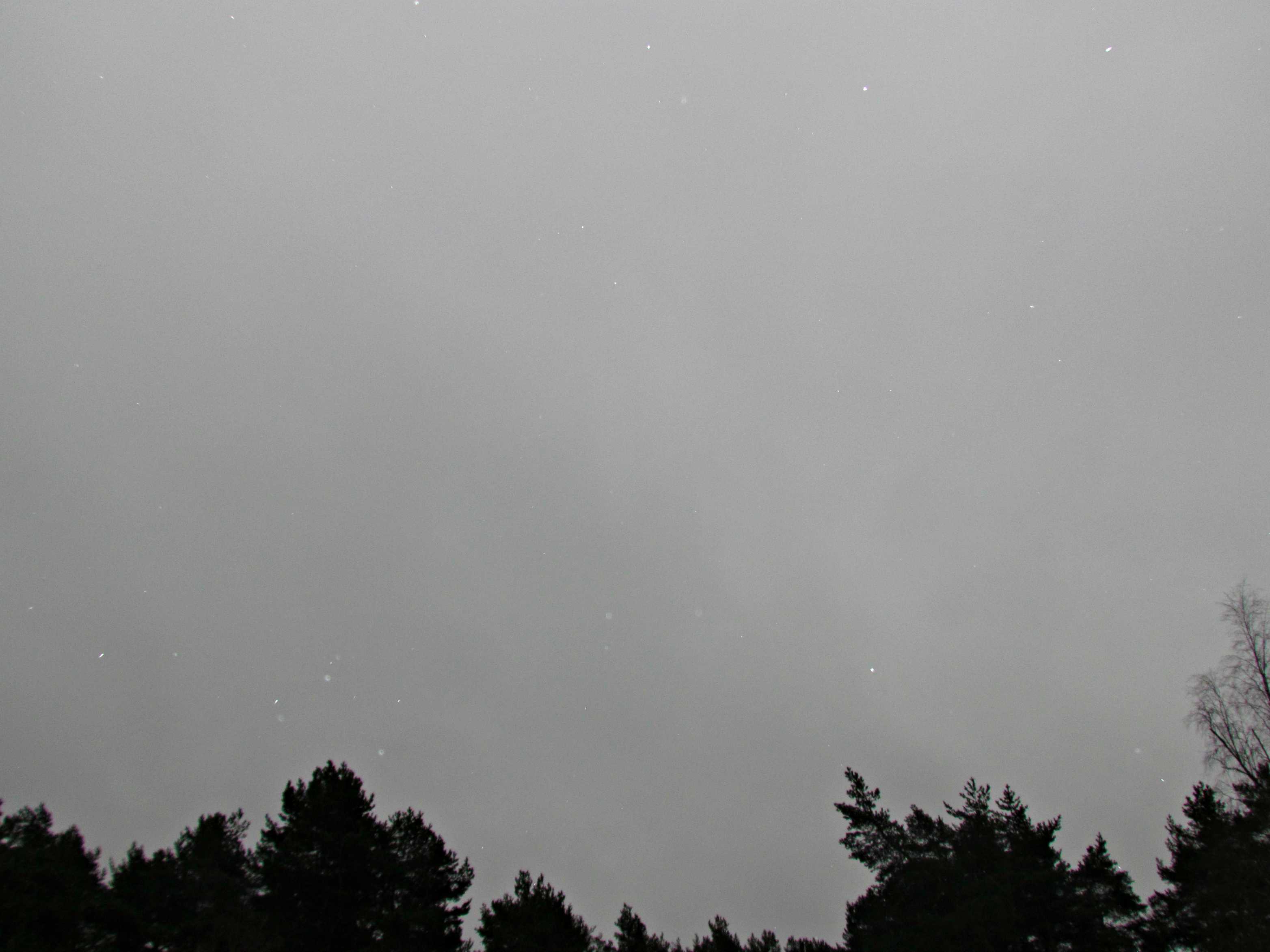
Stratus nebulosus with precipitation
Stratus is generally a grey cloud layer with a fairly uniform base, which may produce drizzle, snow or snow grains. In this image there is little form in the grey cloud, identifying it as the species nebulosus. The cloud is sufficiently dense to obscure the Sun, so we may also define it as the variety opacus. It is also dense enough to produce the supplementary feature praecipitatio, as can be seen by the white spots, which are snowflakes.
Links in the image description will highlight features on the image. Mouse over the features for more detail.
© Jüri KamenikPääsküla, Tallinn, EstoniaLatitude: 59° 21' 33'' NLongitude: 24° 37' 55'' E06 December 2014 1407 (Local Time)Camera direction: towards SCL = 6, CM = /, CH = /Image P/S code: P.8.6Image I.D.: 5142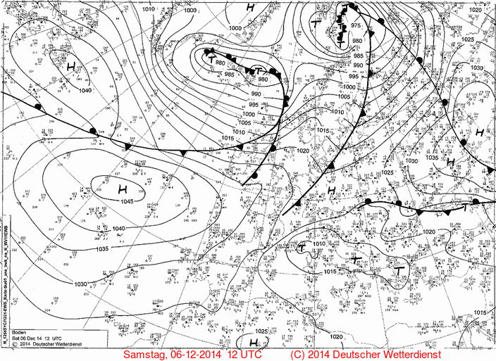
The synoptic chart for 1200 UTC shows high pressure near the Azores, Portugal and centres of low pressure near Iceland and to the north of Scandinavia. The Baltic states were under warm sector conditions.
© Deutscher Wetterdienst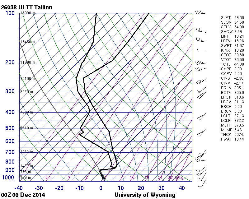
The Tallinn, Estonia (WMO 26038) sounding at 0000 UTC shows very moist air from ground level to approximately 870 hPa (1 200 m). A sharp inversion of more than 6 °C was present at 900 hPa (750 m).
© University of Wyoming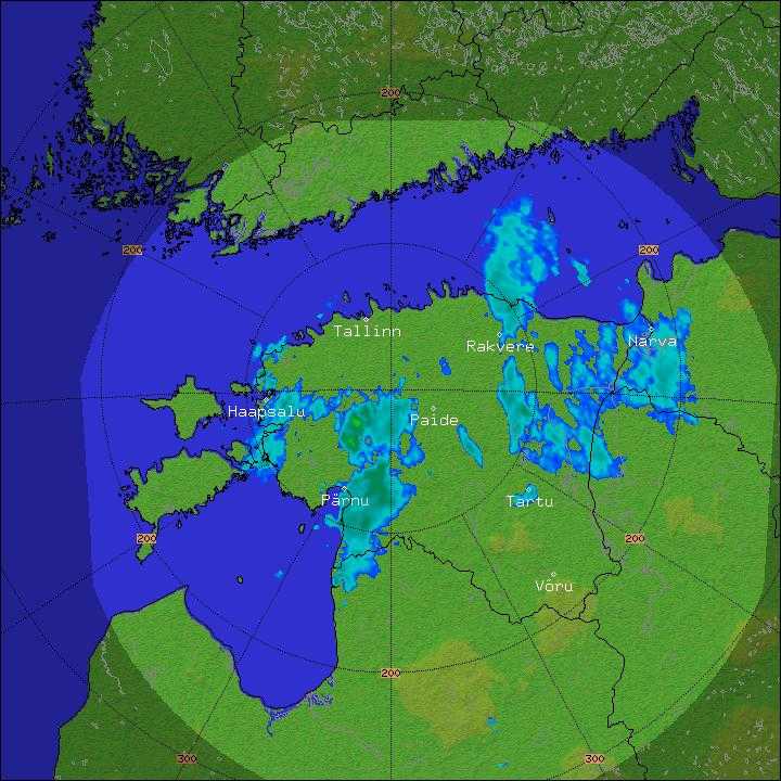
The radar image shows small echoes of light precipitation north-west of the city of Tallinn, Estonia. None are showing over the photograph location, where the hydrometeors are either too sparse or too low to be captured by the radar beam.
© Estonian Weather Service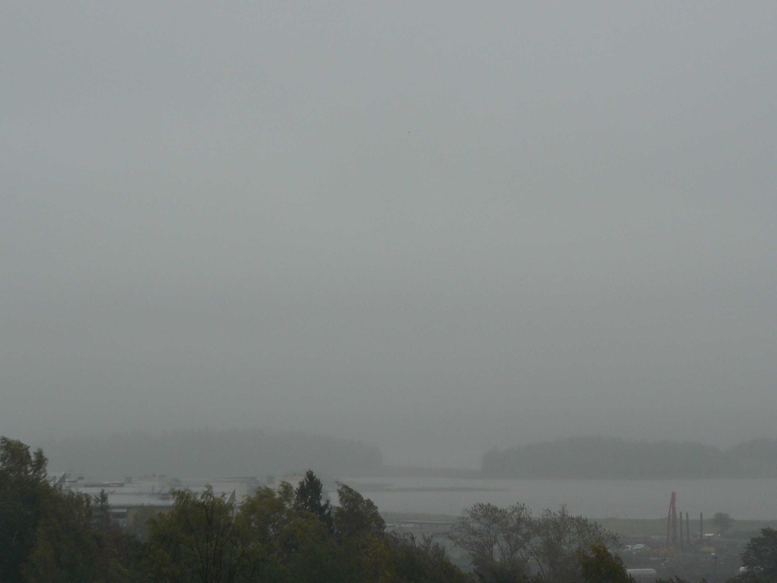
Stratus nebulosus opacus praecipitatio
Stratus is generally a grey cloud layer with a fairly uniform base that may give drizzle, snow or snow grains. In this image, the cloud is uniformly grey with no discernible form, identifying it as being of the species nebulosus. It is also sufficiently dense that the Sun is not visible, defining the variety as opacus. We may also add the supplementary feature praecipitatio as drizzle is reducing the visibility to an estimated 3 km. Ceilometer readings around the time of the image measured the cloud base at 60 to 120 m.
Links in the image description will highlight features on the image. Mouse over the features for more detail.
© Jarmo KoistinenHelsinki, FinlandLatitude: 60° 10' 14'' NLongitude: 24° 54' 54'' E17 September 2007 0929 (Local Time)Camera direction: towards ECL = 6, CM = /, CH = /Image P/S code: S.8.6 1Image I.D.: 5496