© Martin Gudd
Fulda, Germany
Latitude: 50° 33' 47'' N
Longitude: 9° 40' 49'' E
22 July 1985 2100 (Local Time)
Camera direction: towards NW
Image P/S code: P.4.30
Image I.D.: 5146
CL = 0, CM = 9, CH = /
-
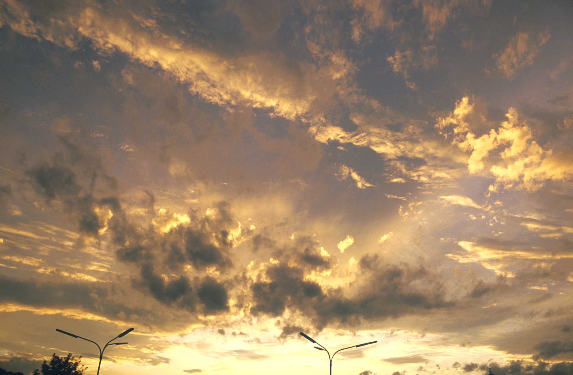
Altocumulus of a chaotic sky
Altocumulus of a chaotic sky has a chaotic, heavy and stagnant appearance. It generally exhibits a diversity of clouds from the low levels through to the high levels.
In this photo there are four layers of clouds, all representing the middle levels. The highest cloud is a layer of Altostratus opacus, clearing from the west to the north-west. Virga from this layer can be seen toward the upper centre of the image. Directly beneath the Altostratus are some patches of Altocumulus undulatus. The third level is Altocumulus lenticularis, visible, for example, in the lower left of the picture. The lowest layer is Altocumulus floccus, mainly visible in the centre of the picture and to the right.
Links in the image description will highlight features on the image. Mouse over the features for more detail.
© Martin GuddFulda, GermanyLatitude: 50° 33' 47'' NLongitude: 9° 40' 49'' E22 July 1985 2100 (Local Time)Camera direction: towards NWCL = 0, CM = 9, CH = /Image P/S code: P.4.30Image I.D.: 5146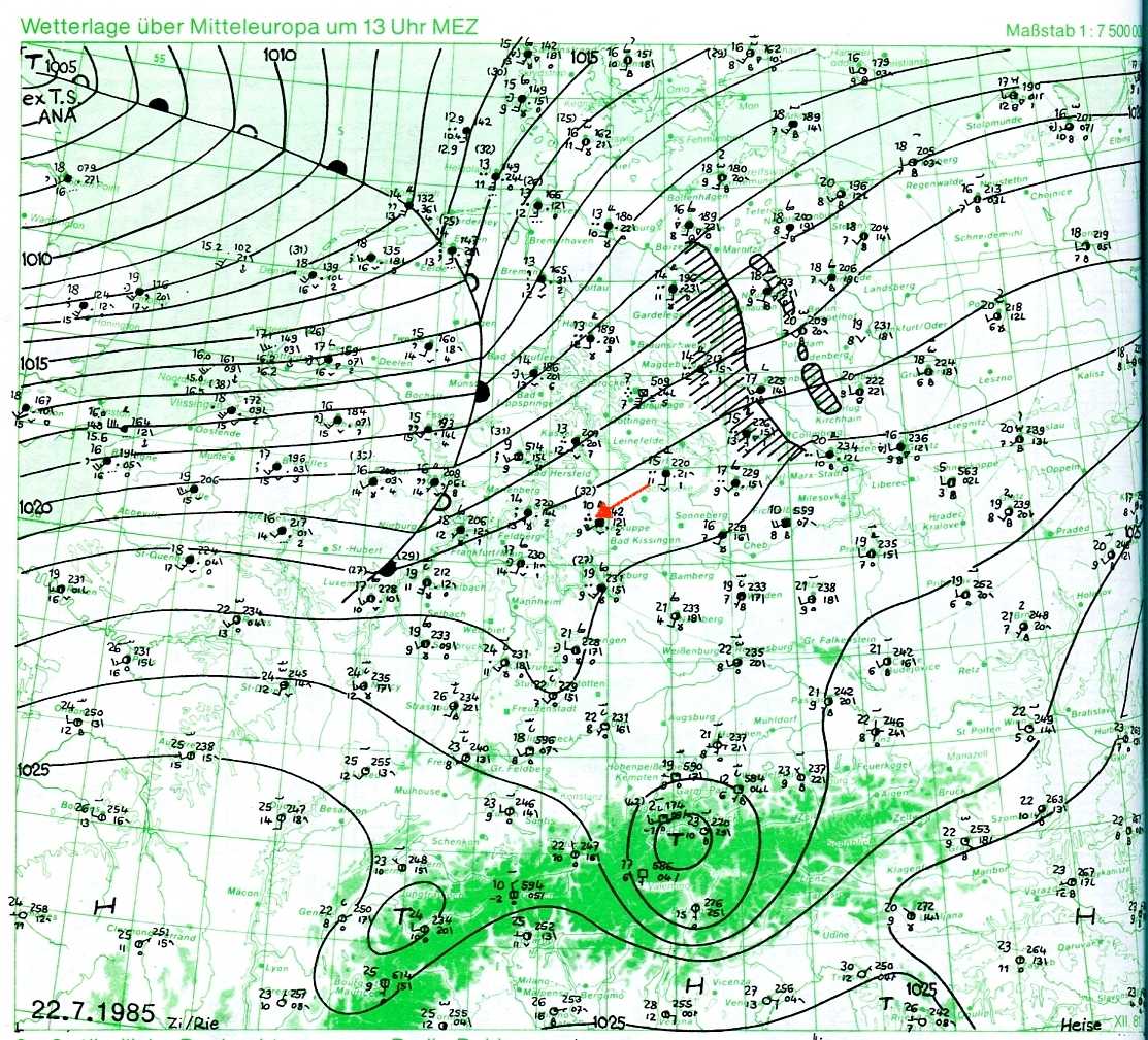
The synoptic chart shows the situation about seven hours before the photo was taken. An advancing warm front from ex-Tropical Storm Ana (located over the British Isles) is to the west of Fulda, Germany. By the time of the photo, the warm front was over central and north-western Germany. Continuous rain was falling from the extensive cloud of this front.
© Verein Berliner Wetterkarte e.V.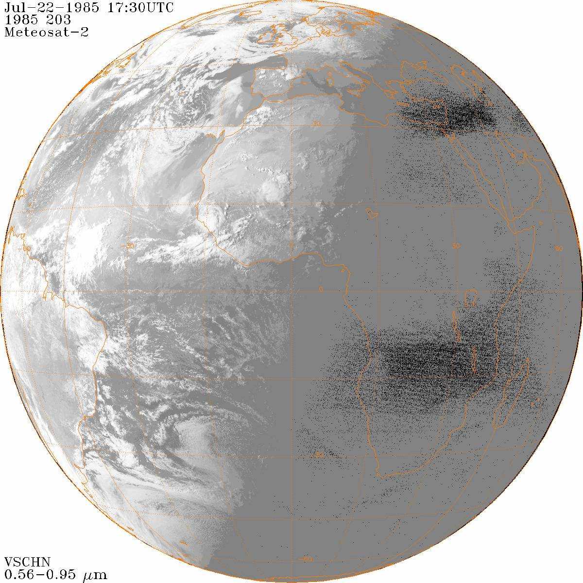
The picture shows the situation about one hour before the photo was taken. Ex-Tropical Storm Ana is situated over the North Sea. The warm front of Ana has just passed over the central parts of Germany and the warm sector is faintly visible between this front and the cold front over the Channel. The photo was taken at the edge of the approaching warm sector.
© Credit NOAA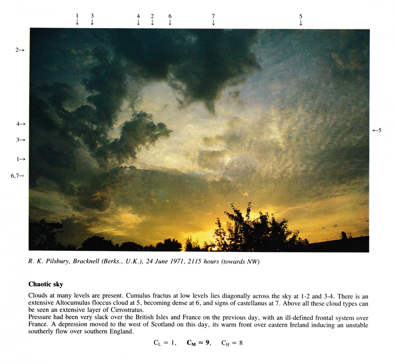
Chaotic Sky (Cumulus fractus, Altocumulus floccus, Cirrostratus)
Clouds at many levels are present. Cumulus fractus at low levels lies diagonally across the sky at 1 - 2 and 3 - 4. There is an extensive Altocumulus floccus cloud at 5, becoming dense at 6, and signs of castellanus at 7. Above all these cloud types can be seen an extensive layer of Cirrostratus. Pressure had been very slack over the British Isles and France on the previous day, with an ill-defined frontal system over France. A depression moved to the west of Scotland on this day, its warm front over eastern Ireland inducing an unstable southerly flow over southern England.
Links in the image description will highlight features on the image. Mouse over the features for more detail.
© R.K. PilsburyBracknell, Berkshire, United Kingdom of Great Britain and Northern IrelandLatitude: 51° 24' 58'' NLongitude: 0° 45' 14'' W24 June 1971 2115 (Local Time)Camera direction: towards NWCL = 1, CM = 9, CH = 8