© George Anderson
Wokingham, England, United Kingdom of Great Britain and Northern Ireland
Latitude: 51° 25' 4'' N
Longitude: 0° 51' 48'' W
13 June 2014 1224 (Local Time)
Camera direction: towards NW
Image P/S code: S.1.7
Image I.D.: 5170
CL = 0, CM = 0, CH = 2
-
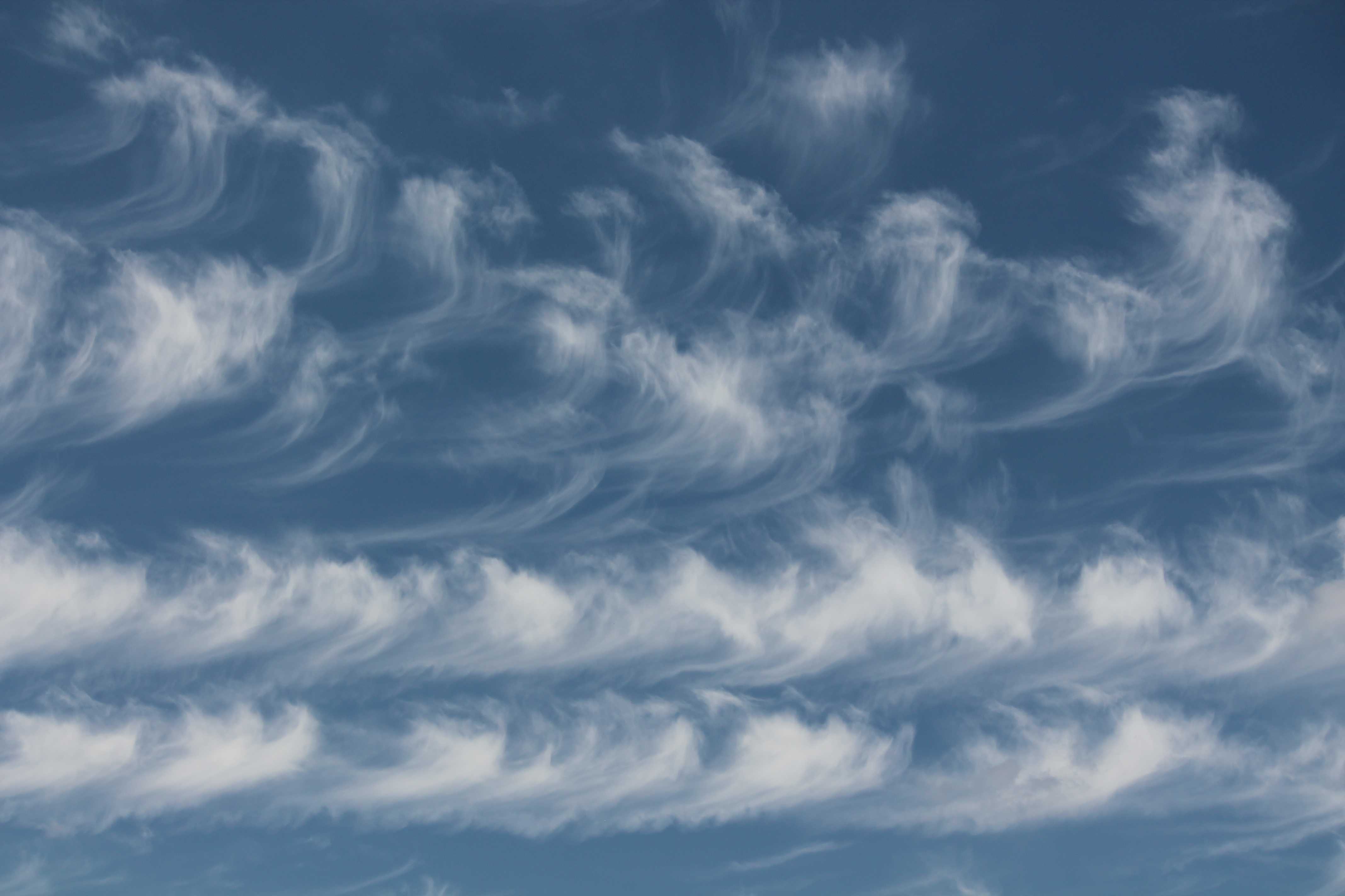
Cirrus floccus radiatus
In this relatively close-up view, trailing streamers of ice crystals (seen at 1 and 2) fall to a lower level from rounded tufts of Cirrus floccus (seen at 3 and 4). The clouds are white with no shading. In the lower part of the picture, the cloud elements are arranged in parallel lines and are of the variety radiatus.
Links in the image description will highlight features on the image. Mouse over the features for more detail.
© George AndersonWokingham, England, United Kingdom of Great Britain and Northern IrelandLatitude: 51° 25' 4'' NLongitude: 0° 51' 48'' W13 June 2014 1224 (Local Time)Camera direction: towards NWCL = 0, CM = 0, CH = 2Image P/S code: S.1.7Image I.D.: 5170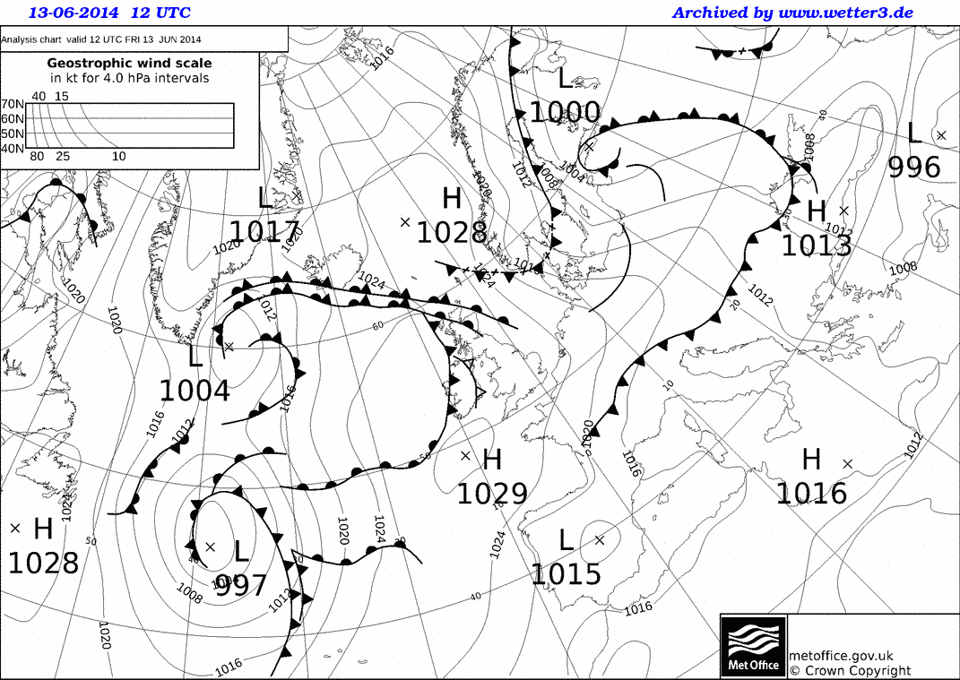
A ridge of high pressure extended across southern UK from an anticyclone (1 029 hPa) centred to the south-west of the British Isles. Fronts affected the north and west of the British Isles.
© Crown Copyright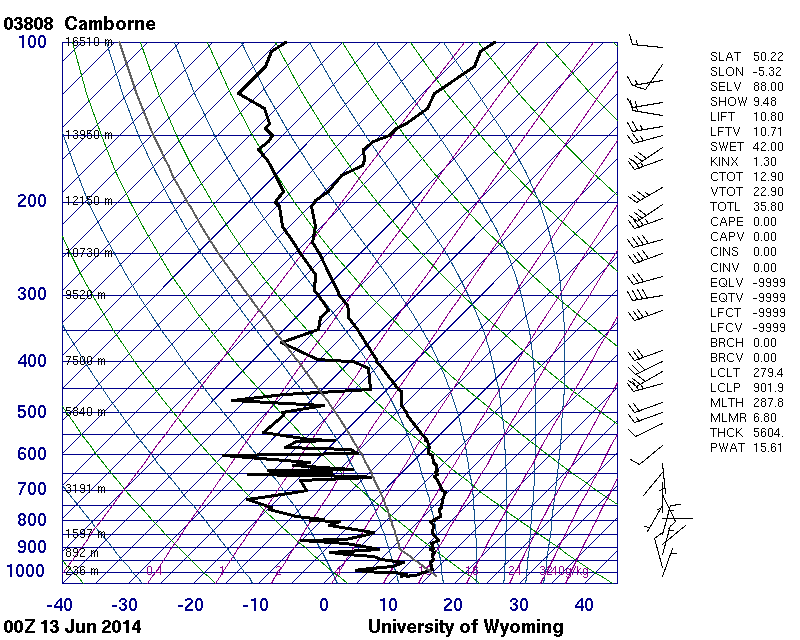
The 0000 UTC upper-air ascent from Camborne, in the south-west of England, UK, best represents the upper-level flow over the area by around the time of the photograph, some 12 hours later.
© University of Wyoming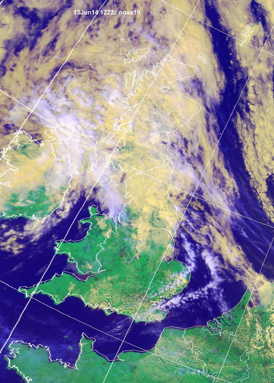
This NOAA-19 image from 1222 UTC (1322 hours local time), one hour after the time of the cloud photograph, shows scattered convective (Cumulus) cloud over southern England, UK and lines of high, cirriform cloud extending from East Anglia, England, UK and the southern North Sea to south-east England.
© Credit NOAA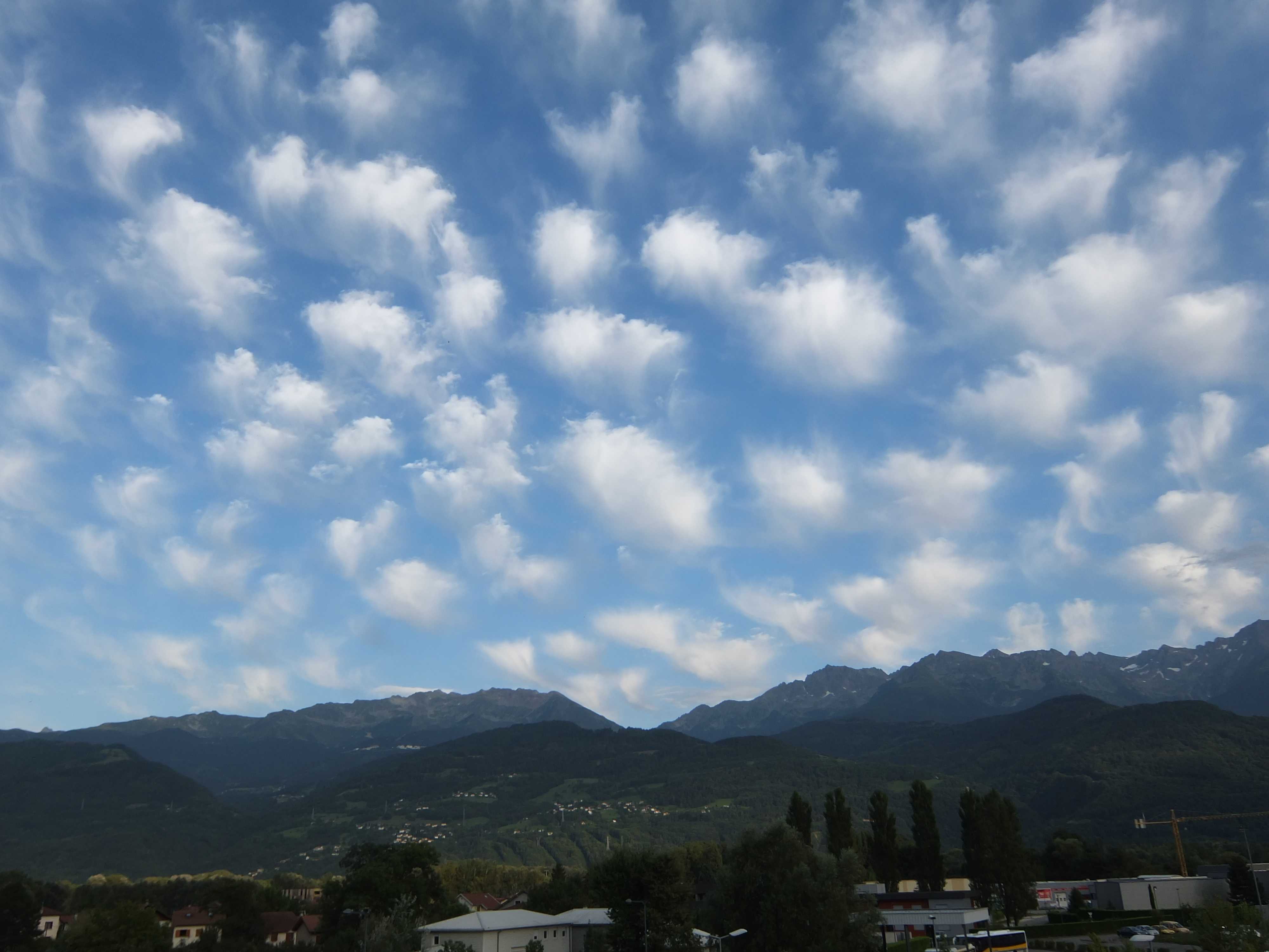
Cirrus floccus
The photograph shows an excellent example of separated, rounded tufts of Cirrus cloud, resembling the dabs of a painter's brush on a canvas, which identify it as Cirrus floccus. Trails are often present beneath the tufts of cloud.
Links in the image description will highlight features on the image. Mouse over the features for more detail.
© Pierre VerlhacCrolles, Isère, FranceLatitude: 45° 17' 6'' NLongitude: 5° 52' 59'' E17 August 2014 0000 (Local Time)Camera direction: towards ECL = 0, CM = 0, CH = 2Image P/S code: P.1.7Image I.D.: 4322