© Martin Gudd
Bad Kreuznach, Germany
Latitude: 49° 49' 20'' N
Longitude: 7° 51' 1'' E
14 October 2012 1806 (Local Time)
Camera direction: towards N
Image P/S code: P.6.3
Image I.D.: 5174
CL = 7, CM = 2, CH = /
-
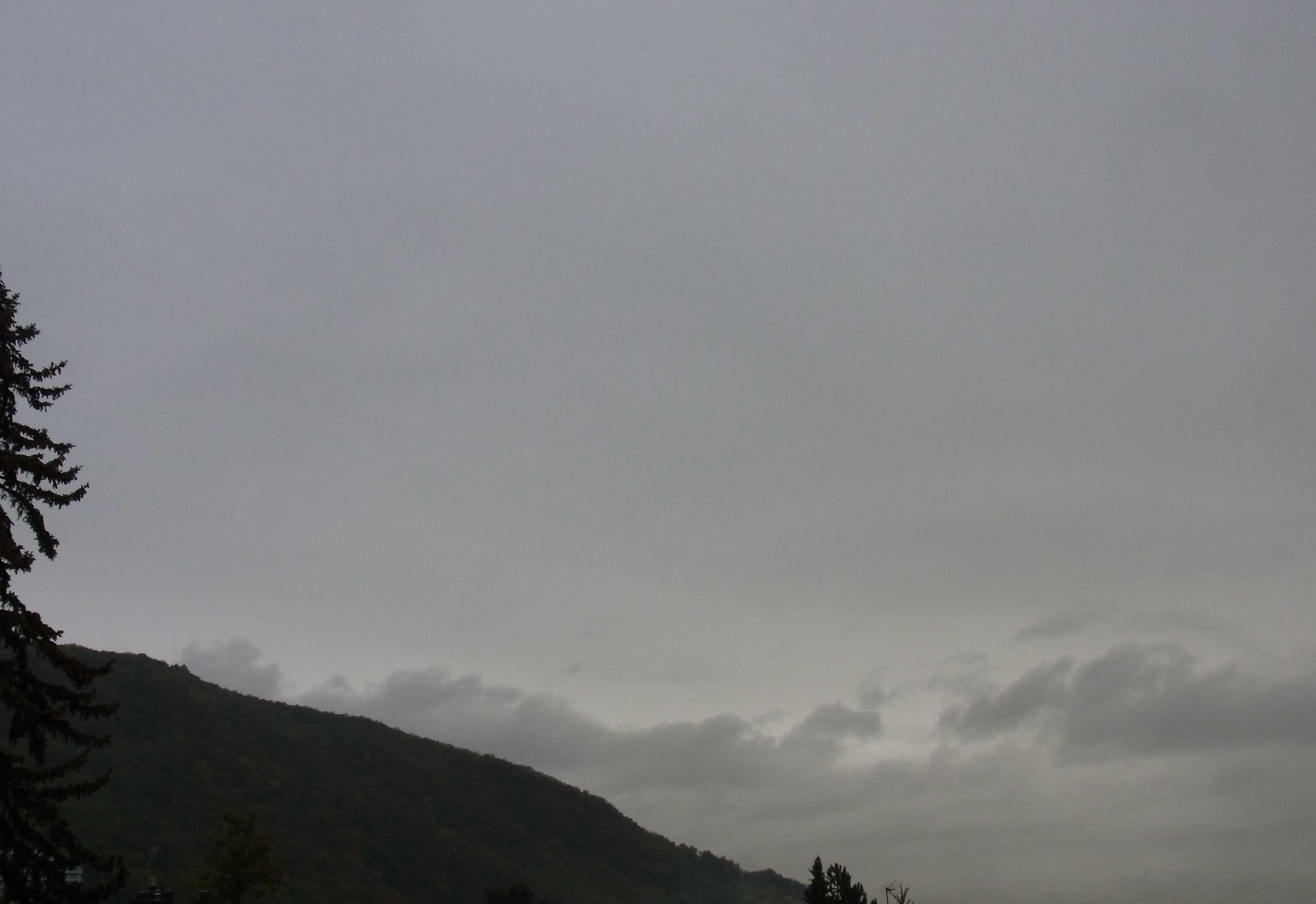
Nimbostratus pannus
On this day, more and more clouds were approaching from the south-west as a new low came nearer. Nimbostratus clouds were visible on multiple occasions after noon. When the photo was taken, it was raining continuously and at times heavily. The underside of the Nimbostratus is clearly visible, plain and smooth, and only at the northern horizon are there several low clouds, which formed earlier in the afternoon and were at the time of the photo gradually changing into Pannus.
Links in the image description will highlight features on the image. Mouse over the features for more detail.
© Martin GuddBad Kreuznach, GermanyLatitude: 49° 49' 20'' NLongitude: 7° 51' 1'' E14 October 2012 1806 (Local Time)Camera direction: towards NCL = 7, CM = 2, CH = /Image P/S code: P.6.3Image I.D.: 5174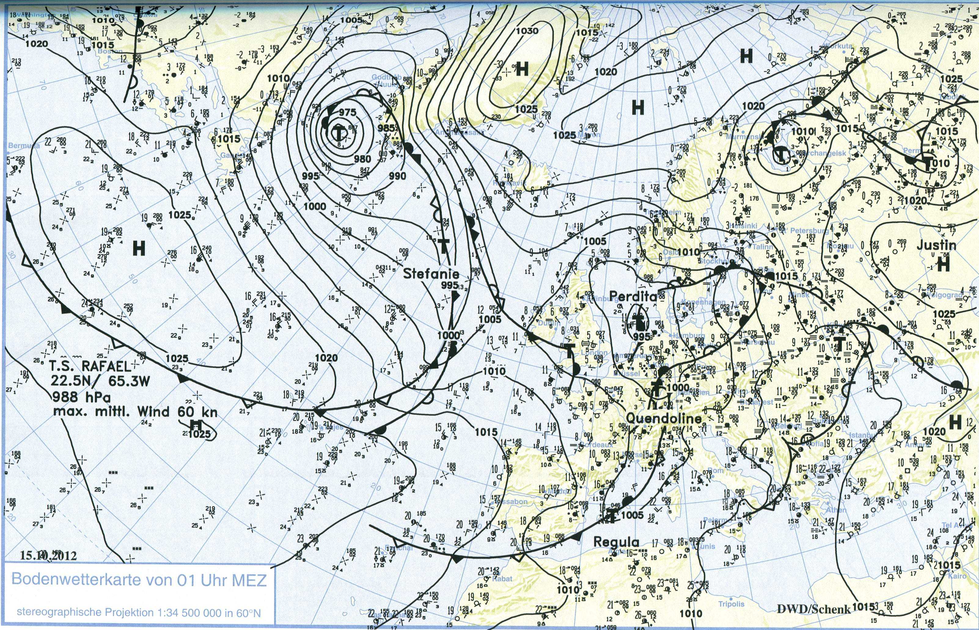
At the time of the photo, the region was under a strong south-westerly flow, with a trough over western Europe. There was a new low developing over France and rapidly moving north-eastward. The surface chart shows the situation about eight hours after the photo was taken. The low can be seen located directly over the region, combined with heavy rainfall. The direction of movement is north-eastward. Milder air is staying over eastern Europe, whereas colder air is situated over western Europe and gradually dispelling the milder air.
© Verein Berliner Wetterkarte e.V.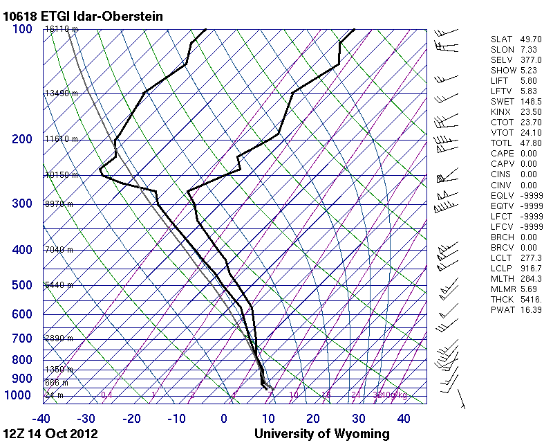 The sounding from seven hours before photo shows a deep layer of moisture.© University of Wyoming
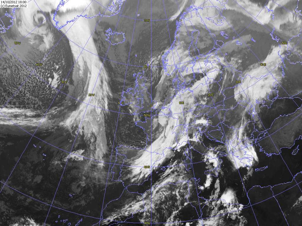
The satellite picture shows the situation a few hours before the photo was taken. The middle parts of Europe are under a strong south-westerly flow and the new low is rapidly approaching from France. One can see developing frontal cloud bands over France and Germany; the north-eastern band corresponds to a warm front, while the cloud band to the south is the cold front. The photo was taken when the centre of the low was immediately to the west of Bad Kreuznach, Germany.
© EUMETSAT, 2012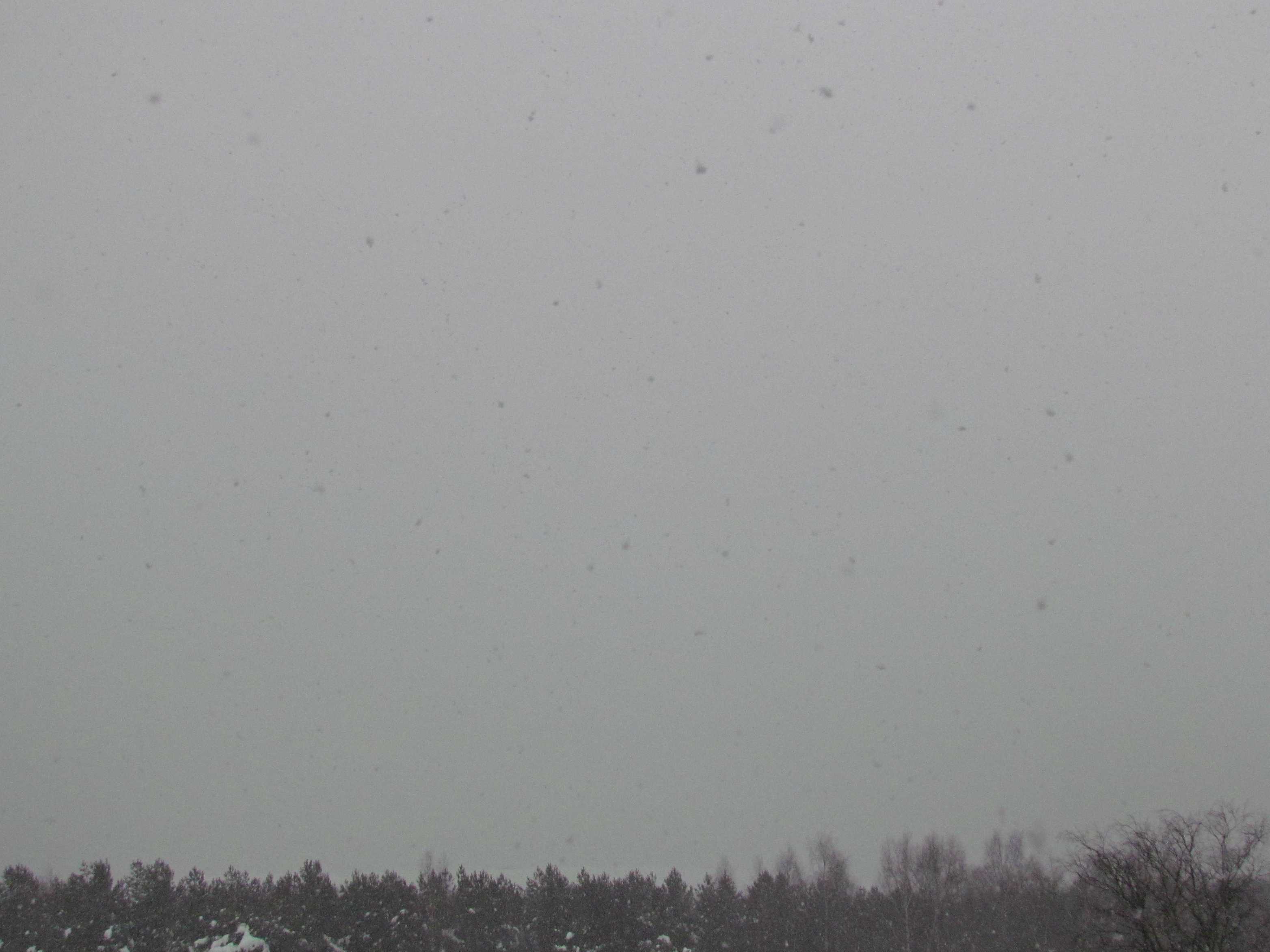
Nimbostratus pannus praecipitatio with continuous snow
The sky is completely covered by a very low layer of Nimbostratus, from which continuous snow is falling. The base of the Nimbostratus is totally hidden by a continuous layer of pannus; a combination of low light and extremely poor vertical visibility makes it impossible to discern the pannus. Observations at the Tallinn, Estonia city and airport showed a broken to overcast cloud base varying from 200 m (600 ft) with pannus to 400 m (1 200 ft) when the pannus was dissipating.
Links in the image description will highlight features on the image. Mouse over the features for more detail.
© Jüri KamenikPääsküla, Tallinn, EstoniaLatitude: 59° 21' 37'' NLongitude: 24° 37' 56'' E25 December 2012 1243 (Local Time)Camera direction: towards ECL = 7, CM = 2, CH = /Image P/S code: S.6.3 1Image I.D.: 5623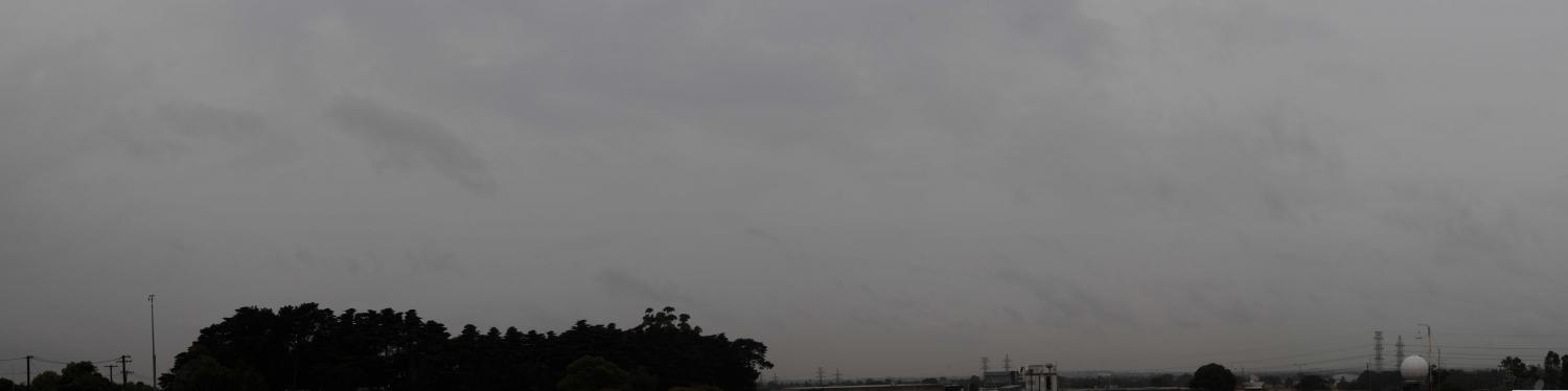
Nimbostratus praecipitatio pannus
The cloud genus Nimbostratus usually develops from thickening Altostratus cloud, the base of which lowers. It is a grey layer of cloud, often dark in appearance and made to look diffuse by a more or less continuous fall of rain or snow that in most cases reaches the ground. As seen in this image, it is thick enough throughout to obscure the Sun. Rain was falling as the photograph was taken, so we may add praecipitatio as a supplementary feature. Low, ragged clouds frequently occur below the cloud layer (with which they may or may not merge) as a result of turbulence in the layers below the main cloud, which have been moistened by precipitation. In this photograph, ragged shreds of Stratus fractus cloud of wet weather have formed as the accessory cloud pannus (seen at 2 and 3), which is often observed under Nimbostratus and sometimes attached to it.
Links in the image description will highlight features on the image. Mouse over the features for more detail.
© Michael BruhnBroadmeadows, Victoria, AustraliaLatitude: 37° 41' 25'' SLongitude: 144° 56' 51'' E24 April 2014 0842 (Local Time)Camera direction: towards ESECL = 7, CM = 2, CH = /Image P/S code: S.6.3 2Image I.D.: 5865