© Matthew Clark
Campo, Colorado, United States of America
Latitude: 37° 4' 6'' N
Longitude: 102° 34' 45'' W
31 May 2010 1806 (Local Time)
Camera direction: towards SSE
Image P/S code: P.11.5.1
Image I.D.: 5189
CL = 9, CM = /, CH = /
-
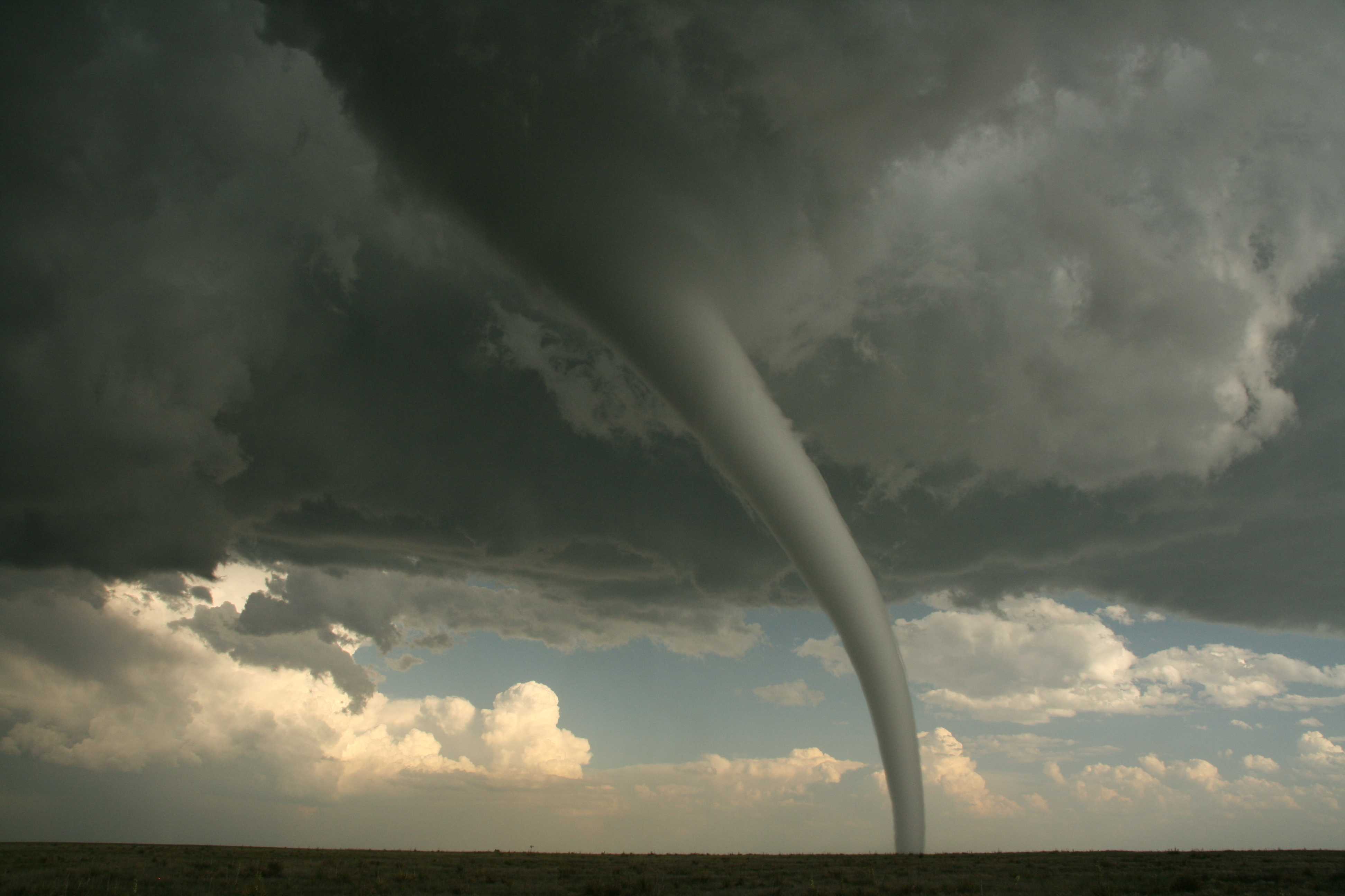
Tornado (Image 1)
The early stages of the Campo, Colorado, USA tornado of 31 May 2010. The tornado had touched down just prior to the photograph being taken. It formed underneath a large wall cloud (murus), which occupies much of the top of the picture. The condensation funnel of the tornado at this stage is relatively narrow.
A tornado is defined as a rotating column of air extending from the base of a cumuliform cloud and is often visible as a condensation funnel in contact with the ground, and/or an attendant circulating dust or debris cloud at the ground.
Links in the image description will highlight features on the image. Mouse over the features for more detail.
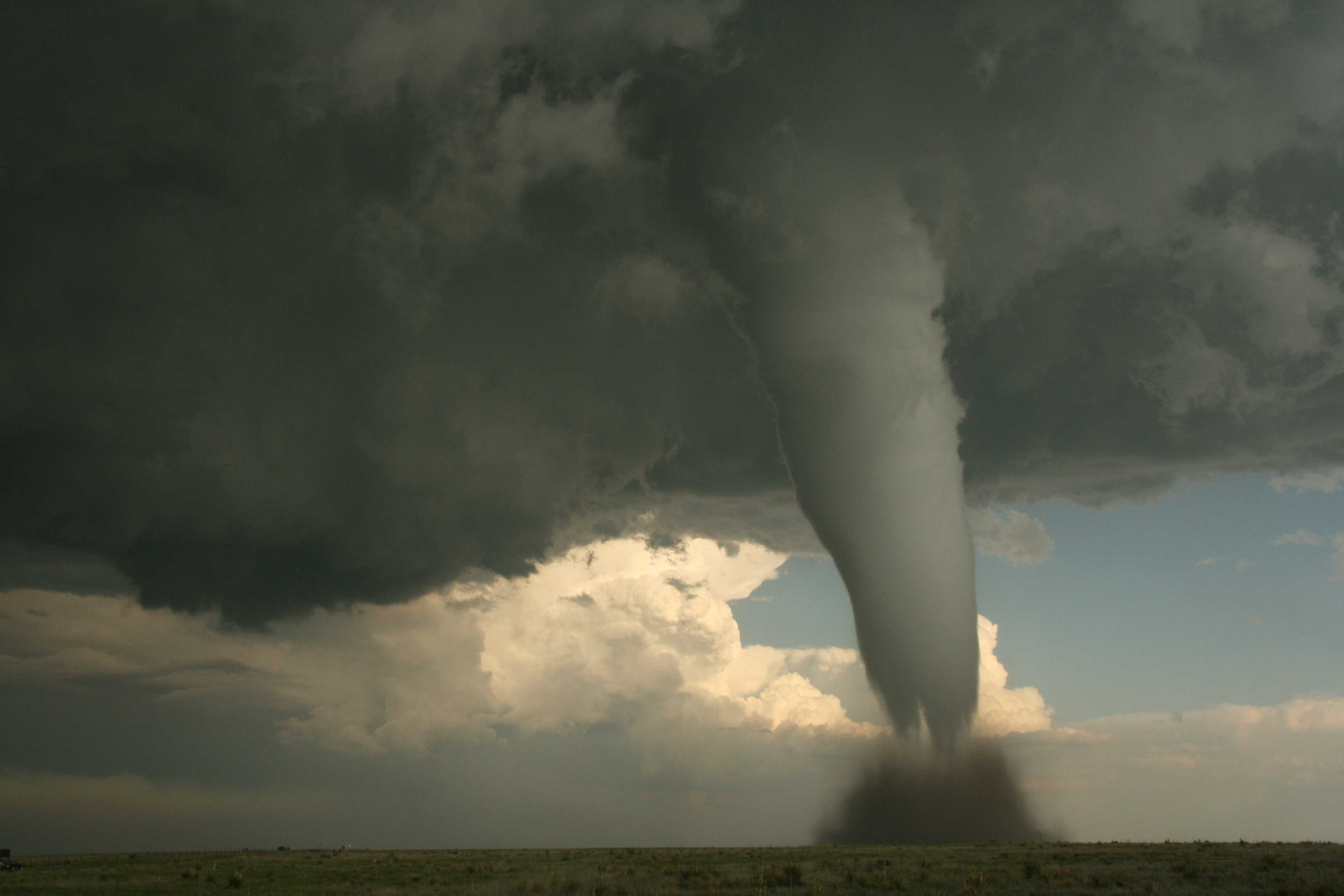
© Matthew ClarkCampo, Colorado, United States of AmericaLatitude: 37° 4' 6'' NLongitude: 102° 34' 45'' W31 May 2010 1806 (Local Time)Camera direction: towards SSECL = 9, CM = /, CH = /Image P/S code: P.11.5.1Image I.D.: 5189Tornado (Image 2)
This image of the Campo, Colorado, USA tornado of 31 May 2010 was taken three minutes after the previous image. The wall cloud (murus) occupies the whole of the top of the photograph. The condensation funnel has widened since the previous image and there is a debris cloud at the ground. A separate Cumulonimbus with a very vigorous updraught tower is visible in the far distance.
Links in the image description will highlight features on the image. Mouse over the features for more detail.
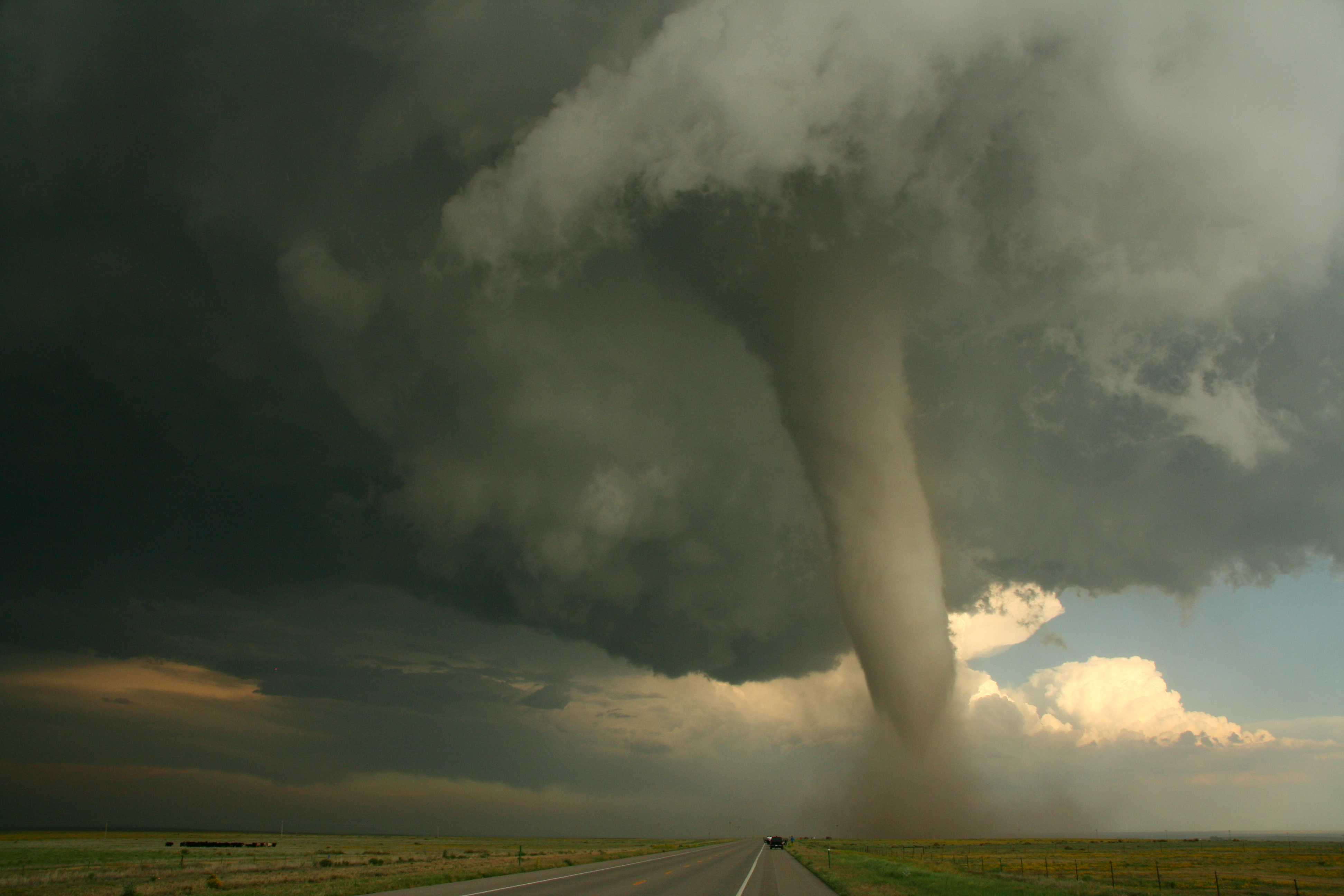
© Matthew ClarkCampo, Colorado, United States of AmericaLatitude: 37° 4' 14'' NLongitude: 102° 34' 45'' W31 May 2010 1809 (Local Time)Camera direction: towards SECL = 9, CM = /, CH = /Image P/S code: P.11.5.1Image I.D.: 5190Tornado (Image 3)
This view of the Campo, Colorado, USA tornado of 31 May 2010 was taken about nine minutes after the tornado touched down. By this stage the condensation funnel had become slightly discoloured (brown-red shades) by the dust it had lifted and ingested from the debris cloud at the surface. The rotating wall cloud (murus) occupies much of the top of the photograph.
Links in the image description will highlight features on the image. Mouse over the features for more detail.
© Matthew ClarkCampo, Colorado, United States of AmericaLatitude: 37° 3' 35'' NLongitude: 102° 33' 56'' W31 May 2010 1814 (Local Time)Camera direction: towards SECL = 9, CM = /, CH = /Image P/S code: P.11.5.1Image I.D.: 5192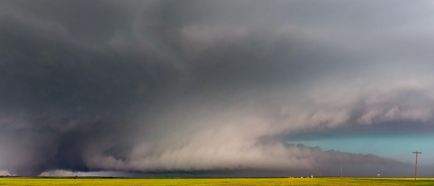
Cumulonimbus capillatus praecipitatio murus cauda flumen tuba
A large, or wedge, tornado is seen here beneath the wall cloud (murus) of this supercell storm viewed during the late afternoon in south-west Oklahoma, USA. A wedge tornado is a type of spout where the condensation funnel is at least as wide horizontally at the ground as it is high from the ground to the cloud base.
A horizontal, tail-shaped cloud extends at low level from the main precipitation region to the wall cloud (murus). This supplementary feature is a tail cloud (cauda). There is also a band of low cloud (flumen) moving in an inflow band into the supercell.
An upper trough approaching from the west resulted in a series of supercells developing from the south-south-west to the north-north-east across north-west Texas and south-west Oklahoma; this high precipitation storm, which was associated with large hail (golf ball to tennis ball size), was one of these.
Links in the image description will highlight features on the image. Mouse over the features for more detail.
© Steve WillingtonElmer, Oklahoma, United States of AmericaLatitude: 34° 30' 23'' NLongitude: 99° 16' 20'' W16 May 2015 1650 (Local Time)Camera direction: towards SWCL = 9, CM = /, CH = /Image P/S code: P.10.9Image I.D.: 4959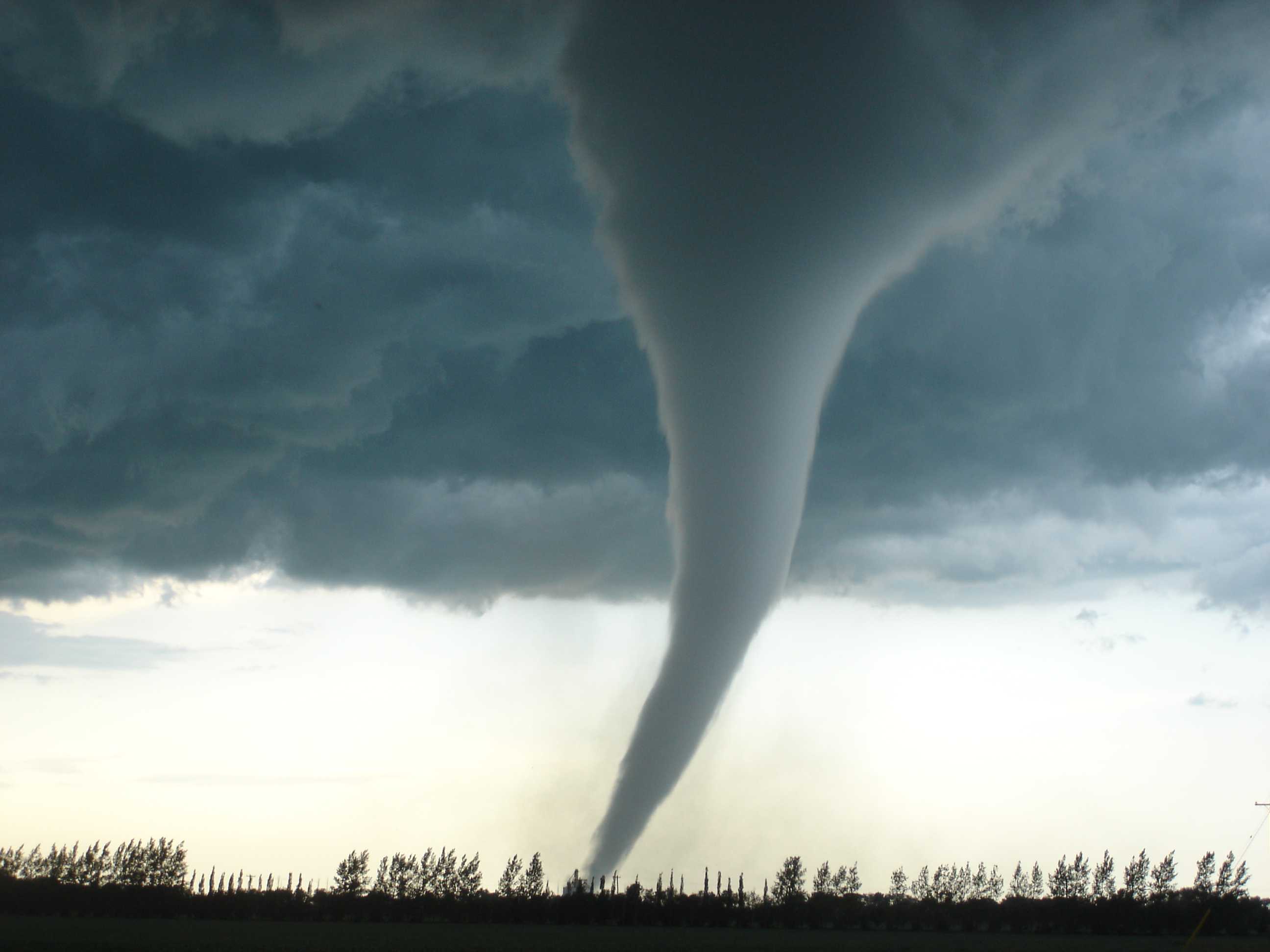
Tornado
This tornado affected the small community of Elie, Manitoba, Canada on 22 June 2007, with winds in excess of 420 km/h. It was Canada's first officially recorded F5 tornado. On the ground, at its widest, it was estimated to be about 300 m across. The ground track was about 6 km.
The tornado's condensation funnel descended to ground from a rotating wall cloud, part of which can be seen here. Near the ground, a debris cloud is just visible against the bright background.
Links in the image description will highlight features on the image. Mouse over the features for more detail.
© Justin HobsonElie, Manitoba, CanadaLatitude: 49° 53' 60'' NLongitude: 97° 46' 2'' W22 June 2007 1845 (Local Time)Camera direction: towards NCL = 9, CM = /, CH = /Image P/S code: S.11.5.1Image I.D.: 4960Spout (tornado)
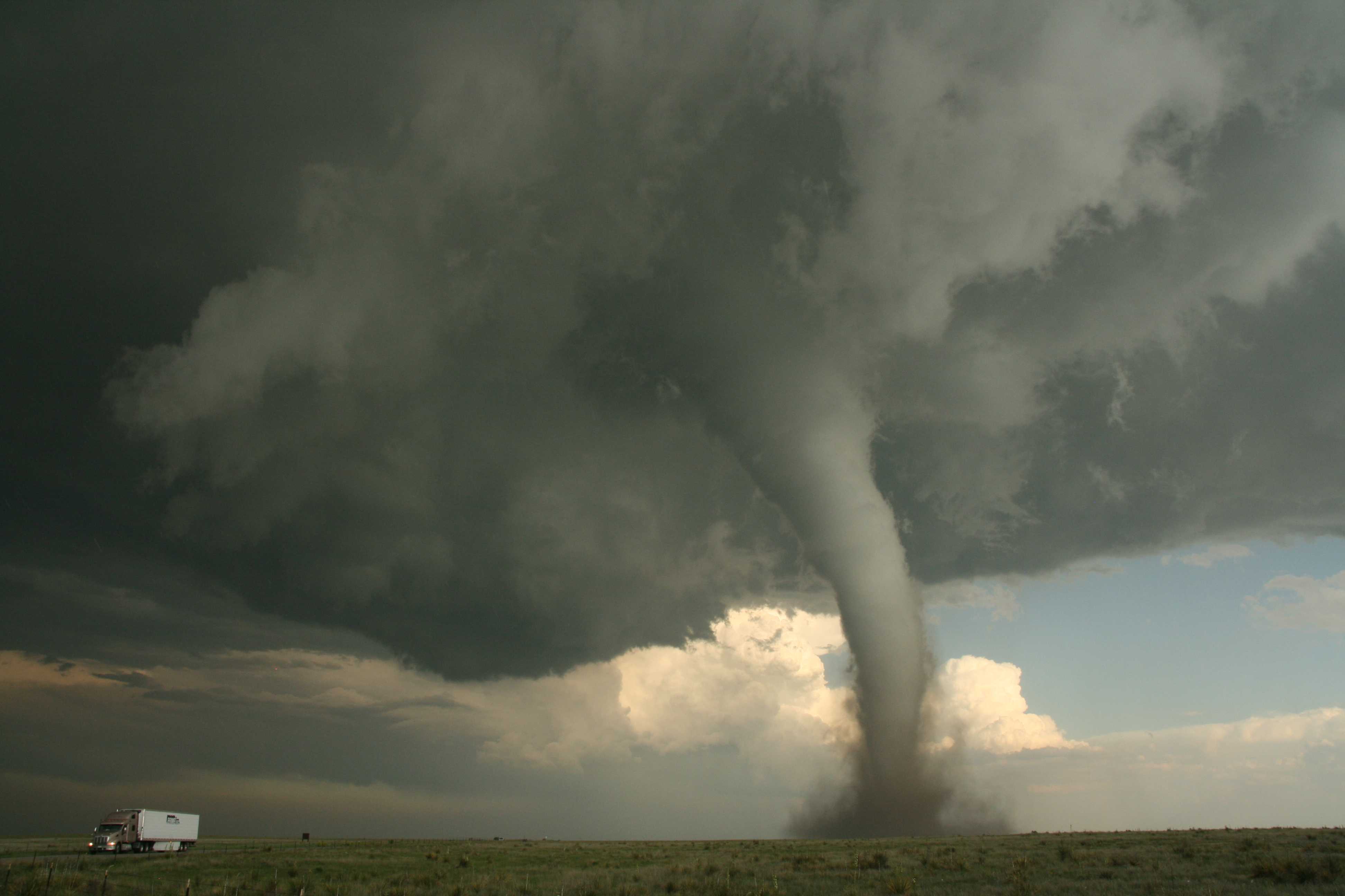
This picture shows a tornado (of strength EF2 on the Enhanced Fujita scale) that occurred near Campo, Colorado, USA. A tornado is a specific type of spout.
A spout is defined as a violent whirlwind, revealed by the presence of a cloud column or inverted cone (funnel cloud) protruding from the base of a Cumulonimbus or Cumulus cloud, and by the presence of a “bush” composed of water droplets raised from the surface of the sea or of dust, sand or litter raised from the ground.
Links in the image description will highlight features on the image. Mouse over the features for more detail.
© Matthew ClarkCampo, Colorado, United States of AmericaLatitude: 37° 4' 10'' NLongitude: 102° 34' 41'' W31 May 2010 1810 (Local Time)Camera direction: towards SECL = 9, CM = /, CH = /Image P/S code: P.11.5Image I.D.: 5191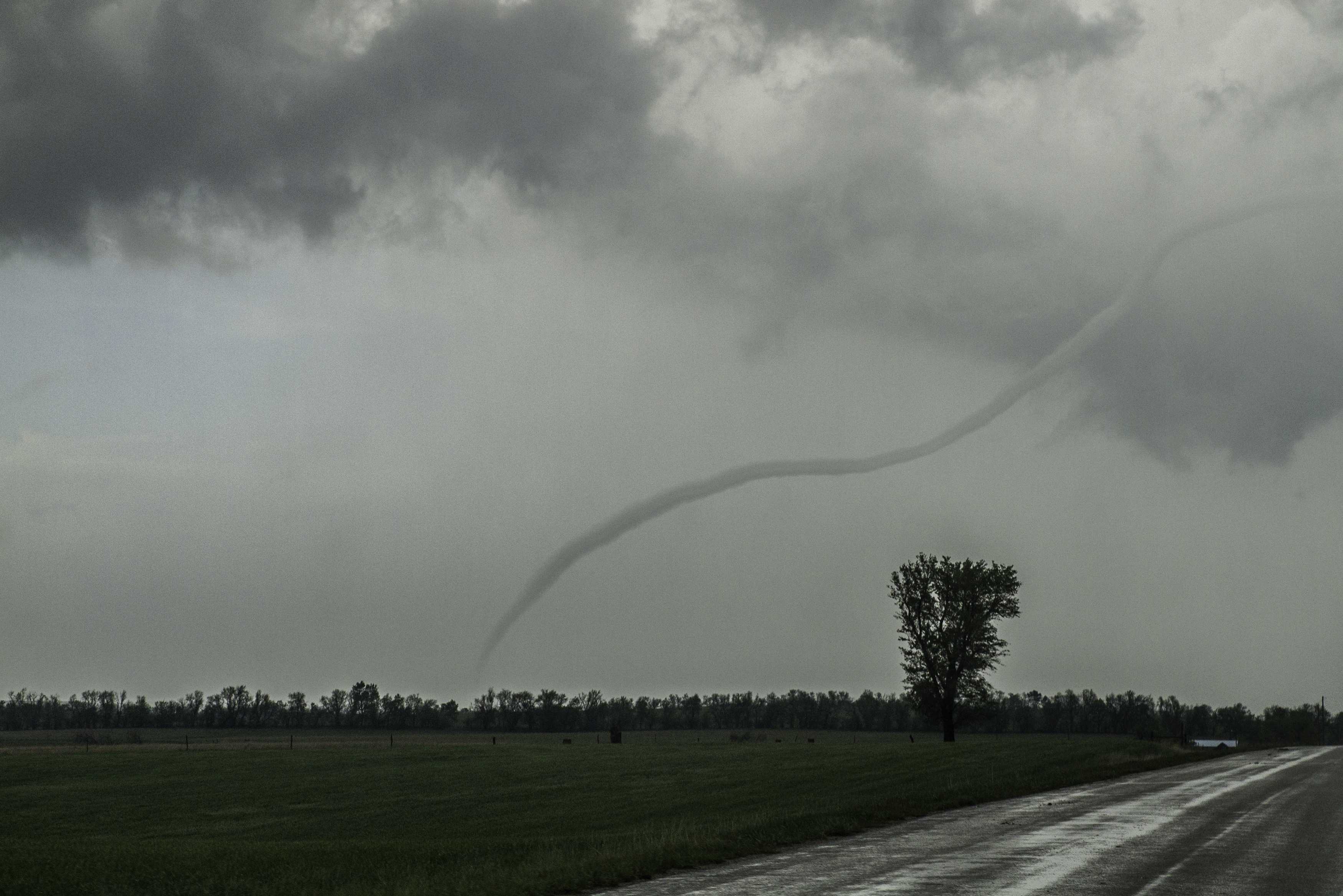
Tornado during the dissipation stage
A tornado is a type of spout. Specifically, it is a rotating column of air extending from the base of a cumuliform cloud and is often visible as a condensation funnel in contact with the ground, and/or an attendant circulating dust or debris cloud at the ground.
During the dissipation stage of a tornado, as seen in this picture, the condensation funnel shrinks and narrows in width, becoming rope-like, and may also become contorted. At this stage, the tornado may popularly be referred to as a “rope tornado” or “rope funnel”, or may be described as “roping out”.
Links in the image description will highlight features on the image. Mouse over the features for more detail.
© Philip AndersonSolomon, near Salina, Kansas, United States of AmericaLatitude: 38° 57' 16'' NLongitude: 97° 26' 6'' W14 April 2012 1905 (Local Time)CL = 9, CM = /, CH = /Image P/S code: P.11.5.1.2Image I.D.: 5464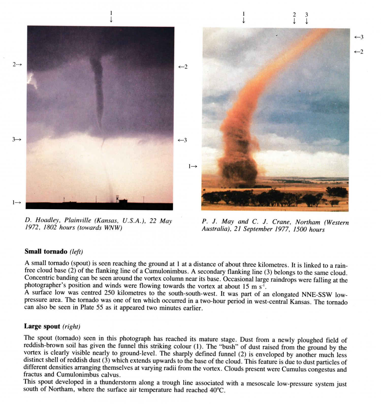
Small tornado
A small tornado (spout) is seen reaching the ground at 1 at a distance of about three kilometres. It is linked to a rain-free cloud base of the flanking line of a Cumulonimbus. A secondary flanking line belongs to the same cloud. Concentric banding can be seen around the vortex column near its base. Occasional large raindrops were falling at the photographer's position and winds were flowing towards the vortex at about 15 m s-1.
A surface low was centred 250 kilometres to the south-south-west. It was part of an elongated NNE-SSW low-pressure area. The tornado was one of ten which occurred in a two-hour period in west-central Kansas.
The tornado can also be seen in image PR.199 as it appeared two minutes earlier.
Links in the image description will highlight features on the image. Mouse over the features for more detail.
© D. HoadleyPlainville, Kansas,United States of AmericaLatitude: 39° 14' 5'' NLongitude: 99° 17' 54'' W22 May 1972 1802 (Local Time)Camera direction: towards WNWCL = /, CM = /, CH = /
