© George Anderson
Wokingham, England, United Kingdom of Great Britain and Northern Ireland
Latitude: 51° 25' 4'' N
Longitude: 0° 51' 48'' W
12 April 2015 0736 (Local Time)
Camera direction: towards NE
Image P/S code: P.1.15
Image I.D.: 5201
CL = 0, CM = 0, CH = 1
-
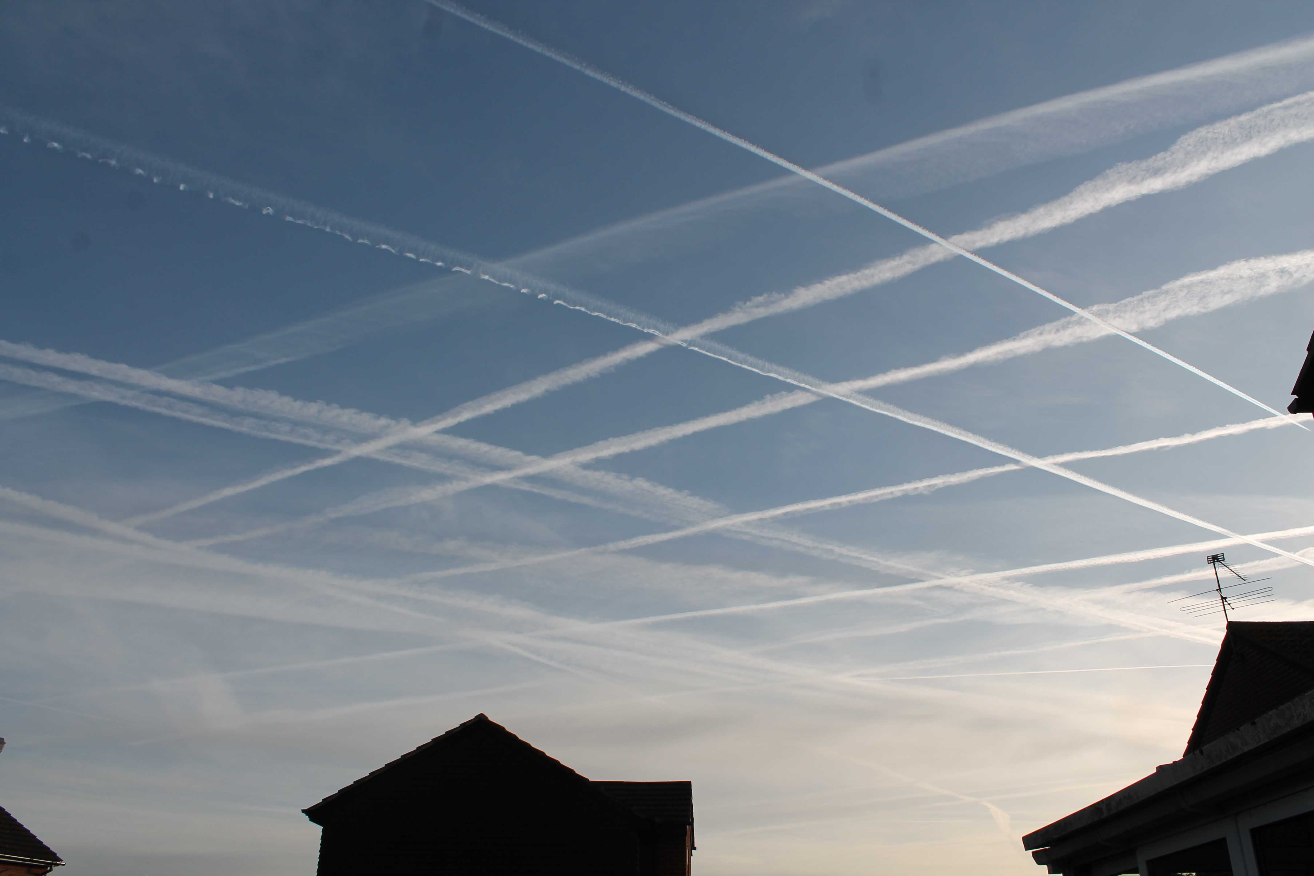
Aircraft condensation trails (contrails): Cirrus homogenitus
Persistent aircraft condensation trails (contrails) cross the sky over southern England, UK. These are classified as Cirrus homogenitus.
Because new or recently formed aircraft condensation trails may display a variety of transient shapes (seen at 2, 3, and 4), no species, varieties or supplementary features are used in the classification.
Links in the image description will highlight features on the image. Mouse over the features for more detail.
© George AndersonWokingham, England, United Kingdom of Great Britain and Northern IrelandLatitude: 51° 25' 4'' NLongitude: 0° 51' 48'' W12 April 2015 0736 (Local Time)Camera direction: towards NECL = 0, CM = 0, CH = 1Image P/S code: P.1.15Image I.D.: 5201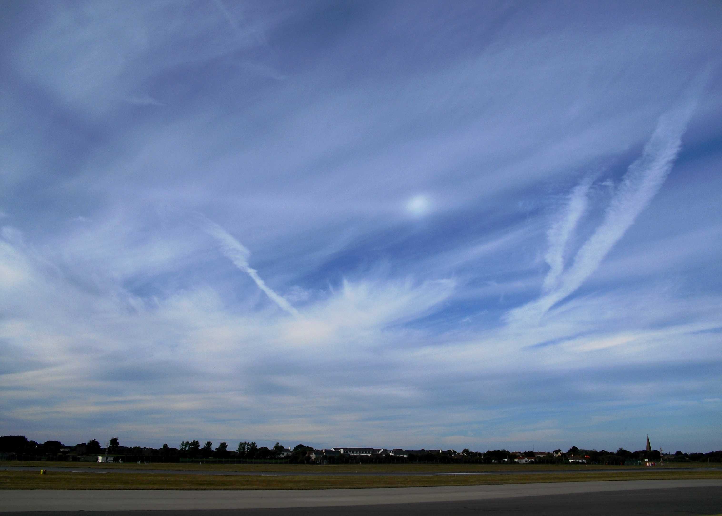
Parhelic circle and 120° parhelion
This picture shows Cirrostratus fibratus and Cirrus spissatus clouds, together with some aircraft condensation trails (Cirrus homogenitus) at 3 and 4. However, there are also two photometeors of particular interest.
The first is the bright spot near the centre of the photograph; this is a 120° parhelion, caused by at least two internal ice crystal reflections of sunlight. Rays entering the top face of plate crystals reflect internally off two adjacent side faces and then exit through the lower face. The second 120° parhelion was not visible on this occasion. At the time of the photograph, the Sun’s azimuth was 274° and the azimuth of the parhelion was 034° (an azimuthal distance of 120° from the Sun).
The second photometeor is a white band which passes through the 120° parhelion; this is a parhelic circle. The parhelic circle is a white horizontal band circling the sky at the same angular elevation above the horizon as the Sun. The vertical faces of many ice crystals each mirror the Sun around the sky to form the circle. Only part of the circle was visible on this day. The elevation of the horizontal band was 020° above the horizon. At the time of these phenomena, a bright circumhorizontal arc was also visible but is not shown in this photograph.
Links in the image description will highlight features on the image. Mouse over the features for more detail.
© Frank Le BlancqJersey Airport, JerseyLatitude: 49° 12' 27'' NLongitude: 2° 11' 43'' W02 August 2010 1836 (Local Time)Camera direction: towards NNECL = 0, CM = 0, CH = 6Image P/S code: S.13.1.6Image I.D.: 4702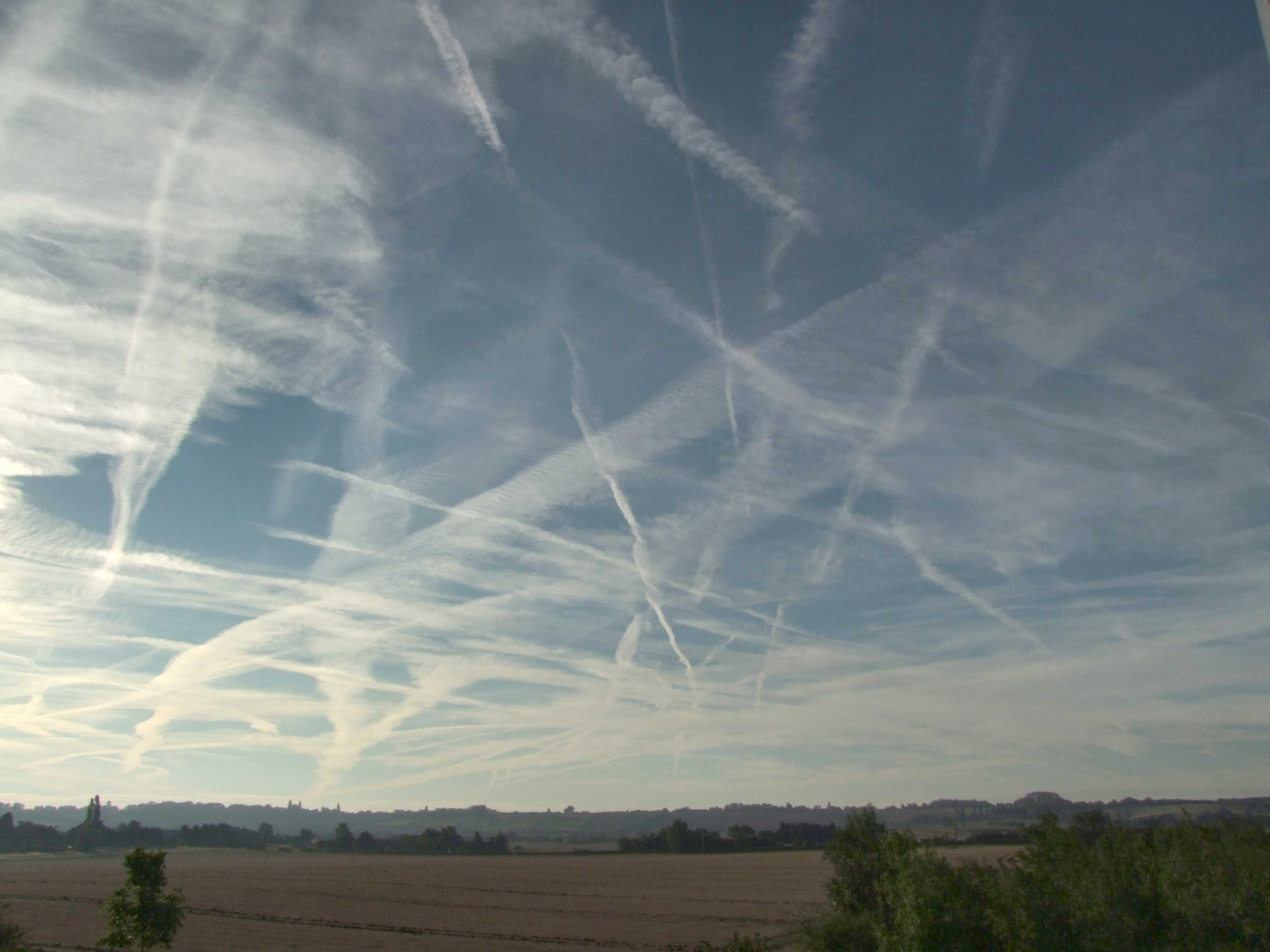
Cirrus homogenitus (contrails) and Cirrus homomutatus
Persistent aircraft condensation trails at 1 and 2 (contrails) cover much of the sky in this picture. These contrails are classified as Cirrus homogenitus. The name homogenitus is used where the cloud has developed as a consequence of human activity. Because new or recently formed contrails may display a variety of transient shapes, no species, varieties or supplementary features are used in the classification.
Some of the older contrails can be seen to have spread out over time. These clouds have lost their original linear appearance and have transformed or mutated into cloud, taking on the appearance of a more natural-looking Cirrus. This cloud is Cirrus homomutatus at 3 and 4.
Links in the image description will highlight features on the image. Mouse over the features for more detail.
© Rodney HaleHoughton Conquest, Bedfordshire, England, United Kingdom of Great Britain and Northern IrelandLatitude: 52° 4' 5'' NLongitude: 0° 28' 18'' W20 August 2011 0730 (Local Time)Camera direction: towards SECL = 0, CM = 0, CH = 1Image P/S code: S.1.15 2Image I.D.: 4803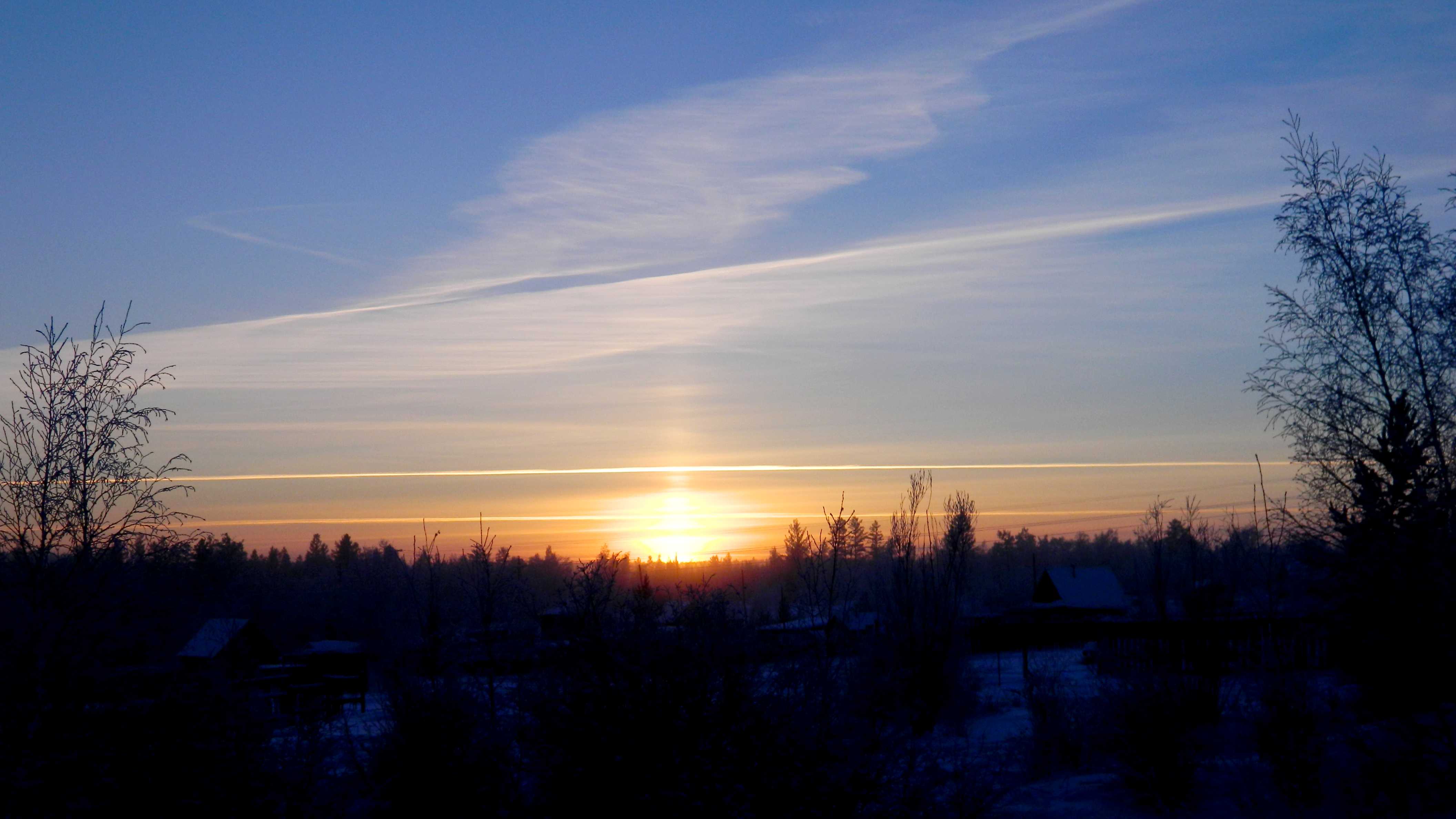
Cirrus homogenitus and Cirrus fibratus homomutatus
In this picture there are several aircraft condensation trails (contrails) across the sky, seen at 1, 2 and 3. These are classified as Cirrus homogenitus. Near the horizon there are Cirrus and Cirrostratus fibratus. A Sun pillar rises vertically above the Sun, formed by the reflection of sunlight on ice crystals in the Cirrostratus. The contrail across the middle of the picture is spreading out to form Cirrus fibratus homomutatus and the cloud at the top of the picture has completely transitioned to Cirrus homomutatus, having lost almost all resemblance to its previous linear shape as a contrail.
Links in the image description will highlight features on the image. Mouse over the features for more detail.
© Alexandra Nikolaevna PetrovaStroitelnyy rayon, Yakutsk, Sakha (Yakutiya) Republits, Russian FederationLatitude: 62° 2' 8'' NLongitude: 129° 40' 32'' E24 February 2016 1151 (Local Time)Camera direction: towards SCL = 0, CM = 0, CH = 8Image P/S code: S.1.15 1Image I.D.: 5131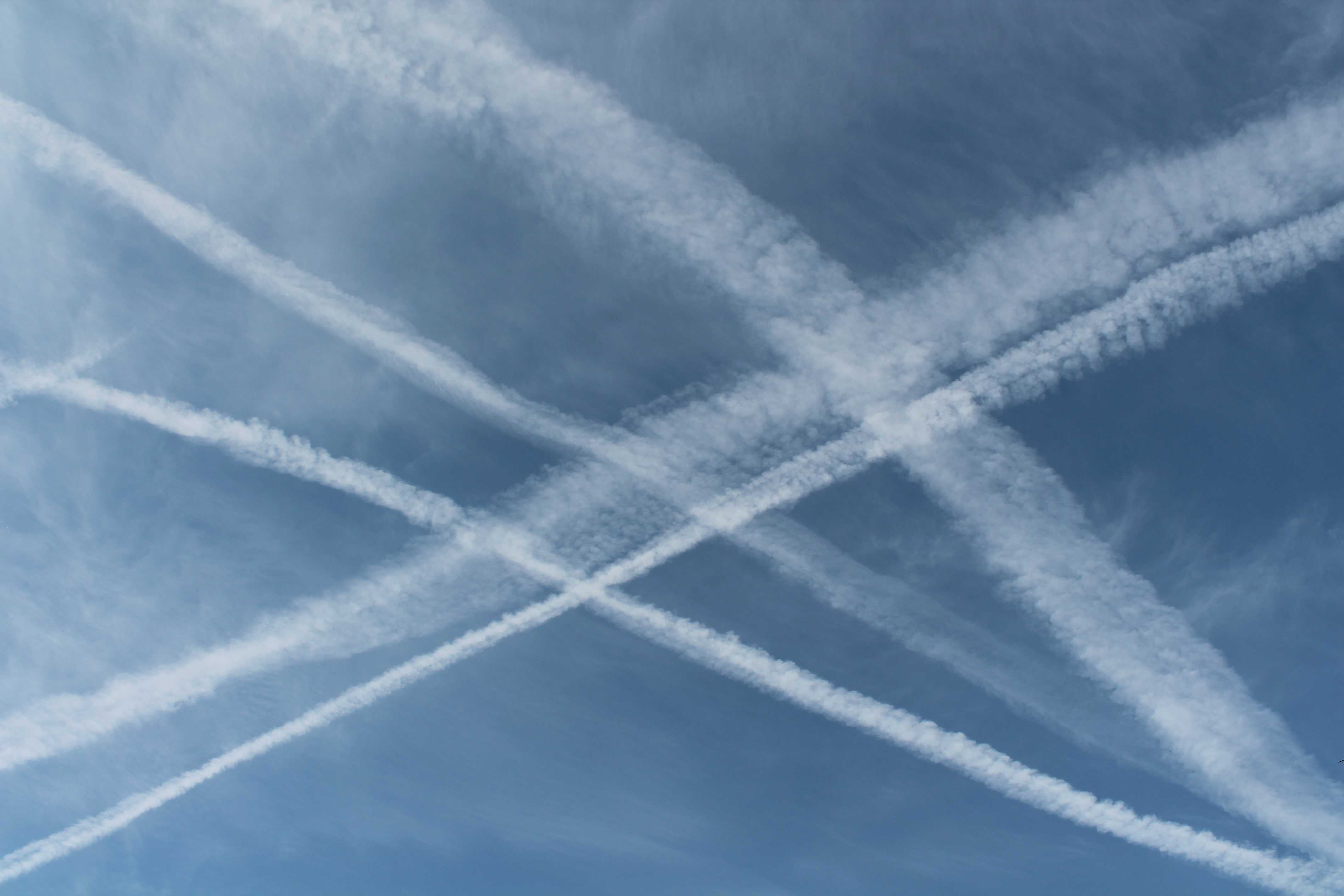
Aircraft condensation trails (contrails): Cirrus homogenitus
Aircraft condensation trails (contrails) in the sky over southern England, UK. Persistent contrails are classified as Cirrus homogenitus.
Links in the image description will highlight features on the image. Mouse over the features for more detail.
© George AndersonWokingham, England, United Kingdom of Great Britain and Northern IrelandLatitude: 51° 25' 4'' NLongitude: 0° 51' 48'' W25 June 2015 0815 (Local Time)Camera direction: towards SCL = 0, CM = 0, CH = 1Image P/S code: S.1.15 6Image I.D.: 5202
Cirrus homogenitus (contrails) and Cirrus fibratus duplicatus homomutatus
All the cloud in this image is man-made (anthropogenic). There are several aircraft condensation trails (contrails), at 1, 2, 3, 4 and 5; these are classified as Cirrus homogenitus. In addition, cloud has spread out from older contrails to form wider areas of Cirrus that resemble naturally formed cloud. However, because it is known that this Cirrus mutated and developed from cloud of man-made origin (the original contrails), it is classed as Cirrus homomutatus.
There are at least two levels of Cirrus cloud (duplicatus) in which there are largely straight cloud filaments (fibratus). Towards the top left of the picture (at 7 and 8), the filaments appear vertically orientated. Towards the bottom, there is thicker Cirrus in which the fibratus filaments stretch more horizontally across the picture. The full cloud classification is therefore Cirrus fibratus duplicatus homomutatus.
Links in the image description will highlight features on the image. Mouse over the features for more detail.
© George AndersonWokingham, England, United Kingdom of Great Britain and Northern IrelandLatitude: 51° 25' 4'' NLongitude: 0° 51' 48'' W13 July 2016 0732 (Local Time)Camera direction: towards WSWCL = 0, CM = 0, CH = 1Image P/S code: S.1.15 4Image I.D.: 5584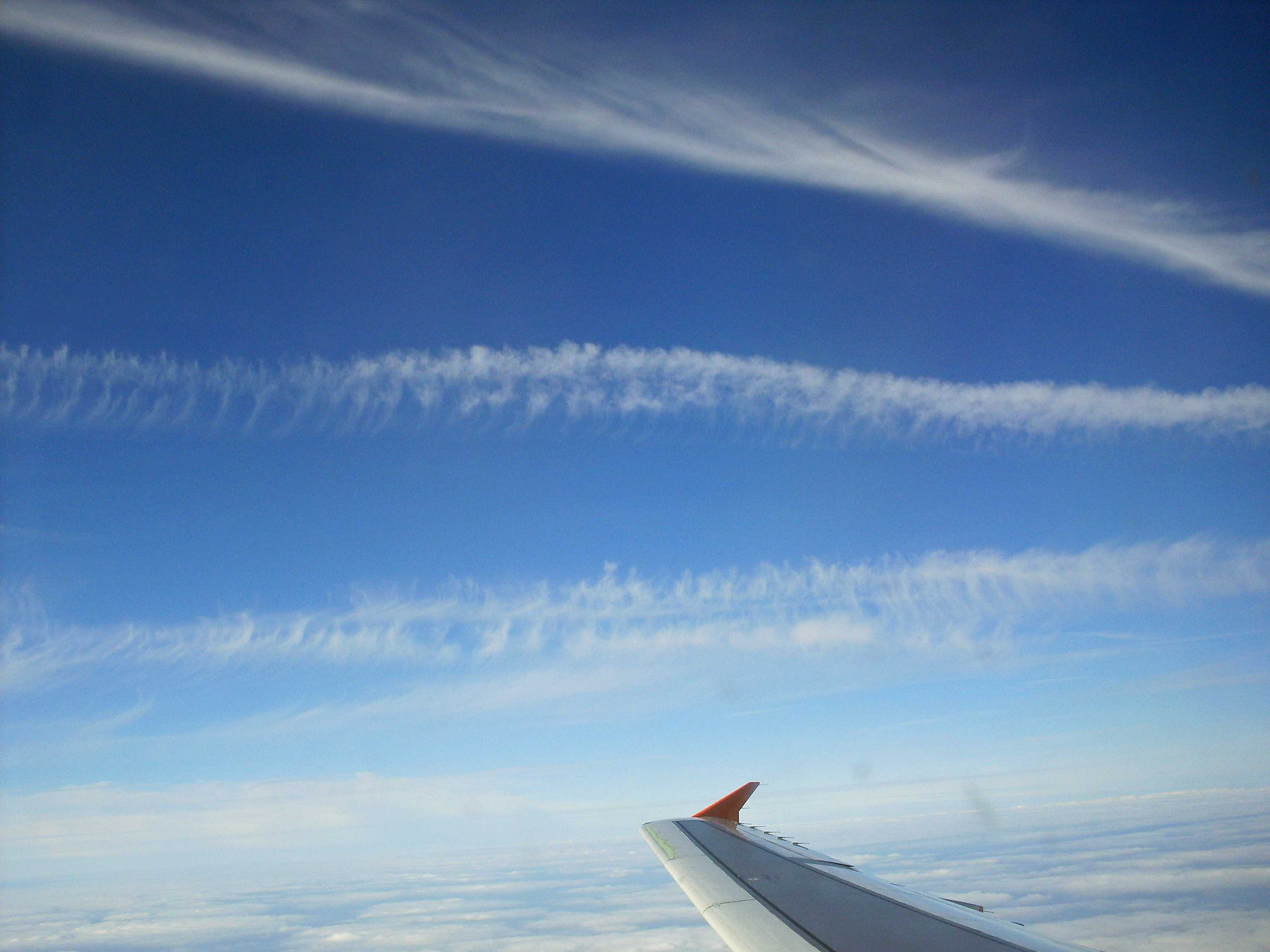
Cirrus homogenitus (contrails)
This image shows Cirrus homogenitus (aircraft condensation trails (contrails)) at an altitude of 6 km, viewed from another aircraft.
Links in the image description will highlight features on the image. Mouse over the features for more detail.
© George AndersonNear the coast of BelgiumLatitude: 51° 10' 48'' NLongitude: 2° 28' 12'' E24 July 2010 0813 (Local Time)CL = 0, CM = 0, CH = 1Image P/S code: S.1.15 3Image I.D.: 5883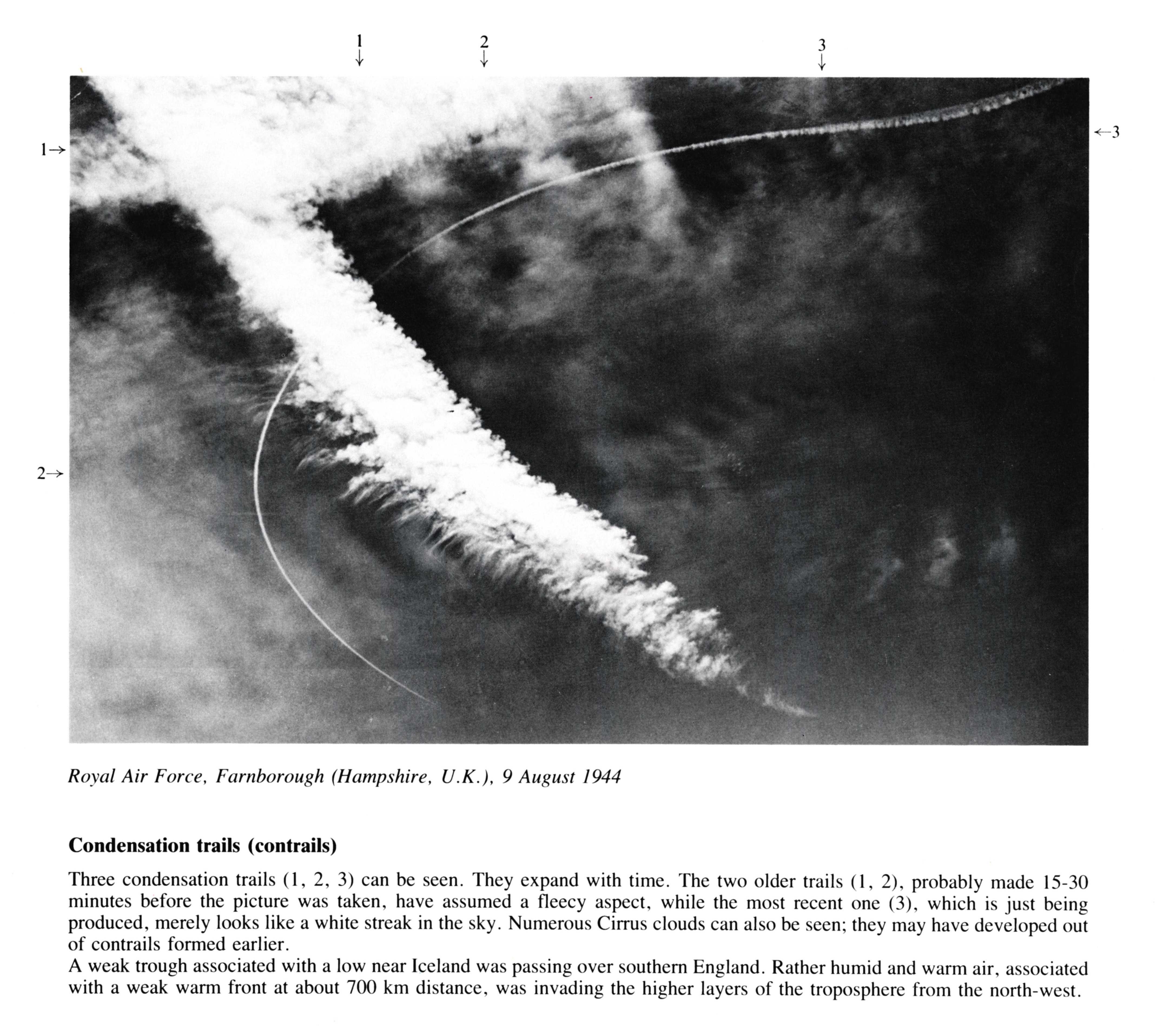
Condensation trails (contrails)
(NB. Hour of day estimated)
Three condensation trails at 1, 2, 3 can be seen. They expand with time. The two older trails at 1, 2. probably made 15-30 minutes before the picture was taken, have assumed a fleecy aspect, while the most recent one, which is just being produced, merely looks like a white streak in the sky. Numerous Cirrus clouds can also be seen; they may have developed out of contrails formed earlier. A weak trough associated with a low near Iceland was passing over southern England. Rather humid and warm air, associated with a weak warm front at about 700 km distance, was invading the higher layers of the troposphere from the north-west.
Links in the image description will highlight features on the image. Mouse over the features for more detail.
© Royal Air ForceFarnborough, Hampshire, United Kingdom of Great Britain and Northern IrelandLatitude: 51° 17' 13'' NLongitude: 0° 45' 9'' W09 August 1944 1200 (Local Time)CL = /, CM = /, CH = /