© Martin Gudd
Bad Vilbel, Germany
Latitude: 50° 11' 19'' N
Longitude: 8° 44' 48'' E
09 February 2016 0909 (Local Time)
Camera direction: towards E
Image P/S code: P.5.5
Image I.D.: 5443
CL = 5, CM = 2, CH = /
-
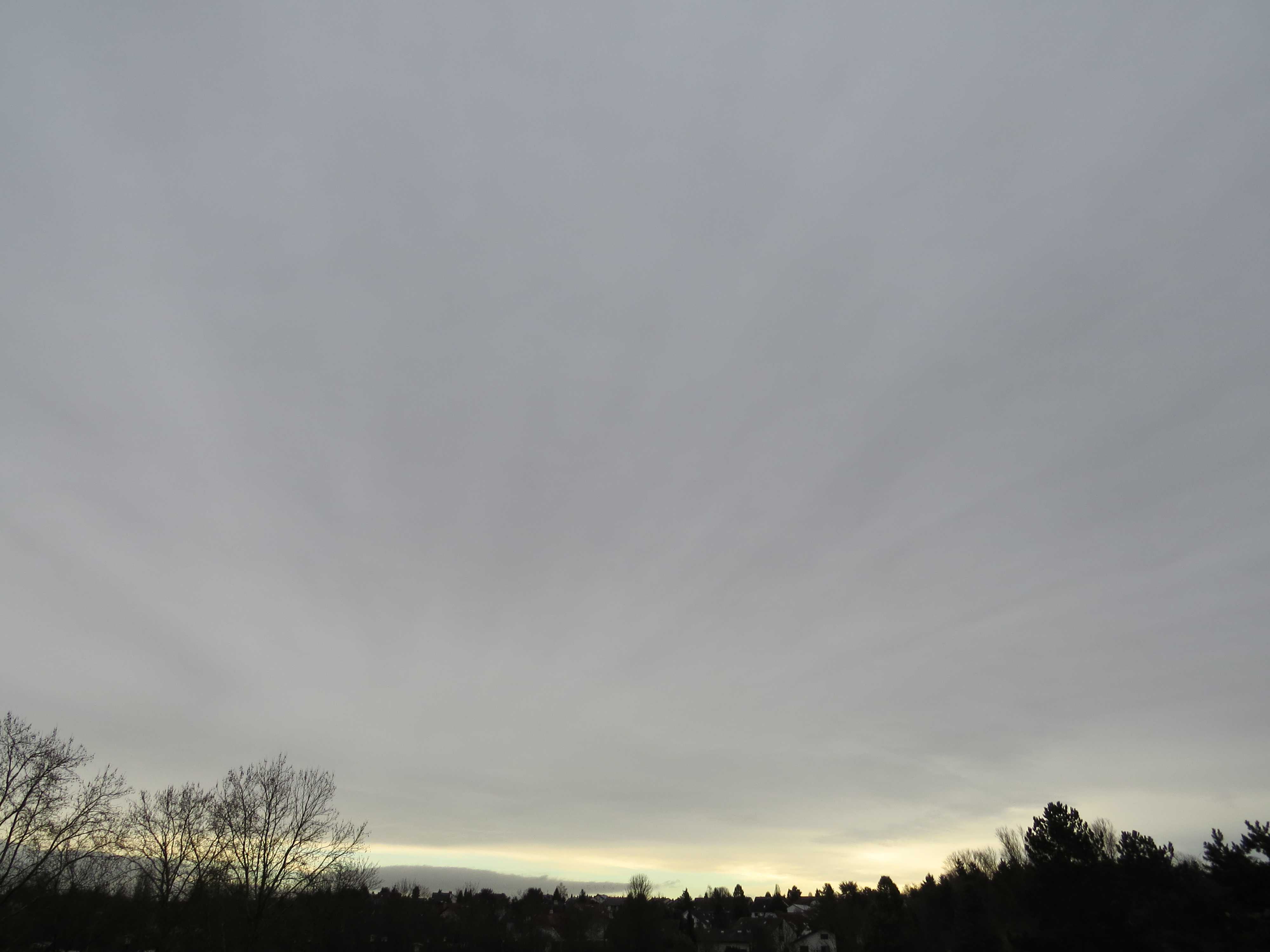
Altostratus opacus radiatus
The image shows a dark layer of Altostratus, identified by its smooth appearance. It is of the variety opacus as the greater part of this layer is thick enough to blot out the Sun. There are pronounced streaks (striations) on the underside of the Altostratus and these striations appear to converge towards the horizon, indicating the variety radiatus. Patches of Stratocumulus lenticularis are low down on the horizon. The Altostratus is rapidly invading the sky from the south-west (from the upper right to the lower left in the image) and a short time after the picture was taken, rain set in. A small, intense and deepening low was approaching the area.
Links in the image description will highlight features on the image. Mouse over the features for more detail.
© Martin GuddBad Vilbel, GermanyLatitude: 50° 11' 19'' NLongitude: 8° 44' 48'' E09 February 2016 0909 (Local Time)Camera direction: towards ECL = 5, CM = 2, CH = /Image P/S code: P.5.5Image I.D.: 5443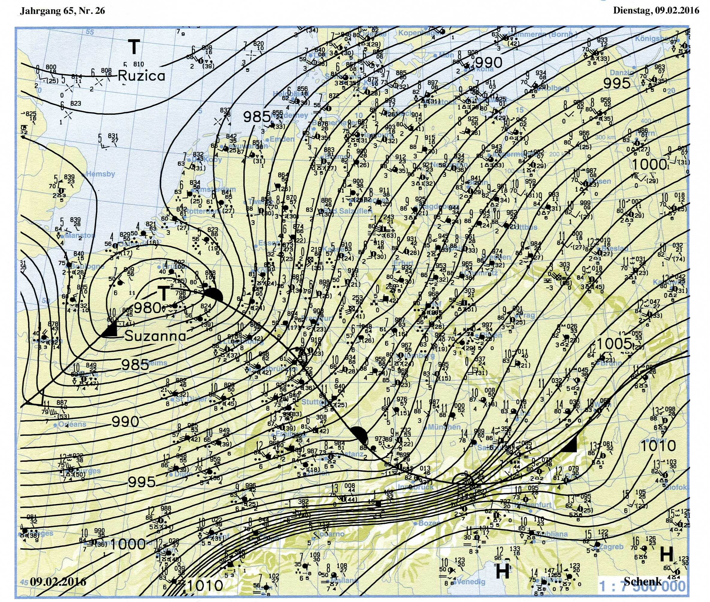
The synoptic chart shows the situation about four hours after the photo was taken. A small but intense and deepening low is situated over Belgium, rapidly progressing to the north-east. The low has a very pronounced frontal system, bringing heavy rain and gusty winds as well as a considerable increase in temperature at the warm front. The photo was taken when the rainclouds of this front began to invade the sky.
© Verein Berliner Wetterkarte e.V.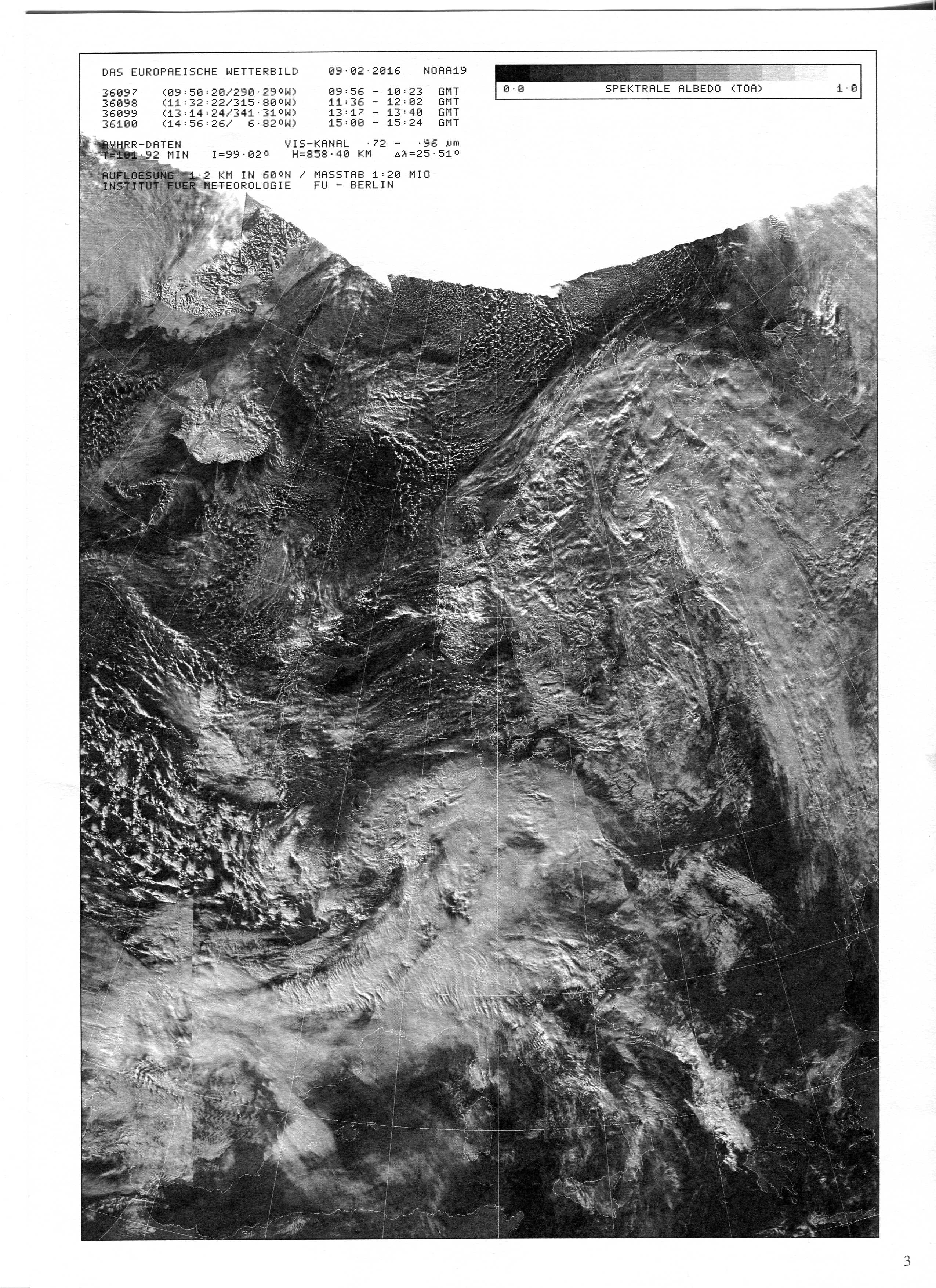
The satellite imagery shows the situation some hours after the photo was taken. There is a small but intense low over Belgium and with it a very pronounced frontal system over parts of middle and western Europe. Meanwhile, the clouds of the warm front have reached north-eastern Germany and the thick clouds of the cold front are stretching south-westward over France and northern Spain. Behind this front, colder air is coming from the west, bringing some heavy showers.
© Verein Berliner Wetterkarte e.V.