© Ian Simpson
Sidmouth, Devon, United Kingdom of Great Britain and Northern Ireland
Latitude: 50° 40' 11'' N
Longitude: 3° 15' 26'' W
08 July 2010 1400 (Local Time)
Camera direction: towards NE
Image P/S code: P.16.8.3
Image I.D.: 5484
CL = 6, CM = 3, CH = /
-
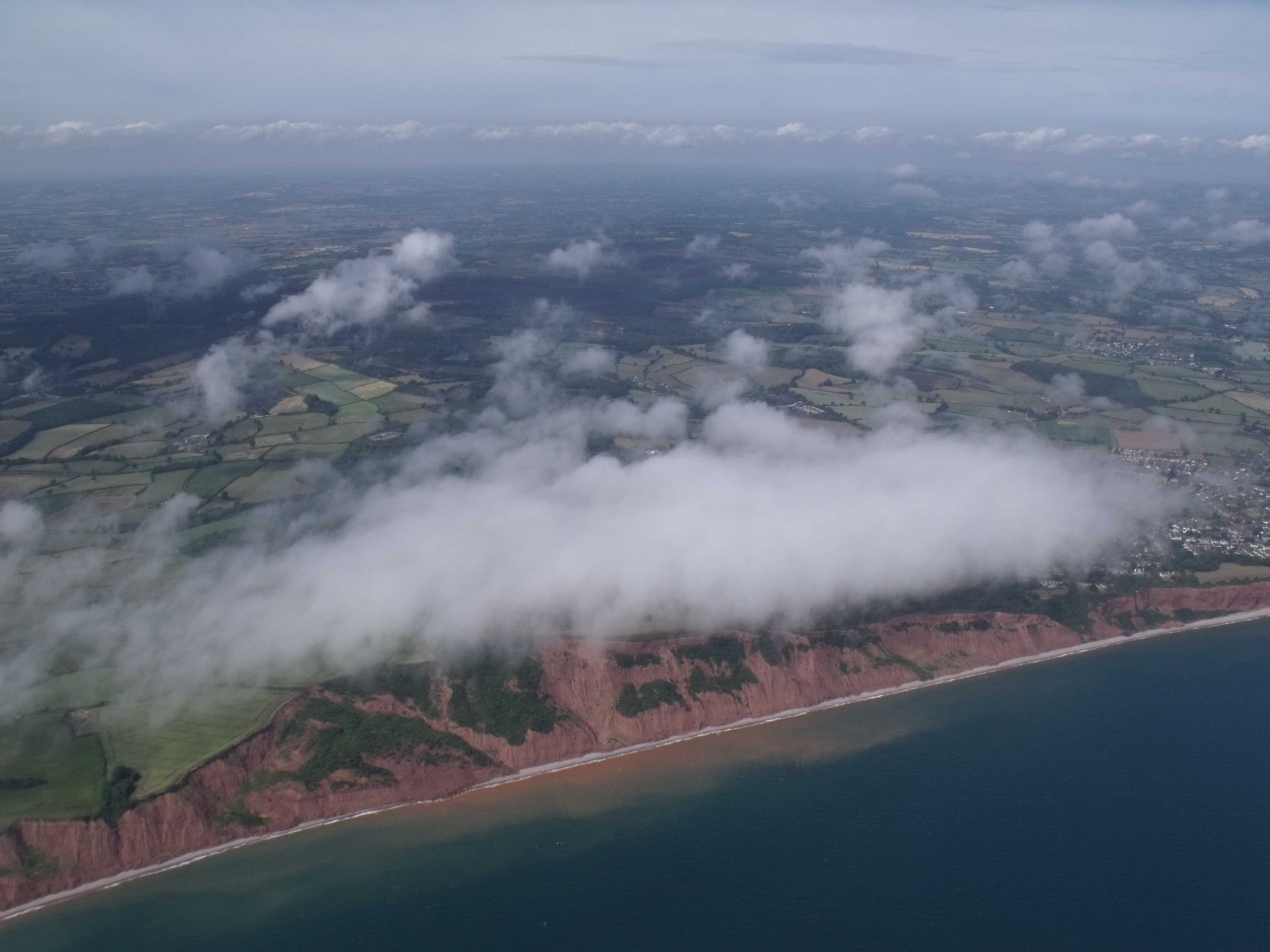
Upslope Stratus
This image shows an aerial view of a fairly uniform patch of Stratus nebulosus cloud. Beneath the cloud is a steep slope, rising sharply to a height of 100 to 150 m (300 to 400 ft). Moist air approaching the windward coast from the sea was forced to ascend the barrier, which cooled the air to its dew point and induced the formation of this patch of upslope cloud. In some cases, the cloud may lower to cover the hilltop with upslope fog. On the far right, where the slope is less high, no cloud has formed. A short distance inland, the cloud has broken into small, ragged pieces of Stratus fractus. In the background, a line of cloud that is of small vertical extent and is seemingly flattened is Cumulus humilis.
Links in the image description will highlight features on the image. Mouse over the features for more detail.
© Ian SimpsonSidmouth, Devon, United Kingdom of Great Britain and Northern IrelandLatitude: 50° 40' 11'' NLongitude: 3° 15' 26'' W08 July 2010 1400 (Local Time)Camera direction: towards NECL = 6, CM = 3, CH = /Image P/S code: P.16.8.3Image I.D.: 5484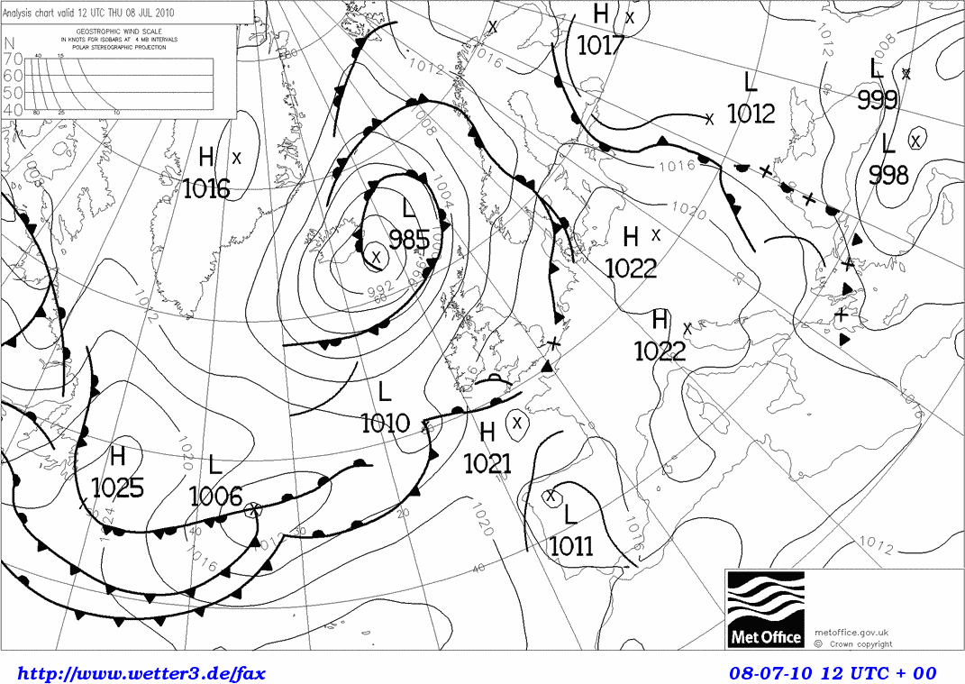
At 1200 UTC, a shallow low of 1 010 hPa was centred to the south-west of Ireland, with a weak anticyclone of 1 021 hPa just west of Brittany, France. A slack but rather moist south-westerly airflow was affecting the coast of south-west England, UK, near the location of the photograph.
© Crown Copyright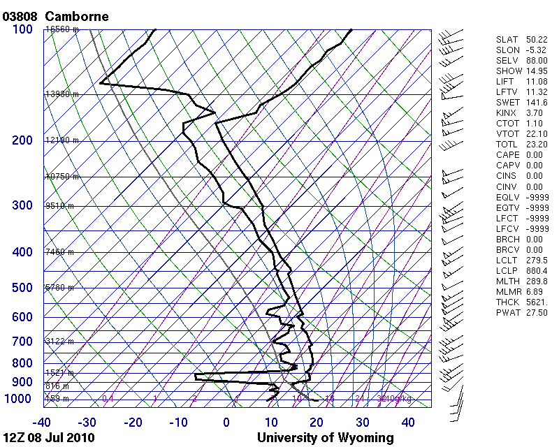
The Camborne, England, UK (WMO 03808) sounding, about 160 km west-south-west of the image location, shows instability in the boundary layer, below a temperature inversion at about 910 hPa. Moisture at various levels indicate layers of cloud are likely at medium and upper levels of the troposphere. The sounding does not reflect the higher dew point (about 14 °C) and slightly lower air temperature at the surface in the vicinity of the photograph.
© University of Wyoming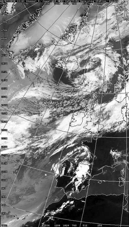
The satellite image shows extensive layers of medium- and high-level cloud (Altocumulus and Cirrostratus) over most of England, UK, including the South-West Peninsula in the vicinity of the photograph. The image is not of sufficient resolution to show the Stratus or shallow convective cloud.
© NEODAAS/University of Dundee