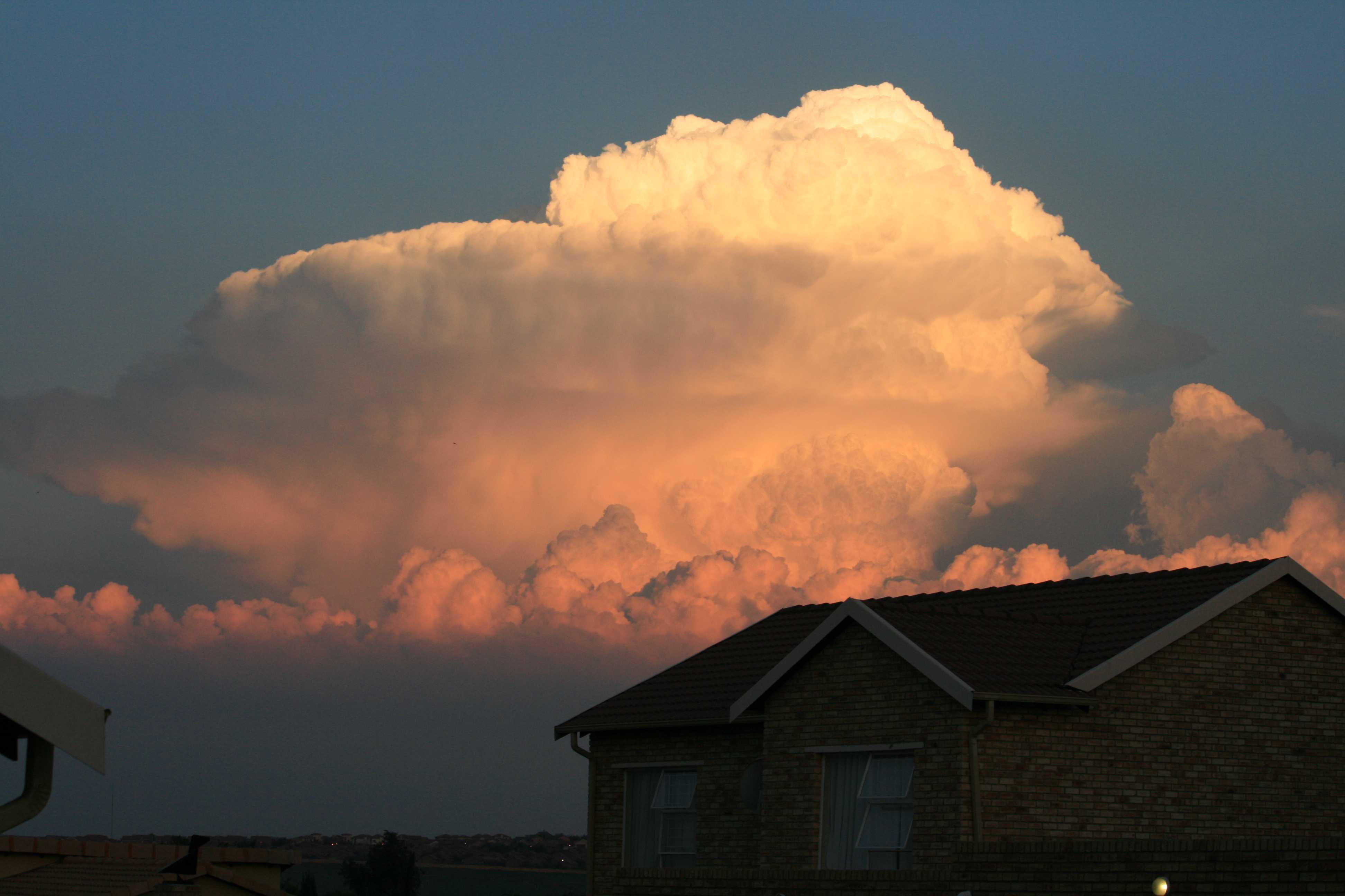
© Jarmo Koistinen
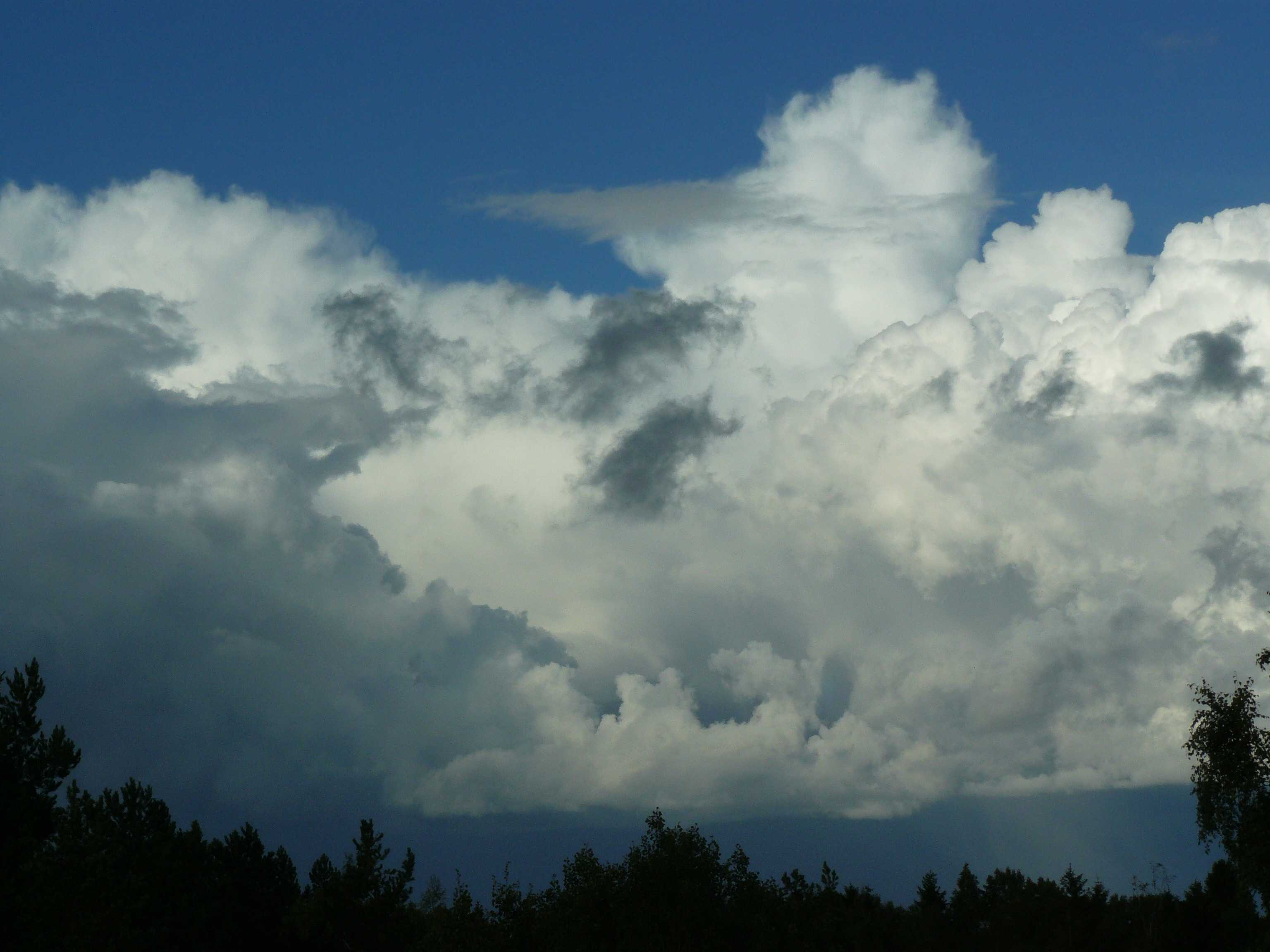
Espoo, Finland
Latitude: 60° 12' 11'' N
Longitude: 24° 38' 30'' E
05 September 2015 1737 (Local Time)
Camera direction: towards NE
Image P/S code: P.10.2
Image I.D.: 5500
CL = 9, CM = 6, CH = 0
-
Cumulonimbus capillatus praecipitatio
Cumulonimbus is a heavy and dense cloud of considerable or great vertical extent, in the form of a mountain or huge towers. At least part of its upper portion is usually smooth, fibrous or striated, and is nearly always flattened. In this zoomed image, most of the sproutings of the upper parts are becoming fibrous and indistinct at 1 and 2 as they transition from Cumulonimbus calvus to the species capillatus. The overall look of the upper parts is still one of bulging domes, but no anvil (incus) has yet developed. Capillatus is usually accompanied by precipitation in the form of a shower (the supplementary feature praecipitatio), seen here on the lower right 15 to 20 km away. Near the top of the highest tower is a small patch of Altocumulus cumulonimbogenesis. Also in this image are the cauliflower-like sproutings of Cumulus congestus, some Cumulus mediocris and probable Cumulus fractus, which appears closer to the camera due to perspective.
Links in the image description will highlight features on the image. Mouse over the features for more detail.
© Jarmo KoistinenEspoo, FinlandLatitude: 60° 12' 11'' NLongitude: 24° 38' 30'' E05 September 2015 1737 (Local Time)Camera direction: towards NECL = 9, CM = 6, CH = 0Image P/S code: P.10.2Image I.D.: 5500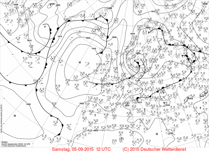
The 1200 UTC synoptic chart shows a broad area over low pressure covering Scandinavia. The main low centre of 998 hPa is over south-west Sweden and a slack pressure gradient is over Finland, which is affected by a polar air mass.
© Deutscher Wetterdienst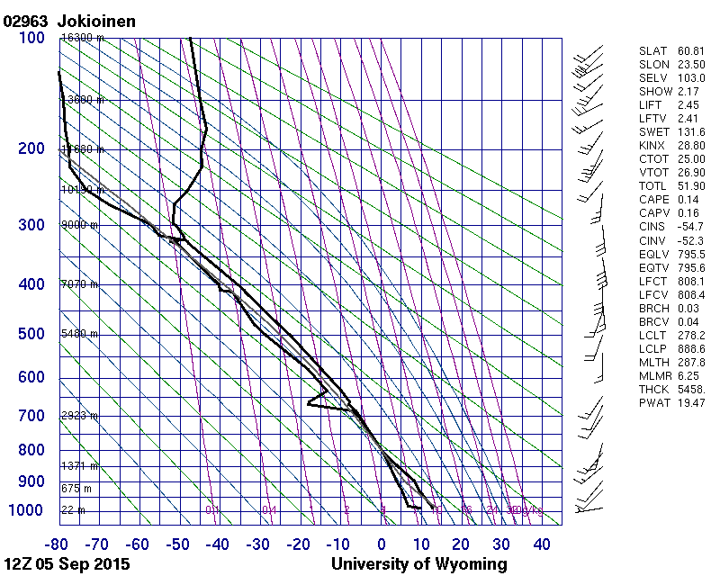
The Jokioinen, Finland (WMO 02963) sounding, from about two hours before the image and 100 km to the north-west, was taken in the same air mass as the photograph and shows a moist and rather unstable troposphere from the surface to the tropopause.
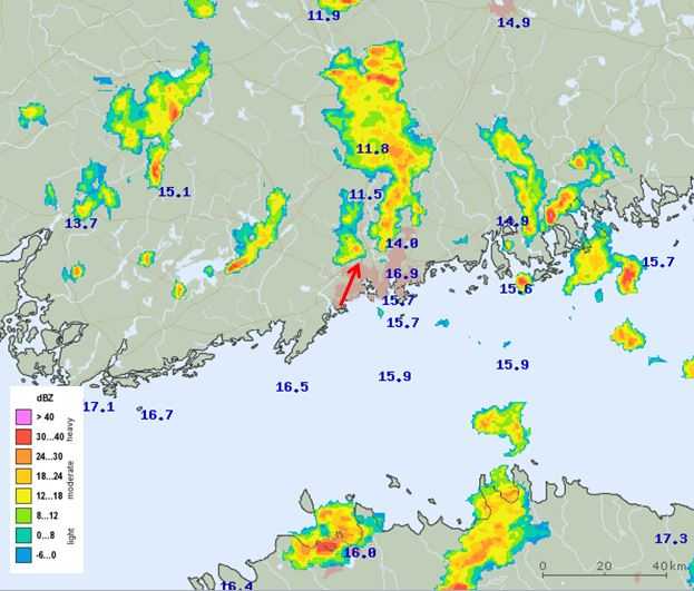
© University of WyomingThe Helsinki, Finland weather radar image shows a scattering of moderate showers over southern Finland, including near Helsinki. The red arrow indicates the observation site and direction of the photo. Temperatures at 2 m are also appended.
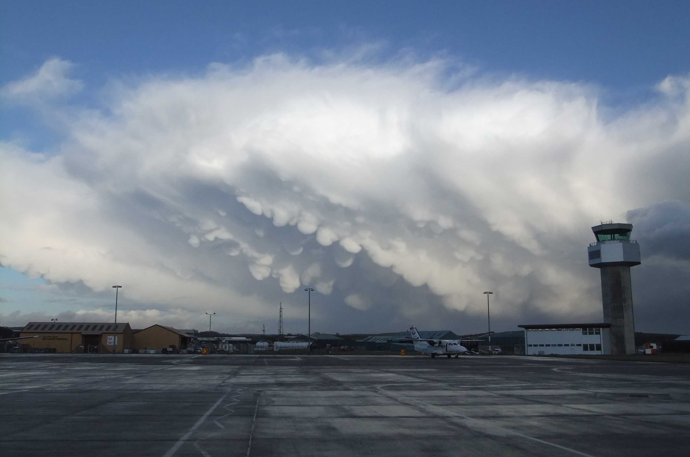
© Finnish Meteorological InstituteCumulonimbus capillatus incus mamma
A prominent feature of this wintertime Cumulonimbus capillatus incus is the hanging protuberances akin to udders on the under surface of the cloud. This is the supplementary feature mamma.
Links in the image description will highlight features on the image. Mouse over the features for more detail.
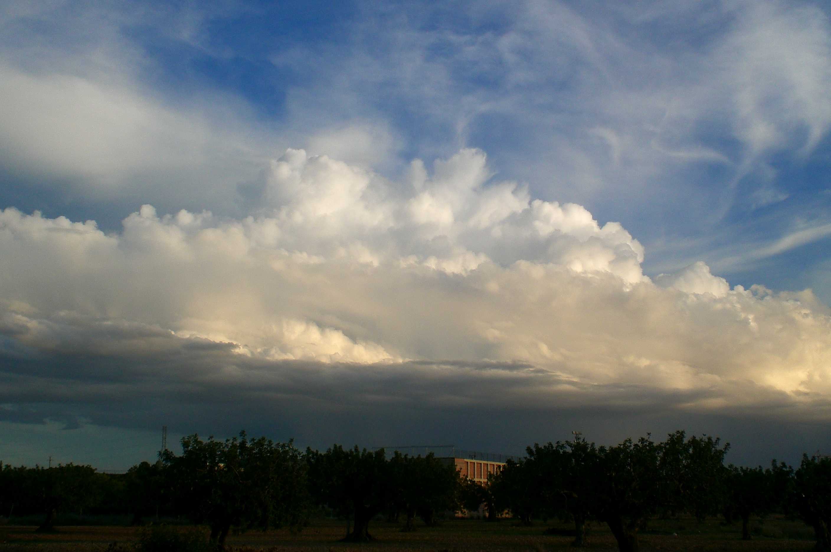
© Gary SalisburyIsle of ManLatitude: 54° 6' 16'' NLongitude: 4° 36' 51'' W14 January 2011 1442 (Local Time)Camera direction: towards ECL = 9, CM = 0, CH = 0Image P/S code: P.10.6Image I.D.: 4767Cumulonimbus capillatus and Cirrus spissatus cumulonimbogenitus
A line of Cumulus and Cumulonimbus capillatus formed in the unstable air on and ahead of a trough of low pressure. The main cell is identified as Cumulonimbus capillatus as some of its upper portion has cirriform parts of clearly fibrous structure (parts of the cloud top have started to freeze). This cell is flanked by Cumulus congestus cells at 1, 2 and 3 that show a range of vertical extents as they are at different stages in their life cycle.
Stratocumulus, Altocumulus and Cirrus formed from the spreading of parts of the cumuliform cloud line are present. The Stratocumulus and Altocumulus are identified as cumulonimbogenitus even if they formed before the mother-cloud reached the Cumulonimbus stage.
Links in the image description will highlight features on the image. Mouse over the features for more detail.
© Elisa Sala Salvador46194 Real, Valencia, SpainLatitude: 39° 20' 7'' NLongitude: 0° 36' 34'' W10 October 2014 1830 (Local Time)Camera direction: towards SECL = 9, CM = 0, CH = 3Image P/S code: S.10.2 1Image I.D.: 4780Cumulonimbus capillatus incus with an overshooting top
Two stable layers at 1 and 2 have momentarily stopped the vertical development of this Cumulonimbus cell. The cloud has transitioned from Cumulonimbus calvus to capillatus incus as the spreading at the second stable layer has evidence of cirriform parts of fibrous structure.
The marked overshooting top appears to be composed of water droplets as the upper parts are sharply defined and no fibrous or striated texture is apparent.
The cloud spreading under the first stable layer is identified as Altocumulus cumulonimbogenitus. A line of Cumulus congestus and mediocris is in front of the Cumulonimbus cell.
Links in the image description will highlight features on the image. Mouse over the features for more detail.
© Malcolm McLeanHeuwelsig Estate, Centurion, 0157, South AfricaLatitude: 25° 52' 29'' SLongitude: 28° 6' 44'' E23 November 2008 1836 (Local Time)Camera direction: towards WNWCL = 9, CM = 6, CH = 0Image P/S code: S.10.2 2Image I.D.: 4878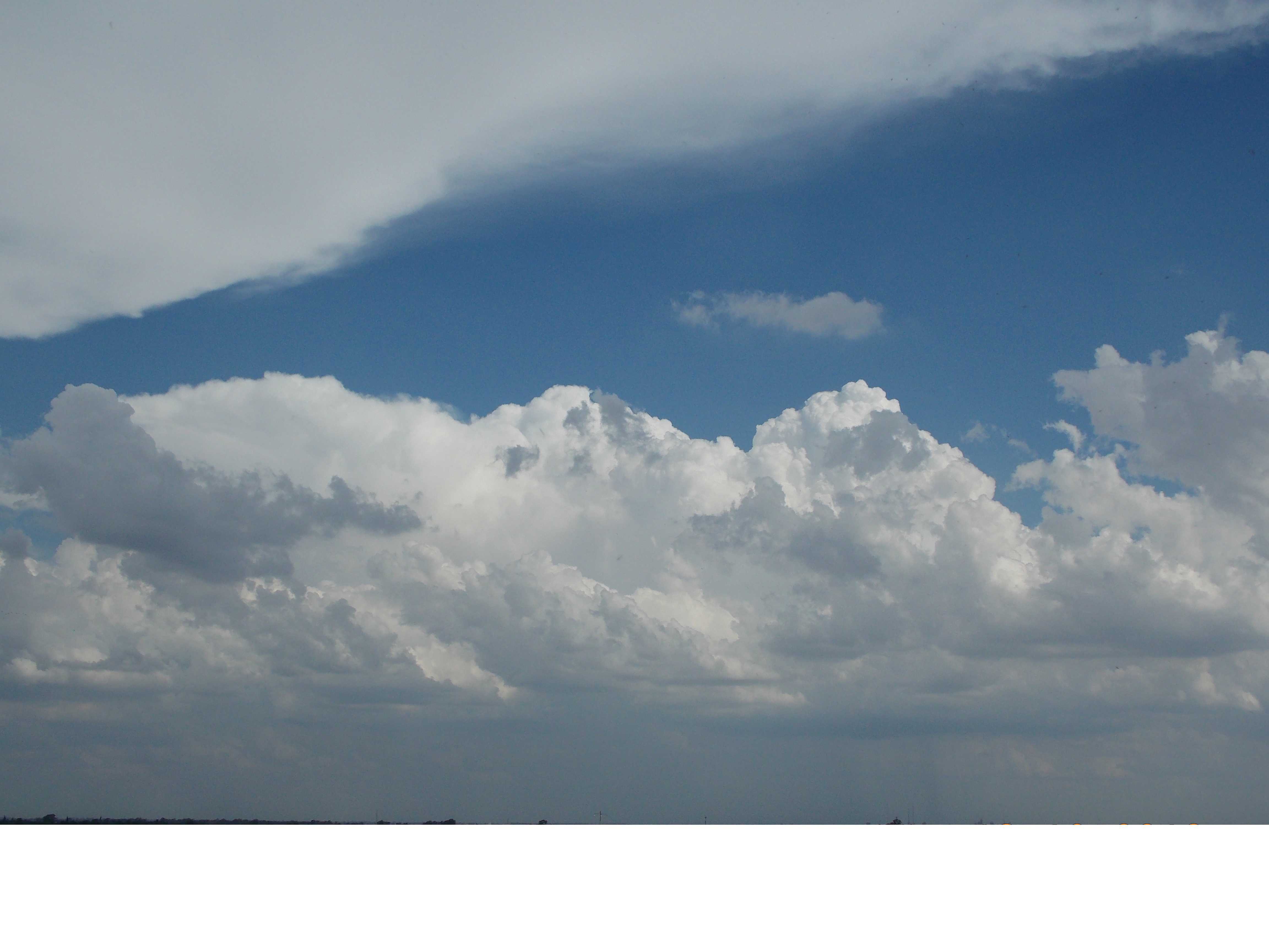
Cumulonimbus capillatus incus and calvus
This photograph illustrates a progression from Cumulus to Cumulonimbus. On the right are the small protuberances and sproutings typical of Cumulus mediocris, and then the stronger outlines, greater vertical extent and cauliflower-like appearance of the bulging upper parts of Cumulus congestus. In the centre, the upper parts of the cloud are becoming indistinct and flattened and have the appearance of a whitish mass without sharp outlines, which is typical of Cumulonimbus calvus. On the left, the cloud has taken on a fibrous appearance, having developed into Cumulonimbus capillatus. The anvil (incus) is just visible on the left-hand edge, but is mostly obscured by the grey cloud. Overhead, as a result of the spreading out of an anvil, a dense layer of Cirrus spissatus cumulonimbogenitus has formed.
Links in the image description will highlight features on the image. Mouse over the features for more detail.
© Victor OviedoColón Department, Cordoba, ArgentinaLatitude: 31° 11' 24'' SLongitude: 64° 7' 48'' W18 December 2013 1934 (Local Time)Camera direction: towards SECL = 9, CM = 0, CH = 3Image P/S code: S.10.2 3Image I.D.: 5809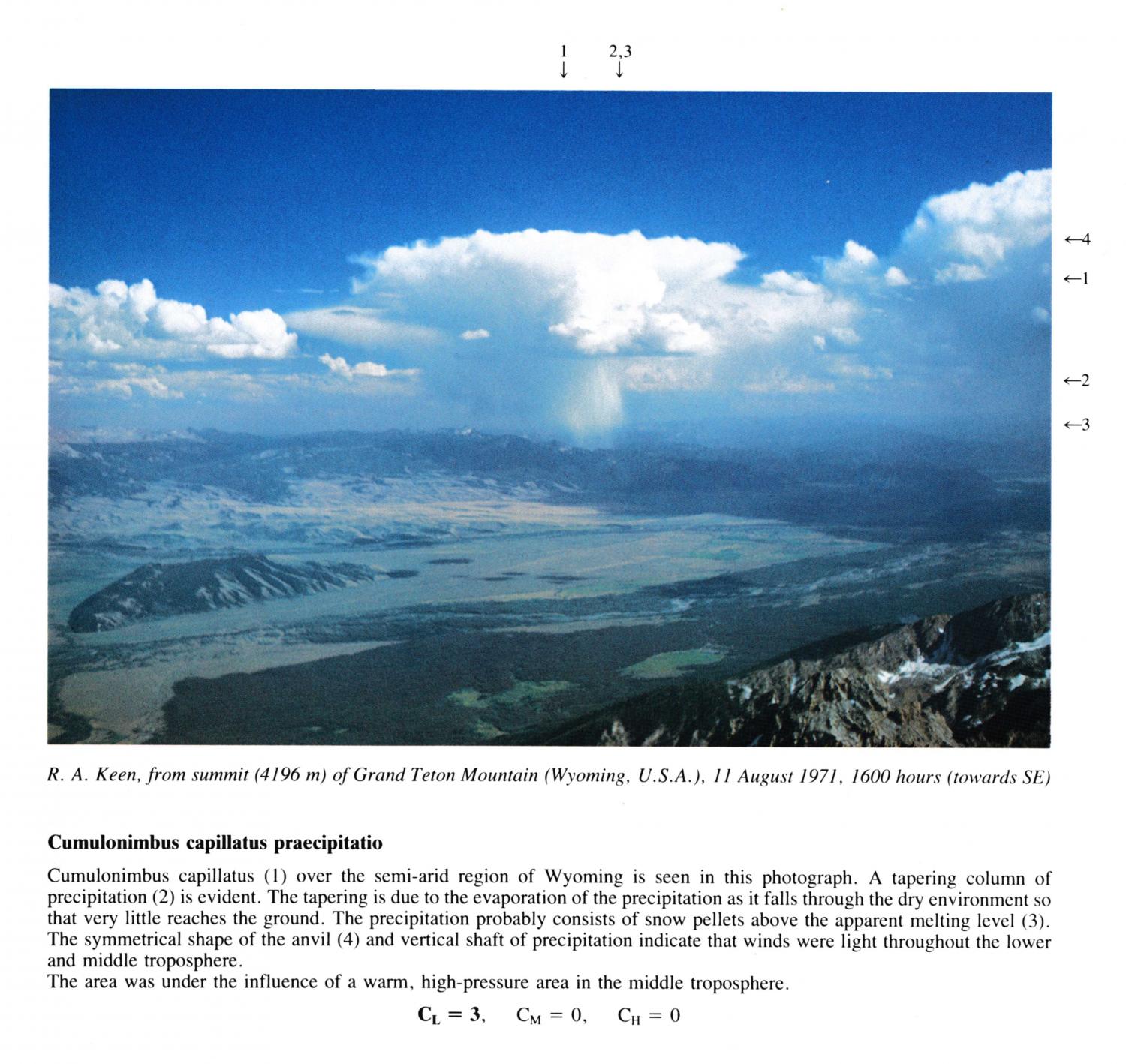
Cumulonimbus capillatus praecipitatio
Cumulonimbus capillatus over the semi-arid region of Wyoming is seen in this photograph. A tapering column of precipitation is evident. The tapering is due to the evaporation of the precipitation as it falls through the dry environment so that very little reaches the ground. The precipitation probably consists of snow pellets above the apparent melting level.
The symmetrical shape of the anvil and vertical shaft of precipitation indicate that winds were light throughout the lower and middle troposphere.
The area was under the influence of a warm, high-pressure area in the middle troposphere.
Links in the image description will highlight features on the image. Mouse over the features for more detail.
© R.A. KeenSummit of Grand Teton Mountain, Wyoming, United States of AmericaLatitude: 43° 44' 27'' NLongitude: 110° 48' 12'' W11 August 1971 1600 (Local Time)Camera direction: towards SECL = 3, CM = 0, CH = 0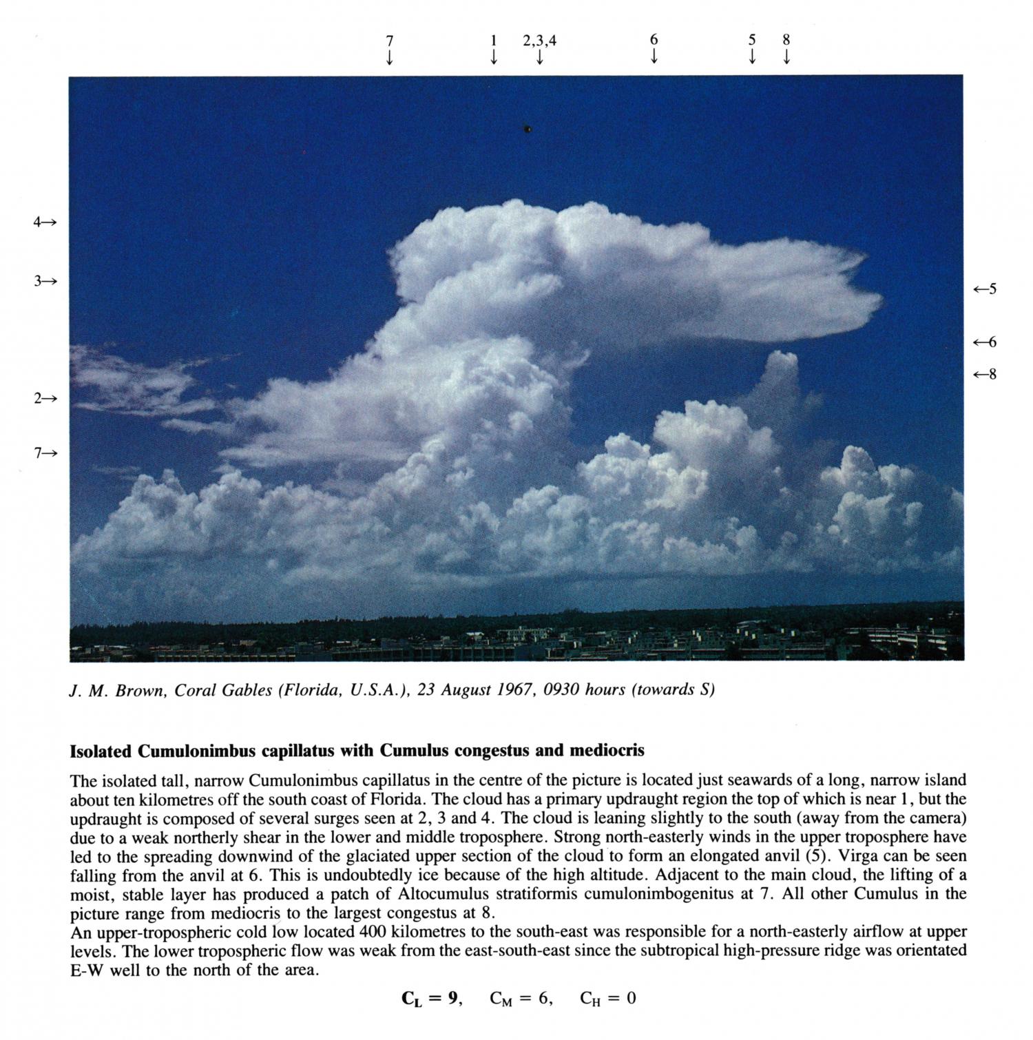
Isolated Cumulonimbus capillatus with Cumulus congestus and mediocris
The isolated tall, narrow Cumulonimbus capillatus in the centre of the picture is located just seawards of a long, narrow island about ten kilometres off the south coast of Florida. The cloud has a primary up-draught region the top of which is near 1, but the updraught is composed of several surges seen at 2, 3 and 4. The cloud is leaning slightly to the south (away from the camera) due to a weak northerly shear in the lower and middle troposphere. Strong north-easterly winds in the upper troposphere have led to the spreading downwind of the glaciated upper section of the cloud to form an elongated anvil. Virga can be seen falling from the anvil at 6. This is undoubtedly ice because of the high altitude. Adjacent to the main cloud, the lifting of a moist, stable layer has produced a patch of Altocumulus stratiformis cumulonimbogenitus at 7. All other Cumulus in the picture range from mediocris to the largest congestus at 8. An upper-tropospheric cold low located 400 kilometres to the south-east was responsible for a north-easterly airflow at upper levels. The lower tropospheric flow was weak from the east-south-east since the subtropical high-pressure ridge was orientated E-W well to the north of the area.
Links in the image description will highlight features on the image. Mouse over the features for more detail.
© J.M. BrownCoral Gables, Florida, United States of AmericaLatitude: 25° 43' 17'' NLongitude: 80° 16' 6'' W23 August 1967 0930 (Local Time)Camera direction: towards SCL = 9, CM = 6, CH = 0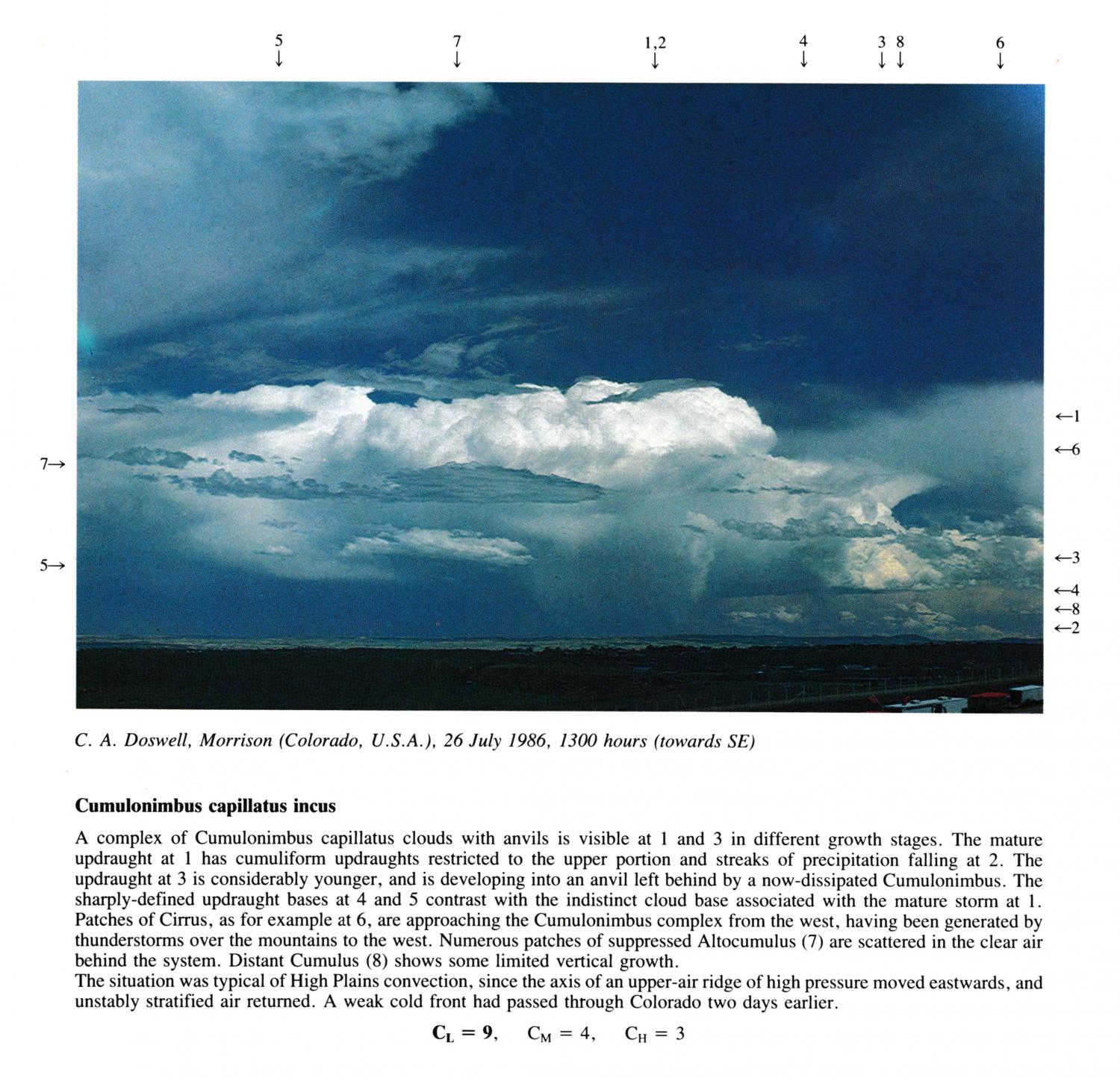
Cumulonimbus capillatus incus
A complex of Cumulonimbus capillatus clouds with anvils is visible at 1 and 3 in different growth stages. The mature updraught at 1 has cumuliform updraughts restricted to the upper portion and streaks of precipitation falling at 2. The updraught at 3 is considerably younger, and is developing into an anvil left behind by a now-dissipated Cumulonimbus. The sharply-defined updraught bases at 4 and 5 contrast with the indistinct cloud base associated with the mature storm at 1. Patches of Cirrus, as for example at 6, are approaching the Cumulonimbus complex from the west, having been generated by thunderstorms over the mountains to the west. Numerous patches of suppressed Altocumulus are scattered in the clear air behind the system. Distant Cumulus shows some limited vertical growth. The situation was typical of High Plains convection, since the axis of an upper-air ridge of high pressure moved eastwards, and unstably stratified air returned. A weak cold front had passed through Colorado two days earlier.
CL = 9, CM = 4, CH = 3
Links in the image description will highlight features on the image. Mouse over the features for more detail.
© C.A. DoswellMorrison, Colorado, United States of AmericaLatitude: 39° 39' 13'' NLongitude: 105° 11' 28'' W26 July 1986 1300 (Local Time)Camera direction: towards SECL = 9, CM = 4, CH = 3
