© Jarmo Koistinen
Espoo, Finland
Latitude: 60° 0' 0'' N
Longitude: 25° 0' 0'' E
06 June 2011 0543 (Local Time)
Camera direction: towards S
Image P/S code: P.1.3
Image I.D.: 5502
CL = 2, CM = 0, CH = 4
-
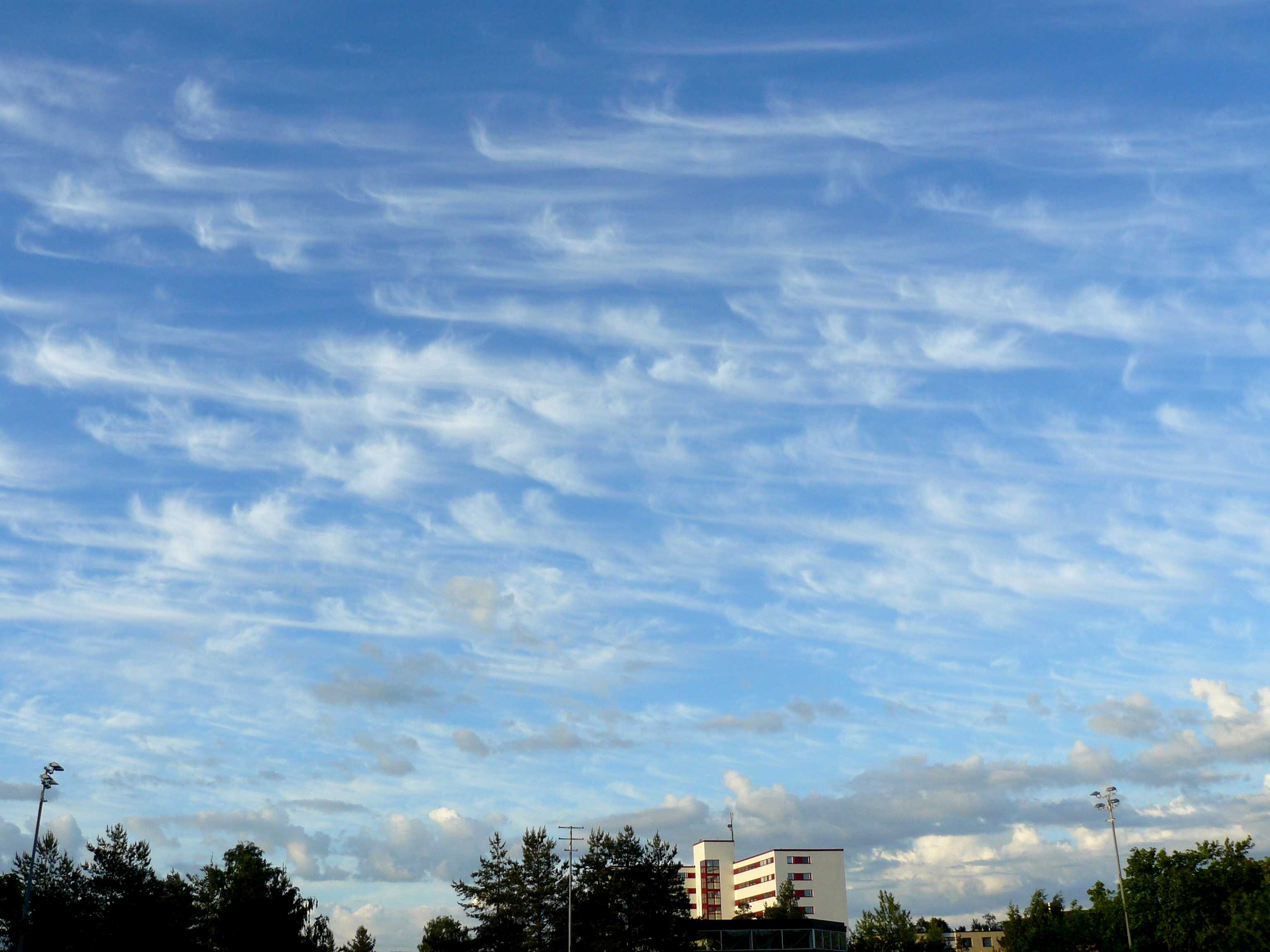
Cirrus uncinus
This is an impressive sky of slowly invading Cirrus uncinus ahead of a warm front. The Cirrus shows the three characteristics of the species uncinus: it is white; comma-shaped and terminating at the top in a hook; and comma-shaped and terminating at the top in a tuft that is not in the form of a rounded protuberance.
Towards the bottom of the image are two species of Stratocumulus: floccus and castellanus. Some of the Stratocumulus castellanus have sufficient vertical development to be identified as Cumulus congestus stratocumulogenitus.
The image was taken ahead of an approaching warm front on the south-western flank of a high pressure area. The Cirrus uncinus increased in amount but by two hours later had moved out of the area. At the time of the observation the Cirrus uncinus was invading, hence the use of CH = 4.
Links in the image description will highlight features on the image. Mouse over the features for more detail.
© Jarmo KoistinenEspoo, FinlandLatitude: 60° 0' 0'' NLongitude: 25° 0' 0'' E06 June 2011 0543 (Local Time)Camera direction: towards SCL = 2, CM = 0, CH = 4Image P/S code: P.1.3Image I.D.: 5502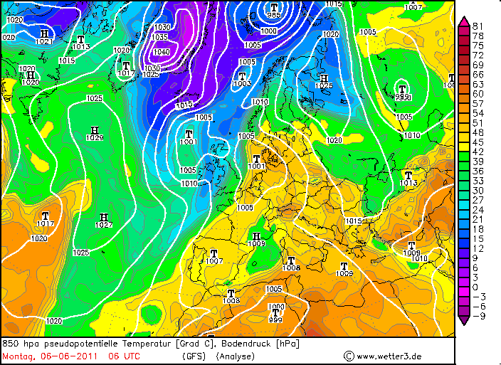
The image was taken ahead of an approaching warm front on the south-western flank of a high pressure area. It was a weak front due to the influence of this high pressure system. It is difficult to determine the location of the front at ground level. The equivalent potential temperature at 850 hPa suggests the front was very close to Espoo, Finland, whereas the thickness and advection chart positions the front 200–300 km to the south.
© www.wetter3.de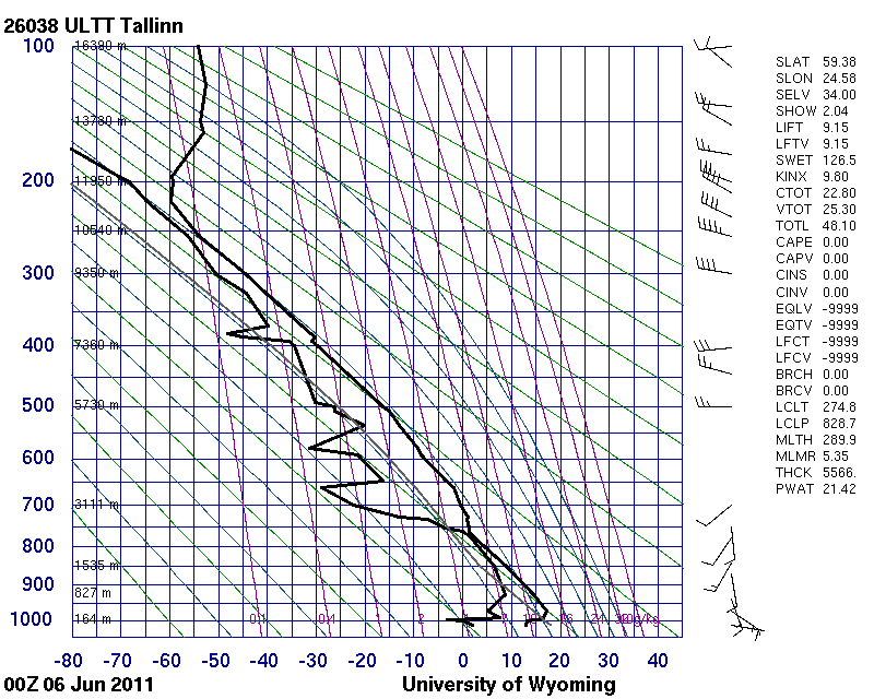
The sounding is from 80 km to the south and 4 hours earlier. During the night, a surface inversion developed that was even stronger on the Finnish continent. The sounding shows a conditionally unstable layer from the top of the surface inversion (noting that the inversion was stronger – that is, warmer – over mainland Finland than in Tallinn, Estonia) to 2 400 m (760 hPa) that is capped by a more stable and drier middle troposphere. An outbreak of deep convection was not possible at the time of the sounding.
© University of Wyoming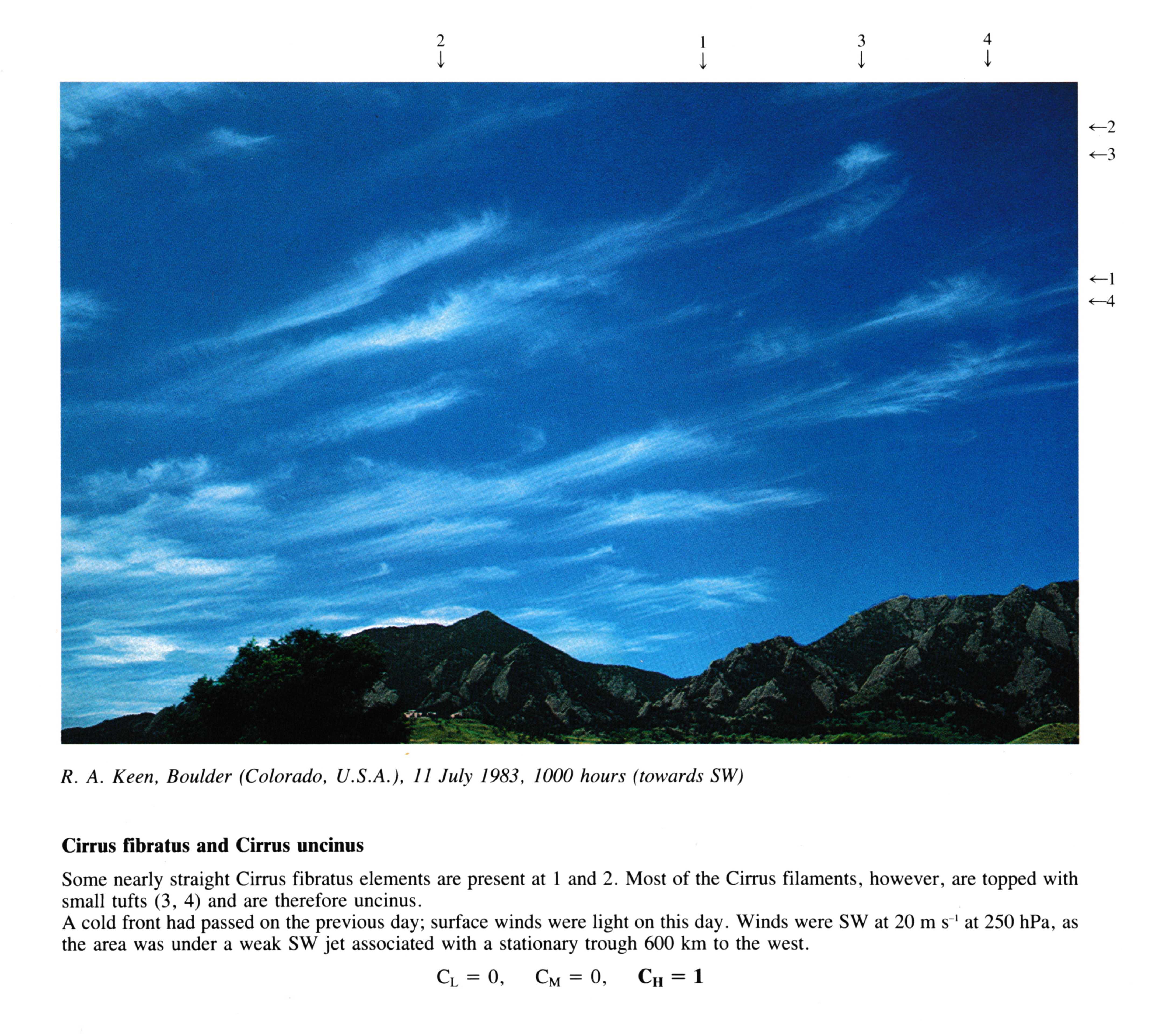
Cirrus fibratus and Cirrus uncinus
Some nearly straight Cirrus fibratus elements are present at 1 and 2. Most of the Cirrus filaments, however, are topped with small tufts(3, 4) and are therefore uncinus. A cold front had passed on the previous day; surface winds were light on this day. Winds were SW at 20 m s-1 at 250 hPa, as the area was under a weak SW jet associated with a stationary trough 600 km to the west.
Links in the image description will highlight features on the image. Mouse over the features for more detail.
© R.A. KeenBoulder, Colorado, United States of AmericaLatitude: 40° 0' 54'' NLongitude: 105° 16' 14'' W11 July 1983 1000 (Local Time)Camera direction: towards SWCL = 0, CM = 0, CH = 1