© Eric Van Lochem
Cheyenne, Wyoming, United States of America
Latitude: 41° 32' 37'' N
Longitude: 104° 19' 9'' W
07 June 2012 1830 (Local Time)
Camera direction: towards NW
Image P/S code: S.10.8
Image I.D.: 5554
CL = 9, CM = /, CH = /
-
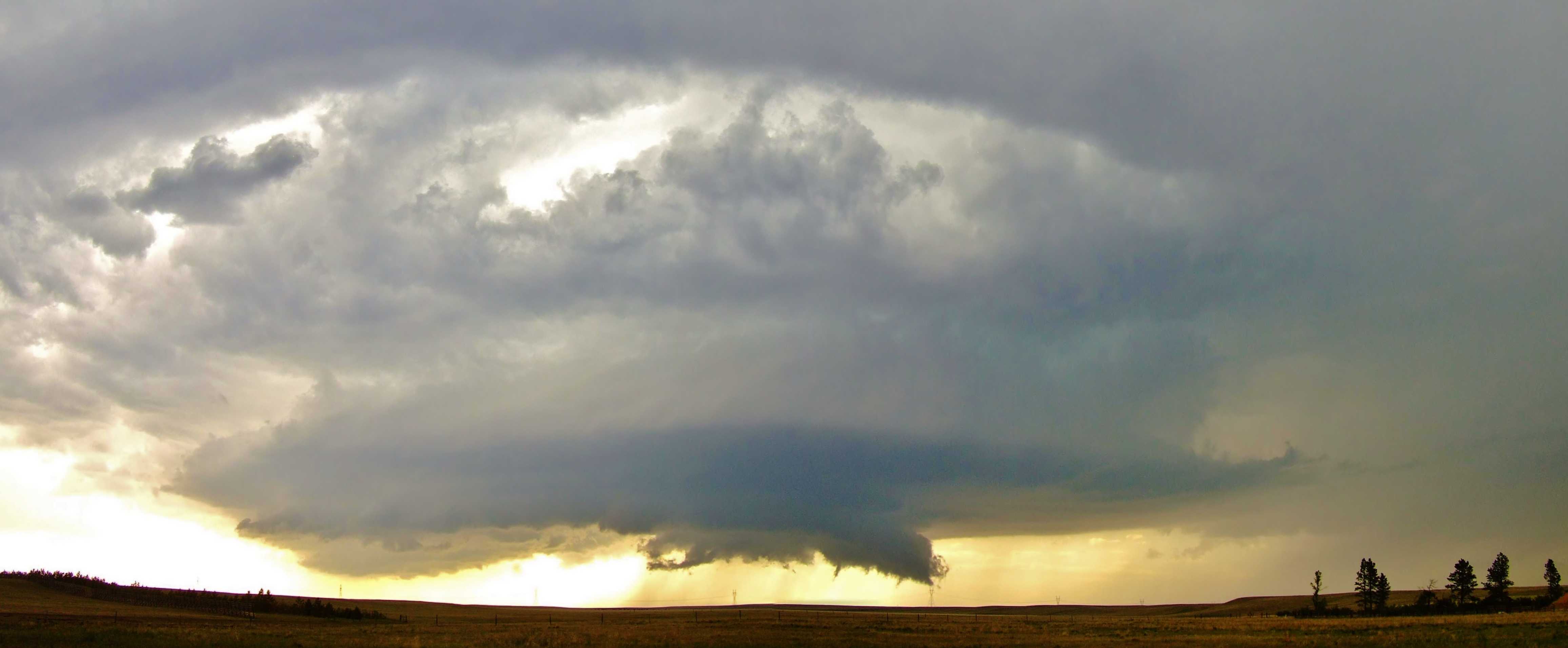
Cumulonimbus praecipitatio murus
Isolated supercell storms developed east of the Rocky Mountains during the late afternoon hours, tracking south-east across eastern Wyoming, USA. The severe convective storm pictured here sported a large and persistent wall cloud (supplementary feature murus), easily seen here under the rain-free base, accompanied by several brief funnel clouds, as it slowly moved from Chugwater, Wyoming toward the Nebraska-Colorado border. Precipitation can be seen on the right of the image.
The wall cloud (murus) is a localized, persistent, and often abrupt lowering of the cloud from the base of a Cumulonimbus. It typically develops in the rain-free portion of a thunderstorm and indicates an area of strong updraft, usually associated with a supercell or severe multicell storm. Murus (wall clouds) that exhibit significant rotation and vertical motion may result in the formation of funnel clouds and tornadoes.
Links in the image description will highlight features on the image. Mouse over the features for more detail.
© Eric Van LochemCheyenne, Wyoming, United States of AmericaLatitude: 41° 32' 37'' NLongitude: 104° 19' 9'' W07 June 2012 1830 (Local Time)Camera direction: towards NWCL = 9, CM = /, CH = /Image P/S code: S.10.8Image I.D.: 5554