© Hernàn Palmisciano
Almagro, Buenos Aires, Argentina
Latitude: 34° 36' 31'' S
Longitude: 58° 25' 18'' W
13 March 2012 0237 (Local Time)
Camera direction: towards NE
Image P/S code: S.14.1
Image I.D.: 5568
CL = 9, CM = /, CH = /
-
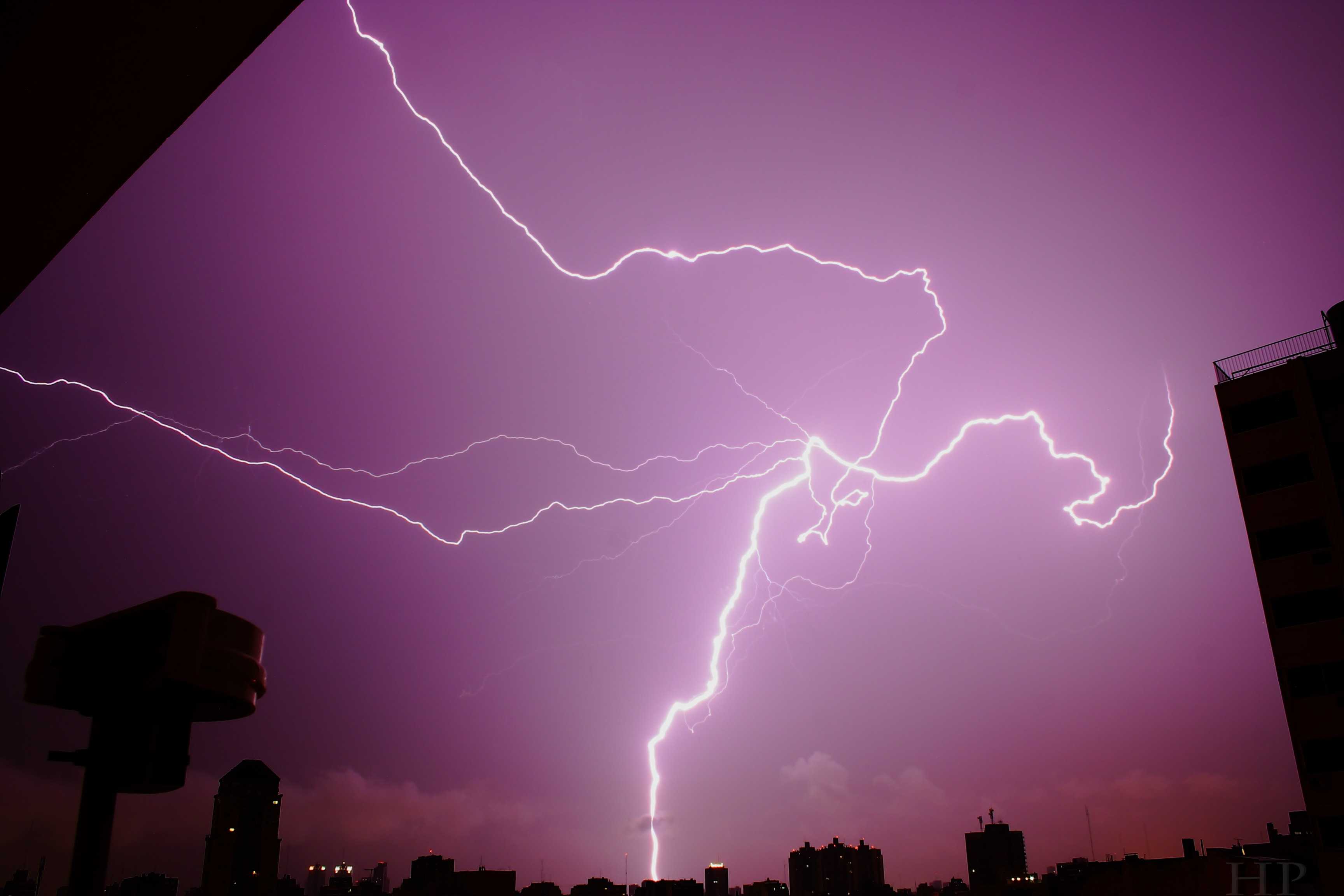
Cloud and ground lightning discharges
Lightning electrical discharges often follow a tortuous course. Here one connects with the ground as a cloud-to-ground discharge while others travel horizontally for some distance within or beneath the cloud.
Links in the image description will highlight features on the image. Mouse over the features for more detail.
© Hernàn PalmiscianoAlmagro, Buenos Aires, ArgentinaLatitude: 34° 36' 31'' SLongitude: 58° 25' 18'' W13 March 2012 0237 (Local Time)Camera direction: towards NECL = 9, CM = /, CH = /Image P/S code: S.14.1Image I.D.: 5568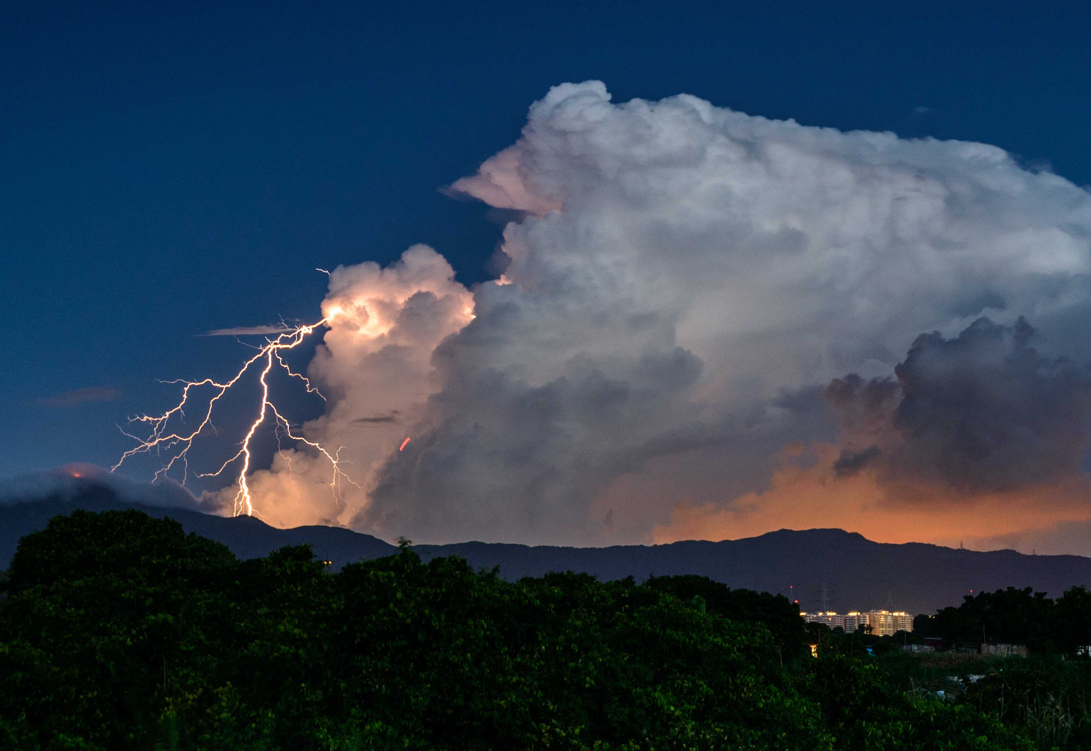
Thunderstorm
A tropical depression over the northern part of the South China Sea intensified into a tropical storm named Mirinae. In Hong Kong (China), the weather was hot with sunny periods during the day and there were also a few squally showers and thunderstorms.
Thunderstorms are associated with Cumulonimbus clouds and are most often accompanied by precipitation. This photograph shows a thunderstorm during the evening from a Cumulonimbus calvus cloud. A thunderstorm is defined as one or more sudden electrical discharges, manifested by a flash of light (lightning) and a sharp or rumbling sound (thunder).
Links in the image description will highlight features on the image. Mouse over the features for more detail.
© Sung Lok CheungYuen Long, Hong Kong, ChinaLatitude: 22° 28' 33'' NLongitude: 114° 1' 20'' E26 July 2016 1934 (Local Time)Camera direction: towards SECL = 3, CM = 0, CH = 0Image P/S code: P.14.1Image I.D.: 4997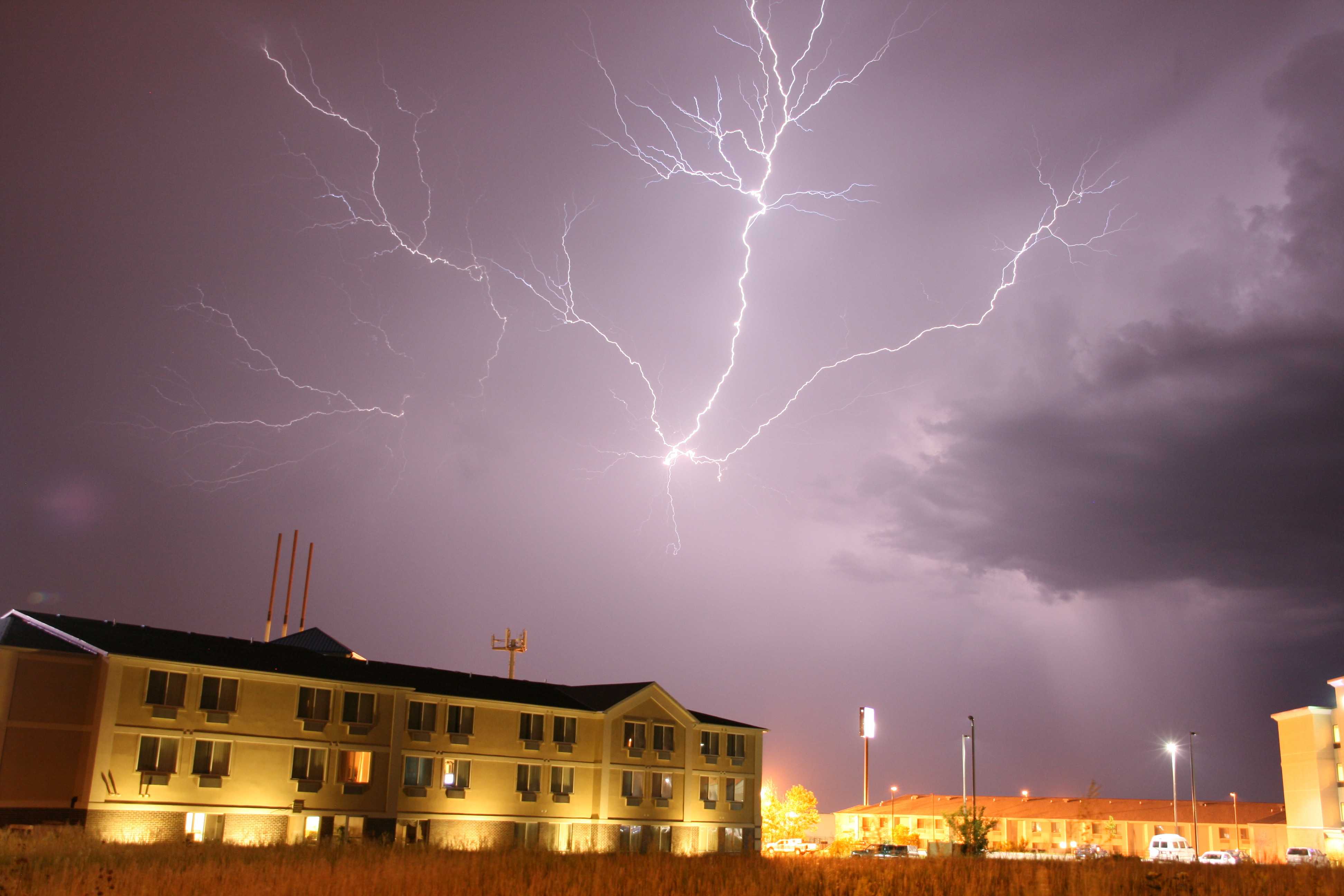
“Anvil crawler” lightning
This picture shows lightning branching through the anvil of a strong mid-level thunderstorm over Lincoln, Nebraska, USA. These cloud discharges are colloquially known as ”anvil crawlers”.
A rain-free updraught base can be seen at the right-hand side of the image. Elsewhere, cloud detail is masked by heavy precipitation. Shafts of precipitation are evident near to the rain-free updraught base.
Links in the image description will highlight features on the image. Mouse over the features for more detail.
© Matthew ClarkLincoln, Nebraska, United States of AmericaLatitude: 40° 48' 49'' NLongitude: 96° 38' 4'' W01 June 2009 0015 (Local Time)Camera direction: towards SWCL = 3, CM = 0, CH = 0Image P/S code: P.14.1.1.2.1Image I.D.: 5074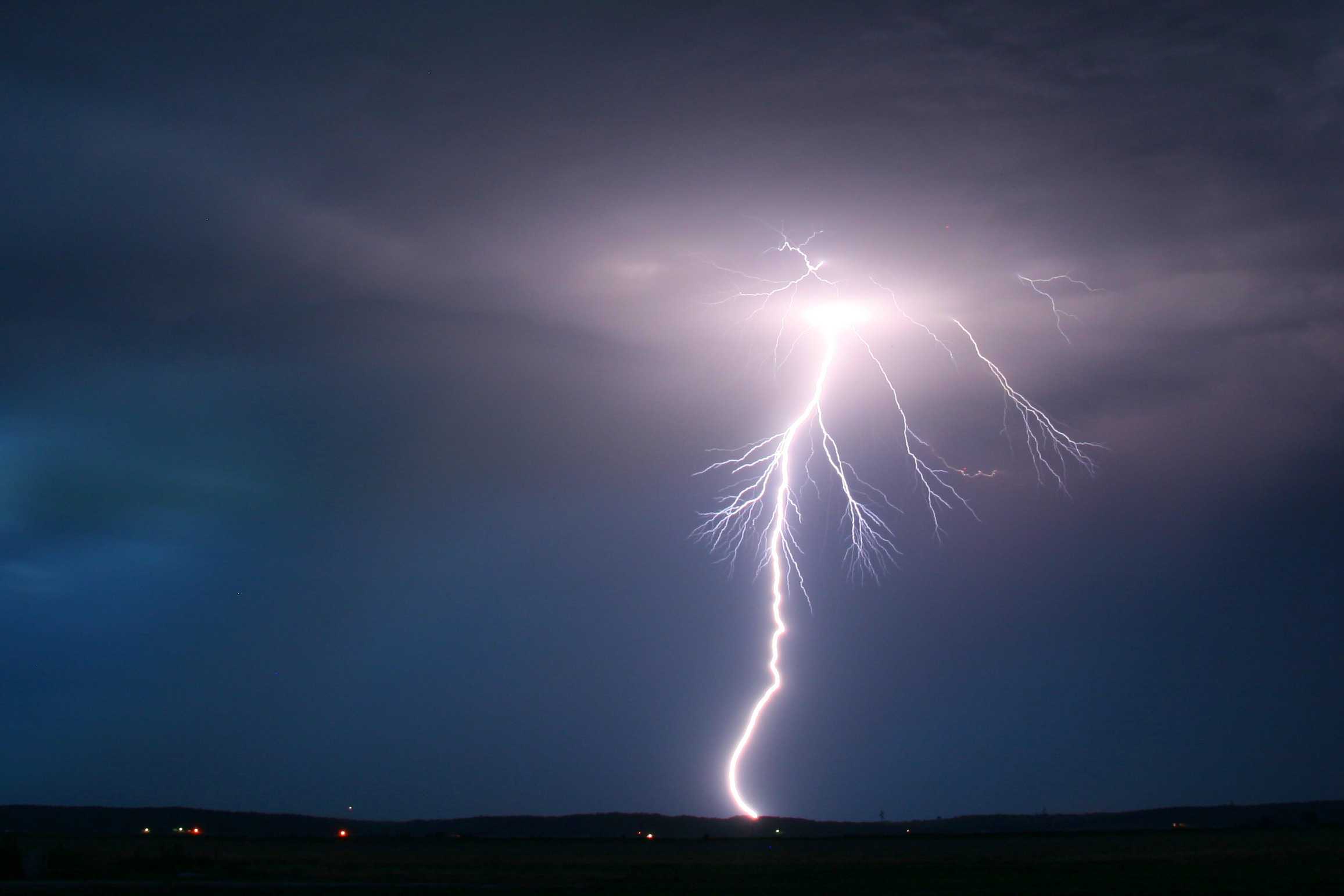
Lightning: ground discharge
This photograph shows a cloud-to-ground lightning discharge from a rather high-based evening thunderstorm over Iowa, USA.
Links in the image description will highlight features on the image. Mouse over the features for more detail.
© Matthew ClarkPrairie, Iowa, United States of AmericaLatitude: 40° 45' 9'' NLongitude: 95° 33' 53'' W31 May 2009 2200 (Local Time)Camera direction: towards ECL = 3, CM = 0, CH = 0Image P/S code: P.14.0Image I.D.: 5073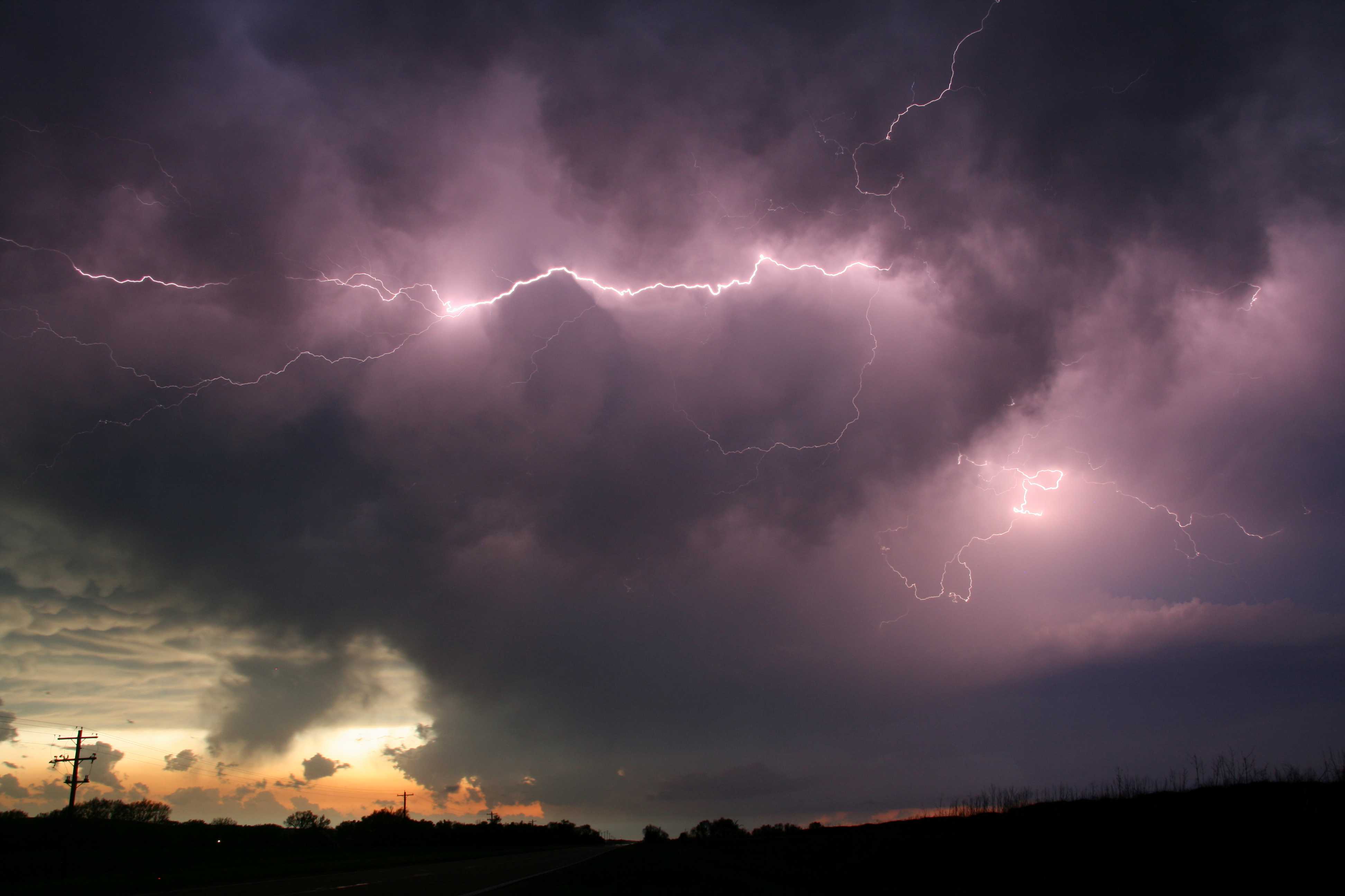
Lightning: cloud discharges
This picture shows cloud discharges of lightning at 1 and 2 during an evening thunderstorm over Nebraska, USA. The thunderstorm was rather high-based, and mamma can be seen in the distance where part of the extensive anvil of the storm is visible. A small updraught base is visible at the lower right, with cumuliform clouds growing into the storm. Cumulus fractus clouds are evident underneath the storm, with other Cumulus species in the distance.
Links in the image description will highlight features on the image. Mouse over the features for more detail.
© Matthew ClarkHamlet, Nebraska, United States of AmericaLatitude: 40° 21' 7'' NLongitude: 101° 7' 25'' W23 May 2010 2000 (Local Time)Camera direction: towards WCL = 3, CM = 0, CH = 0Image P/S code: P.14.1.1.2Image I.D.: 5081