© Rodney Hale
Houghton Conquest, Bedford, Central Bedfordshire MK45, United Kingdom of Great Britain and Northern Ireland
Latitude: 52° 4' 5'' N
Longitude: 0° 28' 17'' W
25 August 2012 1436 (Local Time)
Camera direction: towards NW
Image P/S code: S.10.3
Image I.D.: 5586
CL = 9, CM = 6, CH = 0
-
Extensive line of Cumulus congestus, Cumulonimbus calvus and capillatus incus praecipitatio
The image shows a flanking line of Cumulonimbus calvus and Cumulus congestus in front of a line of mature Cumulonimbus capillatus incus cells. Distant precipitation is falling from the latter line.
Ragged patches of Cumulus fractus are in the foreground, as is Stratocumulus and Altocumulus formed from the spreading of parts of Cumulonimbus.
Links in the image description will highlight features on the image. Mouse over the features for more detail.
© Rodney HaleHoughton Conquest, Bedford, Central Bedfordshire MK45, United Kingdom of Great Britain and Northern IrelandLatitude: 52° 4' 5'' NLongitude: 0° 28' 17'' W25 August 2012 1436 (Local Time)Camera direction: towards NWCL = 9, CM = 6, CH = 0Image P/S code: S.10.3Image I.D.: 5586
Unsettled conditions as a low pressure system moved eastward across Wales and central England, UK
© Crown Copyright
Conditionally unstable and high moisture content from the surface to the tropopause at 268 hPa
© University of Wyoming Cumulonimbus cells over southern and central England, UK© EUMETSAT, 2012
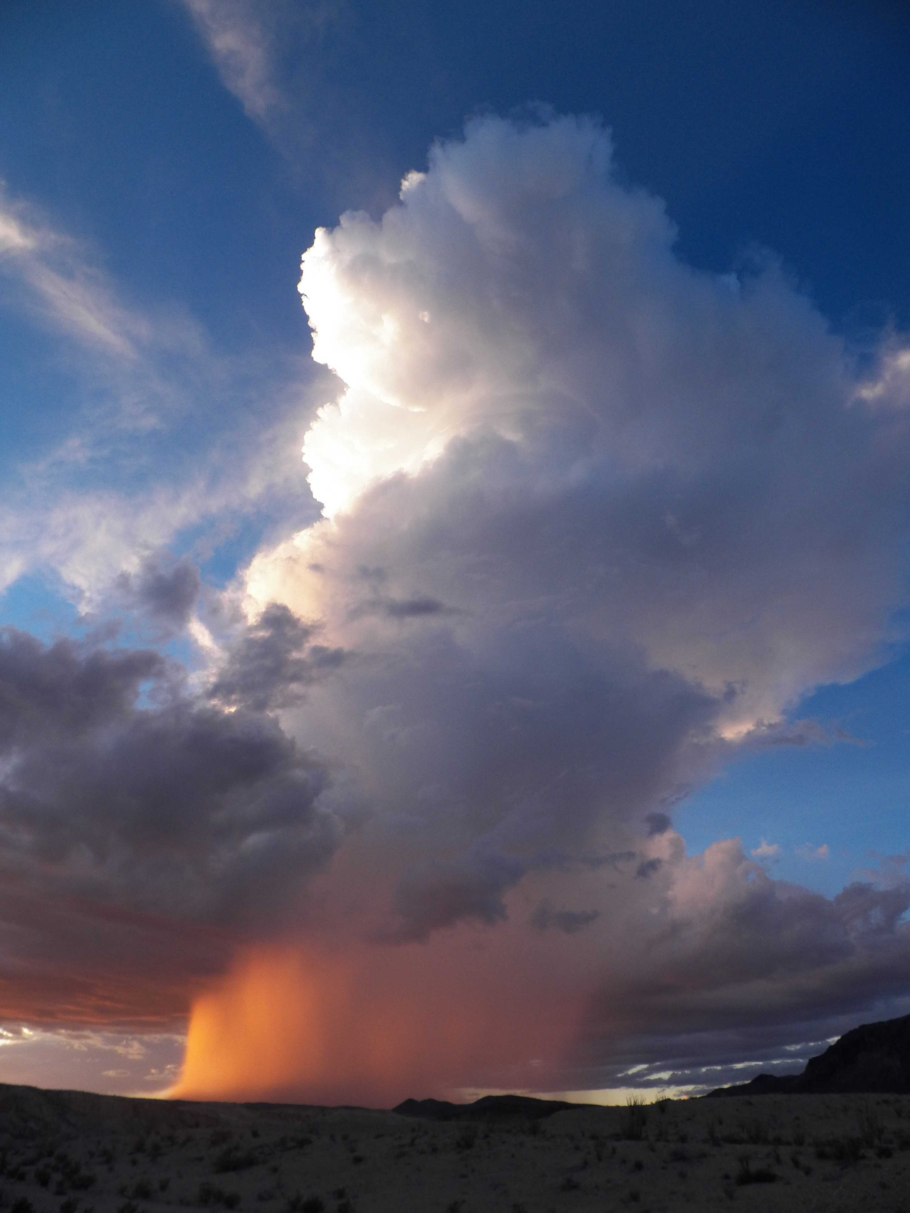
Cumulonimbus capillatus incus praecipitatio
This image shows the strong vertical extent of a rising tower of Cumulonimbus cloud. The top is lit by the evening Sun, rendering the left-hand side bright white, while the remainder of the cloud is darker. The cloud top to the right is fibrous, indicating the species capillatus, with an anvil shearing off to the right – the supplementary feature incus. The top of the cloud (as seen from this perspective) is losing sharpness as this cell transitions from Cumulus congestus to Cumulonimbus. Beneath the cloud, the Sun is lighting up a strong precipitation shaft - the supplementary feature praecipitatio. The dark grey cloud almost surrounding the powerful convective cloud is Stratocumulus, while the white fibrous cloud to the upper left is Cirrus fibratus.
Links in the image description will highlight features on the image. Mouse over the features for more detail.
© Frann BrothersTerlingua, Texas, United States of AmericaLatitude: 29° 19' 18'' NLongitude: 103° 36' 58'' W21 August 2014 1800 (Local Time)Camera direction: towards NWCL = 9, CM = 0, CH = 1Image P/S code: P.10.3Image I.D.: 4752

