© Peter Sunden
Camp Arifjan, Al Ahmadi Governorate, Kuwait
Latitude: 28° 55' 12'' N
Longitude: 48° 9' 0'' E
10 April 2007 0800 (Local Time)
Image P/S code: S.12.2.2
Image I.D.: 5613
-
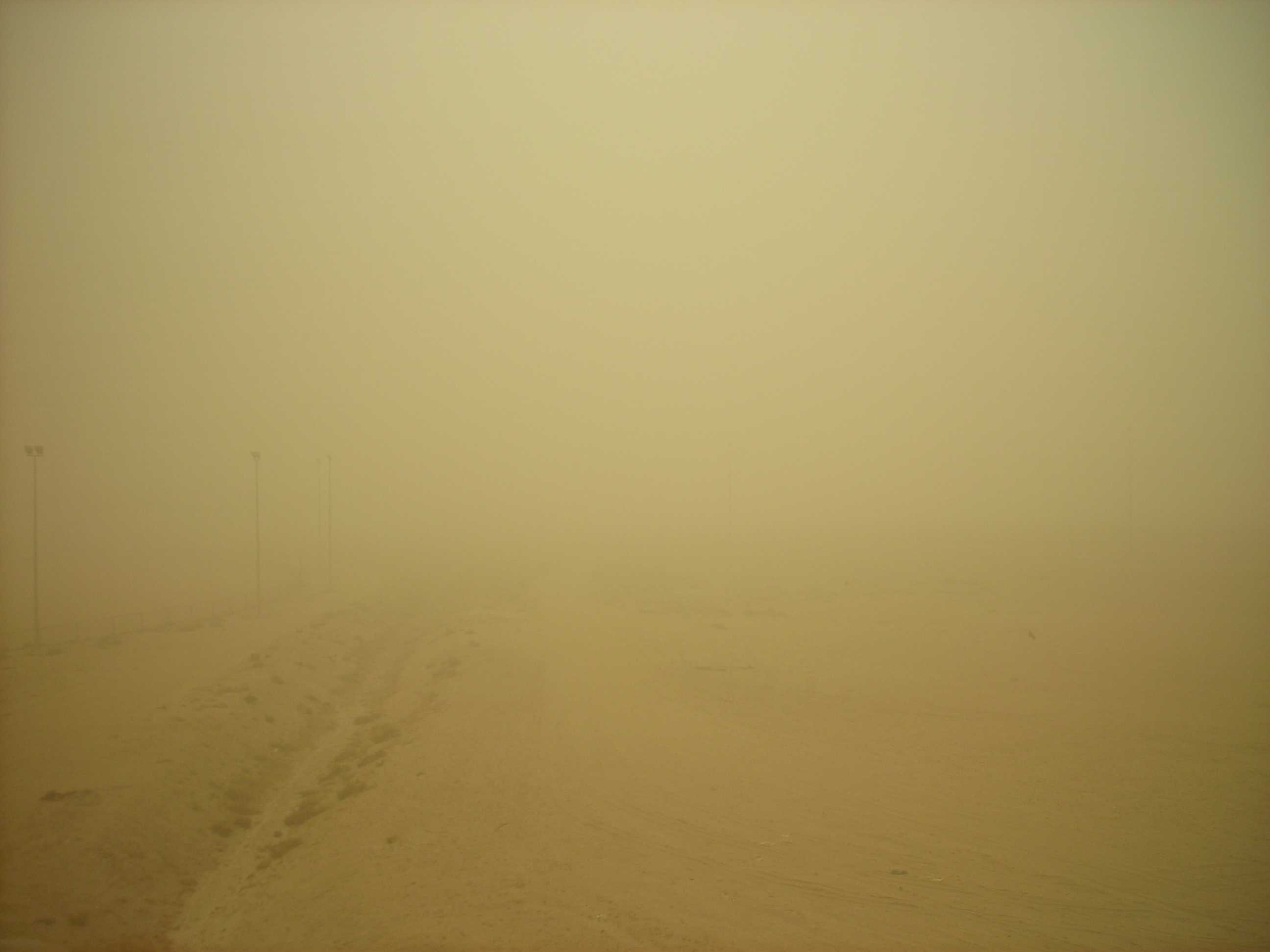
Arrival of a dust storm/sandstorm
In this final picture in the series, the dust storm or sandstorm is now well established over the location. The visibility is very substantially reduced by the numerous particles of dust or sand blowing in the air.
Links in the image description will highlight features on the image. Mouse over the features for more detail.
© Peter SundenCamp Arifjan, Al Ahmadi Governorate, KuwaitLatitude: 28° 55' 12'' NLongitude: 48° 9' 0'' E10 April 2007 0800 (Local Time)Image P/S code: S.12.2.2Image I.D.: 5613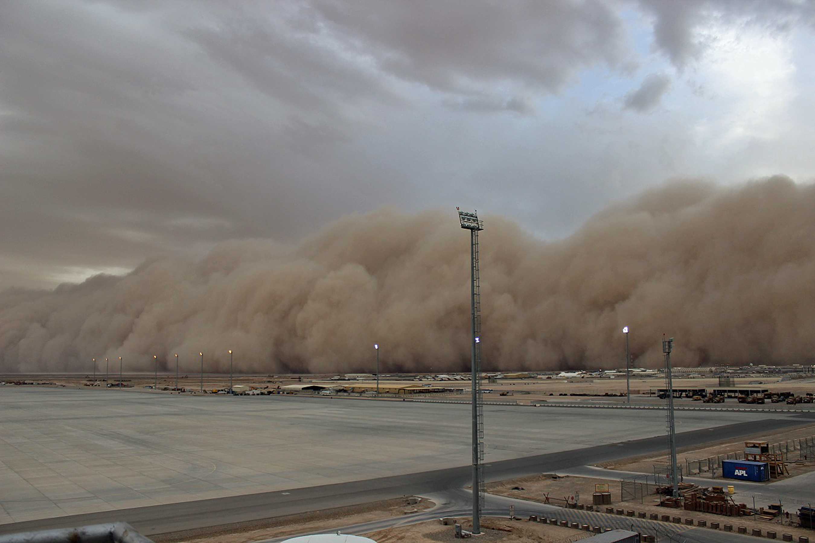
Dust storm
A dust storm or sandstorm (commonly known as a haboob) is an ensemble of dust or sand energetically lifted to great height by a strong and turbulent wind.
This picture shows a dust storm in Helmand Province, Afghanistan. The dust was raised by the downdraft from a high-based thunderstorm.
The forward portion of a dust storm often has the appearance of a wide and high wall that advances fairly rapidly, as in this picture. The leading edge of the “wall of dust” marks the location of the advancing gust front. This dust storm reduced visibility to about 10 m and a maximum wind gust of over 50 kt was recorded. Conditions improved after about an hour.
Links in the image description will highlight features on the image. Mouse over the features for more detail.
© Mike BakerCamp Bastion, near Nad-e Ali, Helmand Province, AfghanistanLatitude: 31° 51' 11'' NLongitude: 64° 13' 12'' E16 May 2014 1345 (Local Time)Image P/S code: P.12.2.2Image I.D.: 4838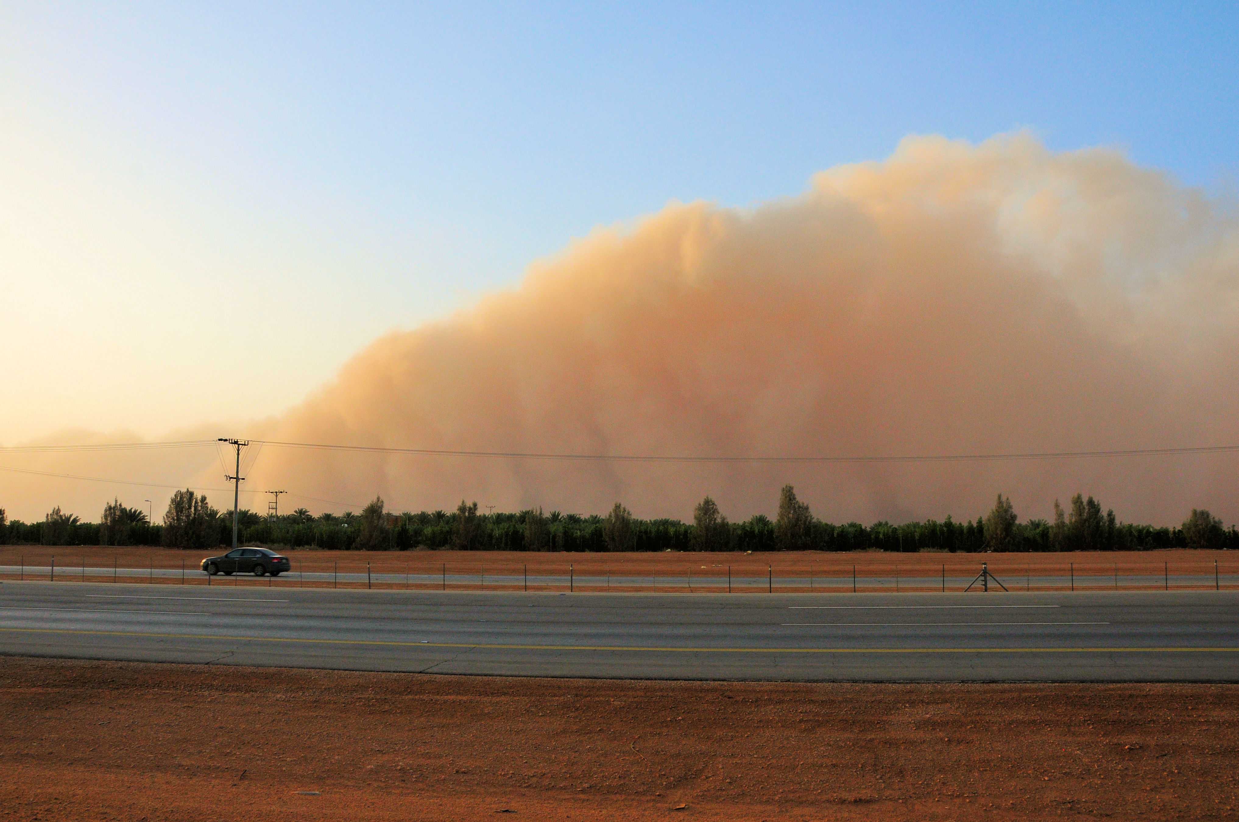
Sandstorm
A sandstorm or dust storm is an ensemble of sand or dust particles energetically lifted to great heights by a strong and turbulent wind. The forward portion of a sandstorm often has the appearance of a wide and high wall that advances fairly rapidly, as in this picture, taken along the Riyadh to Makkah highway in Saudi Arabia.
Links in the image description will highlight features on the image. Mouse over the features for more detail.
© Clifford O'LearyAl-Gjullah, Riyadh, Saudi ArabiaLatitude: 24° 17' 24'' NLongitude: 45° 44' 10'' E13 April 2012 1858 (Local Time)Image P/S code: P.12.0Image I.D.: 5429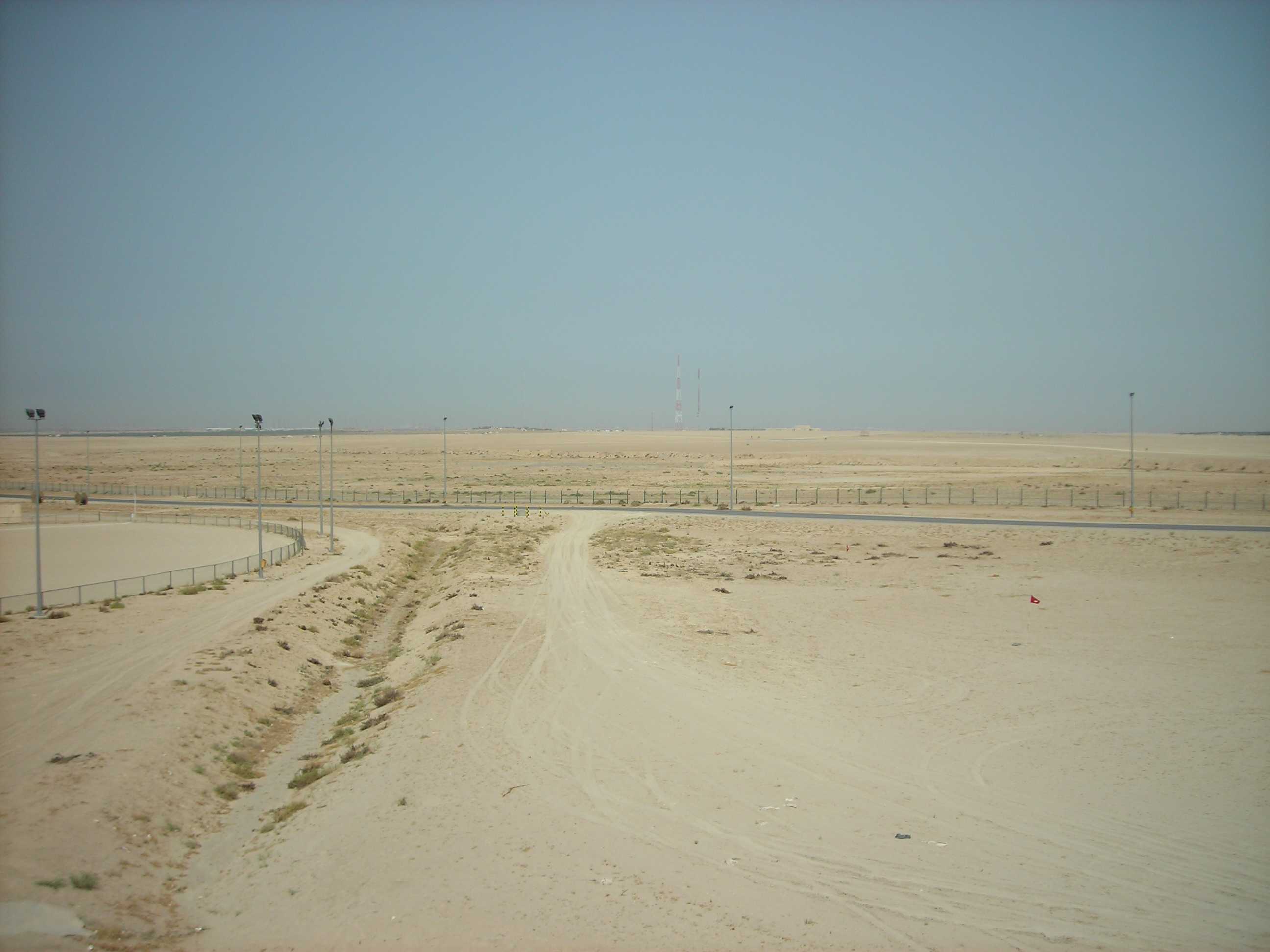
Arrival of a dust storm/sandstorm
This is the first in a series of four pictures that show the onset of a dust storm or sandstorm due to shamal winds.
In this image there is a slight haze. Also, note that the sky is blue at this stage.
Links in the image description will highlight features on the image. Mouse over the features for more detail.
© Peter SundenCamp Arifjan, Al Ahmadi Governorate, KuwaitLatitude: 28° 55' 12'' NLongitude: 48° 9' 0'' E10 April 2007 0800 (Local Time)Image P/S code: S.12.2.2Image I.D.: 5610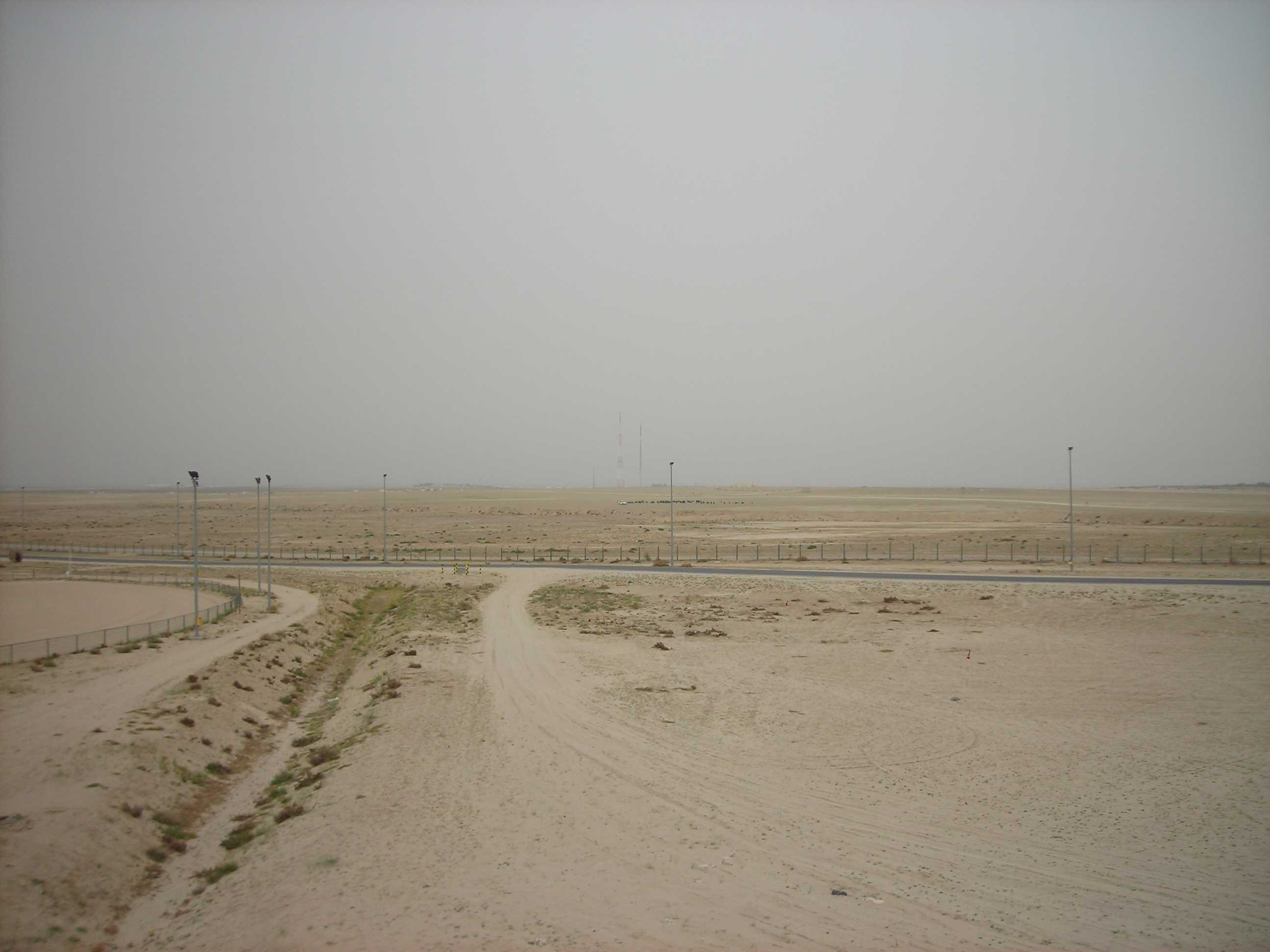
Arrival of a dust storm/sandstorm
In this second picture in the series, the visibility is similar to the previous image; however, note that the sky colour has changed. There is now a suspension in the air of dust or small sand particles (dust haze), raised from the ground as a result of strong winds some distance away from the location.
Links in the image description will highlight features on the image. Mouse over the features for more detail.
© Peter SundenCamp Arifjan, Al Ahmadi Governorate, KuwaitLatitude: 28° 55' 12'' NLongitude: 48° 9' 0'' E10 April 2007 0800 (Local Time)Image P/S code: S.12.2.2Image I.D.: 5611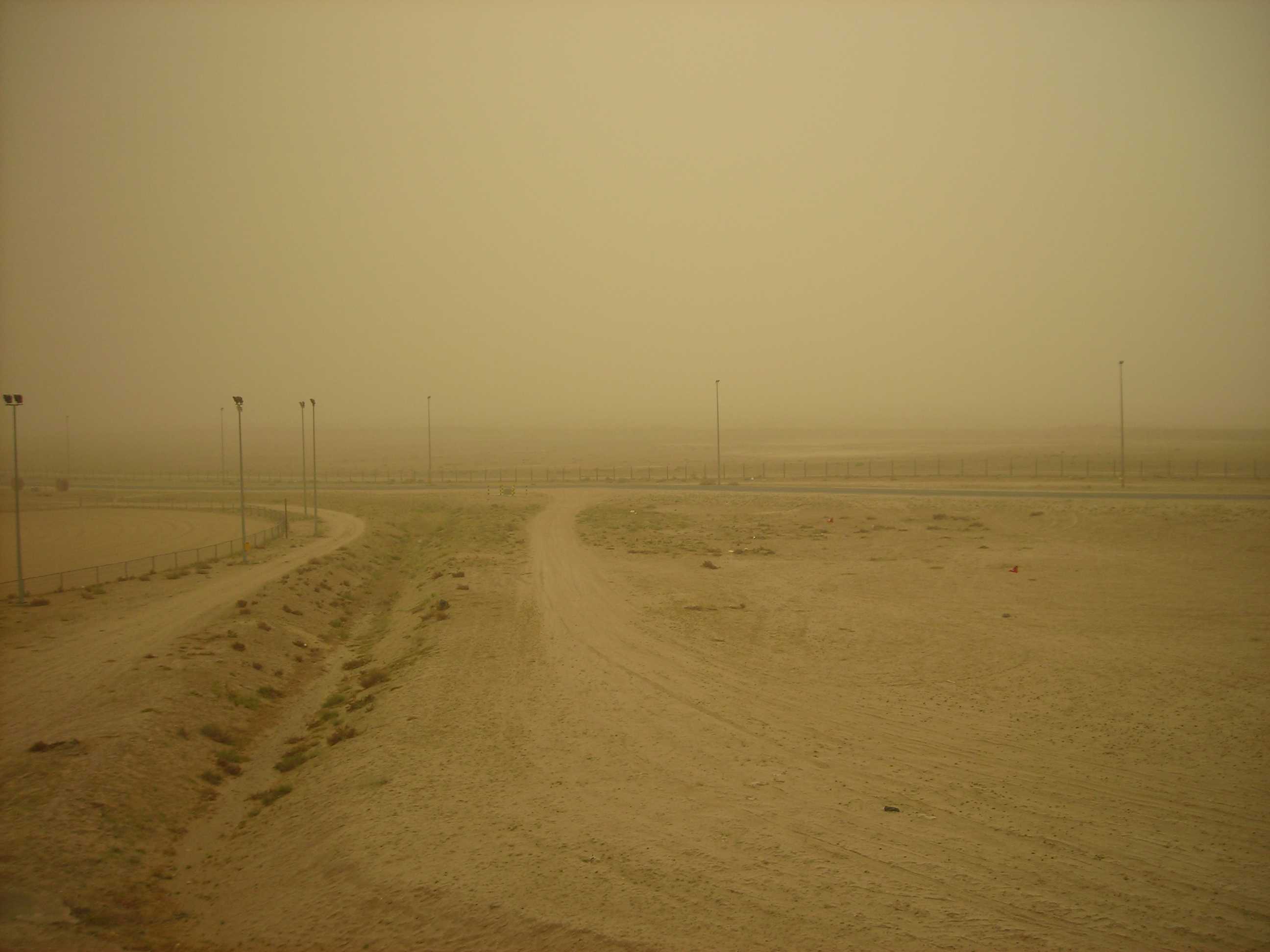
Arrival of a dust storm/sandstorm
In this picture, the third in the series, a dust storm or sandstorm is arriving at the location and the visibility is deteriorating rapidly.
Links in the image description will highlight features on the image. Mouse over the features for more detail.
© Peter SundenCamp Arifjan, Al Ahmadi Governorate, KuwaitLatitude: 28° 55' 12'' NLongitude: 48° 9' 0'' E10 April 2007 0800 (Local Time)Image P/S code: S.12.2.2Image I.D.: 5612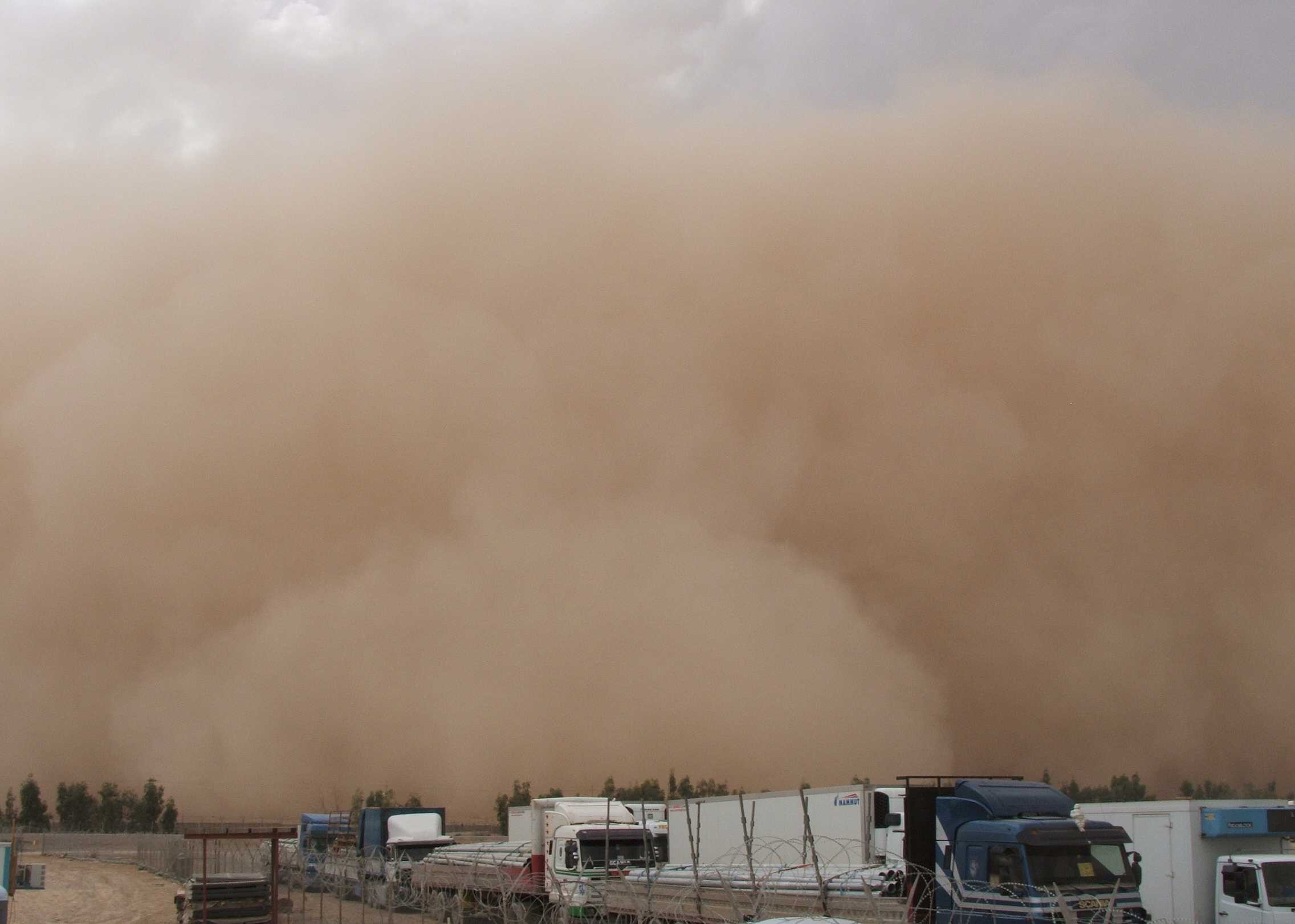
Sandstorm
A sandstorm or dust storm is an ensemble of sand or dust particles energetically lifted to great heights by a strong and turbulent wind. The forward portion of a sandstorm, like the one in this picture, often has the appearance of a wide and high wall that advances fairly rapidly – a “wall of sand”.
Links in the image description will highlight features on the image. Mouse over the features for more detail.
© Andrew ChopeFallujah, Al Anbar, IraqLatitude: 33° 21' 45'' NLongitude: 43° 45' 55'' E08 May 2006 1426 (Local Time)Image P/S code: S.12.2.2Image I.D.: 5614