© Yves Courtel
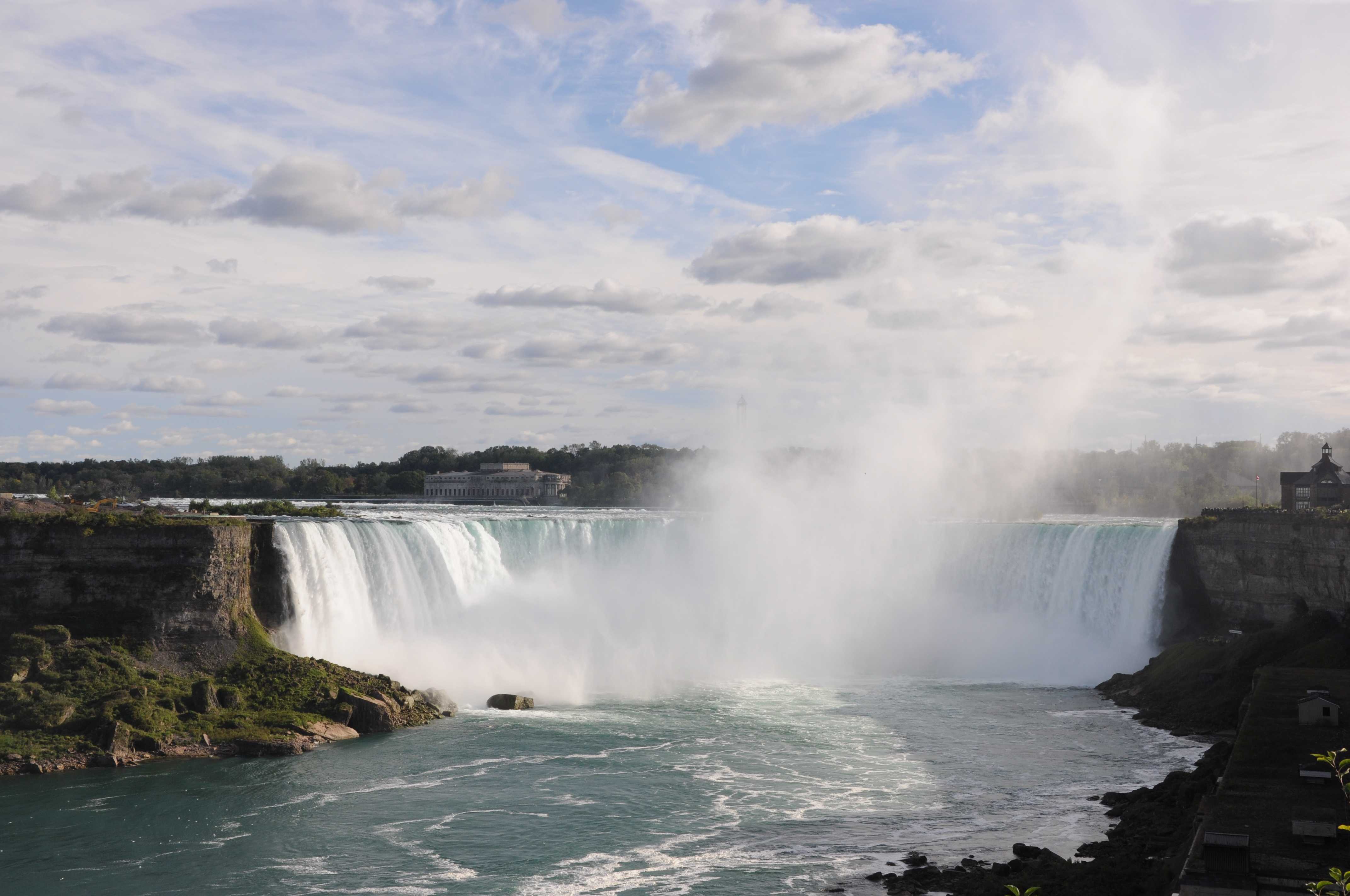
Niagara Falls, Ontario, Canada
Latitude: 43° 5' 17'' N
Longitude: 79° 4' 21'' W
02 October 2015 1644 (Local Time)
Camera direction: towards S
Image P/S code: P.8.14
Image I.D.: 5688
CL = 1, CM = 0, CH = 1
-
Stratus fractus cataractagenitus
Clouds may form locally in the vicinity of large waterfalls as a consequence of water broken up into spray by the falls. The downdraught caused by the falling water is compensated by the locally ascending motion of the air, from which clouds may condense.
This picture shows extensive spray at low level directly in front of the falls and also some spray being carried up into the air by the ascending air motion and a light breeze. However, close inspection reveals that there are three areas where ragged shreds of cloud have begun to condense: at 3, 4 and 5. This is Stratus fractus cataractagenitus. If the cloud develops further, it may initially transition to Cumulus fractus and, with any further development, into other species of Cumulus.
There is Cumulus humilis and some Cirrus in the sky above. The code is CL = 1 because the Cumulus humilis is the predominant cloud in the sky, not the Stratus fractus.
Links in the image description will highlight features on the image. Mouse over the features for more detail.
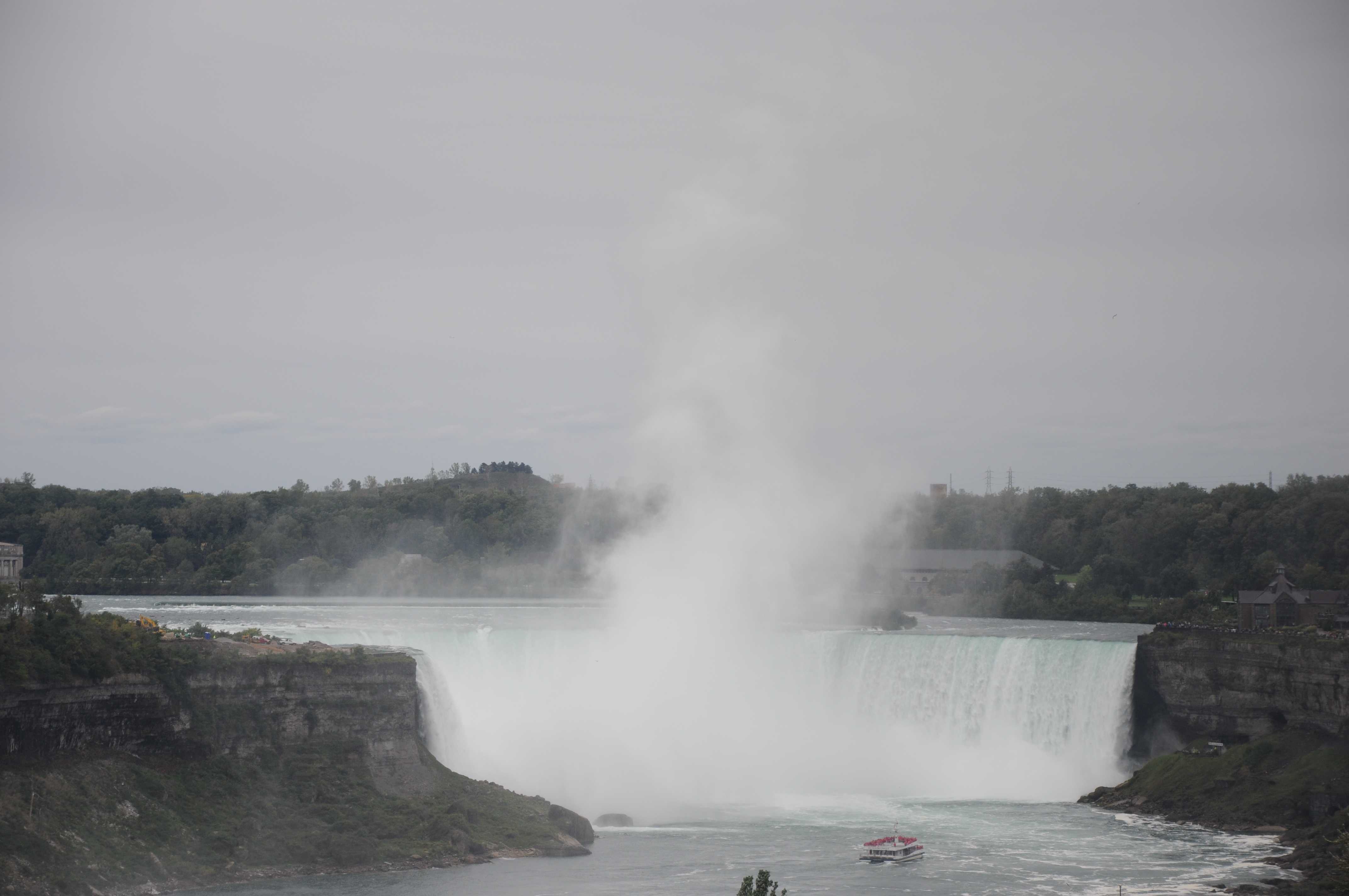
© Yves CourtelNiagara Falls, Ontario, CanadaLatitude: 43° 5' 17'' NLongitude: 79° 4' 21'' W02 October 2015 1644 (Local Time)Camera direction: towards SCL = 1, CM = 0, CH = 1Image P/S code: P.8.14Image I.D.: 5688Stratus cataractagenitus and spray bow
Clouds may form locally in the vicinity of large waterfalls as a consequence of water being broken up into spray by the falls. The downdraught caused by the falling water is compensated by the locally ascending motion of the air, from which clouds may condense.
This picture shows a spray bow formed by the refraction of sunlight by the drops of water spray, but above this the ascending air has condensed to form cloud; this is Stratus cataractagenitus.
Links in the image description will highlight features on the image. Mouse over the features for more detail.
© Yoshiaki SatoNiagara Falls, NY, United States of AmericaLatitude: 43° 4' 48'' NLongitude: 79° 4' 28'' W31 August 2008 0830 (Local Time)Camera direction: towards WCL = 5, CM = 0, CH = 0Image P/S code: S.8.14 1Image I.D.: 4955Stratus fractus cataractagenitus
Clouds may form locally in the vicinity of large waterfalls as a consequence of water broken up into spray by the falls. The downdraught caused by the falling water is compensated by the locally ascending motion of the air, from which clouds may condense.
In this picture, there is extensive spray in front of and just above the falls (seen at 1 and 2). However, close inspection reveals that, although spray is being carried higher into the air by the ascending motion and a light wind, there are some distinct, denser areas where cloud is beginning to condense (seen at 3 and 4); this is Stratus fractus cataractagenitus. Depending on the humidity environment above, these ragged shreds may either dissipate or transition into Cumulus fractus and perhaps later to other species of Cumulus.
Links in the image description will highlight features on the image. Mouse over the features for more detail.
© Yves CourtelNiagara Falls, Ontario, CanadaLatitude: 43° 5' 23'' NLongitude: 79° 4' 17'' W03 October 2015 1244 (Local Time)Camera direction: towards SCL = 1, CM = 1, CH = /Image P/S code: S.8.14 2Image I.D.: 5689


