© Matthew Clark
Exeter, Devon, United Kingdom of Great Britain and Northern Ireland
Latitude: 50° 43' 38'' N
Longitude: 3° 28' 36'' W
22 February 2011 1340 (Local Time)
Camera direction: towards W
Image P/S code: P.7.27
Image I.D.: 5710
CL = 8, CM = /, CH = /
-
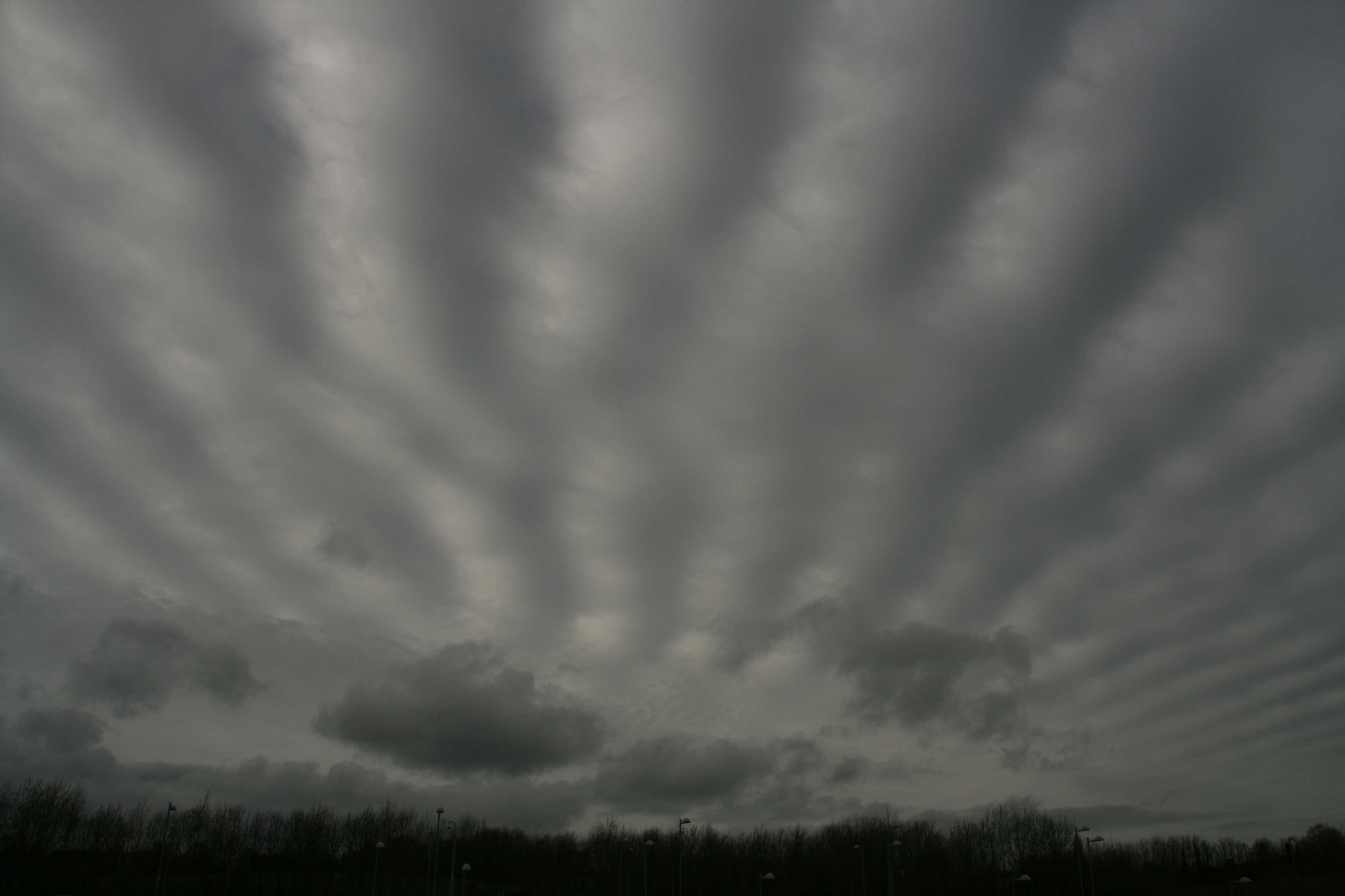
Stratocumulus stratiformis opacus undulatus radiatus with Cumulus
This image shows a typically grey layer of Stratocumulus cloud, with the relatively uniform base associated with the species stratiformis. Several of the cloud varieties associated with Stratocumulus stratiformis can be seen. The cloud is in a continuous layer and is sufficiently thick and opaque to obscure the position of the Sun, which indicates the variety opacus. In addition, as the cloud is composed of prominent, undulating rolls arranged in nearly parallel lines, it is also of the variety undulatus. Furthermore, owing to the effect of perspective, these lines or bands appear to converge towards a point on the horizon, producing the variety radiatus. In the distance we also see the ragged edges of Cumulus fractus, more organized Cumulus humilis and a small amount of lower-based Stratocumulus.
Links in the image description will highlight features on the image. Mouse over the features for more detail.
© Matthew ClarkExeter, Devon, United Kingdom of Great Britain and Northern IrelandLatitude: 50° 43' 38'' NLongitude: 3° 28' 36'' W22 February 2011 1340 (Local Time)Camera direction: towards WCL = 8, CM = /, CH = /Image P/S code: P.7.27Image I.D.: 5710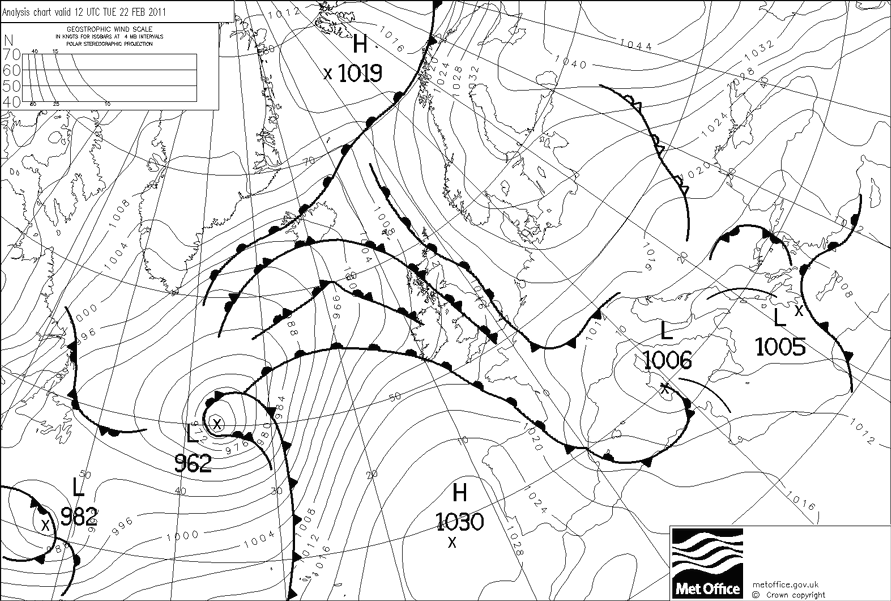
The surface analysis at 1200 UTC shows intense high pressure over Russia, with a deep depression of 962 hPa over the mid-Atlantic. Between them, weak, slow-moving fronts are affecting UK, with an occlusion in the vicinity of the photograph location.
© Crown Copyright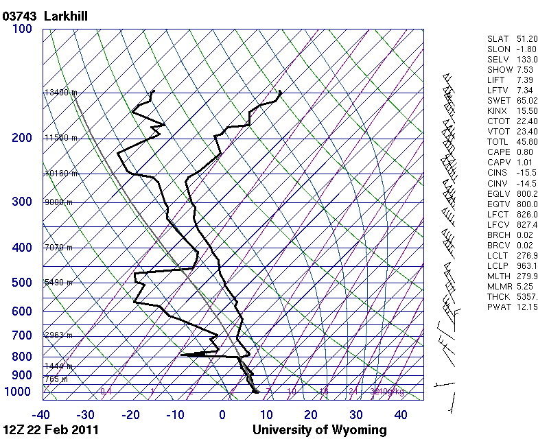
The 1200 UTC sounding is from Larkhill, England, UK (WMO 03743), 130 km east-north-east of the photo location. It shows the lower atmosphere close to saturation from the ground until a sharp temperature inversion is reached at 800 hPa (about 2 000 m). Due to the opaqueness of the cloud, it is likely that the Stratocumulus base was several tens of metres below the inversion.
© University of Wyoming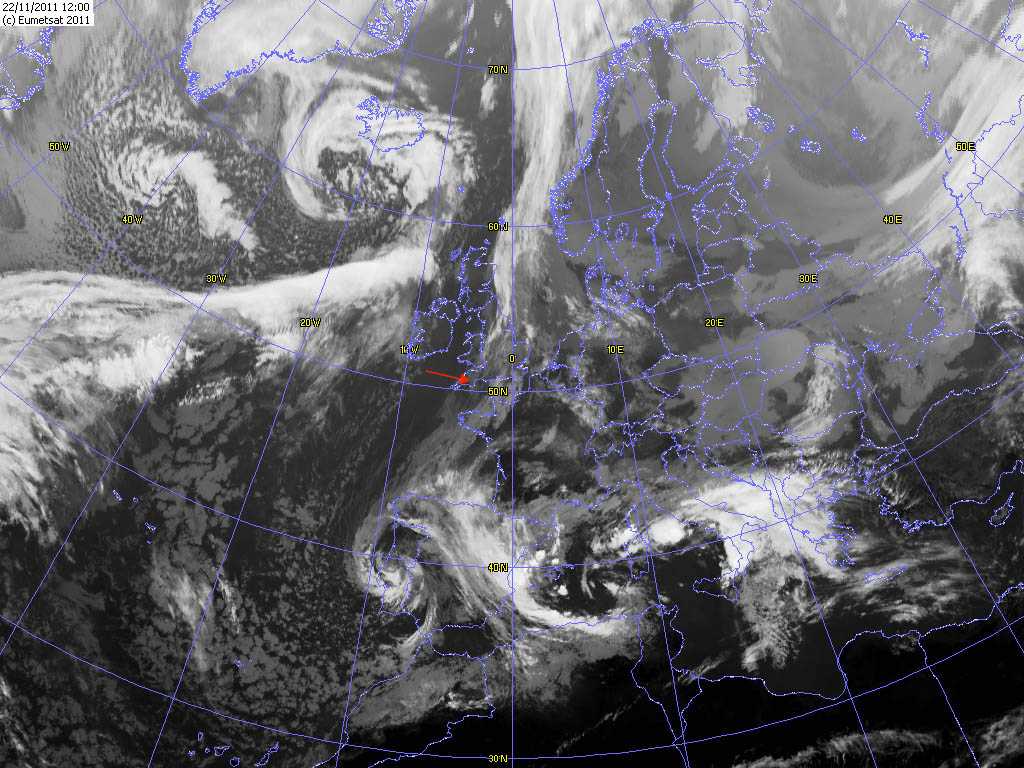
On the 1200 UTC Meteosat infrared satellite image, the red arrow points to the location of the photograph. The light grey colour over Devon, England, UK indicates relatively warm cloud top temperatures, conducive to an estimated cloud top height of about 2 000 m (6 200 ft).
© EUMETSAT, 2011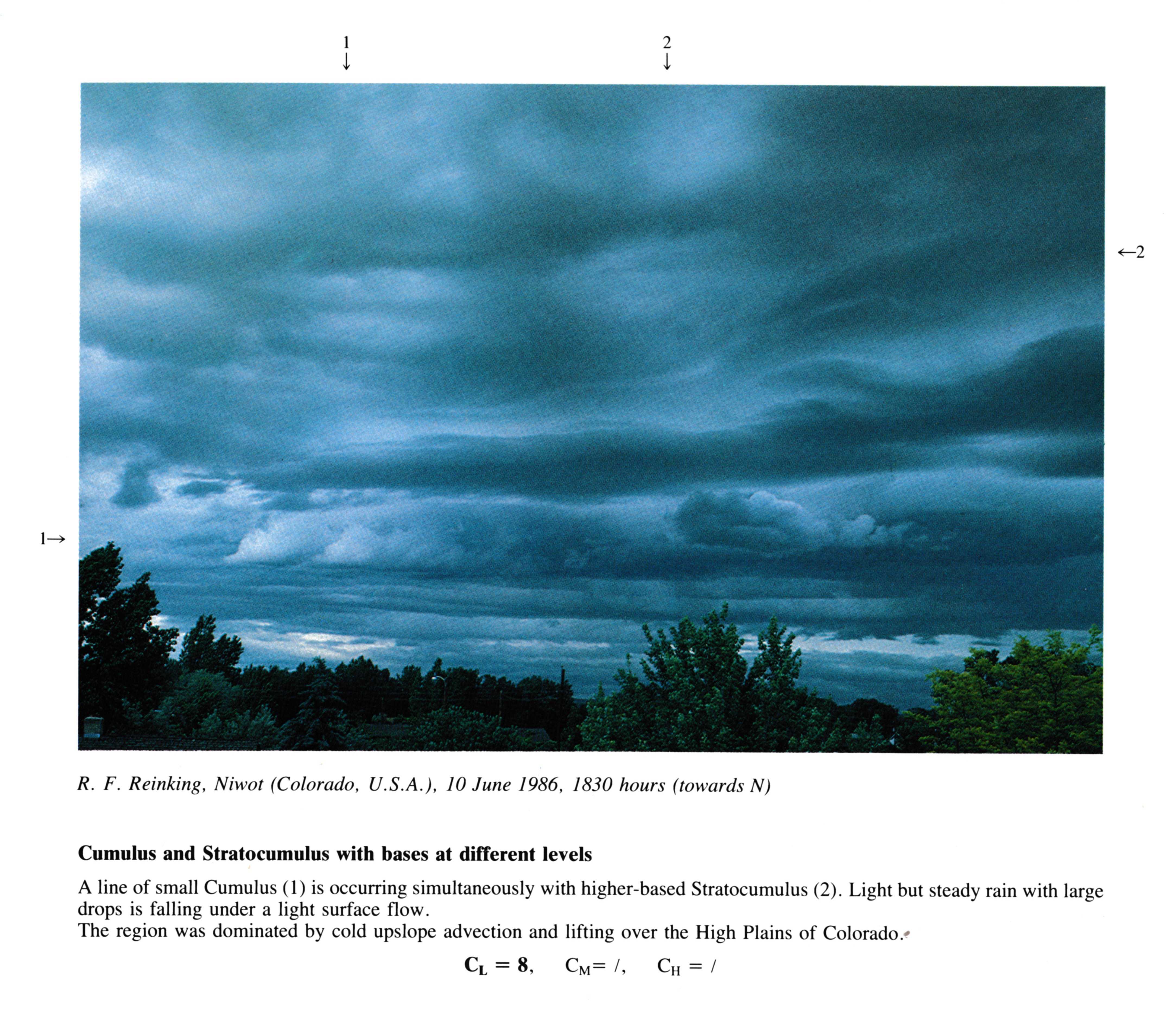
Cumulus and Stratocumulus with bases at different levels
A line of small Cumulus is occurring simultaneously with higher-based Stratocumulus. Light but steady rain with large drops is falling under a light surface flow.
The region was dominated by cold upslope advection and lifting over the High Plains of Colorado.
Links in the image description will highlight features on the image. Mouse over the features for more detail.
© R.F. ReinkingNiwot, Colorado, United States of AmericaLatitude: 40° 6' 14'' NLongitude: 105° 10' 15'' W10 June 1986 1830 (Local Time)Camera direction: towards NCL = 8, CM = /, CH = /