© Jarmo Koistinen
Helsinki, Finland
Latitude: 60° 9' 38'' N
Longitude: 24° 57' 38'' E
19 September 2007 0905 (Local Time)
Camera direction: towards E
Image P/S code: S.6.1
Image I.D.: 5730
CL = 7, CM = 2, CH = /
-
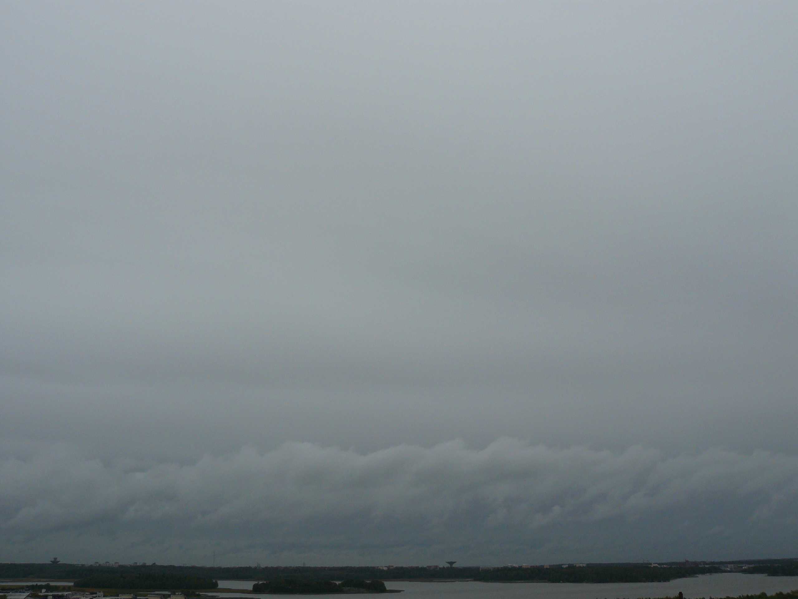
Nimbostratus praecipitatio
Nimbostratus is a grey layer of cloud, often dark, with an appearance rendered diffuse by more or less continuously falling rain or snow that in most cases reaches the ground. It is thick enough throughout to obscure the Sun. In this image, the cloud is typically grey, with some variation, but has little form. As continuous light rain had lasted for several hours, we may add the supplementary feature praecipitatio. Low, ragged clouds frequently occur below the main layer as the air in the lower layers is moistened by the precipitation; such clouds can be seen just above the horizon and are Stratus fractus. More extensive Cumulus fractus can also be seen, the two forming the supplementary feature pannus.
Links in the image description will highlight features on the image. Mouse over the features for more detail.
© Jarmo KoistinenHelsinki, FinlandLatitude: 60° 9' 38'' NLongitude: 24° 57' 38'' E19 September 2007 0905 (Local Time)Camera direction: towards ECL = 7, CM = 2, CH = /Image P/S code: S.6.1Image I.D.: 5730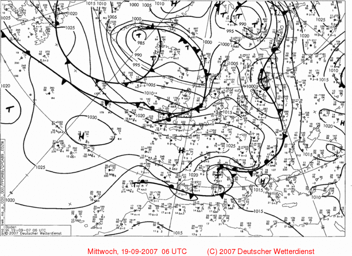
The 0600 UTC synoptic chart shows a low of 994 hPa centred over south-east Finland, about 200 km east of the image location. The low was deepening and moving north.
© Deutscher Wetterdienst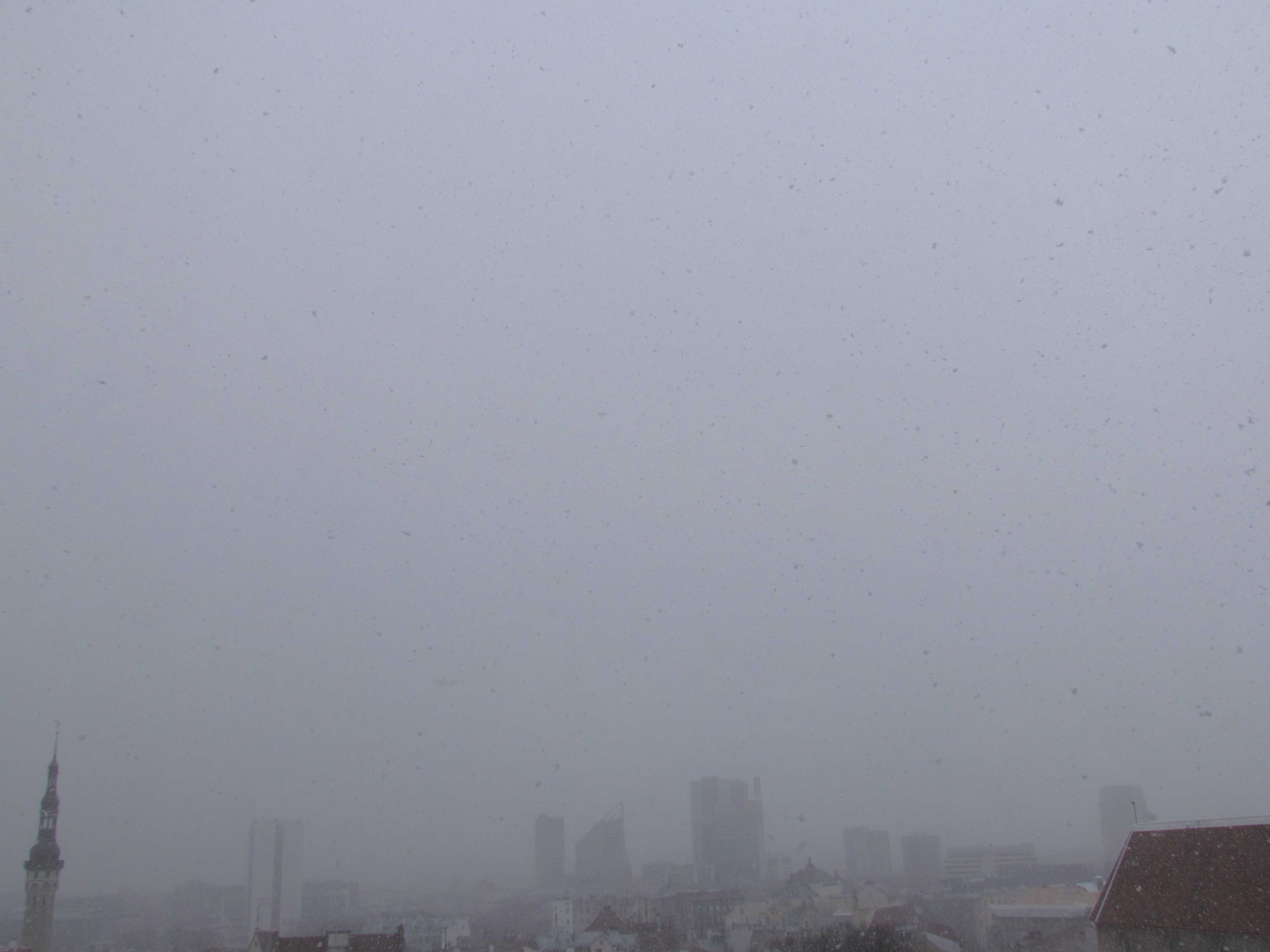
Nimbostratus with continuous snow
An excellent image of precipitating Nimbostratus. An amorphous base, poor visibility and low light typify this cloud, particularly when precipitation has set in. Pannus was measured at 200 m (600 ft) and Nimbostratus at 500 m (1 600 ft). Snow fell for most of the day with the air temperature below 0 °C.
Links in the image description will highlight features on the image. Mouse over the features for more detail.
© Jüri KamenikOld Town of Tallinn, Tallinn, EstoniaLatitude: 59° 26' 12'' NLongitude: 24° 44' 28'' E07 April 2013 1545 (Local Time)Camera direction: towards SCL = 7, CM = 2, CH = /Image P/S code: P.6.1Image I.D.: 5143