© Chuk Man Kwan
Sha Tin, Hong Kong, China
Latitude: 22° 22' 38'' N
Longitude: 114° 11' 51'' E
27 June 2016 1411 (Local Time)
Image P/S code: S.10.1
Image I.D.: 5749
CL = 3, CM = 3, CH = /
-
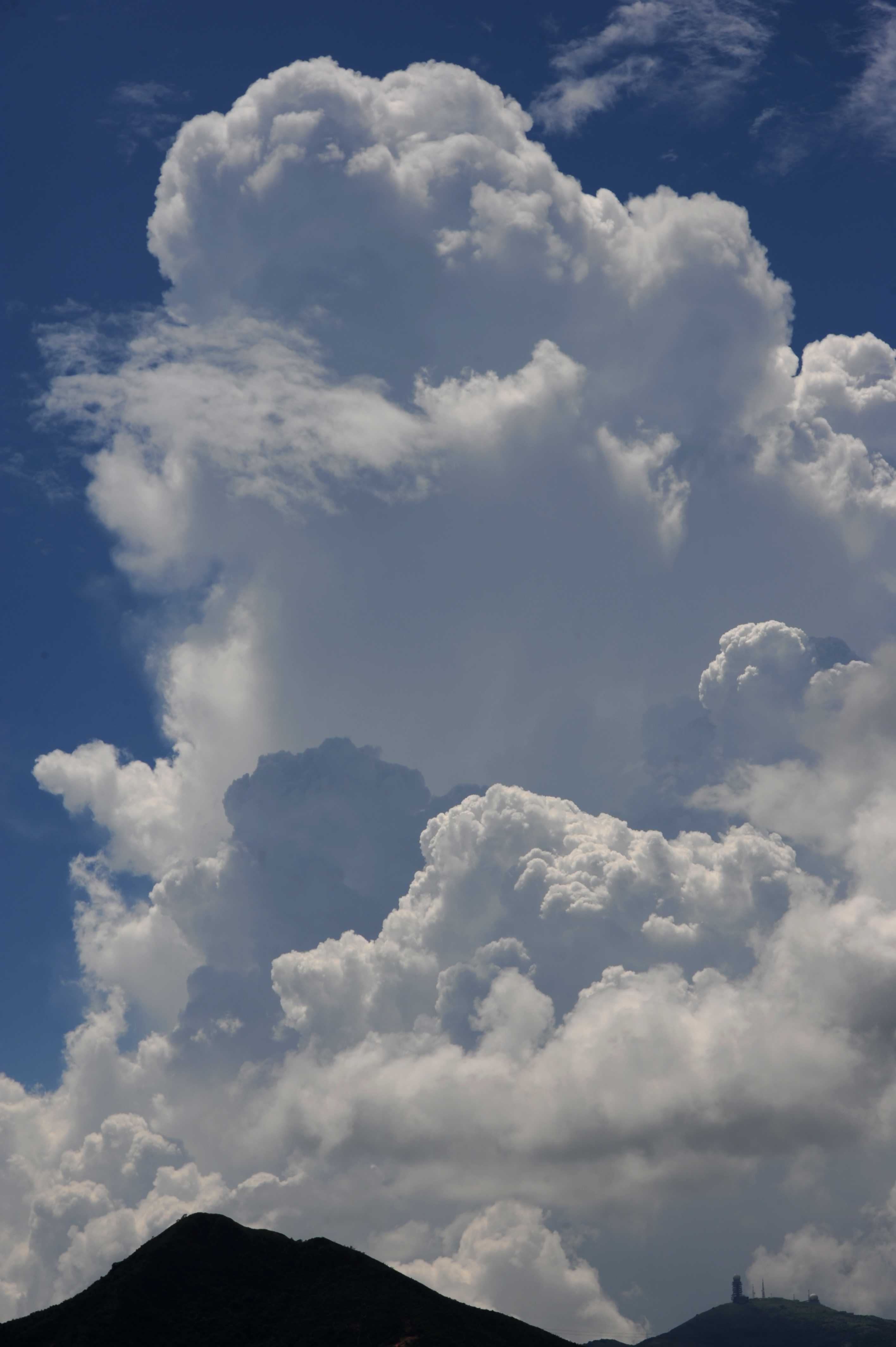
Cumulonimbus calvus
This image permits comparison between the developing Cumulus congestus in the foreground and a recently transitioned Cumulonimbus calvus cell in the background.
The Cumulus congestus are strongly sprouting, generally have sharp outlines and are of great vertical extent. In comparison, the Cumulonimbus is of far greater vertical extent; however, this alone is not a deciding factor in identifying the cloud. The upper parts of the Cumulonimbus calvus are merging into a whitish mass with a domed top that has the suggestion of less-than-sharp outlines.
This is evidence that water droplets in the upper parts of this cloud have started to freeze, denoting the transition from Cumulus to Cumulonimbus. Once started, the transition from water to ice is a very rapid process: the Cumulonimbus will only retain the visible features of calvus for a few short minutes.
The diffuse appearance of the mid parts of the calvus is not due to freezing of water; rather, it is due to falling rain. Some patches of Altocumulus are in the foreground of the calvus and at the top right.
Links in the image description will highlight features on the image. Mouse over the features for more detail.
© Chuk Man KwanSha Tin, Hong Kong, ChinaLatitude: 22° 22' 38'' NLongitude: 114° 11' 51'' E27 June 2016 1411 (Local Time)CL = 3, CM = 3, CH = /Image P/S code: S.10.1Image I.D.: 5749
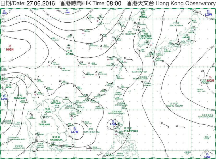
The subtropical ridge continued to bring very hot weather to southern China on this day.
© The Government of the Hong Kong Special Administrative Region
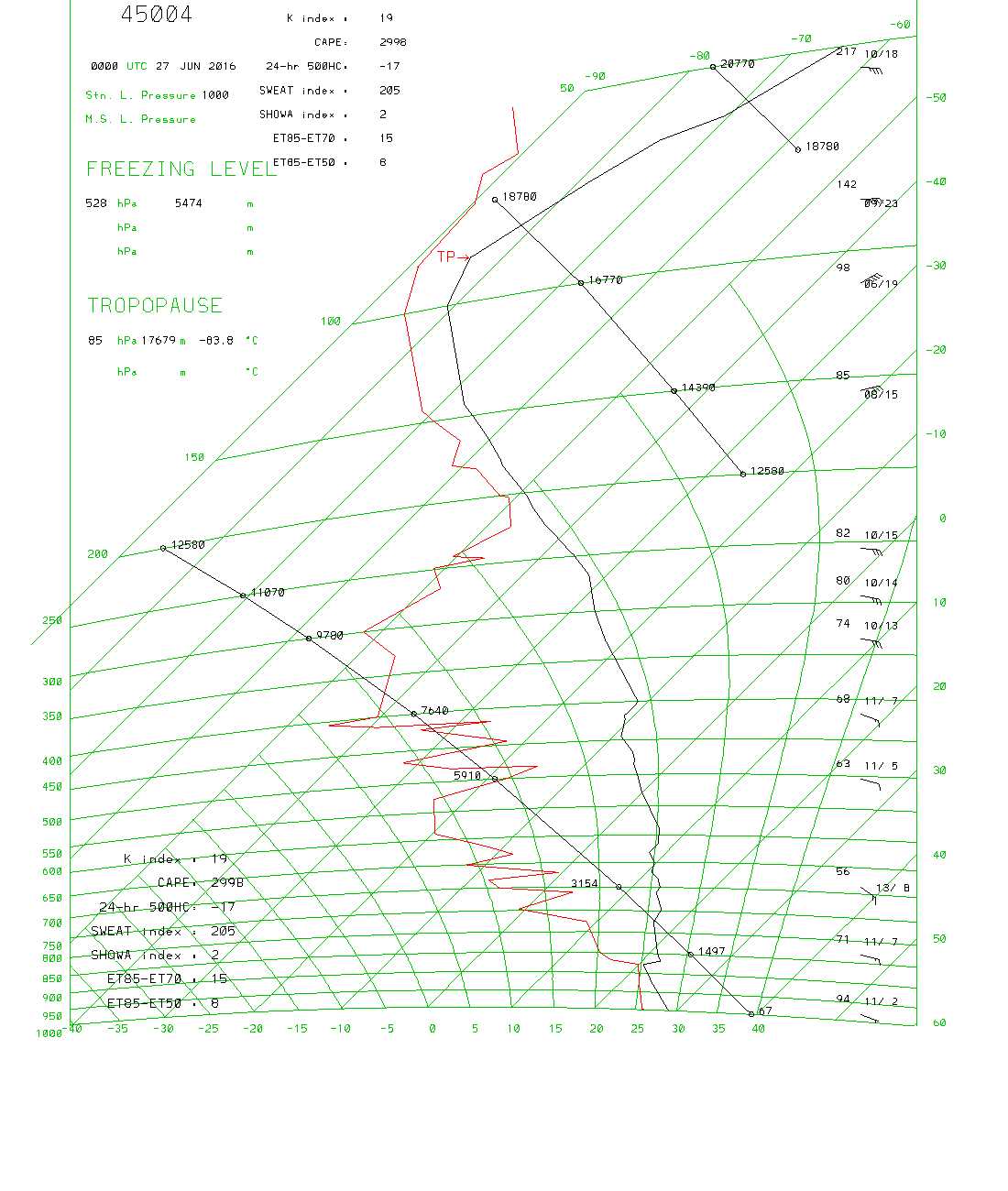
The sounding shows conditionally unstable low and middle levels, apart from a 1.6 °C inversion at 878 hPa. There is also considerable CAPE and a high SWEAT index.
© The Government of the Hong Kong Special Administrative RegionCumulonimbus calvus and Cumulus congestus
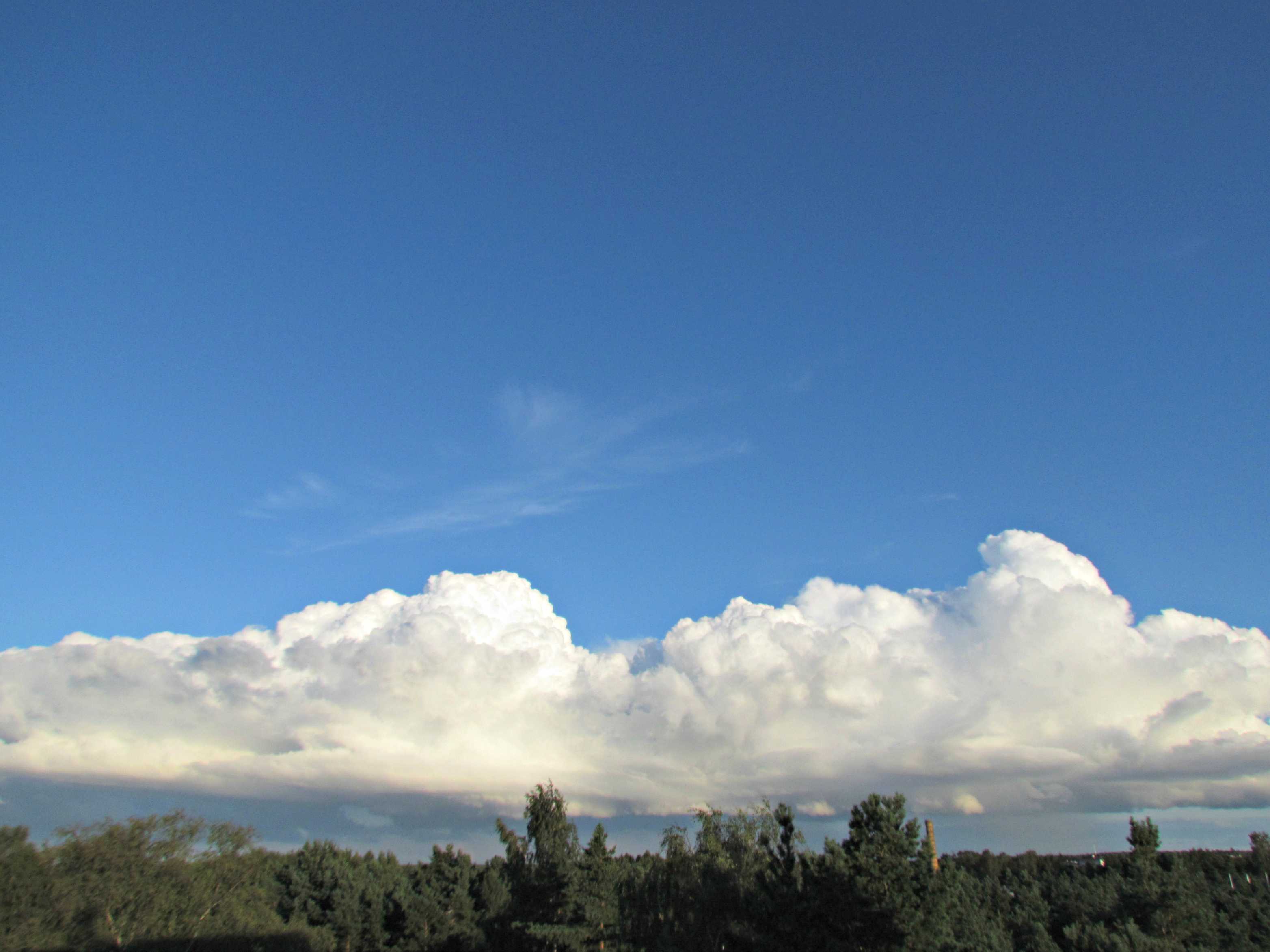
Cumulonimbus clouds are heavy, dense clouds of considerable vertical extent, in the form of a mountain or huge towers. At least part of the upper portion is usually smooth, fibrous or striated and is nearly always flattened. The cloud base is often very dark. In this image, the sproutings of the upper part have become rather indistinct and flattened at 2 and 3, which is characteristic of the species calvus. Between the main towers, the cloud is still developing, having sharper outlines and a cauliflower appearance that identify it as Cumulus congestus. The supplementary feature praecipitatio, in the form of a shower, is falling from the cloud on the left. Higher in the sky, the fibrous elements of Cirrus fibratus can be seen.
Links in the image description will highlight features on the image. Mouse over the features for more detail.
© Jüri KamenikPääsküla, Tallinn, EstoniaLatitude: 59° 21' 37'' NLongitude: 24° 37' 57'' E01 August 2012 1938 (Local Time)Camera direction: towards SECL = 3, CM = 0, CH = 1Image P/S code: P.10.1Image I.D.: 5042

