© Martin Gudd
Bad Kreuznach, Germany
Latitude: 49° 50' 39'' N
Longitude: 7° 50' 32'' E
14 November 2015 0909 (Local Time)
Camera direction: towards SE
Image P/S code: P.3.5
Image I.D.: 5755
CL = 0, CM = 0, CH = 7
-
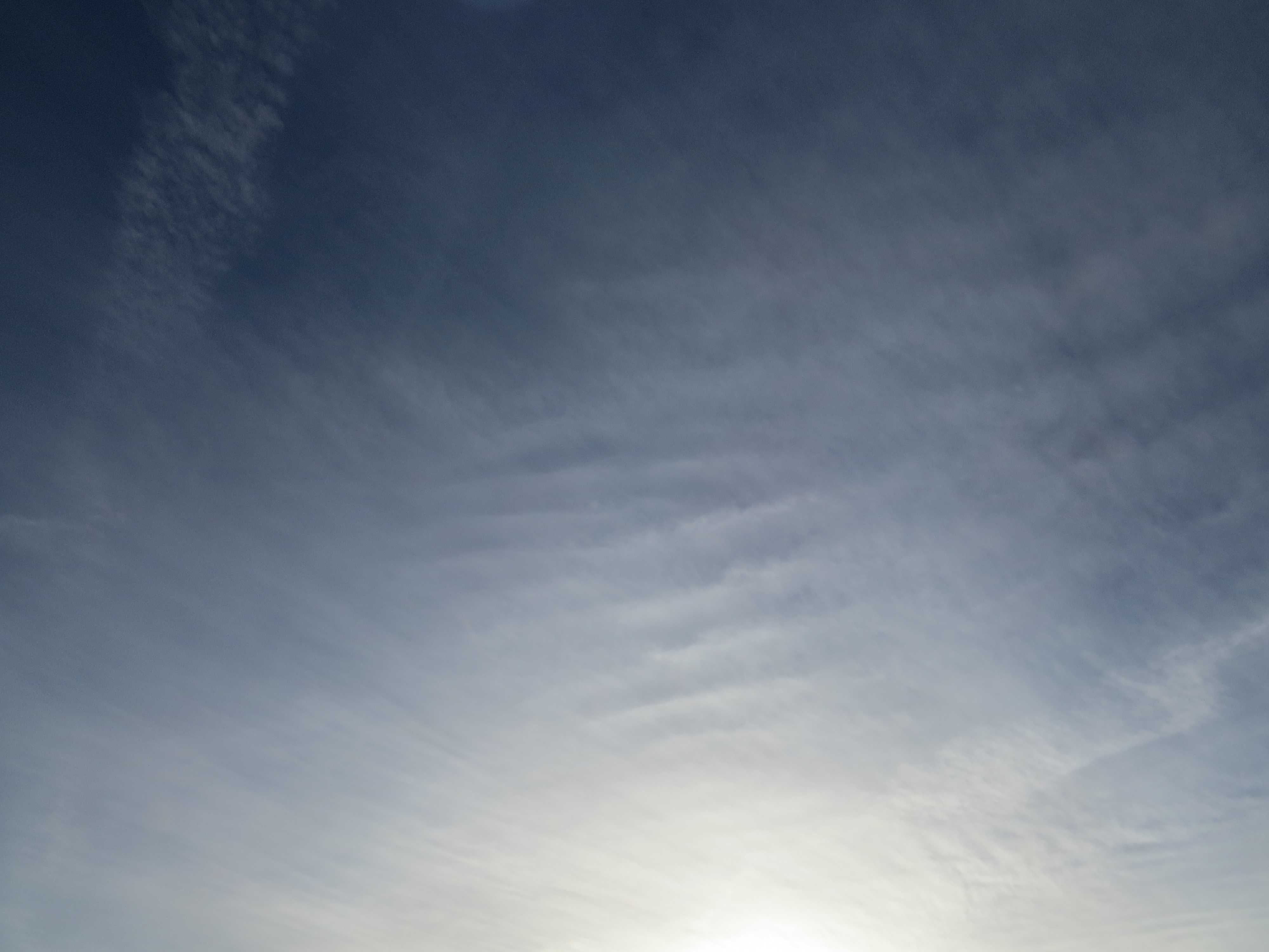
Cirrostratus fibratus undulatus
A veil of Cirrostratus covers the sky. The fibrous appearance identifies the species fibratus. In the centre of the picture and to the upper right, the veil shows undulations; this is the variety undulatus.
Contrails at 1 and 2 are visible.
A series of warm fronts were approaching rapidly from the west. Rain set in later in the evening.
Links in the image description will highlight features on the image. Mouse over the features for more detail.
© Martin GuddBad Kreuznach, GermanyLatitude: 49° 50' 39'' NLongitude: 7° 50' 32'' E14 November 2015 0909 (Local Time)Camera direction: towards SECL = 0, CM = 0, CH = 7Image P/S code: P.3.5Image I.D.: 5755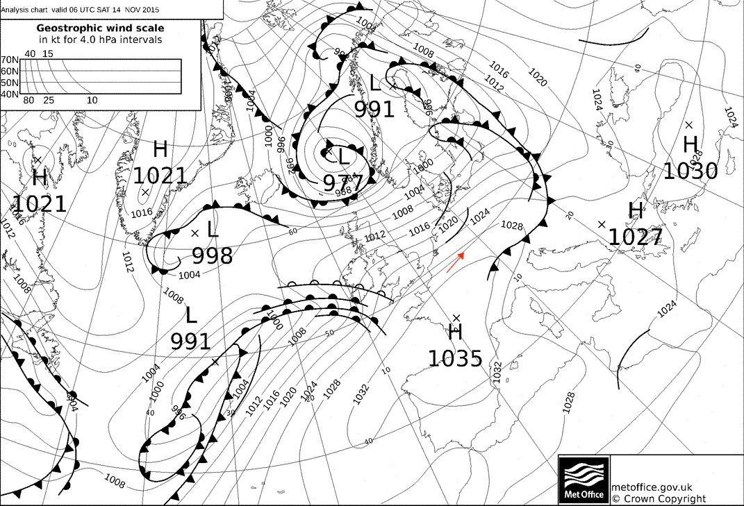
A cold front followed by an occluded front were responsible for overnight unsettled weather in Germany. The weather cleared in the early morning and this chart shows a short clearance behind a cold front in the morning hours. Over the Atlantic, a new low (ex-Tropical Storm Kate) with a very pronounced warm front is seen rapidly approaching from the west.
© Crown Copyright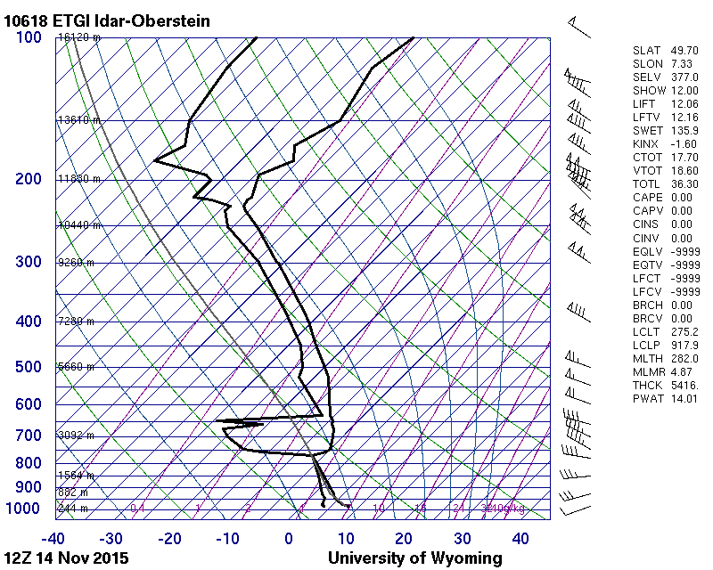
The sounding from 40 km to the west-south-west shows high moisture content from 632 hPa to the tropopause at 195 hPa.
© University of Wyoming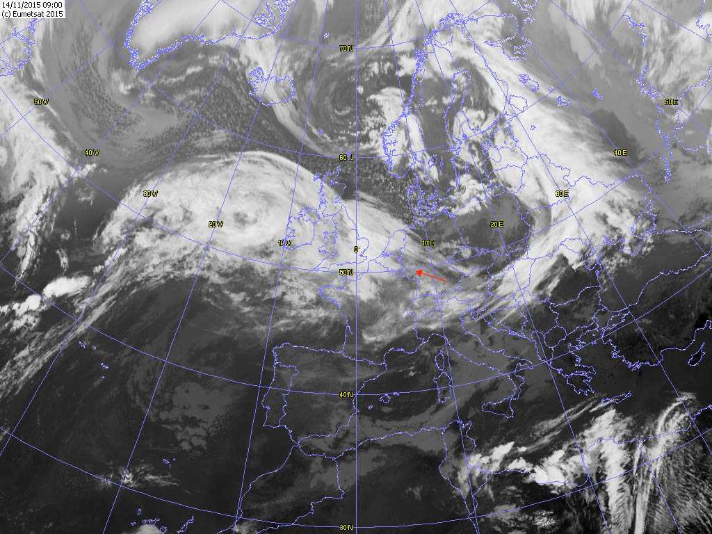
The satellite picture shows high-level cloud that developed as a series of troughs passed over western Germany.
© EUMETSAT, 2015