© Yoshiaki Sato
Fujiwara, Minakami, Tone District, Gunma Prefecture, Japan
Latitude: 36° 46' 59'' N
Longitude: 139° 2' 38'' E
05 May 2015 1029 (Local Time)
Camera direction: towards ENE
Image P/S code: S.3.18
Image I.D.: 5836
CL = 2, CM = 7, CH = 8
-

Passing frontal zone – Cirrostratus and Cirrus fibratus
An extensive, mostly high-level frontal band is clearing to the north-east. The band was up to 1 000 km wide and over 2 000 km from north to south. The tail edge of the band is made up of Cirrostratus fibratus, Cirrus spissatus, Cirrus fibratus, Altostratus translucidus, Altocumulus and Cumulus mediocris.
Links in the image description will highlight features on the image. Mouse over the features for more detail.
© Yoshiaki SatoFujiwara, Minakami, Tone District, Gunma Prefecture, JapanLatitude: 36° 46' 59'' NLongitude: 139° 2' 38'' E05 May 2015 1029 (Local Time)Camera direction: towards ENECL = 2, CM = 7, CH = 8Image P/S code: S.3.18Image I.D.: 5836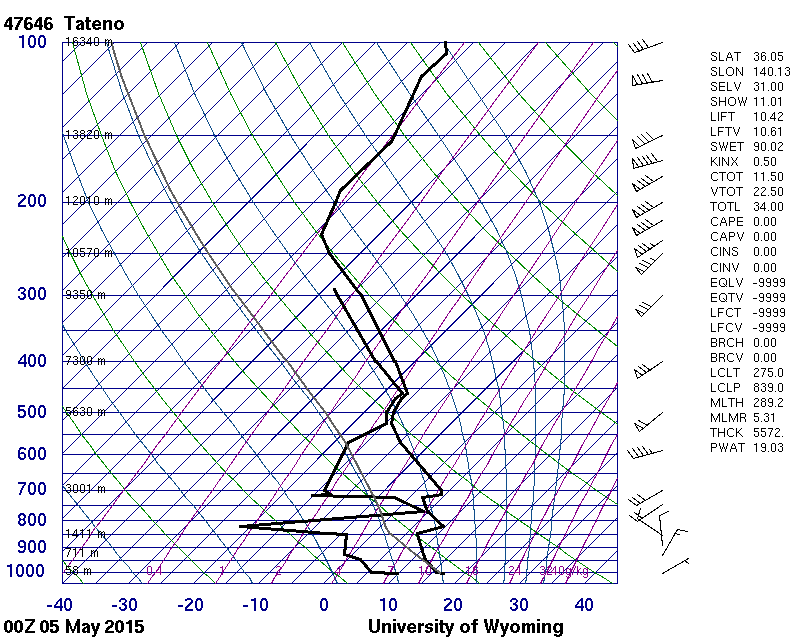
The sounding is from 115 km to the south-south-east and was taken under the cloud band. It shows a very high moisture content above 5 200 m.
© University of Wyoming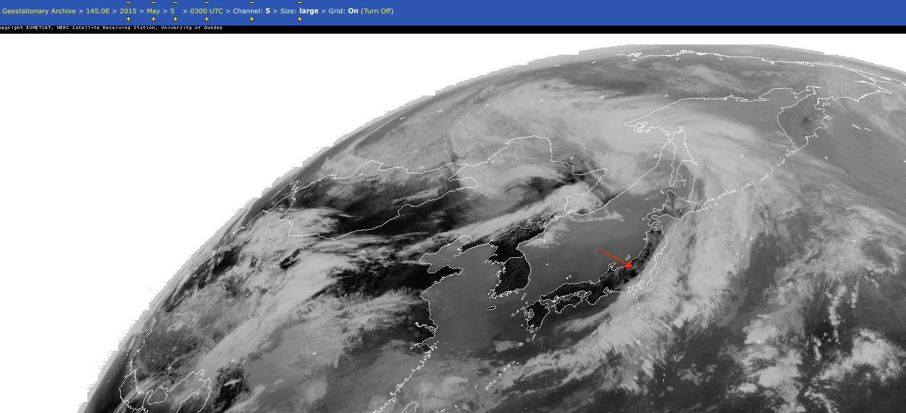 The EUMETSAT image shows the clearing rear edge of the cloud band to the east.© EUMETSAT/NEODAAS/University of Dundee
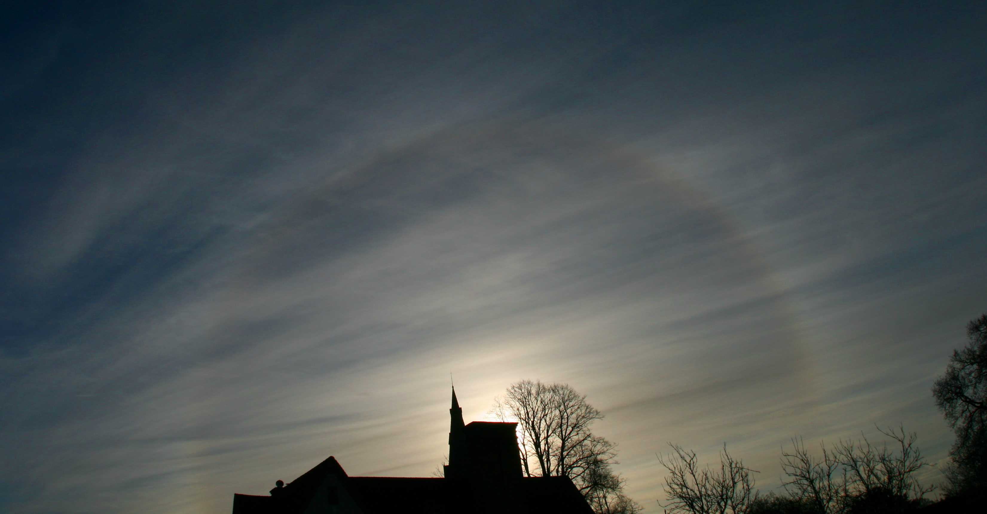
Cirrostratus fibratus undulatus with 22° halo
The double layer of Cirrostratus is identified by the alignment of fibratus striations. In the lower layer, the fibratus is aligned north-east to south-west; the higher layer is at a right angle to the lower layer; that is, south-east to north-west.
Links in the image description will highlight features on the image. Mouse over the features for more detail.
© Stephen BurtStratfield Mortimer, near Reading, Berkshire RG7, United Kingdom of Great Britain and Northern IrelandLatitude: 51° 22' 12'' NLongitude: 1° 2' 24'' W02 December 2009 1011 (Local Time)Camera direction: towards SECL = 0, CM = 0, CH = 8Image P/S code: P.3.2Image I.D.: 5491