© Michael Bruhn
Eaglehawk Neck, Tasmania, Australia
Latitude: 43° 0' 24'' S
Longitude: 147° 55' 56'' E
13 August 2011 1320 (Local Time)
Camera direction: towards SE
Image P/S code: P.9.22
Image I.D.: 5932
CL = 2, CM = /, CH = /
-
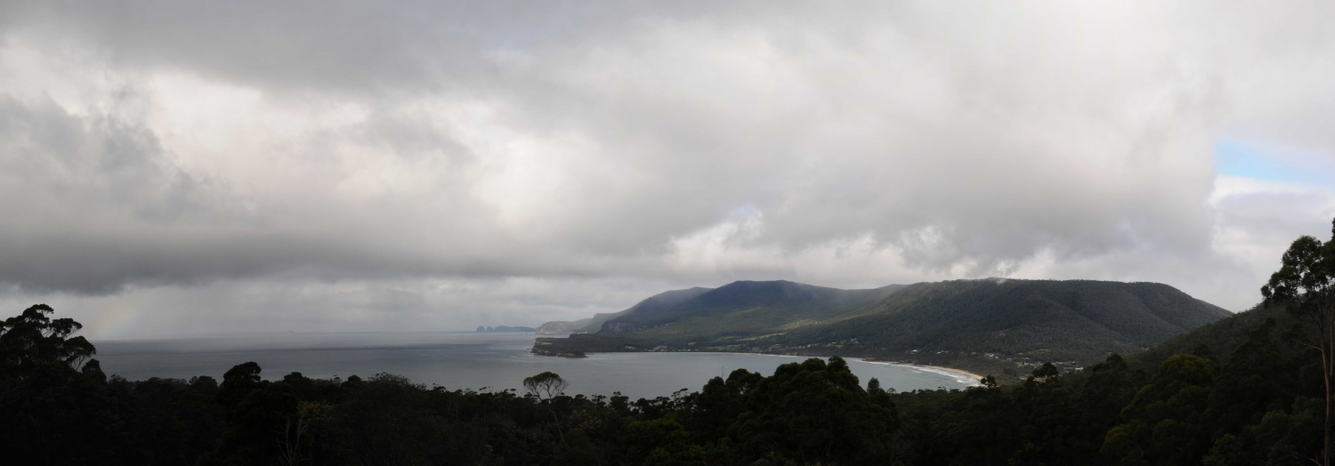
Cumulus fractus of wet weather
In this image are small Cumulus clouds with ragged edges. The outlines often underwent rapid changes and are an example of Cumulus fractus. As the clouds formed due to moistening of the air by precipitation from cloud at a higher level, they are considered Cumulus fractus of wet weather. A few ragged shreds of Stratus fractus are also present, which together constitute the accessory cloud pannus. Precipitation can be seen falling in the bay; this is the supplementary feature praecipitatio.
Links in the image description will highlight features on the image. Mouse over the features for more detail.
© Michael BruhnEaglehawk Neck, Tasmania, AustraliaLatitude: 43° 0' 24'' SLongitude: 147° 55' 56'' E13 August 2011 1320 (Local Time)Camera direction: towards SECL = 2, CM = /, CH = /Image P/S code: P.9.22Image I.D.: 5932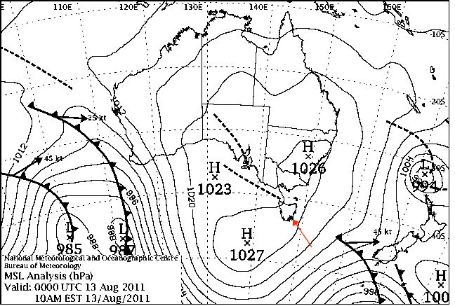
A trough was moving north-east through the area, with a ridge following.
© Commonwealth of Australia 2011, Bureau of Meteorology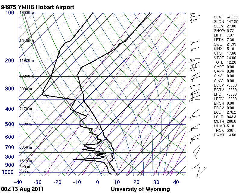
The Hobart, Tasmania, Australia (WMO 94975) sounding shows instability up to approximately 850 hPa. Shallow moist layers can be seen at medium levels.
© University of Wyoming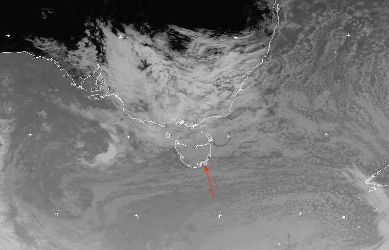
In this infrared image, a trough extends from the cold front in the Tasman Sea to the north of Eaglehawk Neck, Tasmania, Australia (the image location is shown by a red arrow). Low-level cloud covers most of Tasmania.
© EUMETSAT, 2011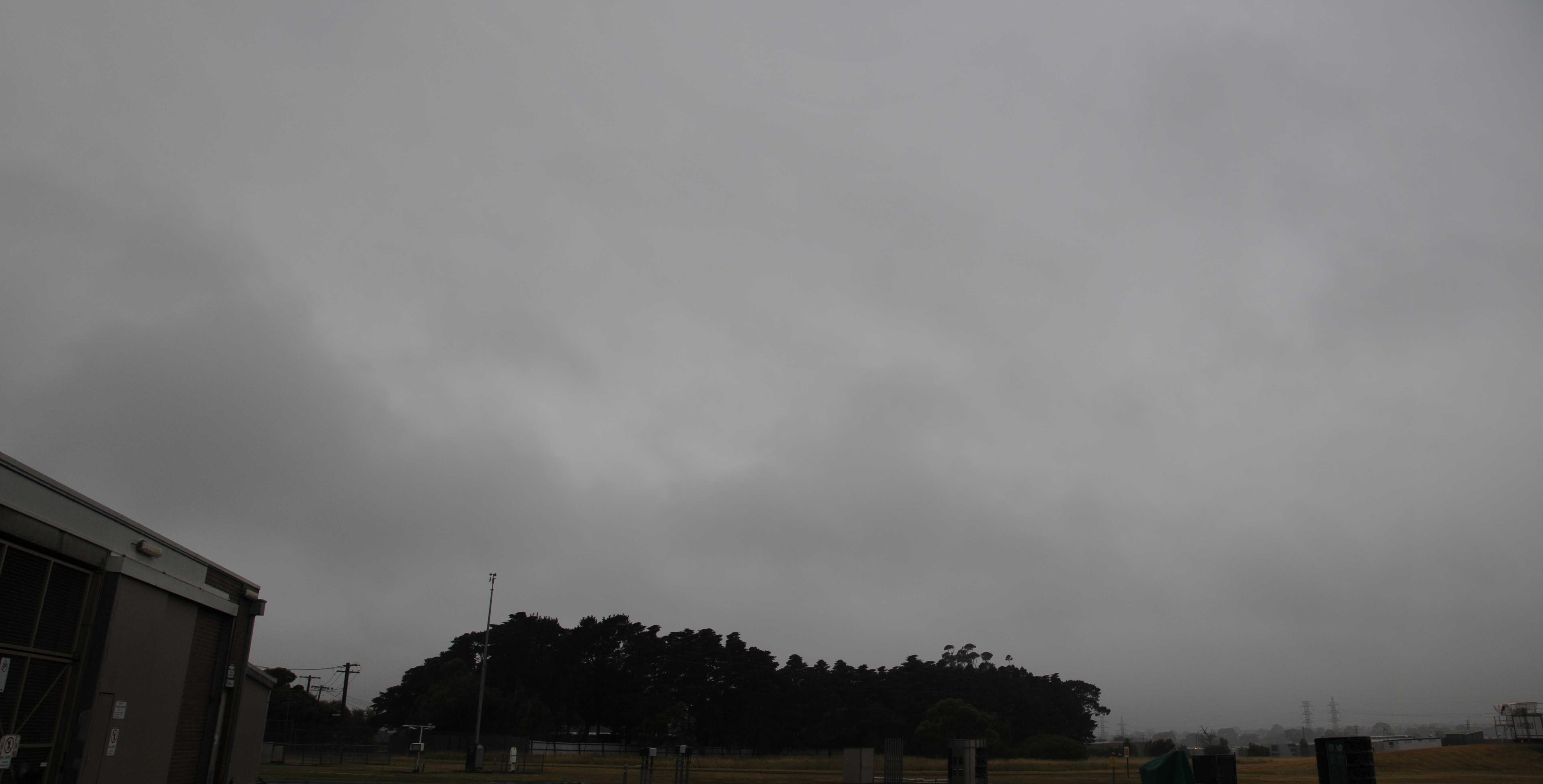
Cumulus fractus and Stratus fractus altostratogenitus
Cumulus fractus of wet weather has formed under an overcast rain-bearing layer of Altostratus opacus. The darker, shaded patches of cloud are Cumulus fractus; these patches are generally of greater vertical extent than Stratus fractus and often have the suggestion of a rounded top.
Links in the image description will highlight features on the image. Mouse over the features for more detail.
© Michael BruhnBroadmeadows VIC 3047, AustraliaLatitude: 37° 41' 24'' SLongitude: 144° 56' 50'' E27 November 2012 0846 (Local Time)Camera direction: towards ECL = 7, CM = 2, CH = /Image P/S code: S.9.22Image I.D.: 5946