© Michael Bruhn
Broadmeadows, Victoria, Australia
Latitude: 37° 41' 24'' S
Longitude: 144° 56' 50'' E
29 October 2009 1158 (Local Time)
Camera direction: towards W
Image P/S code: P.4.23
Image I.D.: 5953
CL = 2, CM = 6, CH = 1
-
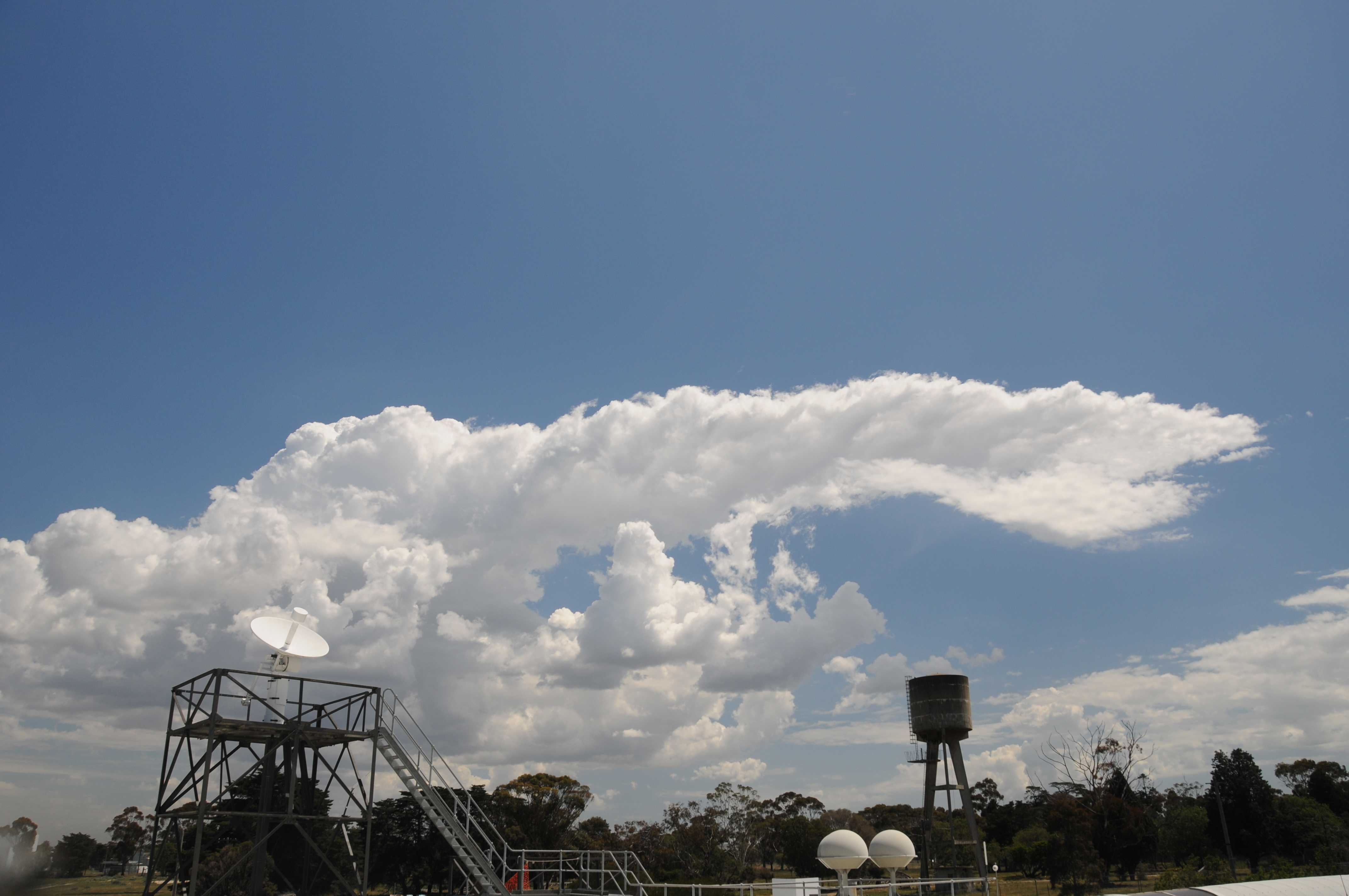
Altocumulus cumulogenitus and Cumulus congestus
The image shows a Cumulus congestus cell whose vertical development was temporarily inhibited by a small inversion at 5 500 m (18 000 ft), resulting in the top spreading downwind. This feature is identified as Altocumulus cumulogenitus. This feature is not incus as it is not attached to a Cumulonimbus cloud and it does not have the fibrous structure, silky sheen and whiteness of an anvil or of Cirrus spissatus cumulonimbogenitus.
Over the next five minutes, the back edge of the congestus top penetrated marginally above the inversion before the cell started dissipating.
Two Cumulus congestus cells can be seen to the right of the water tower, as can patches of Altocumulus cumulogenitus from earlier Cumulus development.
Cumulus fractus, humilis and mediocris cells are present, as well as a very small patch of Cirrus.
Links in the image description will highlight features on the image. Mouse over the features for more detail.
© Michael BruhnBroadmeadows, Victoria, AustraliaLatitude: 37° 41' 24'' SLongitude: 144° 56' 50'' E29 October 2009 1158 (Local Time)Camera direction: towards WCL = 2, CM = 6, CH = 1Image P/S code: P.4.23Image I.D.: 5953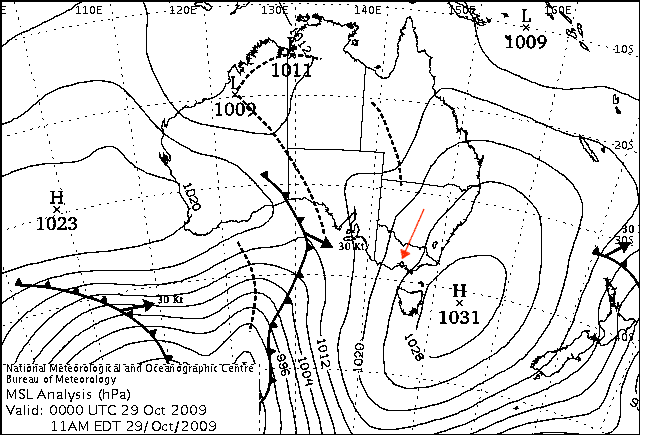
High pressure system moving southward, short-wave frontal system to the west
© Commonwealth of Australia 2009, Bureau of Meteorology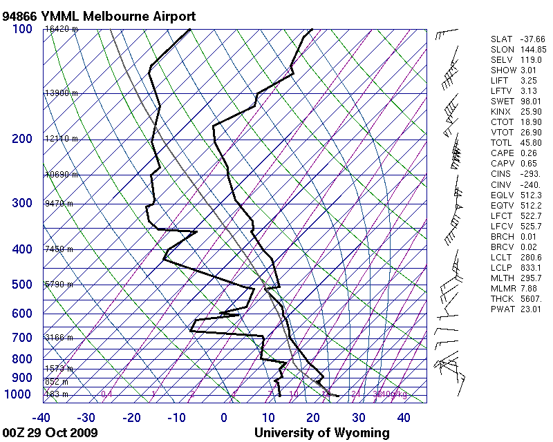
The sounding shows a small inversion at 919 hPa, eroded by daytime heating, and an inversion at 5 500 m that capped Cumulus development.
© University of Wyoming
Altocumulus cumulogenitus, Altocumulus stratifomis translucidus duplicatus and Cumulus congestus
This is a complex sky with Altocumulus formed from the spreading of Cumulus; an extensive sheet of thin Altocumulus; and Cumulus of the species congestus, humilis and fractus.
The highest cloud is an extensive sheet of thin Altocumulus (stratiformis translucidus). This cloud may have formed from the spreading of tops Cumulonombus cells that were in the area in the preceding six hours.
Below this sheet are patches of Altocumulus that have formed from the spreading of the tops of Cumulus congestus cells. At 2, the summit of a strongly sprouting congestus cell has reached a stable layer and is starting to spread out. At 3, the summit of a strongly sprouting but narrow congestus cell is moments away from reaching the stable layer. At 4 are the remains of a congestus cell, where its base has dissipated and its top has spread out over a larger area.
Cumulus fractus and humilis are also present.
Links in the image description will highlight features on the image. Mouse over the features for more detail.
© Fiona HeathcotePraa Sands, Cornwall, United Kingdom of Great Britain and Northern IrelandLatitude: 50° 9' 33'' NLongitude: 5° 14' 6'' W15 November 2014 1432 (Local Time)Camera direction: towards SSWCL = 2, CM = 6, CH = /Image P/S code: S.4.23 1Image I.D.: 5120
Altocumulus cumulogenitus and Cumulus congestus
In this picture, taken from an aircraft, there is an extensive field of Cumulus cells in different stages of development. Most are of the species congestus, having marked vertical sproutings and upper parts resembling cauliflowers. The oldest cells of greatest vertical extent (at 4 and 5) have reached a stable layer where the tops are spreading downwind as Altocumulus cumulogenitus. The top surface of the layer has the slight undulations and rounded elements typical of Altocumulus; there is no evidence of glaciation. The diffuse look of the cloud at the lower right is caused by the evaporation of Altocumulus and, to a lesser extent, by virga. At 9 and 10, virga can be seen falling beneath the Altocumulus cloud.
Links in the image description will highlight features on the image. Mouse over the features for more detail.
© Amanda ChiuSouth China SeaLatitude: 22° 30' 41'' NLongitude: 118° 12' 51'' E04 September 2014 1456 (Local Time)CL = 2, CM = 6, CH = /Image P/S code: S.4.23 2Image I.D.: 5650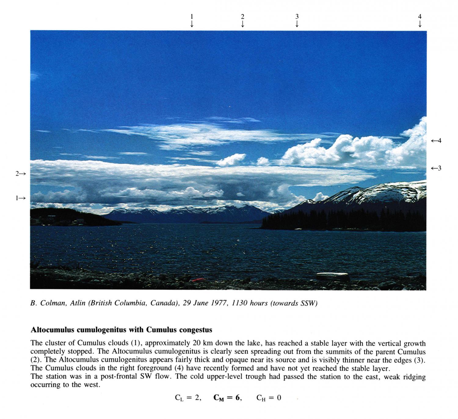
Altocumulus cumulogenitus with Cumulus congestus
The cluster of Cumulus clouds, approximately 20 km down the lake, has reached a stable layer with the vertical growth completely stopped. The Altocumulus cumulogenitus is clearly seen spreading out from the summits of the parent Cumulus. The Altocumulus cumulogenitus appears fairly thick and opaque near its source and is visibly thinner near the edges. The Cumulus clouds in the right foreground have recently formed and have not yet reached the stable layer. The station was in a post-frontal SW flow. The cold upper-level trough had passed the station to the east, weak ridging occurring to the west.
Links in the image description will highlight features on the image. Mouse over the features for more detail.
© B. ColmanAtlin, British Colombia, CanadaLatitude: 59° 34' 41'' NLongitude: 133° 41' 22'' W29 June 1977 1130 (Local Time)Camera direction: towards SSWCL = 2, CM = 6, CH = 0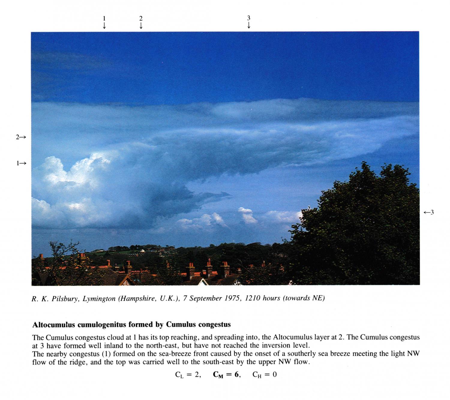
Altocumulus cumulogenitus formed by Cumulus congestus
The Cumulus congestus cloud at 1 has its top reaching, and spreading into, the Altocumulus layer at 2. The Cumulus congestus at 3 have formed well inland to the north-east, but have not reached the inversion level. The nearby congestus formed on the sea-breeze front caused by the onset of a southerly sea breeze meeting the light NW flow of the ridge, and the top was carried well to the south-east by the upper NW flow.
Links in the image description will highlight features on the image. Mouse over the features for more detail.
© R.K. PilsburyLymington, Hampshire, United Kingdom of Great Britain and Northern IrelandLatitude: 50° 45' 31'' NLongitude: 1° 32' 31'' W07 September 1975 1210 (Local Time)Camera direction: towards NECL = 2, CM = 6, CH = 0