© Michael Bruhn
Mentone VIC 3194, Australia
Latitude: 37° 58' 56'' S
Longitude: 145° 4' 15'' E
20 June 2016 1238 (Local Time)
Camera direction: towards W
Image P/S code: P.8.8
Image I.D.: 5957
CL = 7, CM = 2, CH = /
-
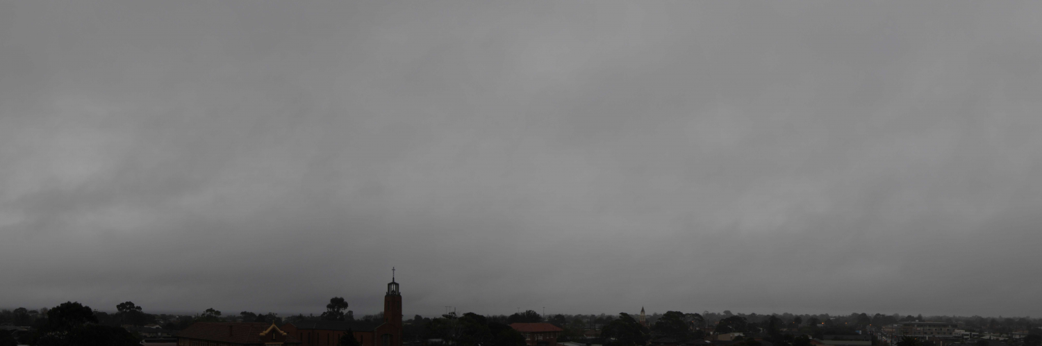
Stratus fractus of wet weather
Irregular and ragged shreds of Stratus fractus of wet weather stand out against the lighter grey of an extensive and thick layer of Nimbostratus. In several places there are patches of Cumulus fractus of wet weather, characterized by distinctive horizontal bases and greater vertical extent.
Slight rain had been falling for nine hours. The rain cleared in the next hour as the Nimbostratus base lifted and retreated eastward.
Links in the image description will highlight features on the image. Mouse over the features for more detail.
© Michael BruhnMentone VIC 3194, AustraliaLatitude: 37° 58' 56'' SLongitude: 145° 4' 15'' E20 June 2016 1238 (Local Time)Camera direction: towards WCL = 7, CM = 2, CH = /Image P/S code: P.8.8Image I.D.: 5957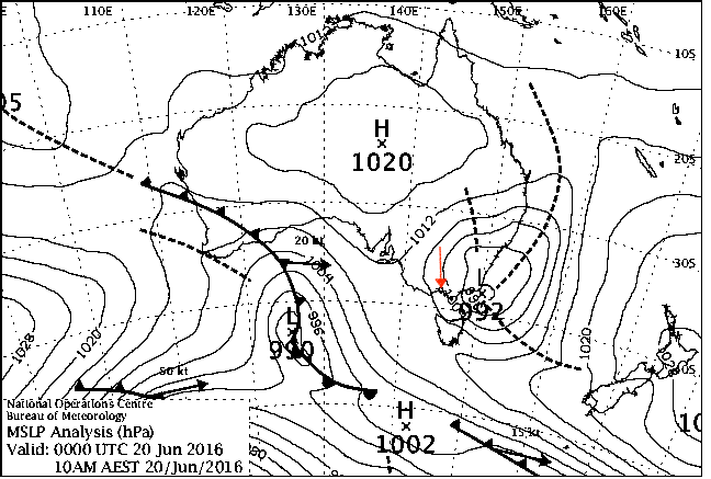
A low pressure system to the east was deepening and moving south-south-east. This low was directing moist onshore south-south-east to east winds over central southern Victoria, Australia.
© Commonwealth of Australia 2016, Bureau of Meteorology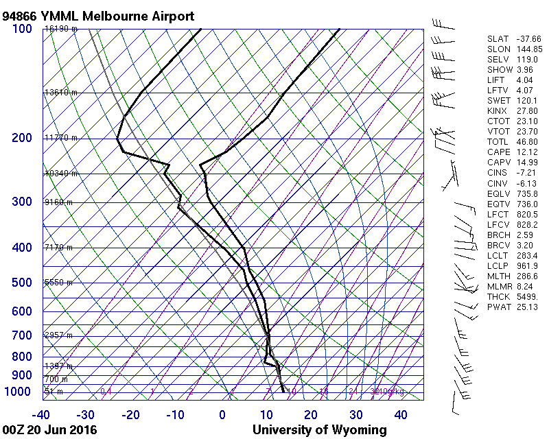
Saturated from surface to 850 hPa, very moist from 850 hPa to tropopause at 236 hPa
© University of Wyoming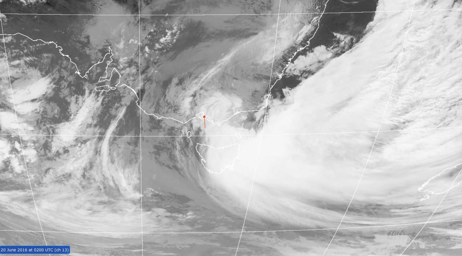
The Himawari-8 channel 13 infrared image shows the extensive cloud band wrapping around the low pressure system off the eastern Victorian coast in Australia. Melbourne is almost on the western edge of the clearing cloud band.
© Commonwealth of Australia 2016, Bureau of Meteorology / Japan Meteorological Agency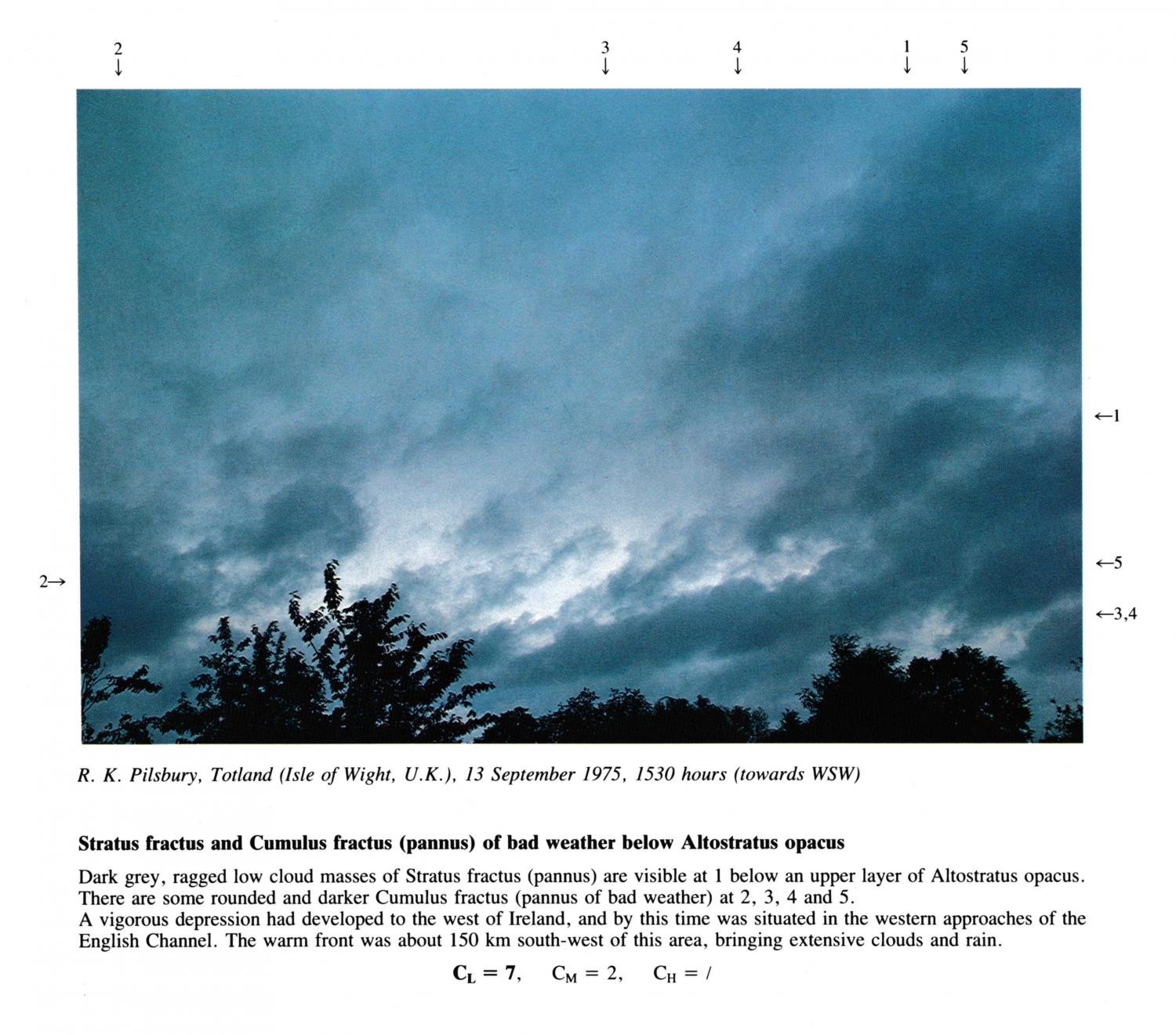
Stratus fractus and Cumulus fractus (pannus) of bad weather below Altostratus opacus
Dark grey, ragged low cloud masses of Stratus fractus (pannus) are visible at 1 below an upper layer of Altostratus opacus.
There are some rounded and darker Cumulus fractus (pannus of bad weather) at 2, 3, 4 and 5.
A vigorous depression had developed to the west of Ireland, and by this time was situated in the western approaches of the
English Channel. The warm front was about 150 km south-west of this area, bringing extensive clouds and rain.
Links in the image description will highlight features on the image. Mouse over the features for more detail.
© R.K. PilsburyTotland, Isle of Wight, United Kingdom of Great Britain and Northern IrelandLatitude: 50° 40' 18'' NLongitude: 1° 32' 51'' W13 September 1975 1530 (Local Time)Camera direction: towards SWCL = 7, CM = 2, CH = /