© Jarmo Koistinen
Helsinki, Finland
Latitude: 60° 0' 0'' N
Longitude: 25° 0' 0'' E
07 September 2011 1211 (Local Time)
Camera direction: towards NW
Image P/S code: P.3.12
Image I.D.: 5964
CL = 1, CM = 0, CH = 5
-
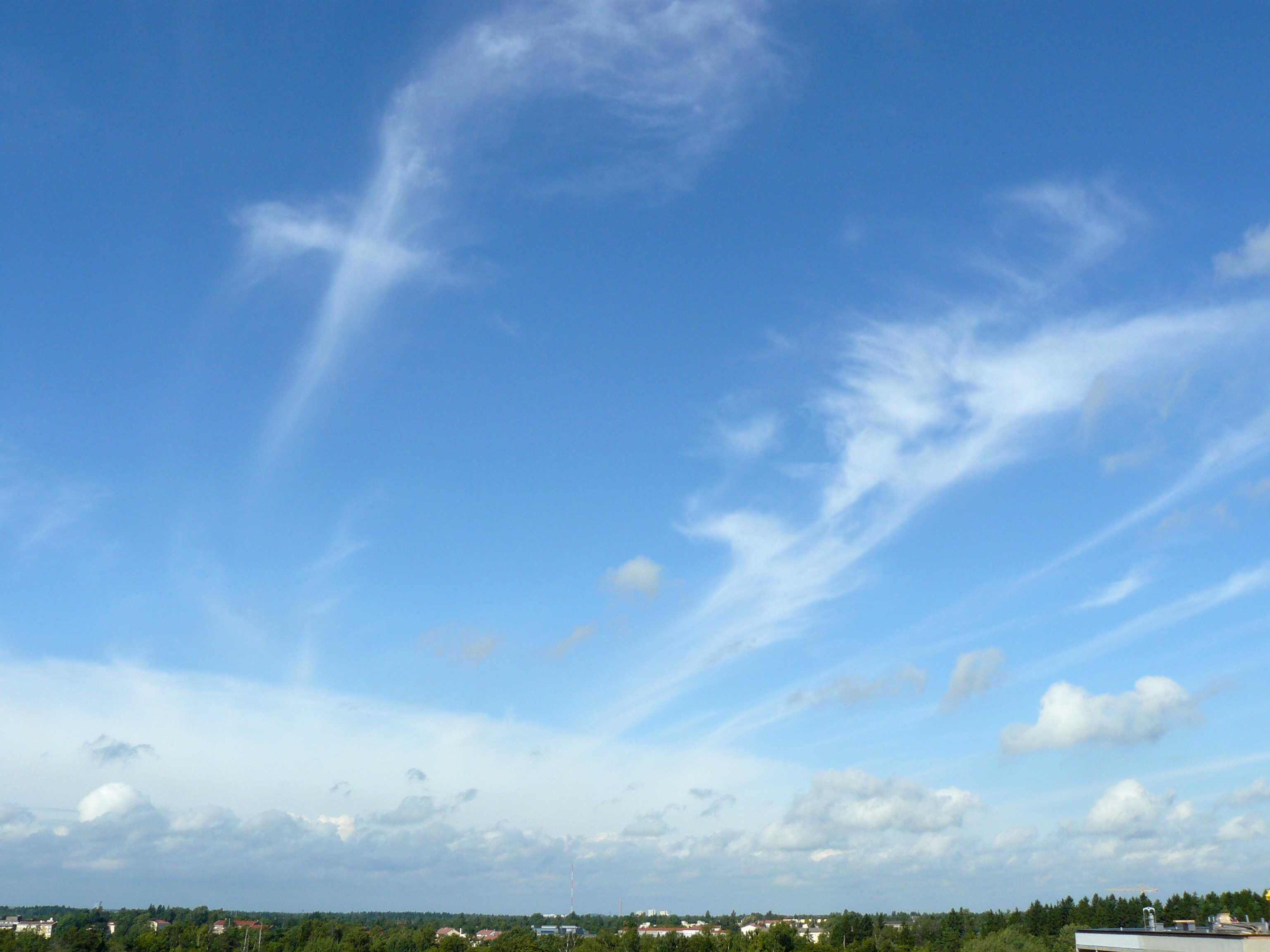
Invading Cirrostratus nebulosus and Cirrus uncinus
The image shows a uniform Cirrostratus veil slowly invading; the continuous veil is below 45° above the horizon. Individual long elements of Cirrus uncinus and fibratus precede the Cirrostratus.
Cumulus of the species humilis and fractus are in the foreground. Round domed tops of a few Cumulus cells look to be developing into mediocris; however, no further development took place.
The supplementary feature fluctus can be seen on one Cumulus fractus cell.
Links in the image description will highlight features on the image. Mouse over the features for more detail.
© Jarmo KoistinenHelsinki, FinlandLatitude: 60° 0' 0'' NLongitude: 25° 0' 0'' E07 September 2011 1211 (Local Time)Camera direction: towards NWCL = 1, CM = 0, CH = 5Image P/S code: P.3.12Image I.D.: 5964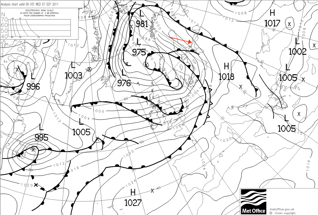
The upper-level clouds in the image were generated by an approaching warm front.
© Crown Copyright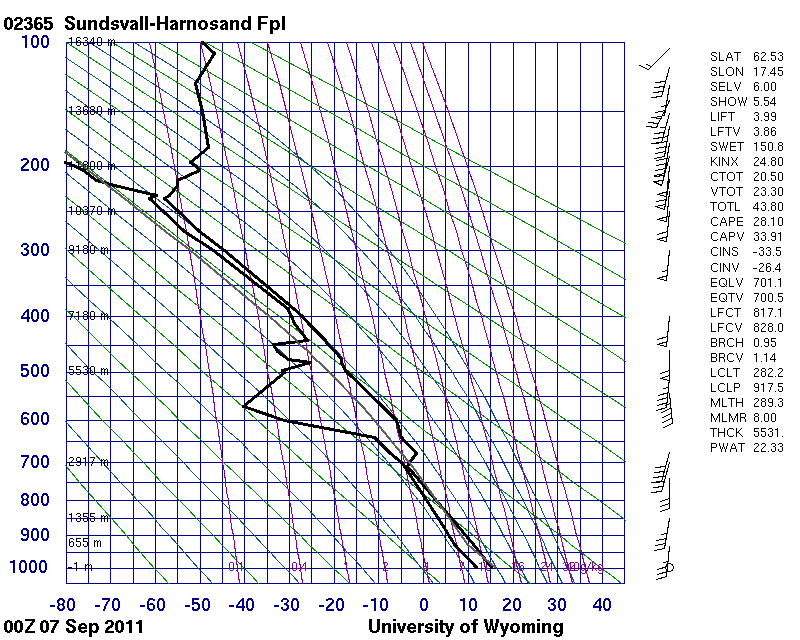
The sounding is from nine hours earlier and 450 km to the north-west. Due to the slow movement of the occlusion, this sounding is considered to be representative. It shows the dry middle levels and significant moisture from 7 000 m to the tropopause. No significant temperature advection can be diagnosed from the sounding, but the upper winds are rather parallel to the front, indicating that it is a cold occlusion.
© University of Wyoming
The EUMETSAT channel 9 image was taken three hours before the photo. It clearly shows the leading edge of Cirrus and Cirrostratus to the west of Helsinki, Finland.
© EUMETSAT/NEODAAS/University of Dundee