© Michael Bruhn
Aspendale Gardens,Victoria, Australia
Latitude: 38° 1' 28'' S
Longitude: 145° 6' 48'' E
21 February 2016 1902 (Local Time)
Camera direction: towards WSW
Image P/S code: P.3.13
Image I.D.: 5965
CL = 0, CM = 0, CH = 6
-

Invading Cirrostratus fibratus duplicatus undulatus
The photo shows invading Cirrostratus fibratus in the form of a continuous veil more than 45° above the horizon. There are two layers of Cirrostratus. The lower layer is in the shadow of the Earth and is shaded grey, while the higher layer has fibratus bands streaming from the south-west (bottom left to top right); a wave pattern can also be seen in this layer. The wave pattern is transverse to the winds at cloud level, confirming the identification of the variety undulatus.
Links in the image description will highlight features on the image. Mouse over the features for more detail.
© Michael BruhnAspendale Gardens,Victoria, AustraliaLatitude: 38° 1' 28'' SLongitude: 145° 6' 48'' E21 February 2016 1902 (Local Time)Camera direction: towards WSWCL = 0, CM = 0, CH = 6Image P/S code: P.3.13Image I.D.: 5965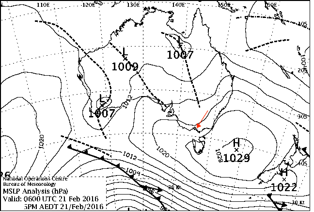
Broad trough extending from northern Australia to Tasmania
© Commonwealth of Australia 2016, Bureau of Meteorology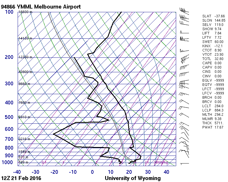
High-level moisture from 303 to 274 hPa(9 700 to 10 300 m)
© University of Wyoming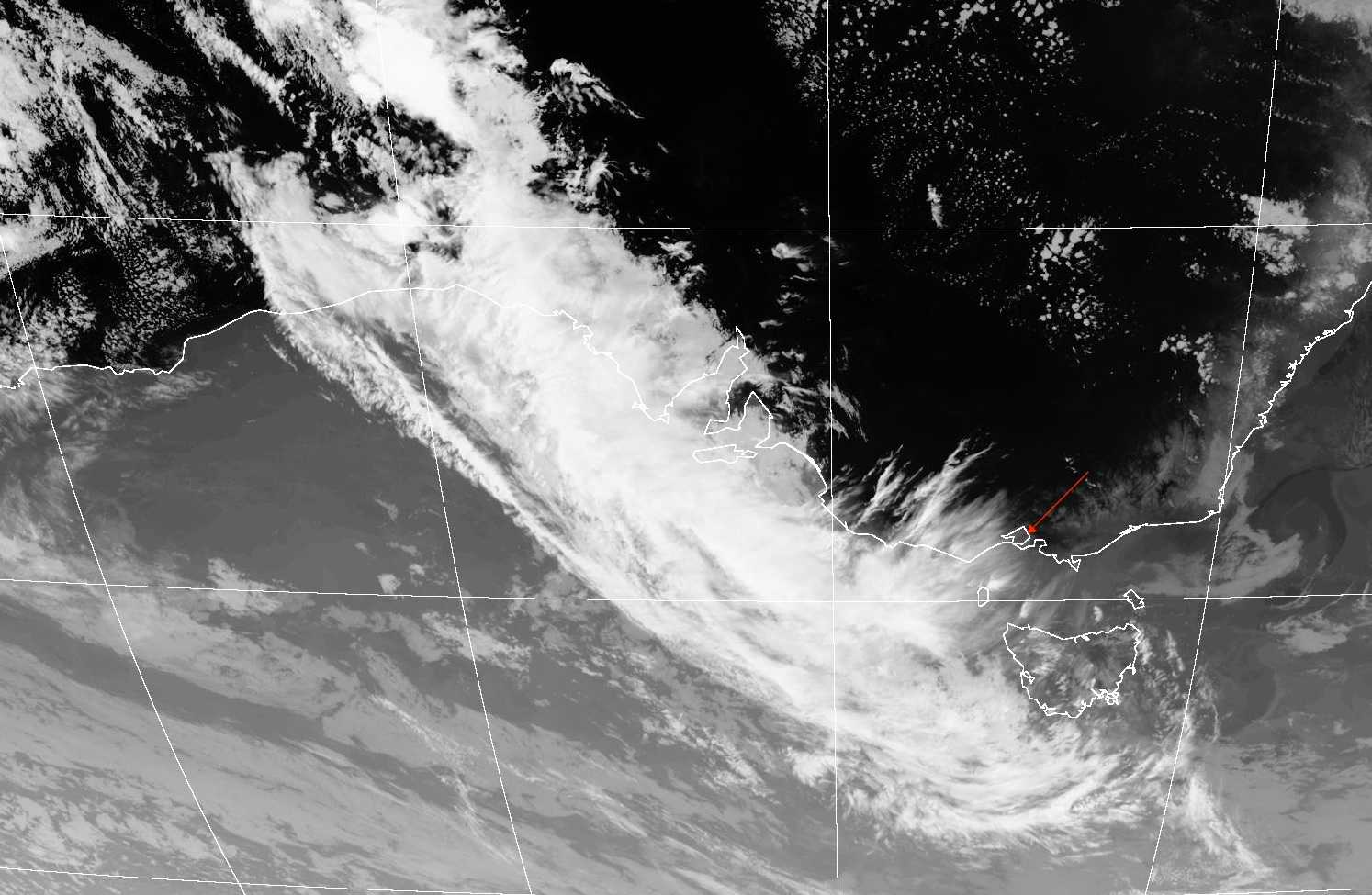
The Himawari-8 channel 13 infrared image shows the northern edge of a north-west tropical cloud band moving parallel to the western Victorian coastline in Australia. An upper-level ridge is positioned at 141° E; east of this upper-level ridge, south-west winds are advecting the cloud mass over southern central Victoria.
© Japan Meteorological Agency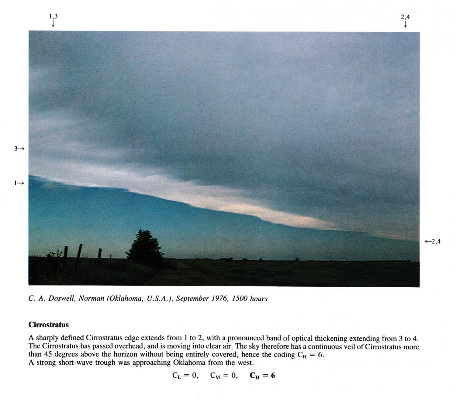
Cirrostratus
(NB. Day in September estimated)
A sharply defined Cirrostratus edge extends from 1 to 2, with a pronounced band of optical thickening extending from 3 to 4. The Cirrostratus has passed overhead, and is moving into clear air. The sky therefore has a continuous veil of Cirrostratus more than 45 degrees above the horizon without being entirely covered, hence the coding CH = 6.
A strong short-wave trough was approaching Oklahoma from the west.
Links in the image description will highlight features on the image. Mouse over the features for more detail.
© C.A. DoswellNorman, Oklahoma,, United States of AmericaLatitude: 35° 13' 21'' NLongitude: 97° 26' 22'' W15 September 1976 1500 (Local Time)CL = 0, CM = 0, CH = 6