© Frank Le Blancq
Kurintar, Darechok, Népal
Latitude: 27° 52' 27'' N
Longitude: 84° 36' 58'' E
10 January 2015 1406 (Heure locale)
Orientation de l'appareil photo: SE
Code P/S de l'image: P.12.1.1
Numéro d'identification de l'image: 4831
-
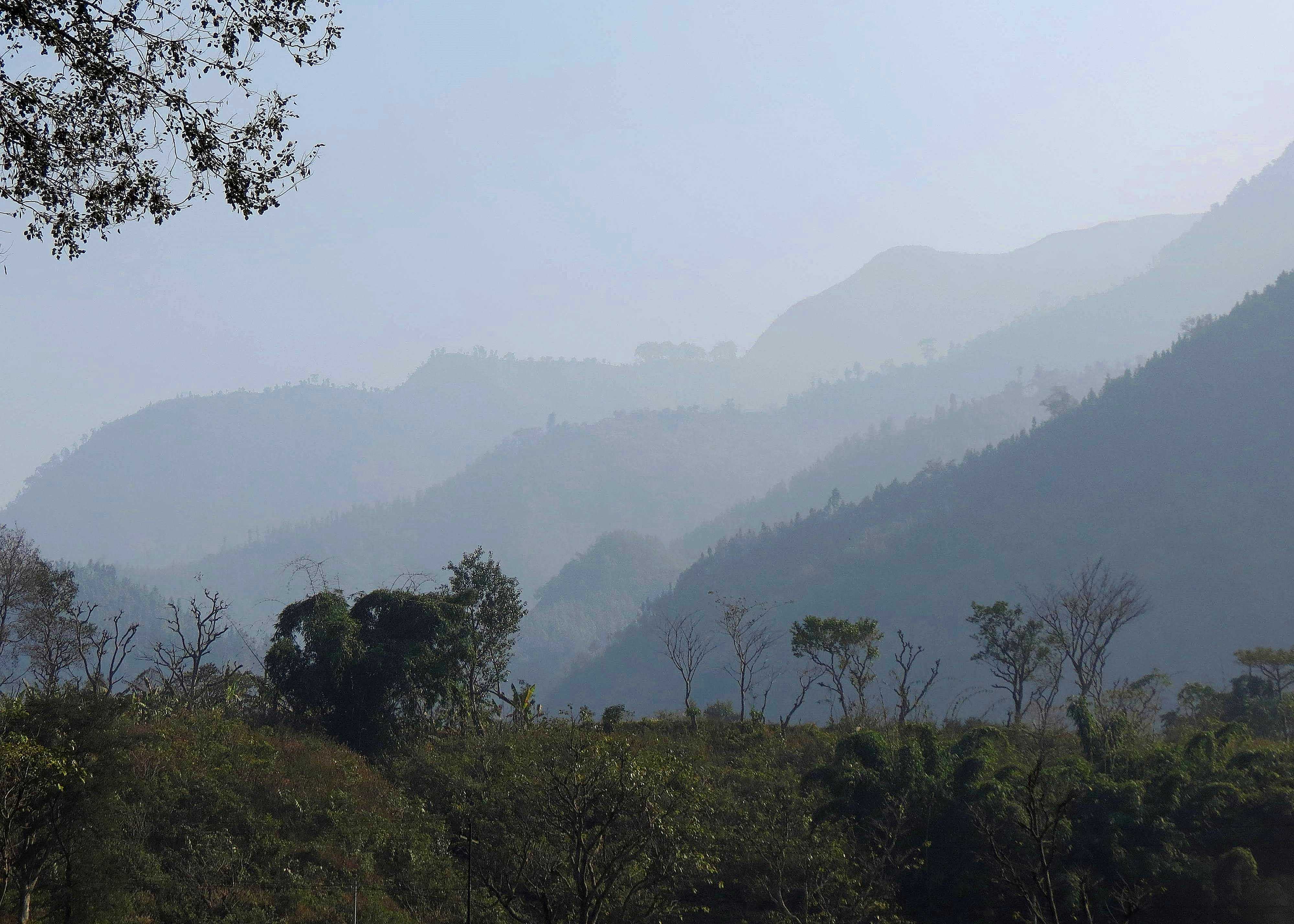
Brume sèche
La brume sèche est une suspension dans l'atmosphère de particules sèches, extrêmement petites, invisibles à l'œil nu et suffisamment nombreuses pour donner à l'air un aspect opalescent.
Sur cette photographie, la brume sèche gomme progressivement les détails des pentes montagneuses à mesure de leur éloignement du point d'observation. Sa présence est due à la pollution générale et à des fumées de petits feux de camp qui ont stagné dans la vallée centrale abritée du Népal plusieurs jours durant au cours de l'hiver.
Les liens dans le descriptif donnent des précisions sur certaines caractéristiques de l'image. Cliquer sur le lien pour plus de détails.
© Frank Le BlancqKurintar, Darechok, NépalLatitude: 27° 52' 27'' NLongitude: 84° 36' 58'' E10 January 2015 1406 (Heure locale)Orientation de l'appareil photo: SECode P/S de l'image: P.12.1.1Numéro d'identification de l'image: 4831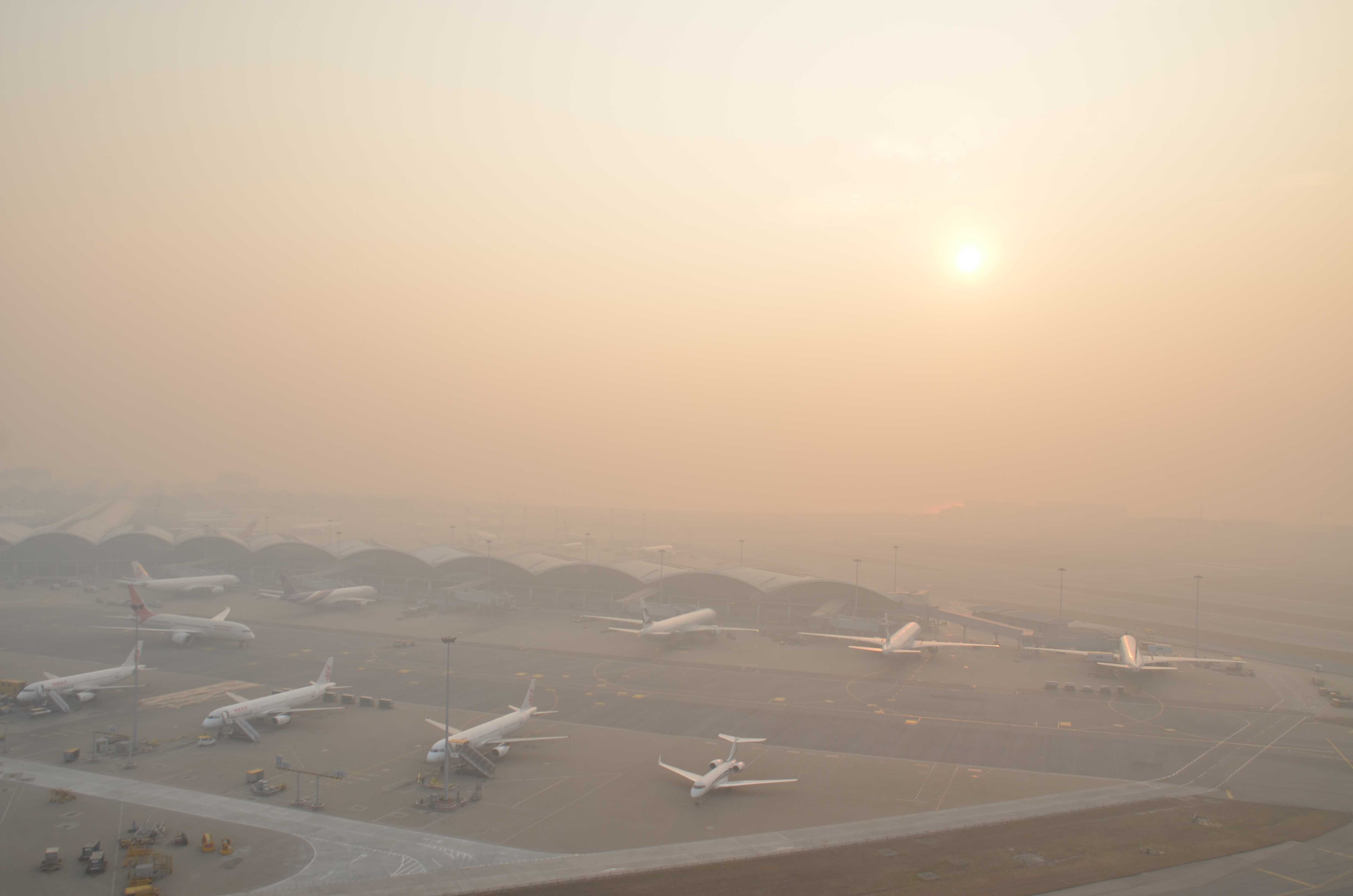
Brume sèche
La mousson sèche de nord-est a amené un temps beau dans l'ensemble mais brumeux sur les côtes du Guangdong (Chine). Au moment où cette photographie a été prise, la brume sèche avait réduit la visibilité à 1 900 m à l'aéroport international de Hong Kong.
La brume sèche est une suspension dans l'atmosphère de particules sèches extrêmement petites. Sous l'effet de la dispersion de la lumière par les particules de brume sèche, les objets brillants dans le lointain (dans le cas présent, le Soleil et le ciel clair qui l'entoure) prennent des couleurs jaunâtres ou rougeâtres.
Les liens dans le descriptif donnent des précisions sur certaines caractéristiques de l'image. Cliquer sur le lien pour plus de détails.
© Man Yi MakChek Lap Kok, Hong Kong, ChineLatitude: 22° 18' 55'' NLongitude: 113° 55' 22'' E12 February 2015 0752 (Heure locale)Orientation de l'appareil photo: ECode P/S de l'image: S.12.1.1Numéro d'identification de l'image: 4970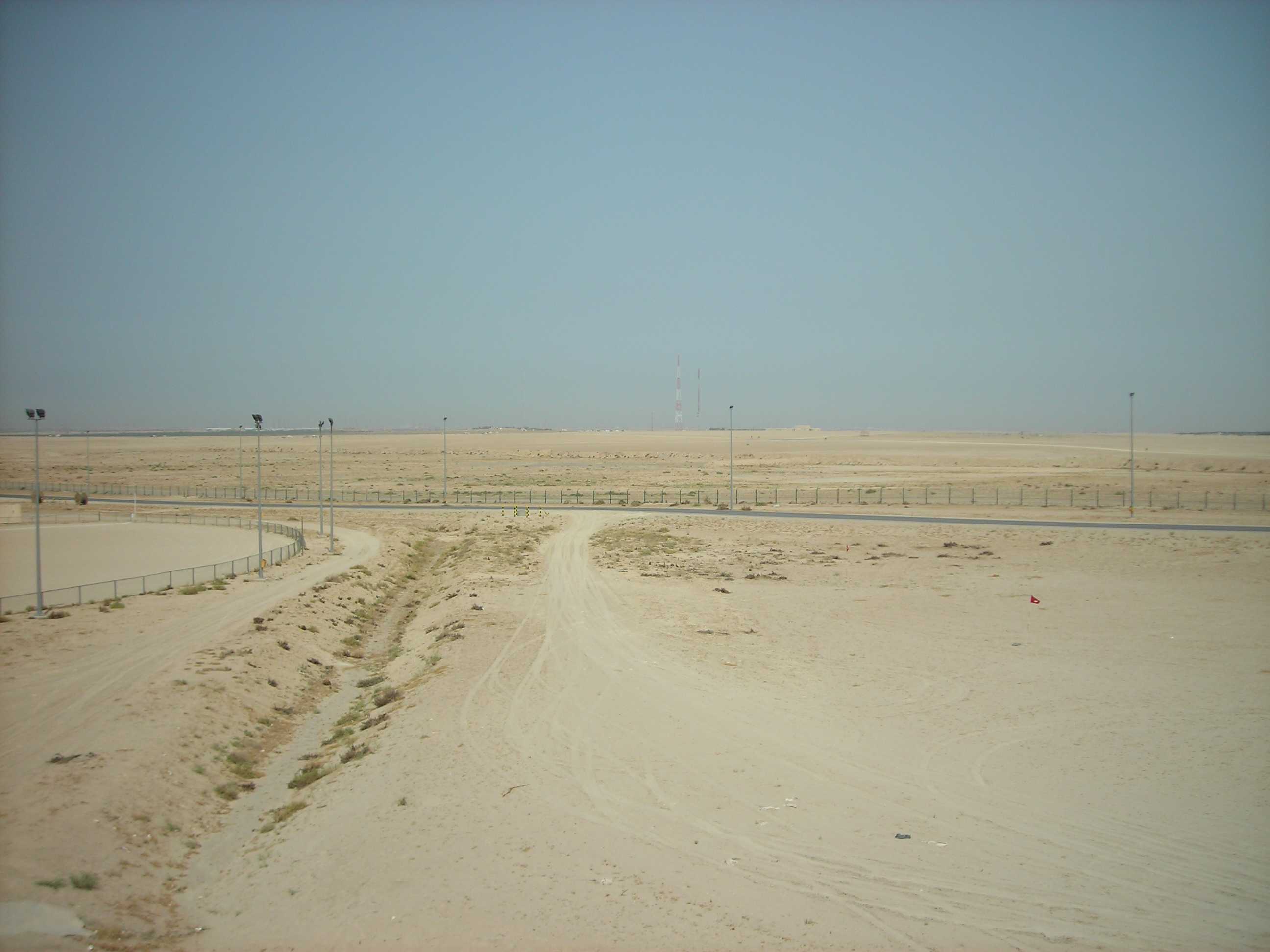
Arrivée d'une tempête de poussière, ou tempête de sable
Ce cliché est le premier d'une série de quatre photographies montrant le début d'une tempête de poussière, ou tempête de sable, due au shamal.
Une légère brume sèche est visible sur ce cliché. On peut également constater que le ciel est encore bleu à ce stade.
Les liens dans le descriptif donnent des précisions sur certaines caractéristiques de l'image. Cliquer sur le lien pour plus de détails.
© Peter SundenCamp Arifjan, gouvernorat d'Al Ahmadi, KoweïtLatitude: 28° 55' 12'' NLongitude: 48° 9' 0'' E10 April 2007 0800 (Heure locale)Code P/S de l'image: S.12.2.2Numéro d'identification de l'image: 5610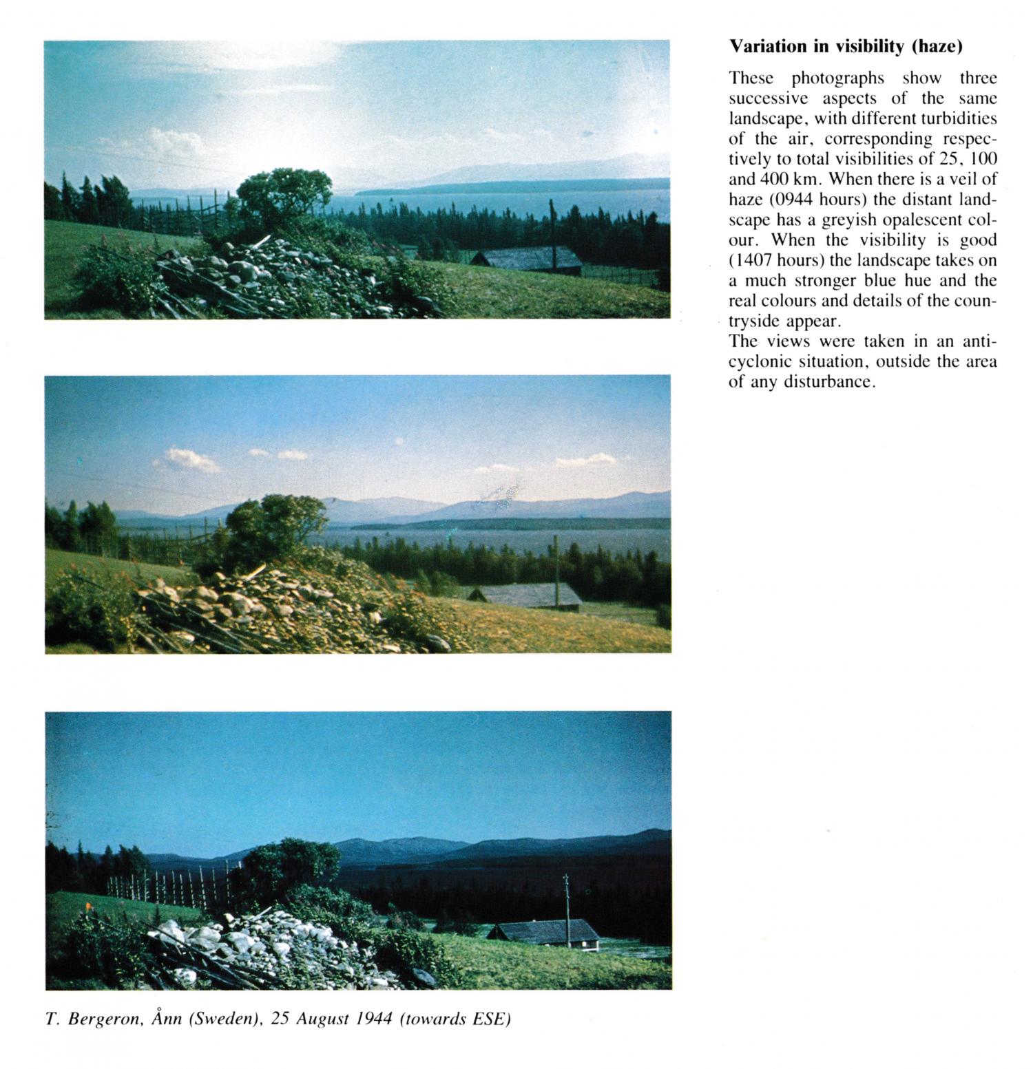
Variation in visibility (haze)
(Please refer also to image identifiers PR.203 and PR.204)
These photographs show three successive aspects of the same landscape, with different turbidities of the air, corresponding respectively to total visibilities of 25, 100 and 400 km. When there is a veil of haze (0944 hours) the distant landscape has a greyish opalescent colour. When the visibility is good (1407 hours, in this image) the landscape takes on a much stronger blue hue and the real colours and details of the countryside appear.
The views were taken in an anticyclonic situation, outside the area of any disturbance.
Les liens dans le descriptif donnent des précisions sur certaines caractéristiques de l'image. Cliquer sur le lien pour plus de détails.
© T. BergeronÅnn, SwedenLatitude: 63° 19' 32'' NLongitude: 12° 32' 5'' E25 August 1944 1407 (Heure locale)Orientation de l'appareil photo: ESECL = /, CM = /, CH = /